A New Trail for 3 Sisters Waterfalls

A New Trail for 3 Sisters Waterfalls

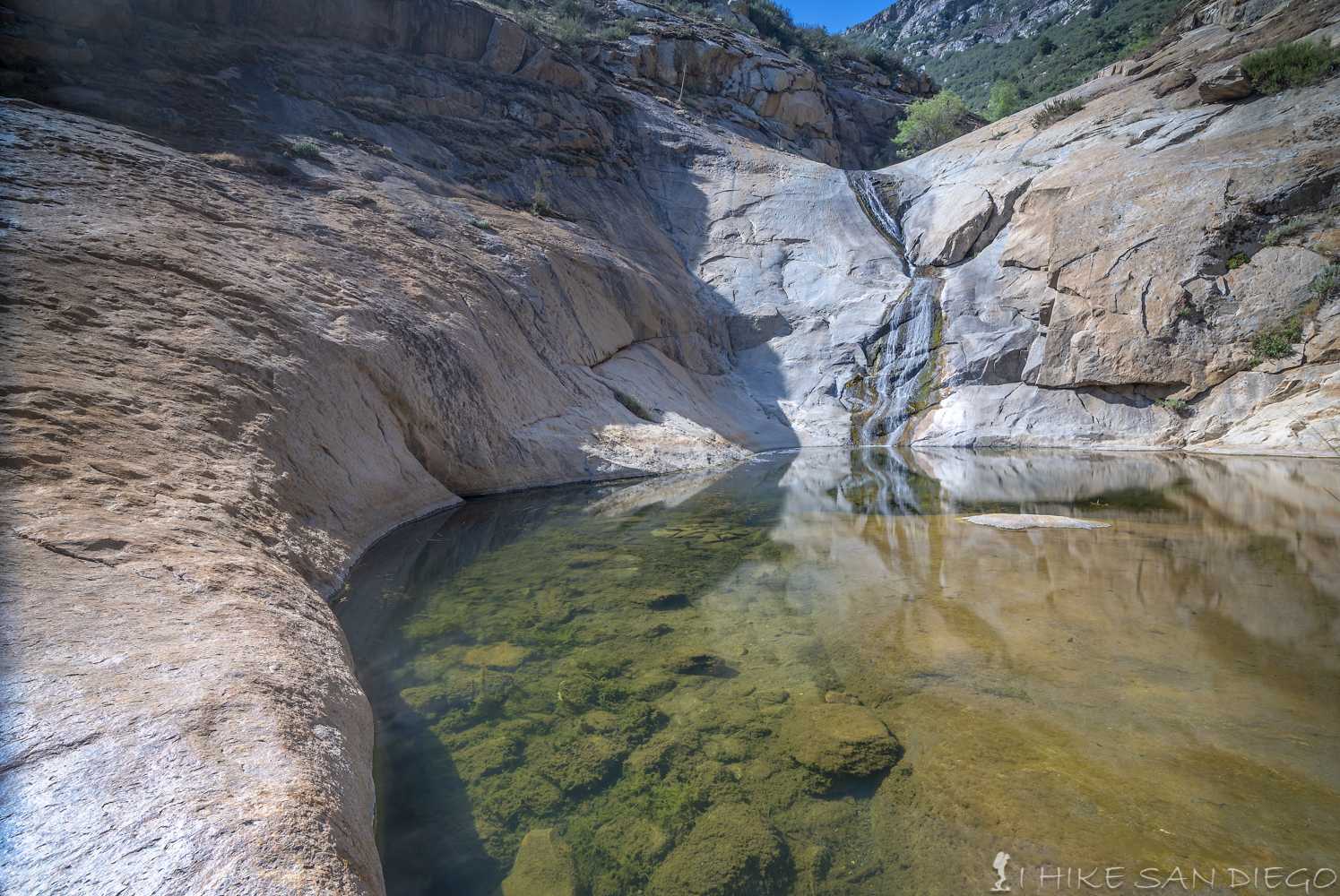
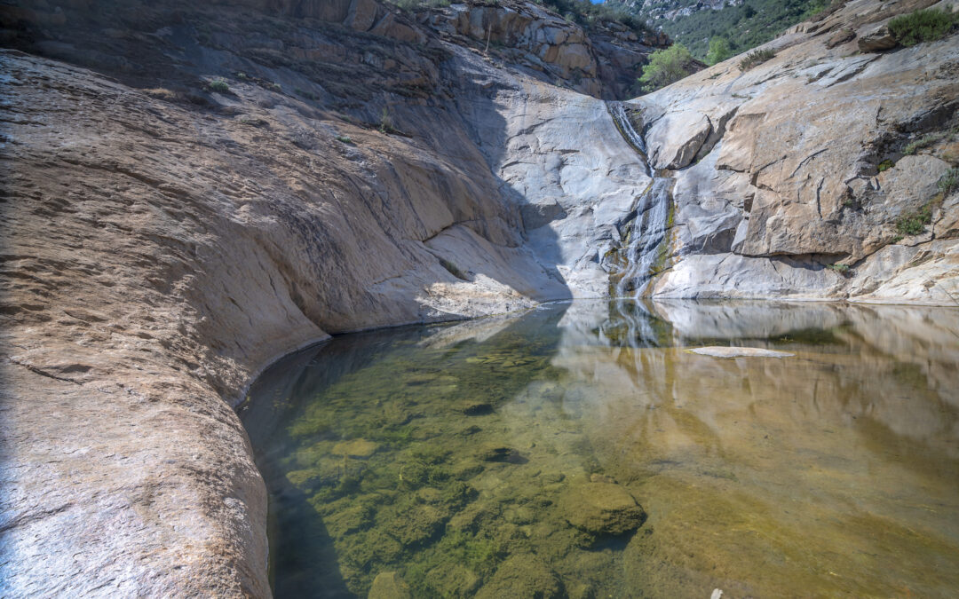
This past weekend I decided to take advantage of the cooler weather and head out to the 3 Sisters Waterfalls to check out the new trail I had heard all about. At this time of the year you really are not heading out to see the falls in its full glory as you can see from the picture above, I was just going out to update the information on this hike. 

The first thing I noticed when rolling up on the trail head was the change in the parking situation. It used to be that everyone parked along the road and sometimes you would see 50-60 cars parked along the tight corner. Now there is a dirt parking lot with Porta-Pottys, what a welcome change. 

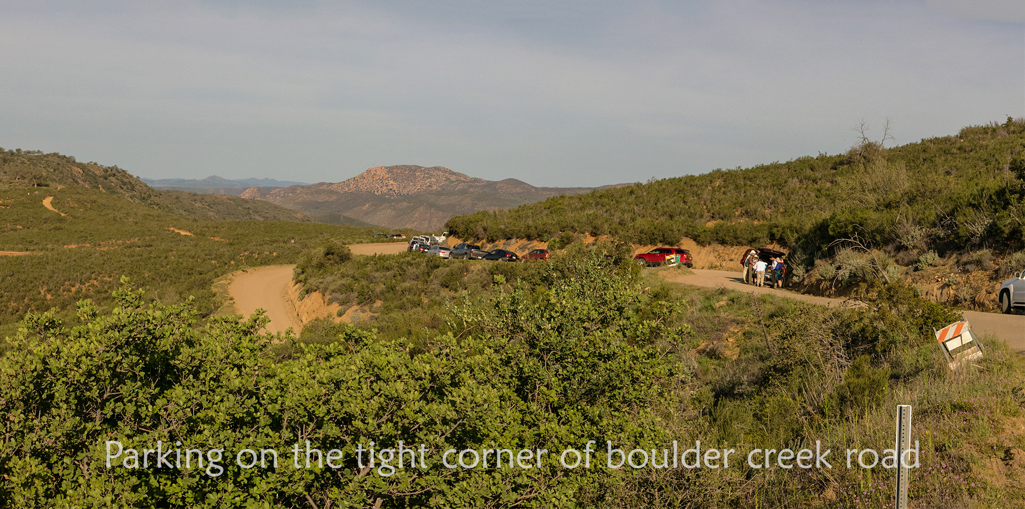
Parking at the old trail-head for 3 Sisters Waterfalls

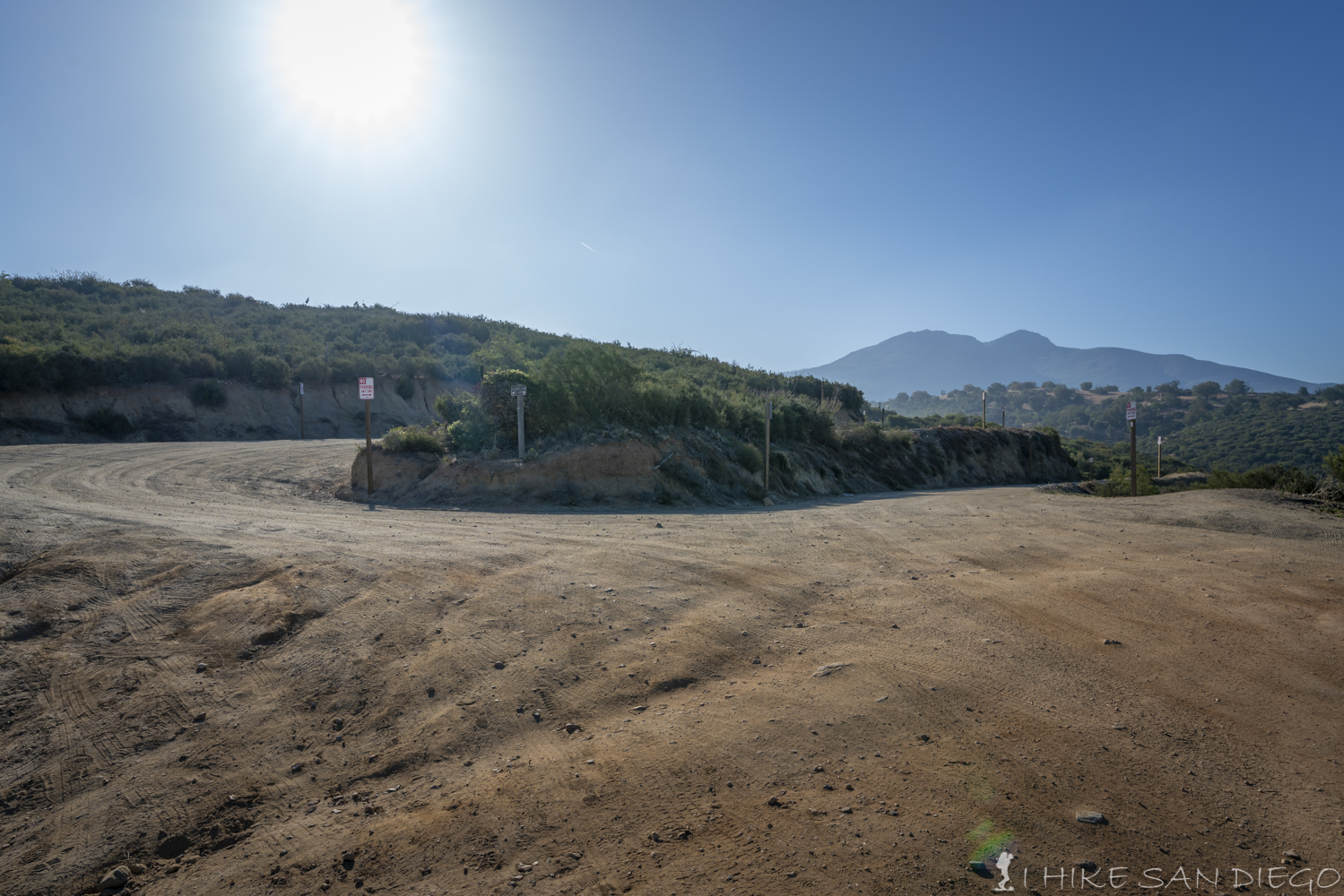
The road where you used to park has a lot of no parking signs

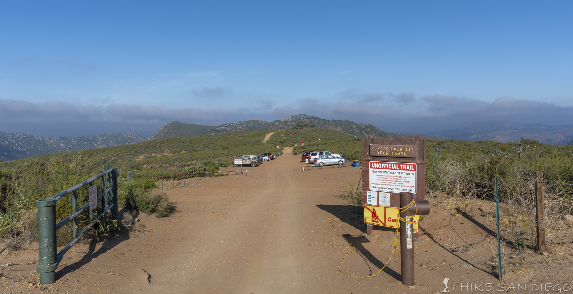
The New Parking Lot for the 3 Sisters Waterfall Hike

The rest of the trail is just like it always was until you get to the area that you used to climb down ropes on. That is now sectioned off and the trail now continues along the side of the canyon until you come out at the middle waterfall and pool.

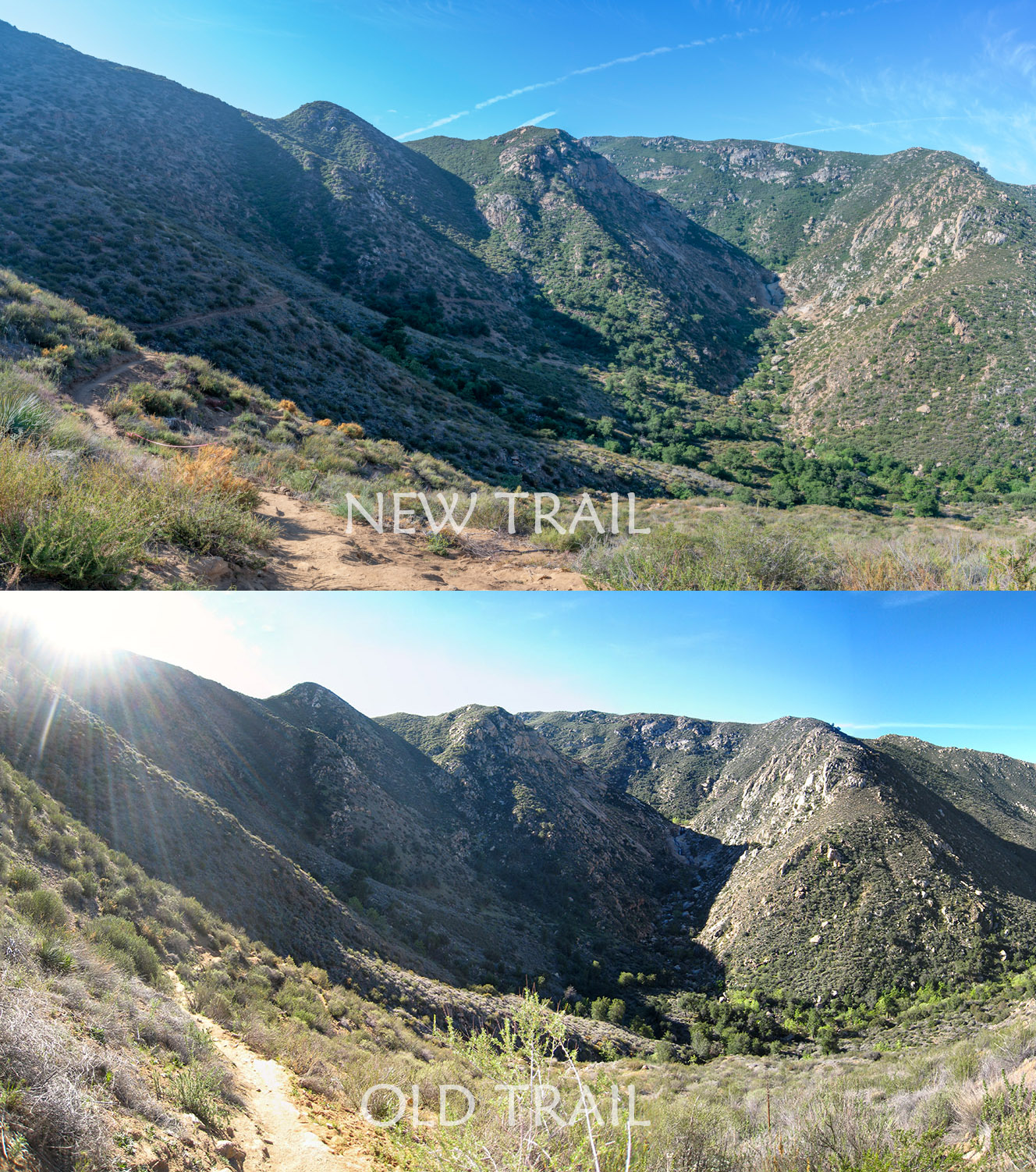
A view of the new trail vs the old trail system.

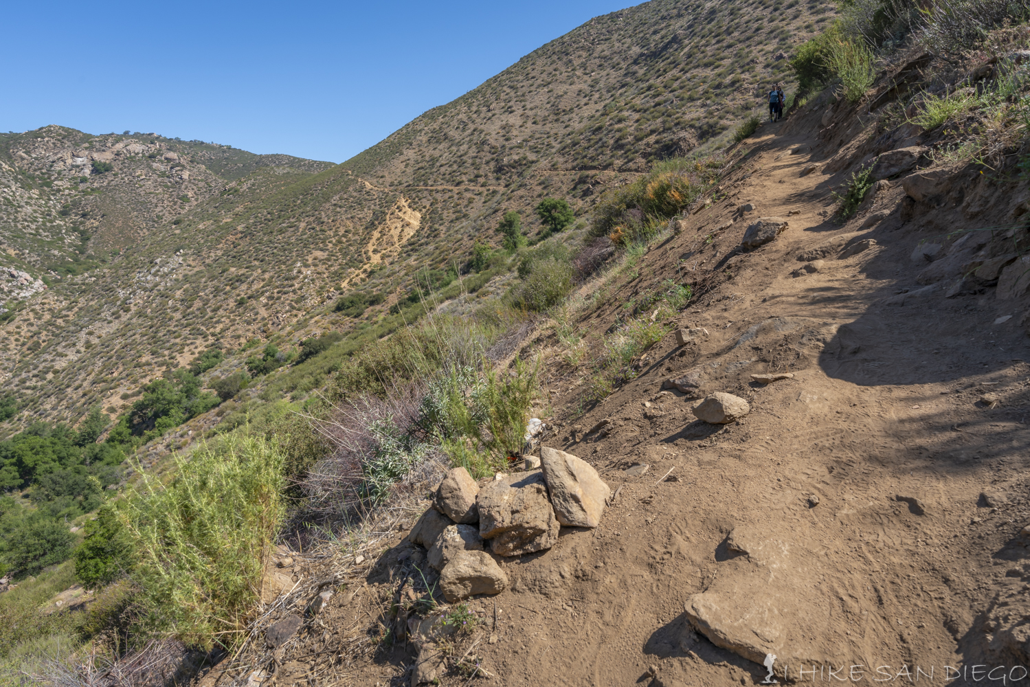
Another view of the new trail with a view of the old steep trail down the hill as well

3 Sisters Waterfall at the Middle Falls

I know some people will lament the loss of the rope area of this trail, and I will admit that it added a little something to the adventure of coming out to the falls, but I think what was lost was far outweighed by what was gained. Every time I would come out these falls I would see that the trail had further eroded and had become sketchier then the last time I had been there. With all the people who come out to this trail unprepared I can understand the need to soften up the experience a little. My only warning would be to whom ever decides what to do with this trail in its further upkeep. As I was sitting there talking with some hikers about the changes to the trail I could already hear people talking about heading back up the sketchier trail anyways ( I think it would take an exhaustive amount of work to make this section less alluring to those who want to challenge themselves. I’ve also noticed parts of the new trail that are already being cut through with short cuts and people who get a little lost when you get closer to the water fall ( just follow the pink ribbons) I would suggest a more permanent signage for the trail. All in all I think the changes are a welcome addition to this popular trail and I hope people enjoy the experience without ruining it for everyone else. 

Check Out the refined trail description below. 

Check out 3 Sisters Waterfalls

Winter Hiking in San Diego

Winter Hiking in San Diego

Hiking up Stonewall Peak trail in the Cuyamaca’s during sunrise.

We don’t get much of a winter here in San Diego, but when we do its a chance to get out and experience a little bit of winter hiking in the snow. Usually the snow level is not going to get really low here in San Diego, so when it snows the usual areas to grab a little hiking are going to be Mt Laguna, The Cuyamaca Mountians, and Palomar Mountain. Recently I got out to one of my favorite easy hikes for a little hiking in the snow : Stonewall Peak in the Cuyamaca Mountains. 

Looking up at the top of Stonewall Peak from the bottom of the trail after a recent snowfall

Some things to keep in mind when hiking in the snow are:

  • If you are just starting out you may want to try hiking on a trail you are familiar with so that you are not trying to find the trail in the snow. 
  • More then likely you will not need micro spikes or gaiters, but depending on where you are hiking it may still be a good idea to bring them if you are hiking in deeper snow or icy conditions.   
  • You don’t want to necessarily put on the most insulated cloths, its better to layer so that you can add a layer if you need more heat and or take a layer off if you get to hot. I generally find that as I am hiking up hill I will produce more heat and therefore don’t need as much insulation, but when I get to the top of a mountain or I am on a exposed area with a lot of wind I will need more insulation, also as you go downhill during the 2nd half of the hike you will generally not be producing as much heat. 
  • A pair of Trekking Poles is a god send while you are hiking in the snow to help keep your balance and let you utilize your upper body as well to help you climb, and to help decelerate as you are going down.  
  • Even though it is cold and you are not sweating as much you can still dehydrate and this can cause fatigue and cramping. I experienced some cramping after this hike even though I knew better and keep telling myself to stop and drink some water my other competitive mind keep telling me to just keep going and we would have some water once I got back to the car. I payed for it later with about 10 min of abdominal cramping as I was trying to get back into my car after enjoying breakfast and coffee in Julian. Keep drinking your water, your body will thank you. 

On the Stonewall Peak trail looking across the valley at Cuyamaca Peak lit up by sunrise.

Some areas to experience the snow around San Diego:

Other areas in Southern California for snow hiking ( these areas tend to be higher in elevation and my require more planning and equipment ) that are all about 2 hours away. 

Looking down at Lake Cuyamaca during sunrise from the Stonewall Peak Trail

Getting up to the local mountains after it snows. 

After it snows in our local mountains a lot of people can tend to head up there in order to enjoy the experience. 

  • Make sure you have chains for your car, you may not even need them, but “its better to have them and not need them rather then need them and not have them”. Make sure to buy chains when you have some spare time and not at the last minute. Make sure they fit your vehicle. If they are the older type of chains you may need to take them in and get them fitted for your car. A lot of newer vehicles need a different type of tire chains and you don’t want to be running around like a mad man or women looking for them when everyone else that wants to go up as well. Better to just get them and have them sitting in your garage waiting for you to use them. 
  • Bring some snacks for the drive, for yourself and or your kids. Beyond just bringing food for the hike, you may find that drive takes longer because of the snow and its much better to start the hike with energy then being drained when you get there.
  • Bring extra water ( and a thermos of hot coffee or hot chocolate ) for after the hike, it feels so good to get back to the car and have a hot drink, and along the earlier point you never know how long it may take you to get there. 
  • Most defiantly bring a camera of some kind, your going to want to remember this. 
  • Bring some patience if you are heading up during the weekend and or right after it snows. I remember watching the news one year where it seemed like everyone in San Diego decided to descend on to Julian after a snow fall and the traffic was a nightmare.  

Looking east at the sun rising over Mount Laguna from the top of Stonewall Peak.

Looking north from the top of Stonewall Peak after a recent snowfall. Lake Cuyamaca can be seen on the left while the mountains are lit by the sun rising in the east from the right.

So remember that you can a little taste of winter here in San Diego once in a while, and it can be a lot of fun. Just keep your eye on the weather and be properly equipped so that you may enjoy the experience.  

Bushwhacking up Lawson Peak and Gaskill Peak

Bushwhacking up Lawson Peak and Gaskill Peak

Its amazing how much the landscape can change over the years, especially when there is a lot of human interaction with it. I would swear I had been up this hike 20 years ago and the climb up the back fissure was not as bad, but time and erosion have a way of changing things, I see it every year when I go to 3 Sisters and see how much worse the trail is from the previous year. With all that said, this is a great little adventure, just make sure to wear some long pants and long sleeves, your skin will thank you later. You will have to use your whole body at points in this hike / rock climb, but the view at the top is a great pay off. If you want more of an adventure follow the 2nd part of the Gaskill Loop as you bushwhack your way to the trail, if not so adventurous retrace your steps back down, either way this is a great adventure for your next weekend hike. 

Check It Out

Check out the Lawson Peak and Gaskill Peak Hike
Mt Langley, another California “14 er “.

Mt Langley, another California “14 er “.

Lake #1 in the Cottonwood Lakes area and the first lake you come across as you crest the trail at 11,000 feet.

Lake #1 in the Cottonwood Lakes area and the first lake you come across as you crest the trail at 11,000 feet.

Another good hiking season is upon us in California. While it may be to hot down in the dessert, the high sierras are a great place to get up into the cooler air with green meadows and melting snow fields. There is plenty of water up there right now and you could not pick a better time to head up. My buddy’s and I went up towards the end of July. Our biggest mistake with this hike was trying to do it in one grueling 15 hour day. I gassed out just a mile or so from the top while my friends were able to make it all the way up, but all of us were completely exhausted after that grueling all day hike. I would suggest splitting the hike up and camping at one of the lakes before going for the top.

Read on to find out more : Mt Langley via New Army Pass

Hiking Cougar Crest Trail to Bertha Peak

Hiking Cougar Crest Trail to Bertha Peak

Big Bear Lake below. Snow Summit and Bear Mountain in the left side with San Gorgonio in the back ground, and off to the far left you can just make out the top of Mt Baldy.

Big Bear Lake below. Snow Summit and Bear Mountain in the left side with San Gorgonio in the back ground, and off to the far left you can just make out the top of Mt Baldy.

One of my favorite holiday memory’s was hiking this trail with my family on Thanksgiving. My mother hired our neighbor, a gourmet cook who was running a catering business at the time to cook us Thanksgiving dinner. We went hiking here towards the end of the day and by the time we got back home we opened to front door to the wonderful smells of the feast that awaited us. Needless to say I have fond memories of this hike, the view from the top does not hurt either. Once you make it to the top you will have a great view of Big Bear Lake below and San Gorgonio Peak beyond. While not a hike in the San Diego area, if you are ever in the Big Bear area and want to experience a great hike, this would be one to check out.

Check out the hike:

Check it out: Cougar Crest Trail to Bertha Peak
Hiking up to High Point on Palomar Mountain from Oak Grove

Hiking up to High Point on Palomar Mountain from Oak Grove

Looking towards the Palomar Observatory's from High Point on Palomar Mountain.

Looking towards the Palomar Observatory’s from High Point on Palomar Mountain.

This past weekend I took a hike up the eastern side of Palomar Mountain on the Oak Grove to High Point Hike. This hike starts in the little town of Oak Grove on highway 79 and takes you up through the Chaparral and Manzanita on a steep single track trail before joining up with the Oak Grove Road and finally High Point Road as you make your way up out of the valley to the High Point at 6140 feet of elevation. At 14 miles it is a long hike, but not over overly rough terrain or excessively steep terrain. Its a enjoyable hike and even though we were expecting it to be a scorcher with Santa Ana Winds blowing that day, we had the nicest breeze all the way up and we were even a little chilly at the top. This would be a great hike to take as we get into the fall.

Check it out:

Hike Oak Grove to High Point