Cuyamaca Peak
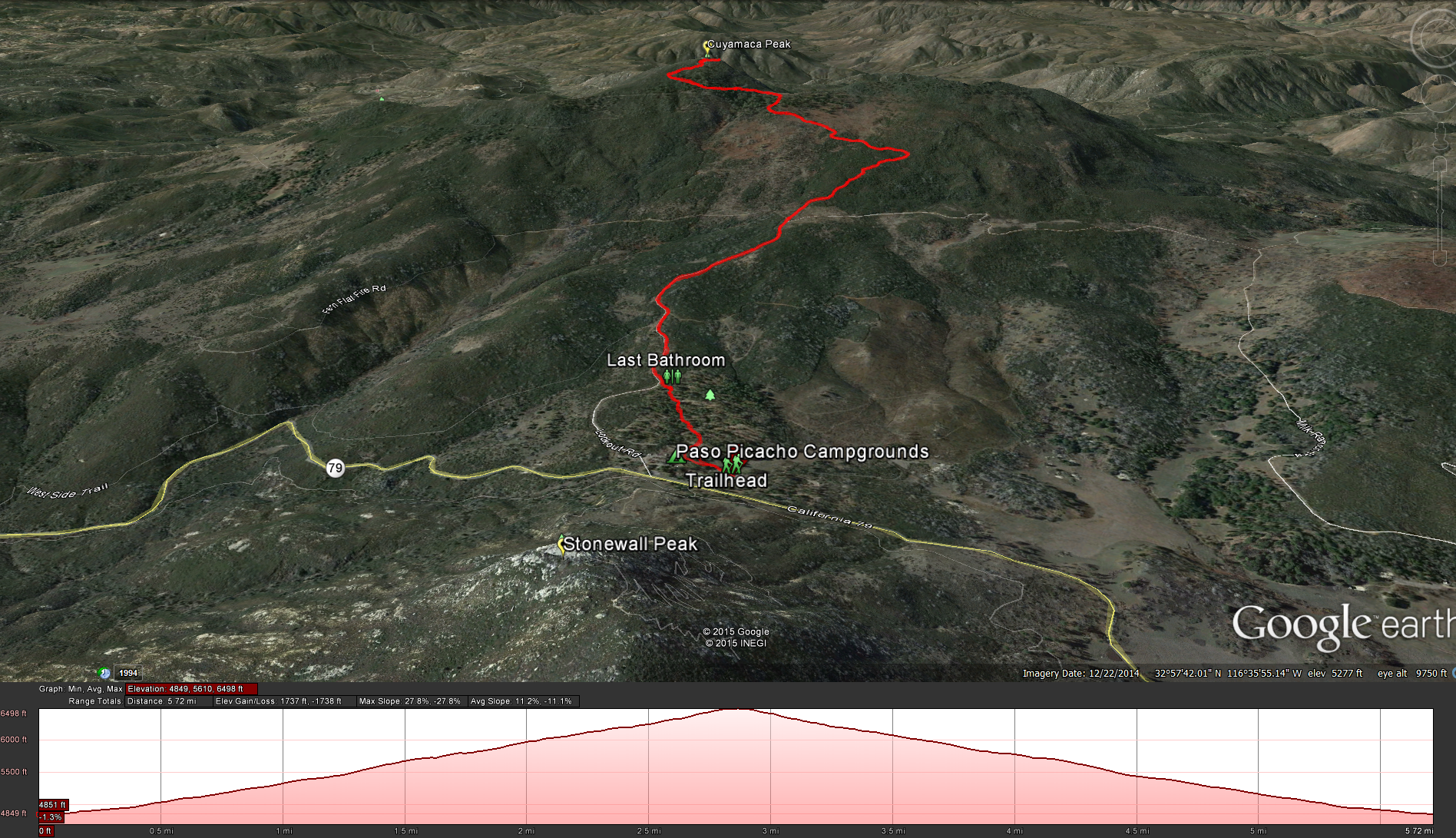
Distance: 5.8 miles . Elevation Gain and loss : 1700 feet Time to complete: 2-3 hours Moderately Strenuous
Directions: To get to this hike you can take highway 79 off of Interstate 8 freeway and head north 12 miles into the Cuyamaca State Park, or you can take highway 78 through Ramona and Julian until you connect into highway 79 and head south in the Cuyamaca State Park. Look for the Paso Picacho Campgrounds on the west side of the 79. Pay the $8 day use fee at the entrance and park at the picnic area just beyond to the right.
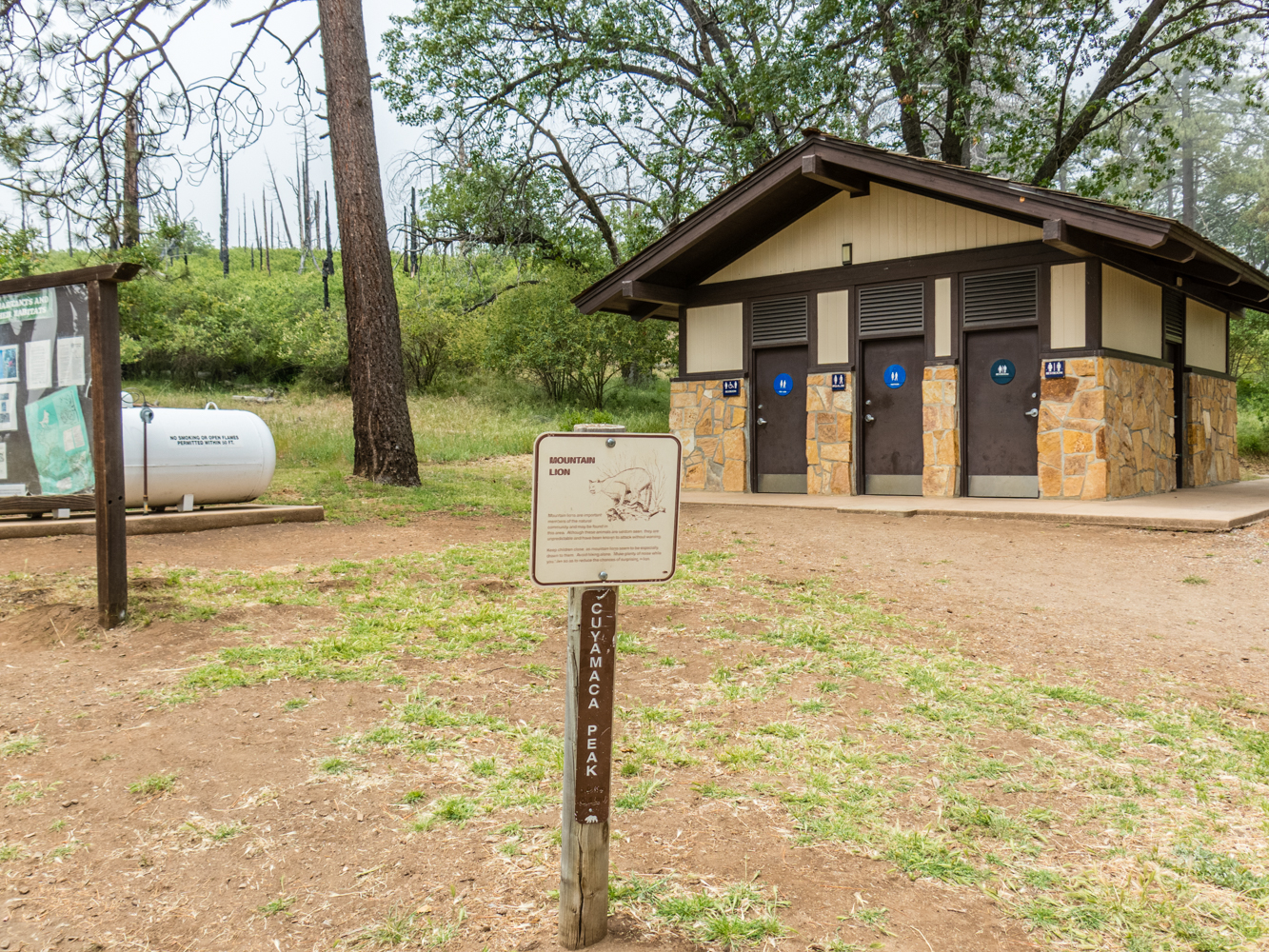
Bathroom Facilities: There are several in this area. Near the entrance. Near the Dayuse Parking Lot. Several scattered throughout the campgrounds, the last one being right next to the point where you connect up with the paved access road after walking through the campgrounds towards the back.
Cautions: Beware the Poodle Dog Bush. I don’t know why there isn’t more information posted about this plant around the area. It is a nasty plant that is worse then poison oak. You don’t end up with a rash, you end up with blisters that can last several weeks. It is far enough removed from the trail, but you will know your passing by when you smell a slightly musty, skunky odor. There are also a few bush’s at the top around the buildings, so if you explore up there or are looking for a spot for the bathroom be careful. Check out more about it here.
Fees or Permits: $8 daily use fee.
Pets: This is the ONLY trail in the Cuyamaca Park system that allows you to take your dog, so have at it.
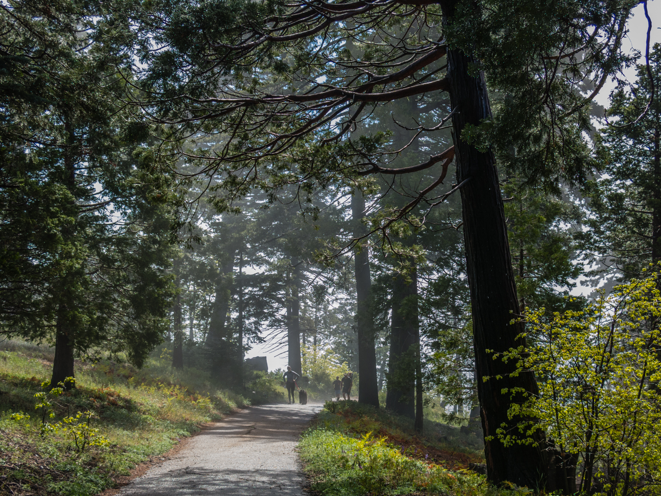
The start of the trail at the back of the Paso Picacho Campgrounds
Once you have parked and are ready for the hike, head back through the campgrounds, follow the road to the back left of the campgrounds and you will see a sign for Cuyamaca Peak next to some bathrooms and an information sign. Once you are on the road its pretty easy to follow, just stay on the paved road all the way to the top. You will pass several other trails and or fireroads on the way to the top, the West Side Trail towards the bottom of the trail, Azalea Spring Fire Road and Fern Flat Road towards the middle of the trail, and Conejaos Trail and Burnt Pine Fire Road towards the top of the trail. Again keep your eye open or nose open ( slightly musty, skunky smell) for the Poodle Dog Bush, its not close enough to the road for you to brush up against it by mistake but I would rather have you know what to look for rather then not.
Poodle Dog Bush by the side of the trail on the way up, I could smell it before I saw it.
We got lucky on this trip out. The weather report said some light drizzle in Alpine, but we where hitting rain from before Alpine on the 8 east all the way until just a few miles away from the campgrounds, I was not looking forward to hiking in the rain. So I was pleasantly surprised to get to the campgrounds and have the weather cooperating with us. It was cold, and slightly misty, but nothing bad, besides once you start heading up the hill you will start stripping layers off.
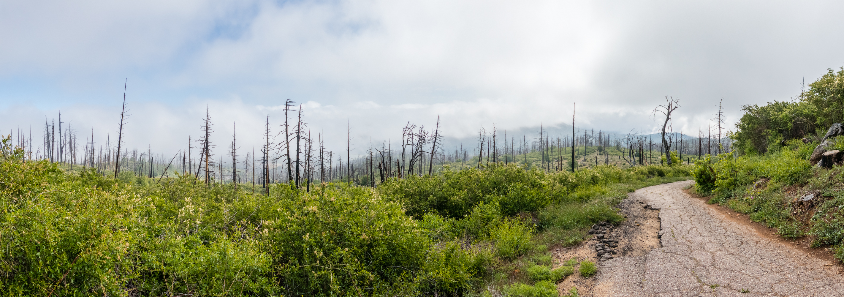
Heading up the lookout road through the clouds.
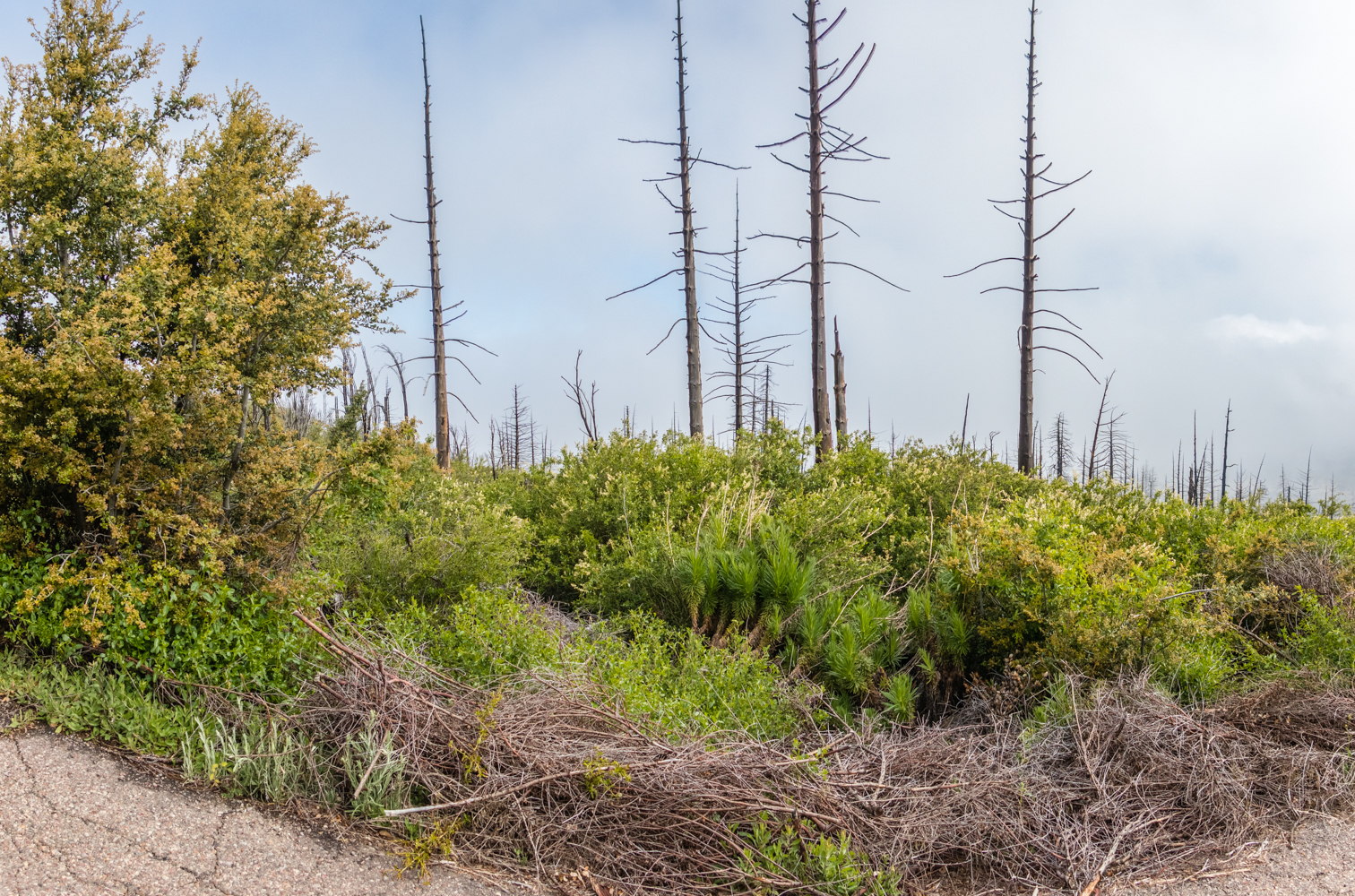
As you make your way up its hard not to wonder what this hike used to look like when this was a healthy living forest, the forest of dead, burnt trees are a stark reminder of the 2003 Cedar Creek Fire which decimated 90 % of Cuyamaca Rancho’s 24,700 acres. Even this devastation can have a kind of beauty to it.

Looking back at the devastated forest as you make your way up Cuyamaca Peak
As you make your way towards the top you eventually start to see some of the old forest that survived the fire and you start to get a whole different feeling to the hike. On this day with the heavy clouds it was nice to be walking under these great trees as the water dripped down onto the hikers below.
Starting to see the remaining trees towards the top of the hike
As you reach the top of the hike you will usually have some of the best views of all of San Diego County, but today it looked like we were just reaching cruising altitude on Cuyamaca Hiking Express, as we came to the top of the peak and looked down on top of a blanket of clouds as far as the eye could see with little mountain tops periodically poking out like little islands.
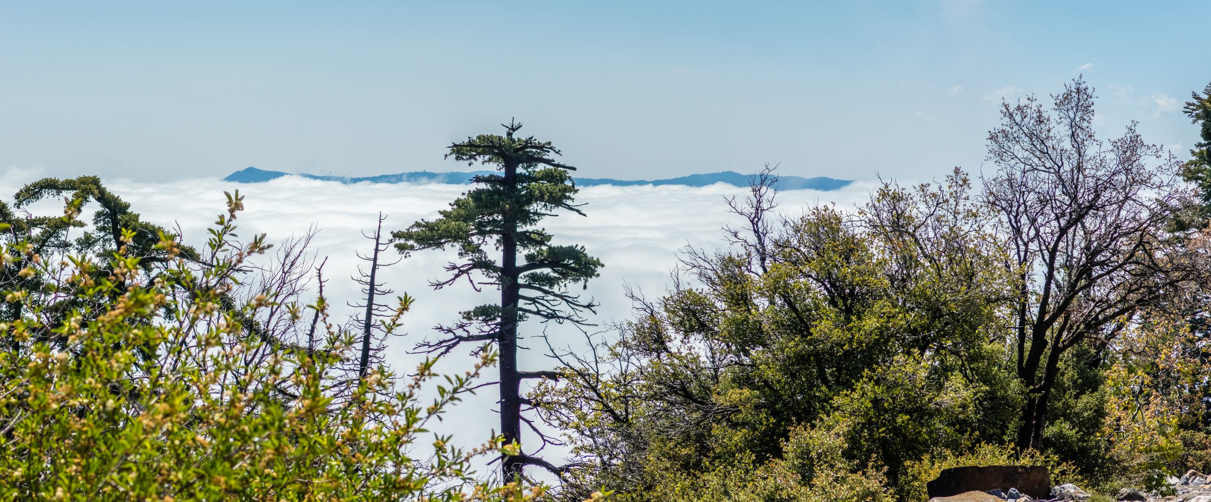
Looking east towards Mt Laguna poking out of the clouds.
While you are at the top of the peak enjoying the view and traipsing around looking for a bathroom spot, keep an eye open for that damn Poodle Dog Bush, I noticed it around the last building towards the south as I looked for a place to use the bathroom, you really don’t want to tangle with this bush.
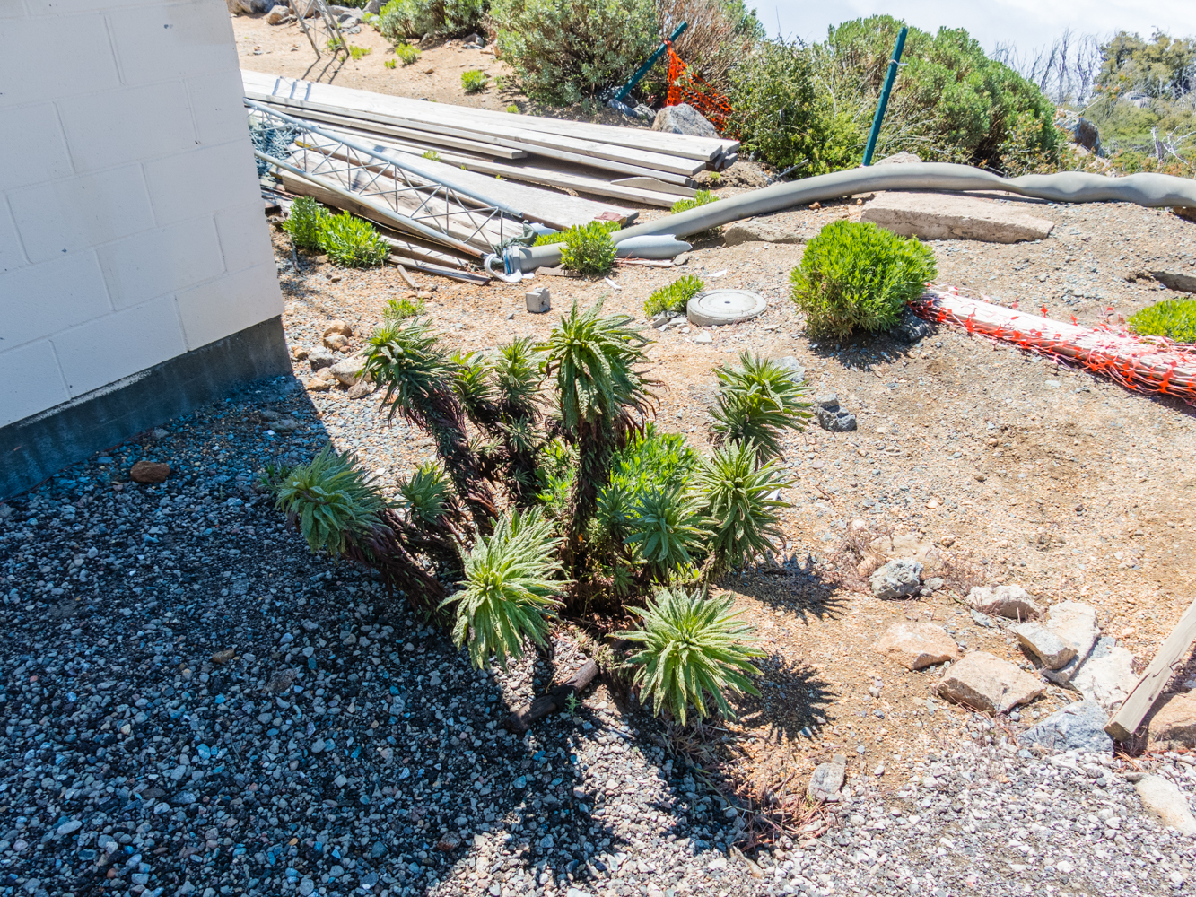
Poodle Dog Bush around some of the buildings at the peak
As we made our way back down the mountain, the clouds started to part somewhat and we started to get views of mountain tops that had been hidden all morning long.
Stonewall Peak starting to show as the clouds part on our way down


