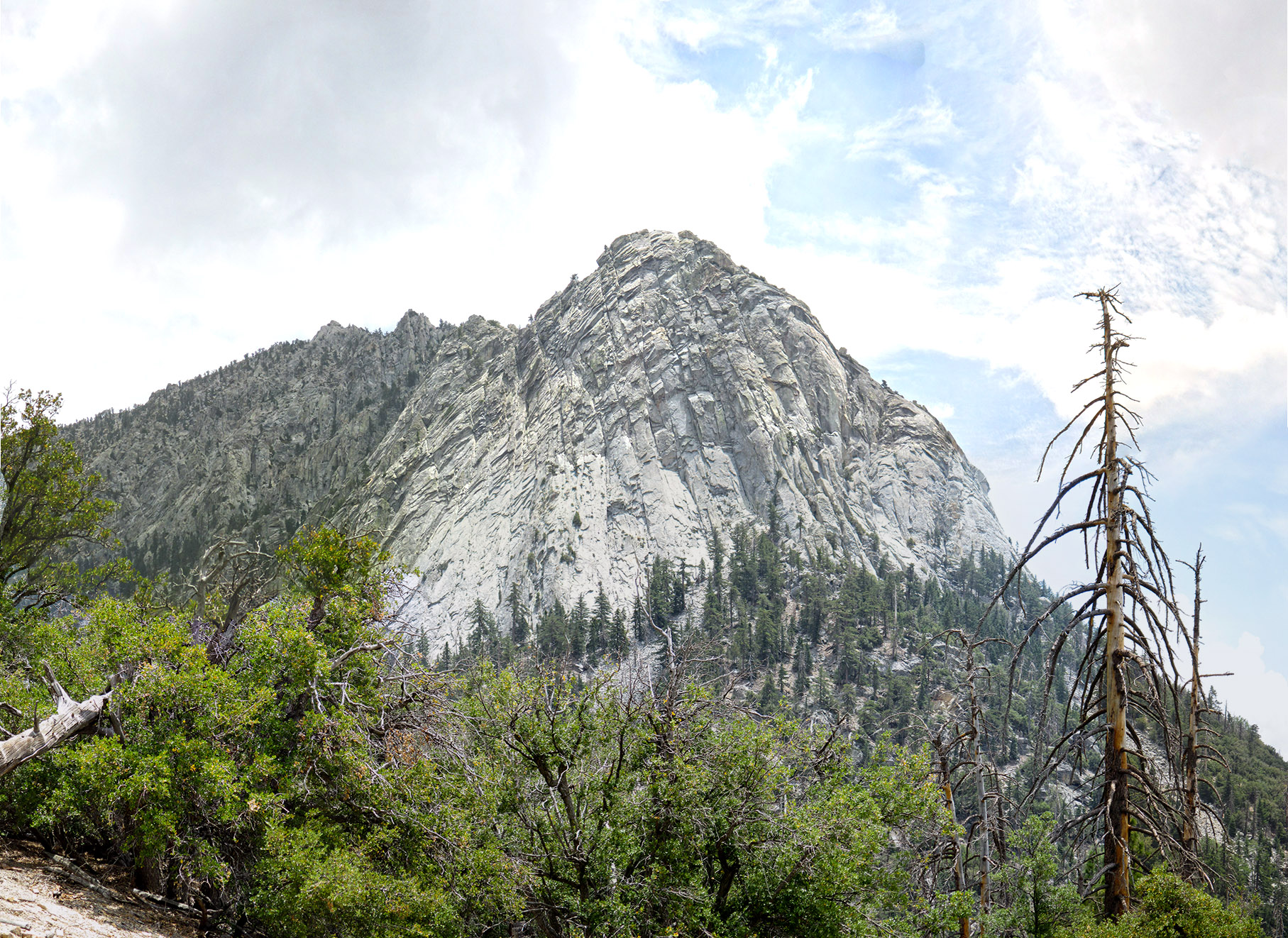
Looking up at Lily Rock from the Devils Slide Trail
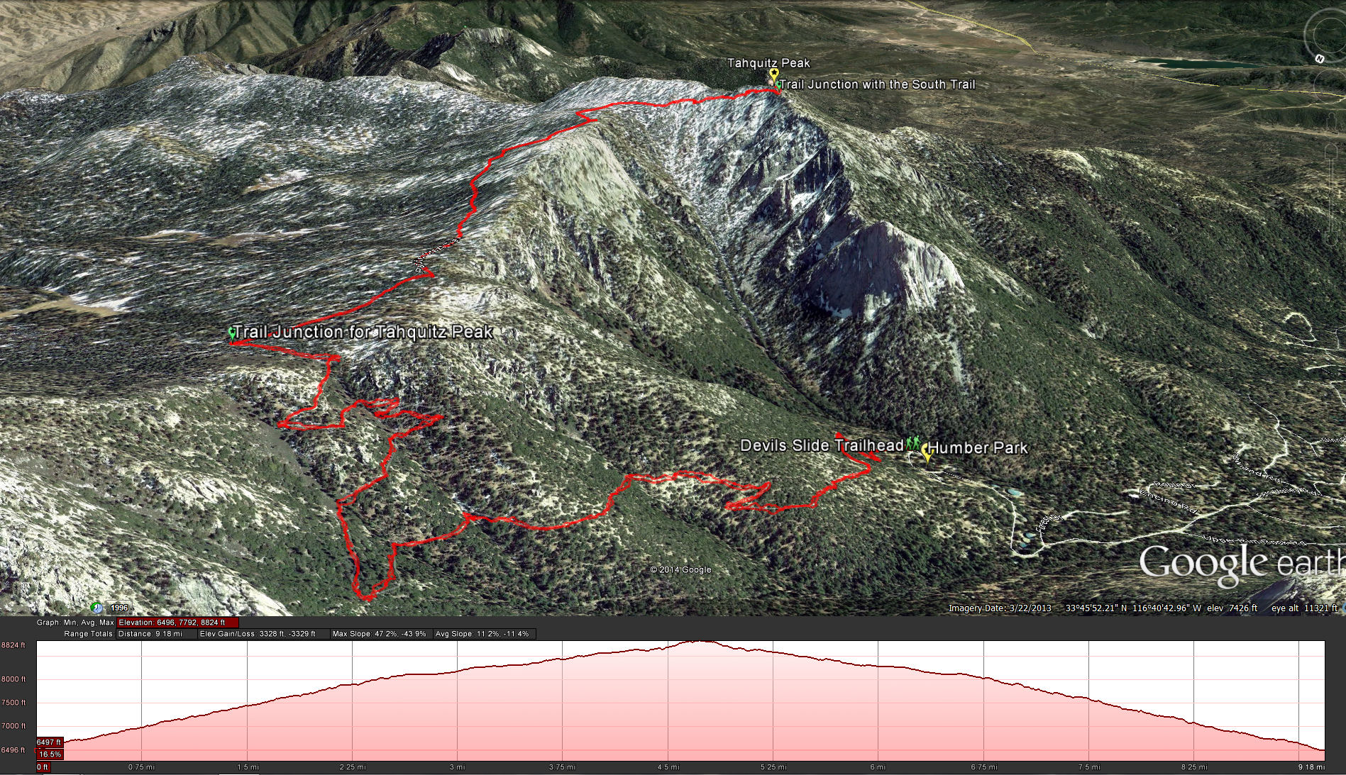
Devils Slide to Tahquitz Peak Trail
Distance: 9 miles. Elevation Gained: 2350 feet. Top Elevation : 8,846 feet.
Fees and Permits: Adventure Pass for your car and a Wilderness Permit. Adventure Pass: $5.00 daily or $30.00 annually. Wilderness Permit: Free but hard to get on the weekends. There is a quota of 30 permits per day on wilderness permits for Devils Slide weekends from Memorial Day to Labor Day. I found that if I faxed in an application beforehand I received back the permit in a very timely manner.
To get to the trail head: From state route 243 in the town of Idyllwild, turn east onto North Circle Dr. Continue on North Circle Dr. for about a mile until you hit South Circle Drive. Turn right onto South Circle Drive and then take the first left onto Fern Valley Road. Take Fern Valley Road all the way until you reach Humber Park. There you will find the trail head. https://www.google.com/maps/preview?hl=en#!data=!1m4!1m3!1d1138!2d-116.6866594!3d33.7647198!2m1!1e3!4m18!3m15!1m0!1m4!3m2!3d33.7645972!4d-116.6859272!6e2!3m8!1m3!1d1138!2d-116.6866594!3d33.7647198!3m2!1i1920!2i1054!4f13.1!7m1!3b1&fid=0i7
T o Start the hike park at the trail-head in Humber Park. The trail-head is to the far upper-right of the parking area. Immediately you will start with a good incline to the trail. You will gain the majority of the altitude in the first 2.5 miles ascending from 6500 feet to around 8100 feet at which point the trail will even out and start a slower ascent after the saddle junction, going up another 700 feet in 2 miles or so, a much better pace after the beginning of the hike. As you make your way up the trail from Humber park take a look behind you and while see Suicide Rock, another popular hiking and rock climbing area close by, you will also get some impressive views looking up at Lily Rock, the most prominent feature in the Idyllwild area, you can’t escape it wherever you are in town, its really quite impressive. Hiking on this trail made me feel like I was up in the Sierra’s, it was a nice change of pace from the mostly desert hiking we find in most of San Diego. Eventually you will make your way to the crest and enter the saddle junction which will allow you to connect to the Pacific Crest Trail which will connect to Strawberry Junction, The Wellman Divide, and Round Valley to the north. The two trails that head east are currently off limits due to the 2013 mountain fire. Finally the part of the Pacific Crest trail that heads south towards Tahquitz Peak. As you head south along the trail you will continue to ascend but at a much slower pace. Enjoy the break and take in some of the scenery, before you know it you will wrap around a little peak and start the last little bit of the trail on a precarious trail with a steep drop to the right of you down towards the valley, in better weather this isn’t really a problem, but you can easily see how in the winter time this can become very dangerous with ice. Finally you will see one more junction sign where the trail connects up with the South Ridge Trail and heads up the final distance to the top and the fire lookout station. You’ve made it to the top, sit have some lunch and take in the views. Depending on what time of the year you go up keep an eye on the weather, if you hear thunder in the distance you better head back down.
Weather forecast for the hike:


