Eagle Peak

Eagle Peak Hike
Distance: 4.5 miles .Elevation Gain: 1200 feet. Time to complete: 2 – 3 hours roundtrip
To Get There: From Interstate , exit at Highway 79 ( the Descanso exit) and drive north. After 1.3 miles turn left on Riverside Drive. Continue 0.6 miles to the main crossroads (post office, etc.) of the hamlet of Descanso. From there take Oak Grove Drive 1.6 miles to the intersection of Boulder Creek Road on the right. Follow Boulder Creek Road north for 13.0 miles (the first half is paved and the rest is dirt) to a hairpin turn where unpaved Cedar Creek Road joins from the west. Park there, at the Eagle Peak and 3 Sisters Waterfall Trailhead taking care not to block traffic, and post an Adventure Pass on your car. (This hairpin turn and intersection can also be reached, more circuitously by way of Engineers Road or Pine Hills Road to the north.)
Bring Lots of Water: This area can get really hot, and if you decide you want to go down to the falls your going to need even more water as well.
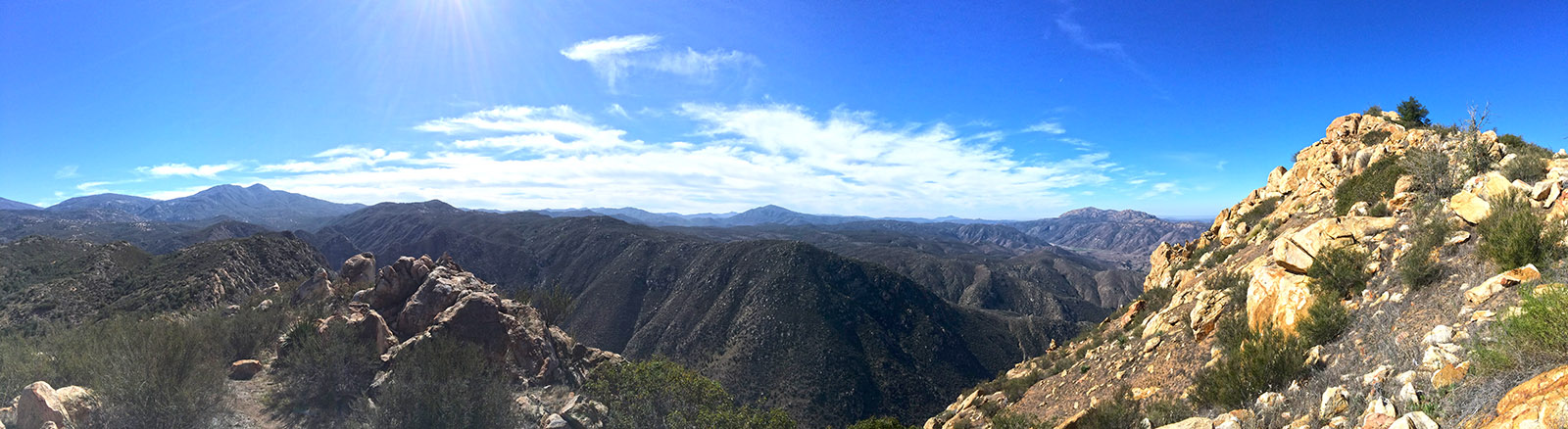
This hike starts on the same trail as the 3 Sisters Hike, so if you want to get a good place to park your car, not to mention beating the heat I would suggest getting to the trailhead as early as possible, by the time I finished around noon there had to be 30 cars there. Head along the trail past some nice little shady spots under the remaining oak trees in the area. If you look down to the right of the trail you can see the dirt road that takes off from the trail head and ends up at the Julian side trailhead for Cedar Creek Falls, you can see an old rusty car that didn’t quite make it. Keep heading along the trail until you see the trail split, another path will head left and down the hill to the 3 Sisters Waterfalls hike, continue on straight as the path narrows down. The path will continue down and then start to climb, this is a very pleasant part of the trail will lots of shade so enjoy it. Eventually you will come to another split in the trail, with a trail heading up and left ( this is the climbers route) and another trail heading up and right ( Eagle Peak Route), continue on the right side trail and soon you should come to the uphill climb for the peak. As you climb up the peak there are some great vistas on your left side looking down into the valley with a little meandering creek feed by the same water from the 3 Sisters Waterfall. You will eventually come to the rim of the mountain, continue along the rim to the 3rd peak, which is where you will find the geological survey marker and the climbers registry in a little tin can if you would like to sign it. If you continue just a little past the geological survey marker you will come to a great vista that allows you to see El Cajon Mountain, Iron Mountain, Mt Woodson, Mt Gower, the Cedar Creek Falls Trails and Mildred Falls. When you are finally done and ready to head back you may want to take the climbers route just for a little fun so see the back side of the mountain you are on, but be careful this route is very steep and very slippery.
Weather forecast for the Eagle Peak Hike:


