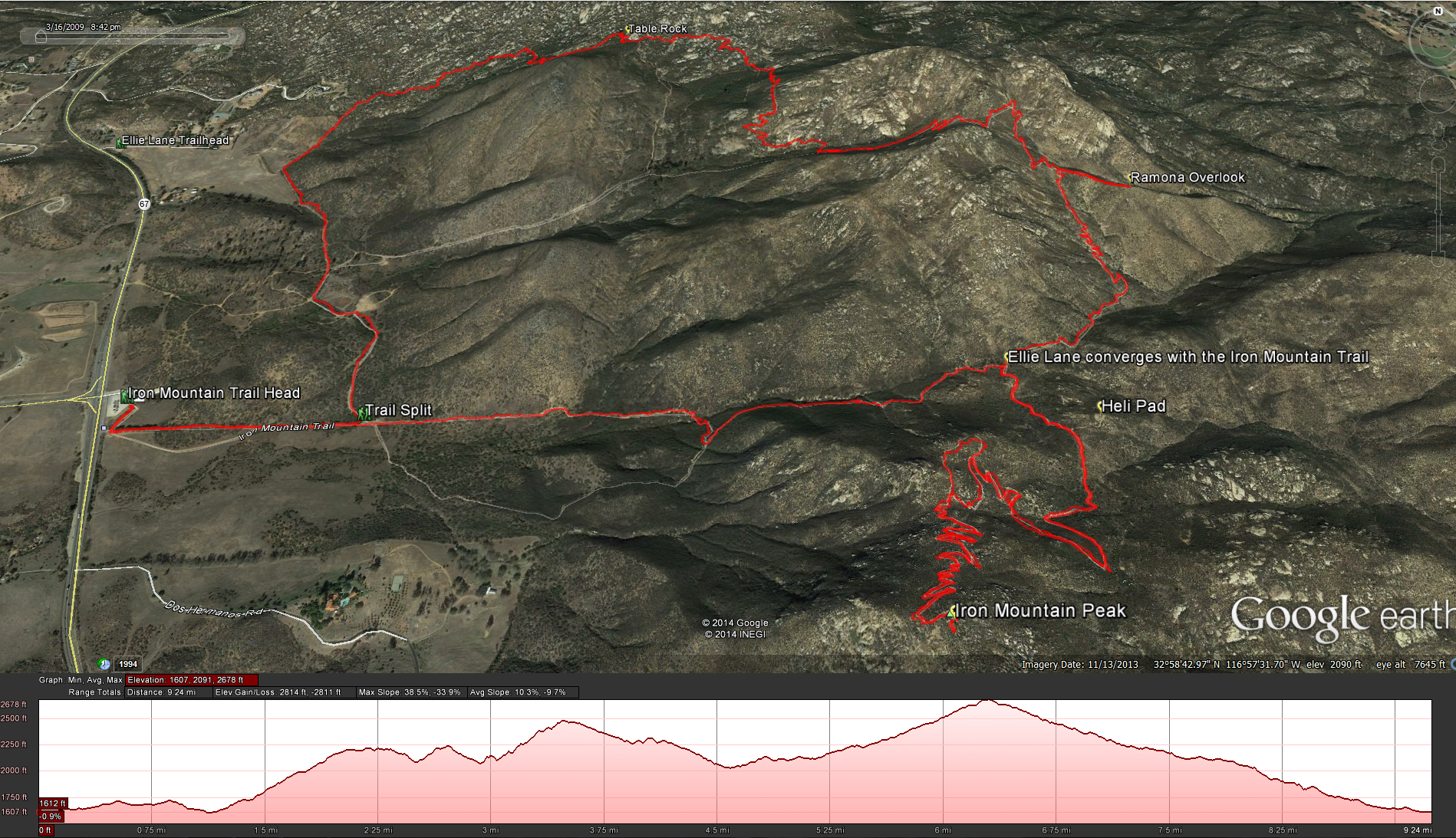
Distance: 10 miles .Elevation Gain: 1700 feet. Time to complete: 4 hours round trip. Difficulty: Moderate
Bathroom Facilities: Yes – at the main Iron Mountain Trail Head, but not at the Ellie Lane Trail Head.
Permits Needed: None.
Is this hike good for dogs: Yes, but only in the cool months. It is a long hike and you will need to bring water and food for you and your dog.
How to get there: From the 15 free way take either Scripps Poway Parkway or Poway Road East, either road will get there. If you take Scripps Poway Parkway it will eventually end at the 67, at which point you can turn right or left, turn left and head north 1.8 miles to the Iron Mountain Trailhead and that is where your hike will start. If you take Poway Road when it hits the 67, the Iron Mountain Trailhead is directly across the highway from you.
To Start the hike: Once you get to the Iron Mountain Trailhead, park either in the parking lot or on the highway if its a really busy day. You can also start the hike from the Ellie Lane Trailhead, I just prefer to start from the Iron Mountain Trailhead because of the bathrooms, which inevitably someone will need to use before we start the hike.
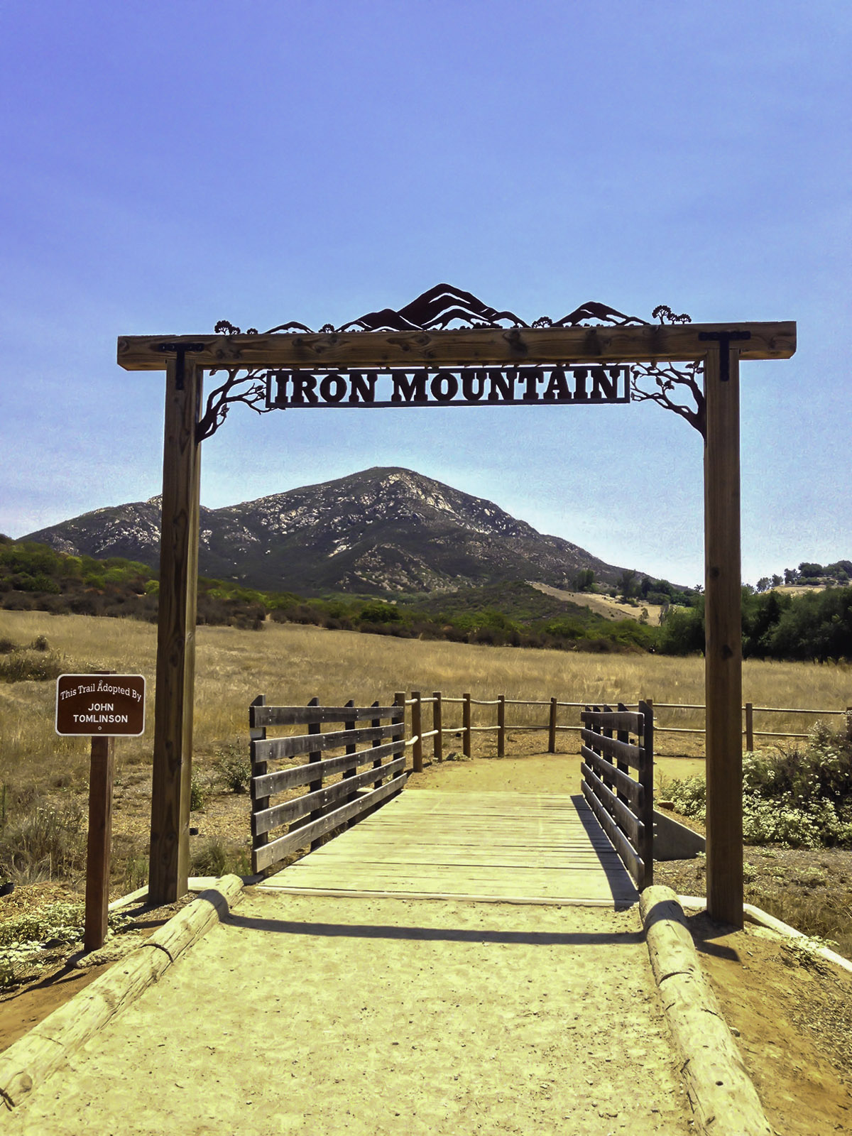
Iron Mountain Trail Head Sign
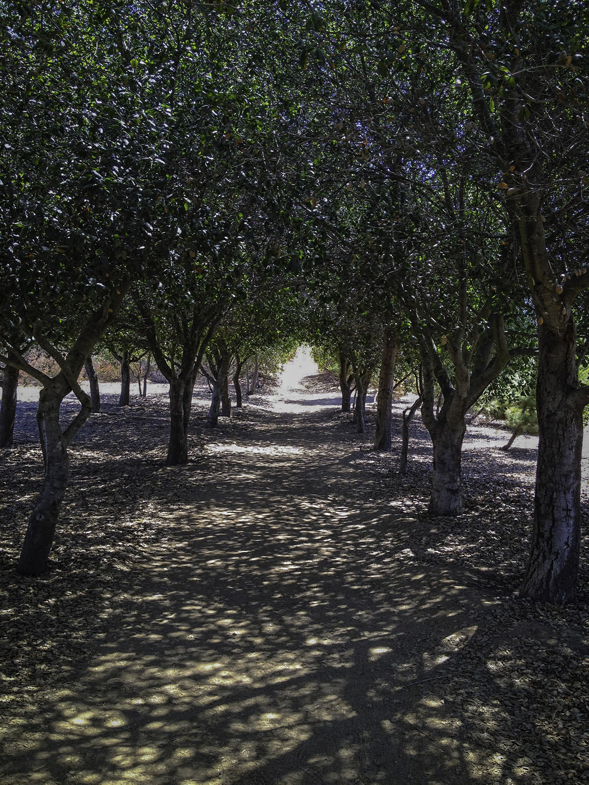
The Tunnel of Trees that you walk through in the beginning of the trail.
After starting on the trail from the trail head walk through the tunnel of trees and continue on the trail for about 0.4 miles until you see another trail split to the left, this is the connection to the Ellie Lane Trail. So head left ( north) along the trail . Soon you will see a dried out pond on your right, when I first started hiking here in the 90’s this pond was completely full. At about 0.7 miles into the trail it will split again, head right ( north east) along the trail. Head up and down the hill and you will see some pasture land in front of you and another dried out pond around a mile into the hike, about that time you should see the trail connecting up with Ellie Lane.

Connecting up with Ellie Lane.
As you connect up with the Ellie Lane Trail at about 1.25 miles into the hike you will start to climb up through the little valley surrounded by boulders. You will do a lot of climbing through this part. Rising about 540 feet in .80 miles from the connection with the Ellie Lane Trail to Table Rock.
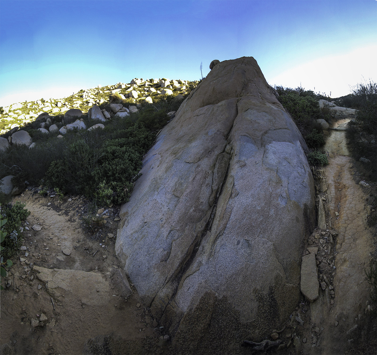
Some of the cool rocks you come across on the way up Ellie Lane Trail
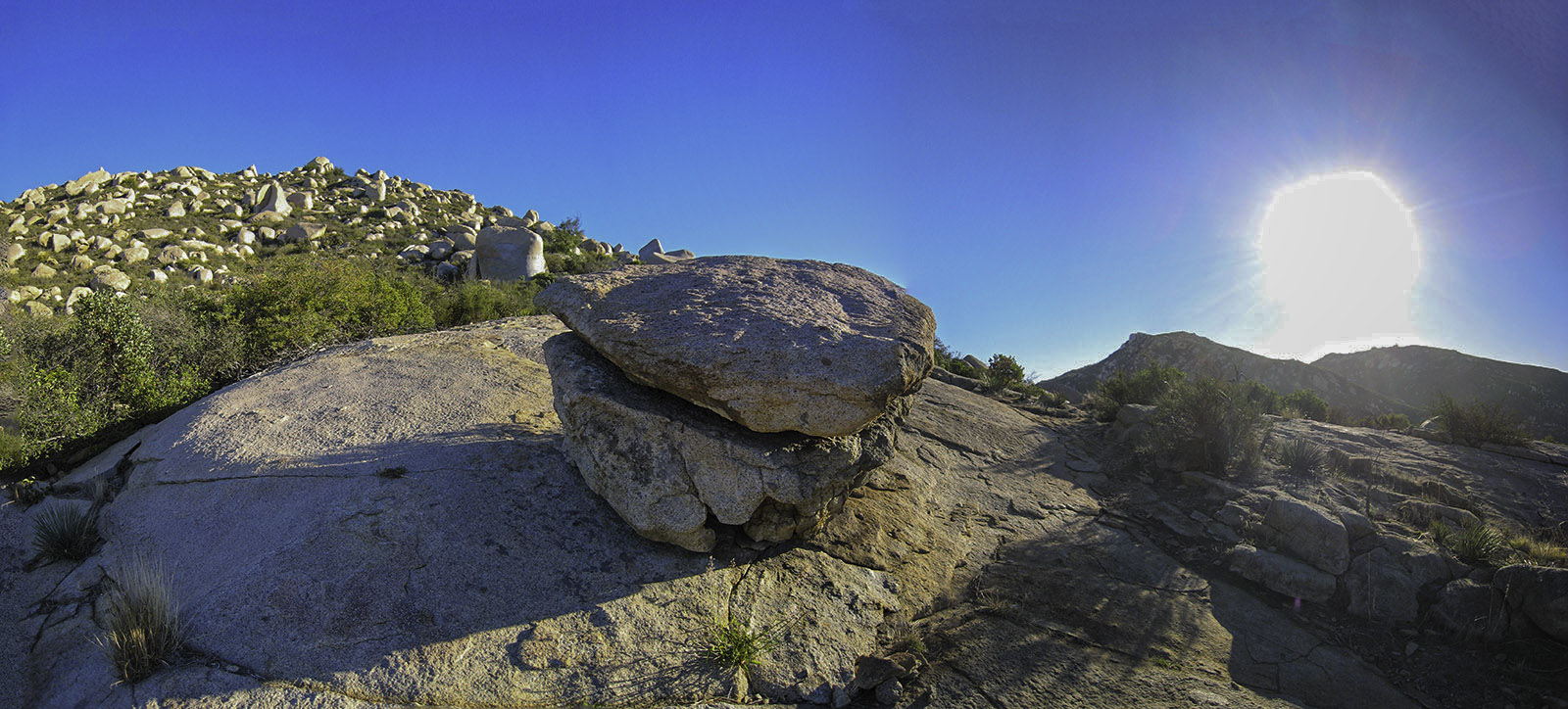
Table Rock on the Ellie Lane Trail
At the top of the trail, about 2.08 miles into the hike you will come across Table Rock. Its a funny looking little rock but I wouldn’t go on this hike just to see this funny little rock. Soon after you come across Table Rock the trail will split again, you can go straight or right, right will take you down to the bottom of the canyon you will climbing up, but I Prefer to head straight and at about 2.5 miles into the trail you will start climbing up the side of a little mountain ( you will see two trails on the side of the mountain, one lower and one higher, it doesn’t matter which one you take, they both end up in the same place, but I prefer the upper trail) after you head up and over the little hill you will come down into the canyon and connect up with the trail on the southern side of the canyon at about 3 miles into hike.
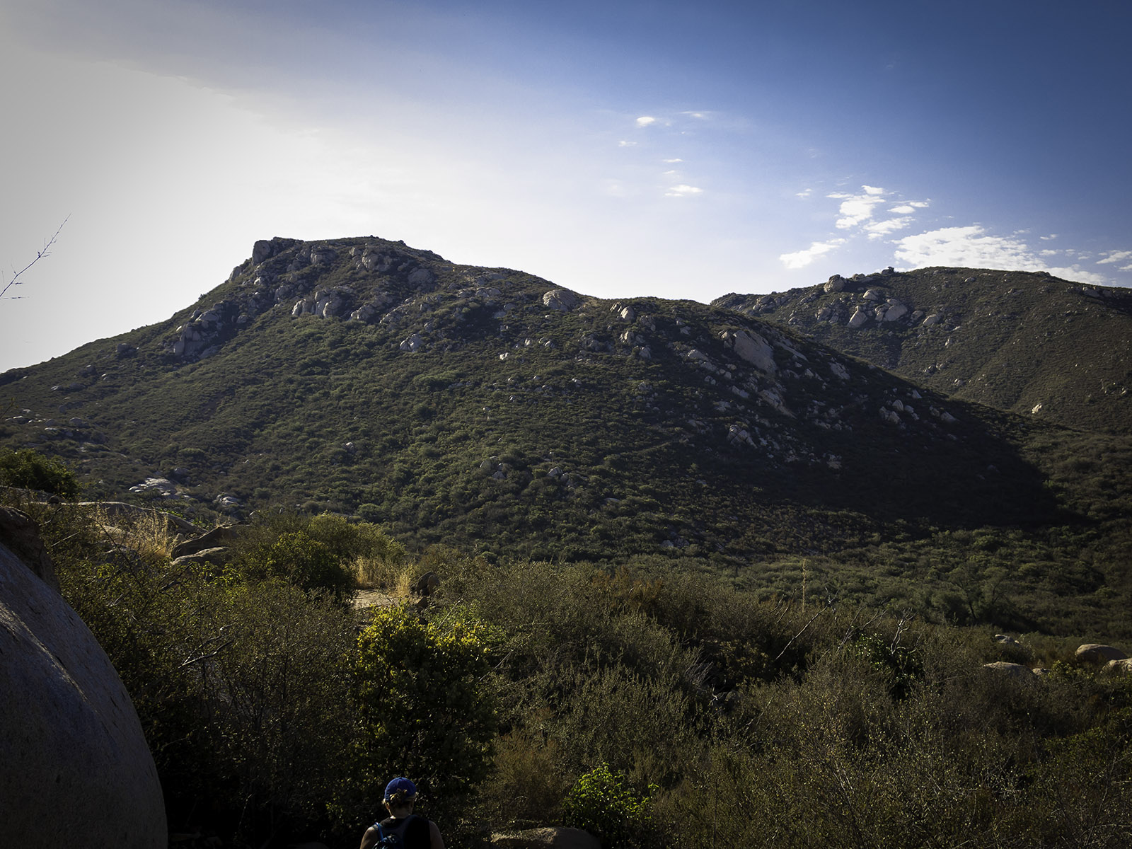
Looking across to the two trails heading up the hill and connecting up to the canyon trail
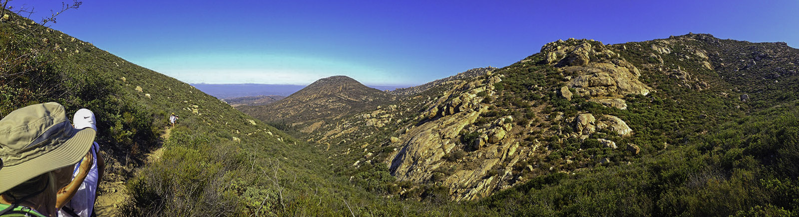
Heading up Ellie Lane Trail through the canyon
Once you connect up with the trail on the southern side of the canyon you will make an ascent of another 400 feet between the 3 mile marker to the 3.5 mile marker. Once you reach the top take in the view and then start heading down the backside. You will see a small trail that looks like it is heading straight away from you, this is the Ramona Outlook trail, its only a 1/10 of a mile, so you might as well head out on it and see the views.
Looking down the backside of the mountain on Ellie Lane Trail
Looking up towards the top of Iron Mountain from the Ramona Outlook
When you are done with taking in the views head back towards the trail and then take a left and head south towards Iron Mountain. For the next 0.8 miles you will wind down into a little valley and then back up until you meet up with the main Iron Mountain Trail ( Poway Road Trailhead).
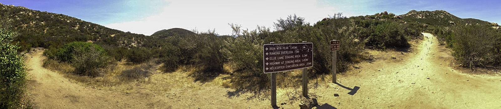
Ellie Lane and Iron Mountain Trail Junction
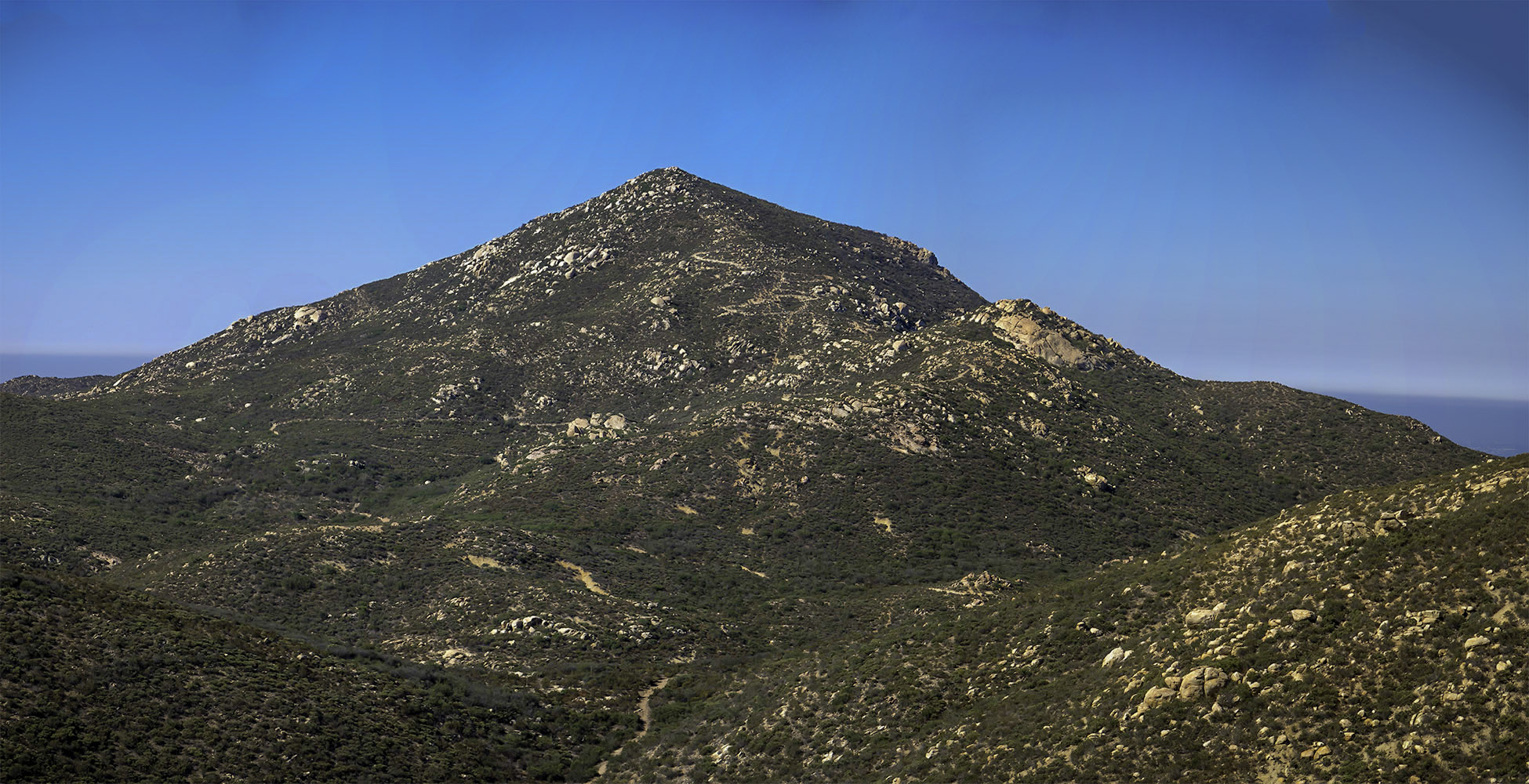
At this point you have about another 1.5 miles to go to the top of the mountain. The first 0.7 miles is a moderate meandering trail, and then the remainder is all switch backs to the top. Even though the meandering part of the trail is easy, when its hot this is the part of the trail that usually gets no breeze. Once you make it to the switch backs and you can see down the front of the mountain to the main trail head you start to get the breeze back and realize what was missing. Once you get to the top take in the views, look through the telescope and sit down and enjoy a little bite to eat. It can get really crowded up at the top but you can usually find somewhere to sit down and take a break if you look.
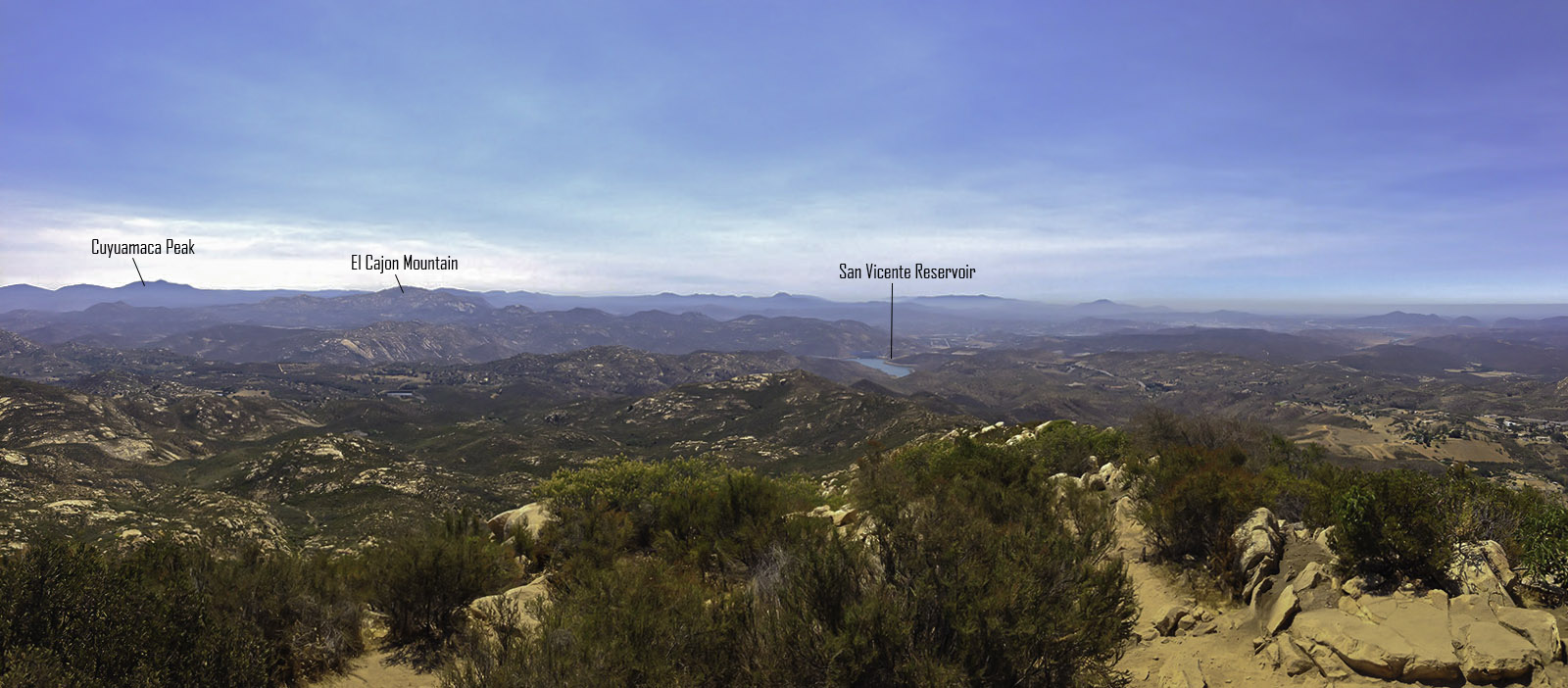
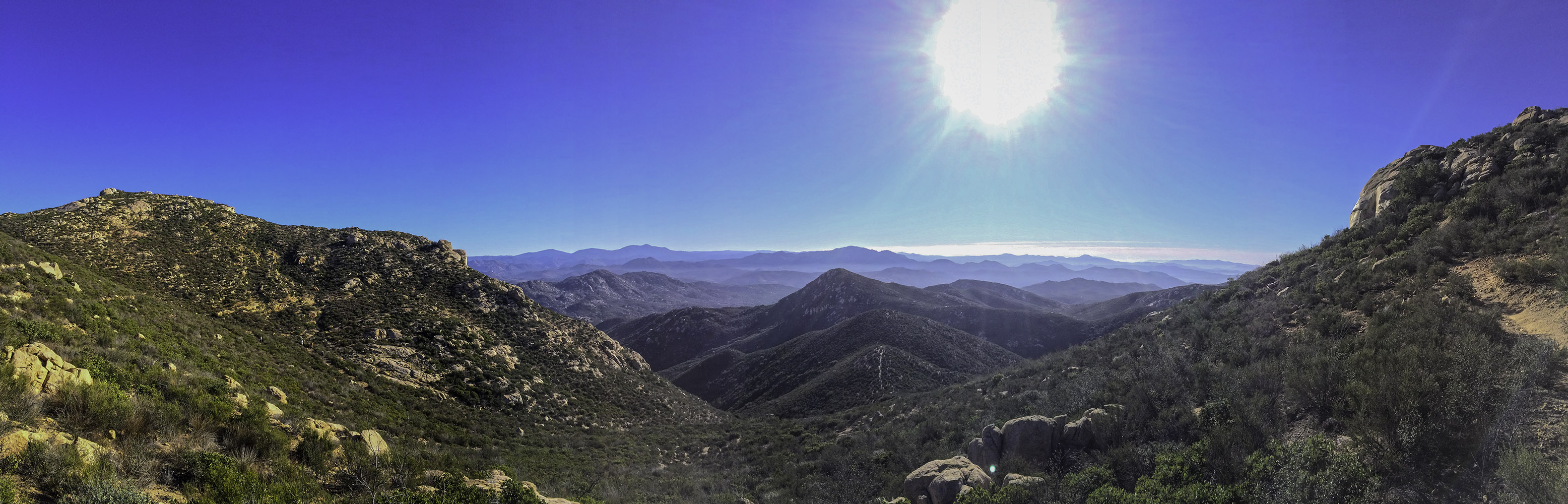
Looking southeast from the top of Iron Mountain
When you are ready to head back down, take the trail down 1.45 miles to the trail junction with the Highway 67 staging area ( Poway Road Trail Head) and then head down the additional 1.45 miles back to the trail head.


