
Garnet Lake from Agnew Meadows
Distance : 16.5 miles. Elevation Gain: about 2200 feet.Time to complete: 1-2 days depending on fitness and comfort levels.
If you want to just do a kick ass day trip and start early this should take you 8-9 hours. However if you want to enjoy yourself and relax I would suggest camping in which case you need to consider how much weight you are going to carry on your back, cold weather clothing ( even in summer it gets cold at night at 10,000 feet), food in a bear can, etc…
Red Tape: You need a permit for this hike. You can get your permit here Recreation.Gov-River Trail
There several trails you can use for the permit system. River Trail. High Trail. Shadow Creek. John Muir. It doesn’t really matter once you get back into the back country.
Season: Spring through Fall. When the snow has melted, otherwise the road down to the valley is closed. During the summer months you will have to catch a Shuttle from the Mammoth Resort down into the valley, after Labor Day the shuttle is stopped and you can drive down into the valley until they close it up for the winter, I found this time to be the best time, at least in my eyes. All the summer traffic is gone, so there is hardly anyone down there. You can drive your own car down into the valley which makes it convenient if your camping in Reds Meadow to drive over to Agnew Meadows Trailhead. If you would like to enjoy a real hot meal, the Mule House Cafe is still open at the Reds Meadow Resort and since there is hardly anyone around you can walk right in sit down and enjoy a great meal before and or after the hike.
For your enjoyment : If you enjoy the hop flavored beverage of beer may I suggest that you place a couple in a cooler ( and anything else in your car that smells in the least so a bear doesn’t break into it over night) and place the cooler in one of the bear box’s at the trail head. We did this and 2 days later at the end of our hike we were rewarded with a cold beer as we sat at our car and stripped our boots off of our aching feet. What a pleasure.

The Devils Post Pile – not to far from Reds Meadow Campgrounds.
We originally had planned on going all the way to Thousand Island Lakes, about another 2.5-3 miles from where we stopped and camped over night, but we were so exhausted by the time we hit Garnet Lake we decided to drink in its beauty and enjoy a night of camping there. We were also originally thinking of starting out the hike from Reds Meadow Campgrounds where we were camping the night before, but that would have added at least another day to the hike and another 12-13 miles to the hike, not to mention then you would have to pay for a campsite that you are not occupying at the time ($22 a night). Luckily when we talked to the camp host ( George – what a nice guy), he told us that Agnew Meadows trailhead parking was still open even though the campsite was not ( closed because of blown down trees from wind ).
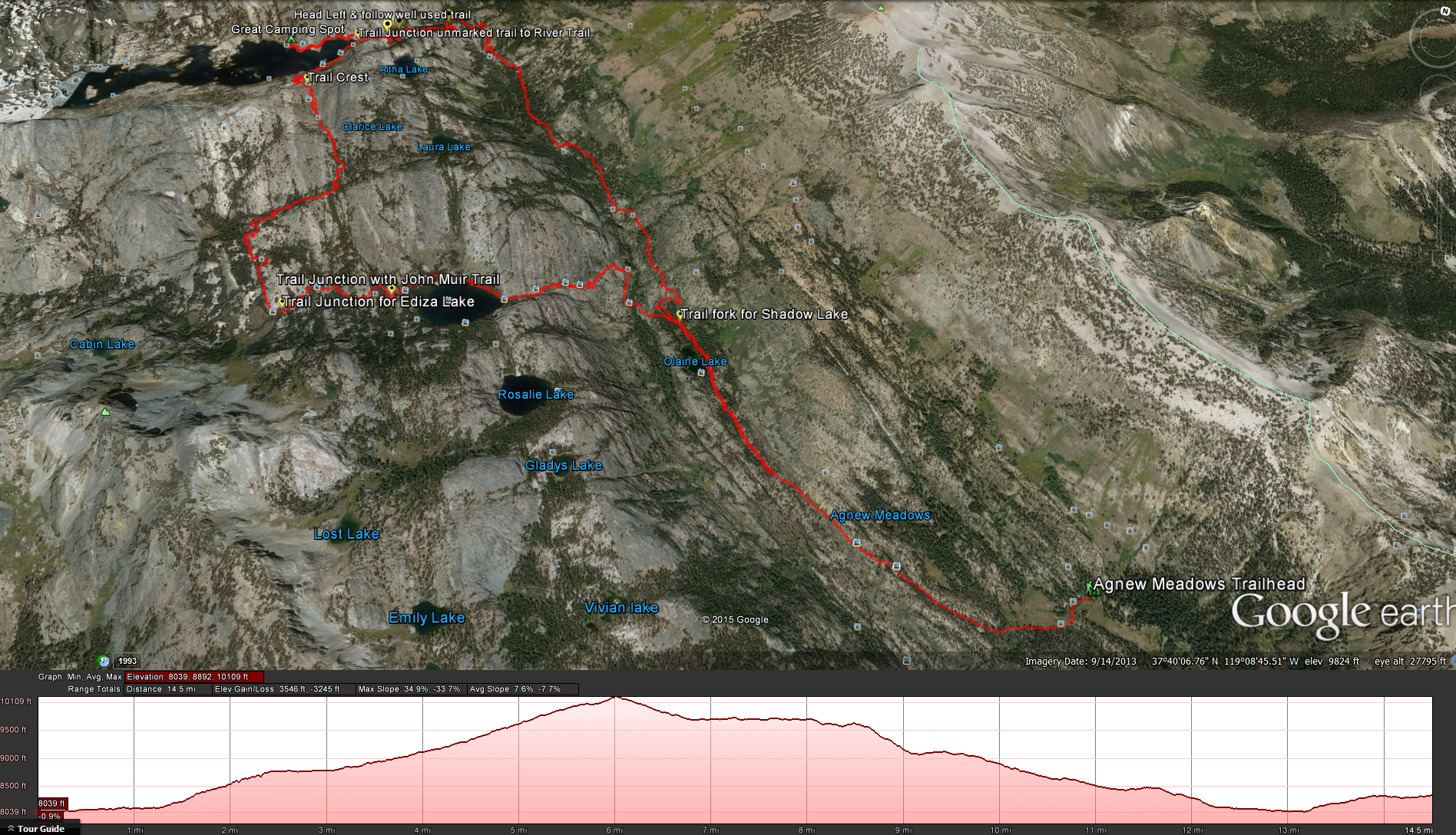
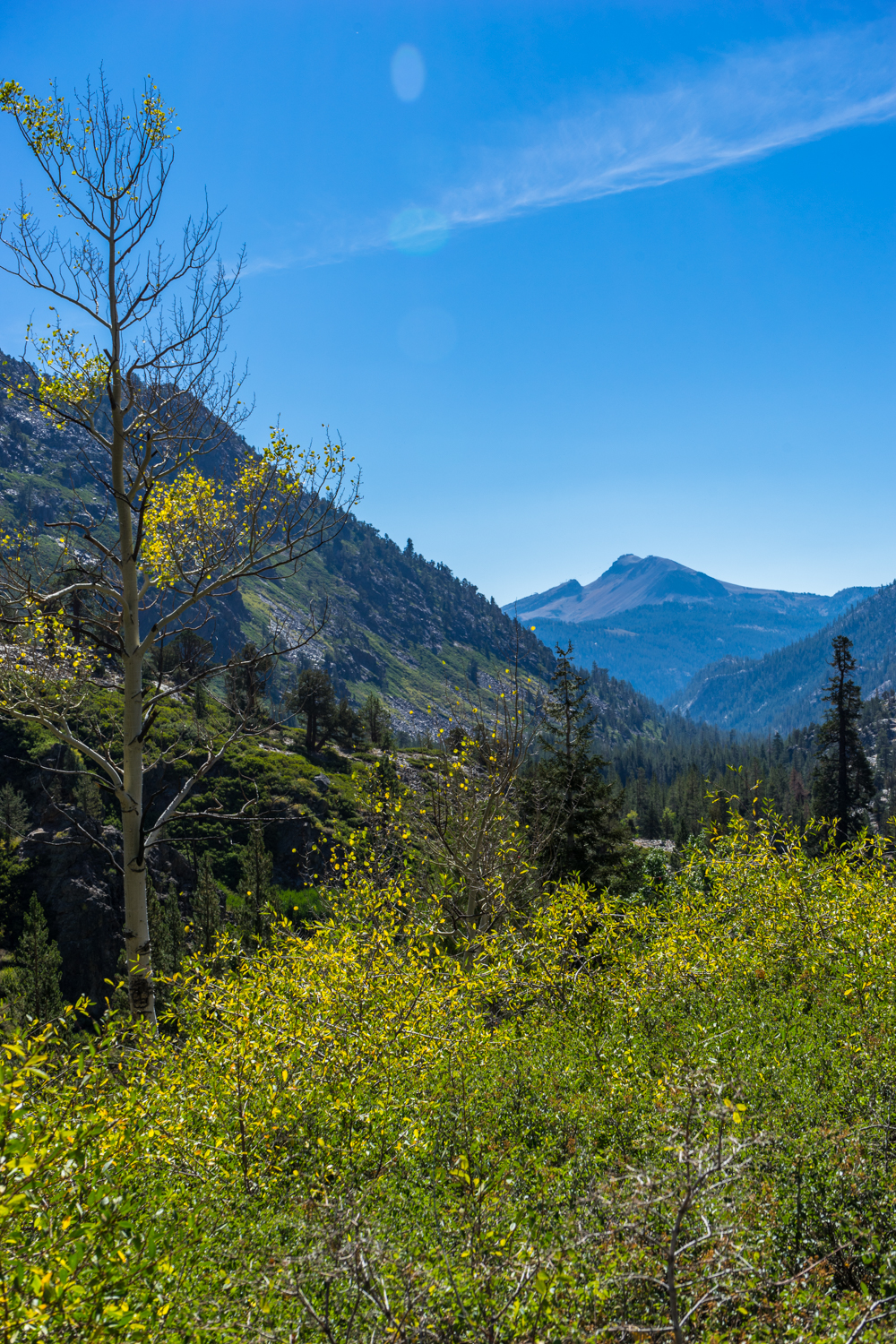
Starting off from Agnew Meadows take the River Trail along the southern edge of Agnew Meadows and follow it for about 2 miles until you reach the trail fork for Shadow Lake. Along the way in the beginning of the trail you will go up and over a little hill before you start to descend into the wooded valley below ( remember this – it seems so benign on the way down but its going to kick your butt on the way back when your are tried).

Looking up at the pass that you will climb to get to Shadow Lake
Looking south towards Mammoth Mountain
From the turn off to Shadow Lake it will take you about 1.6 miles and 650 of elevation before you reach Shadow Lake. This is a good place to stop and take a break, take in the scenery enjoy the peace and quite before moving on.
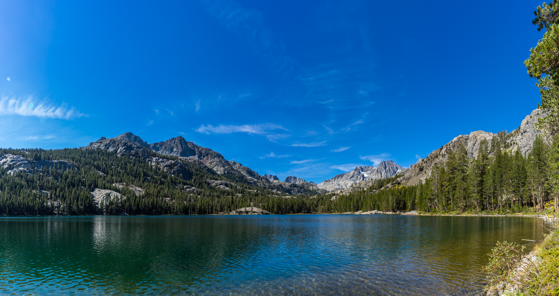
Shadow Lake
Once you see Shadow Lake it should take you about 0.5 miles to make your way along the northern edge of the lake until you meet up with the John Muir Trail. If you are not packing a lot of water somewhere along this point would be a good place to fill back up, you will have about 3 miles of trail, climbing 1300 feet before you get to another water source.
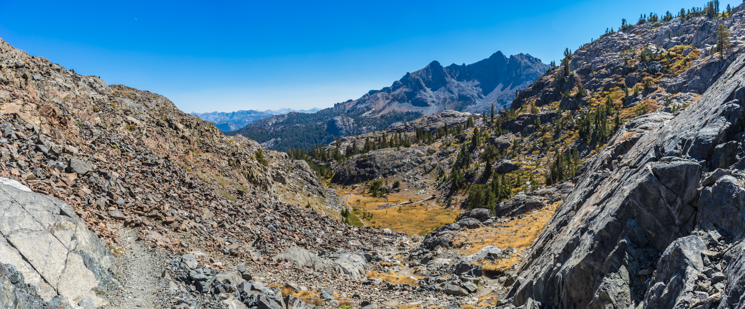
Looking back towards the trail up from Shadow Lake and the Volcanic Ridge
As you near the top of the trail at over 10,000 feet take in the scenery behind you, its a great view. Once you get to the trail crest you will start making your way down towards Garnet Lake. It’s approximately 1 mile from the trail crest down to the bridge over to the other side of the lake. Somewhere along this route my buddy and I dropped our packs and rested a while taking in the scenery around the lake and trying to decide if you would camp here or move one. We decided to head over to the north side of the lake and after doing so decided that it was a great place to set up camp and enjoy the night. Its about 0.25 miles after the bridge before the trail starts making its way further north and up the pass towards Thousand Islands Lake. We continued on a smaller trail just below this point that skirts the northern edge of the lake for another 0.25 miles before we came across the perfect camp site and decided to call it a day.
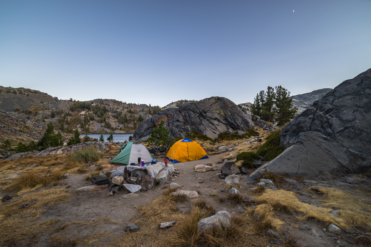
Our campsite on the northern edge of Garnet Lake
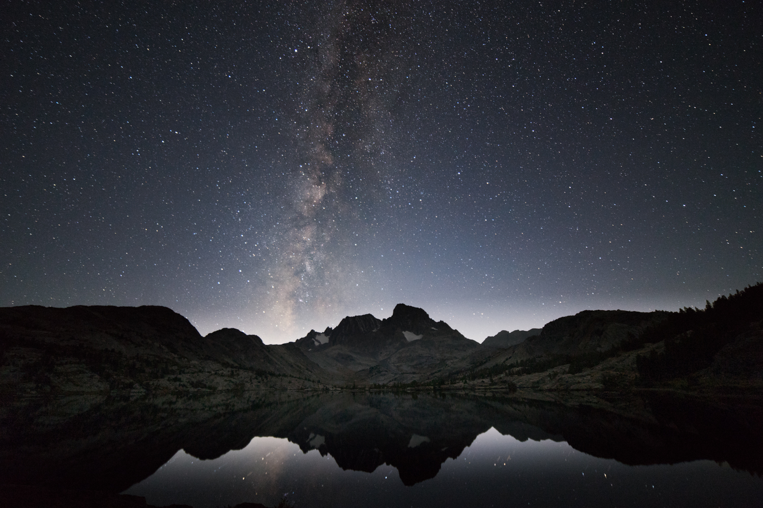
The Milky Way over Banner Peak and Mt Ritter in the background and Garnet Lake in the foreground.
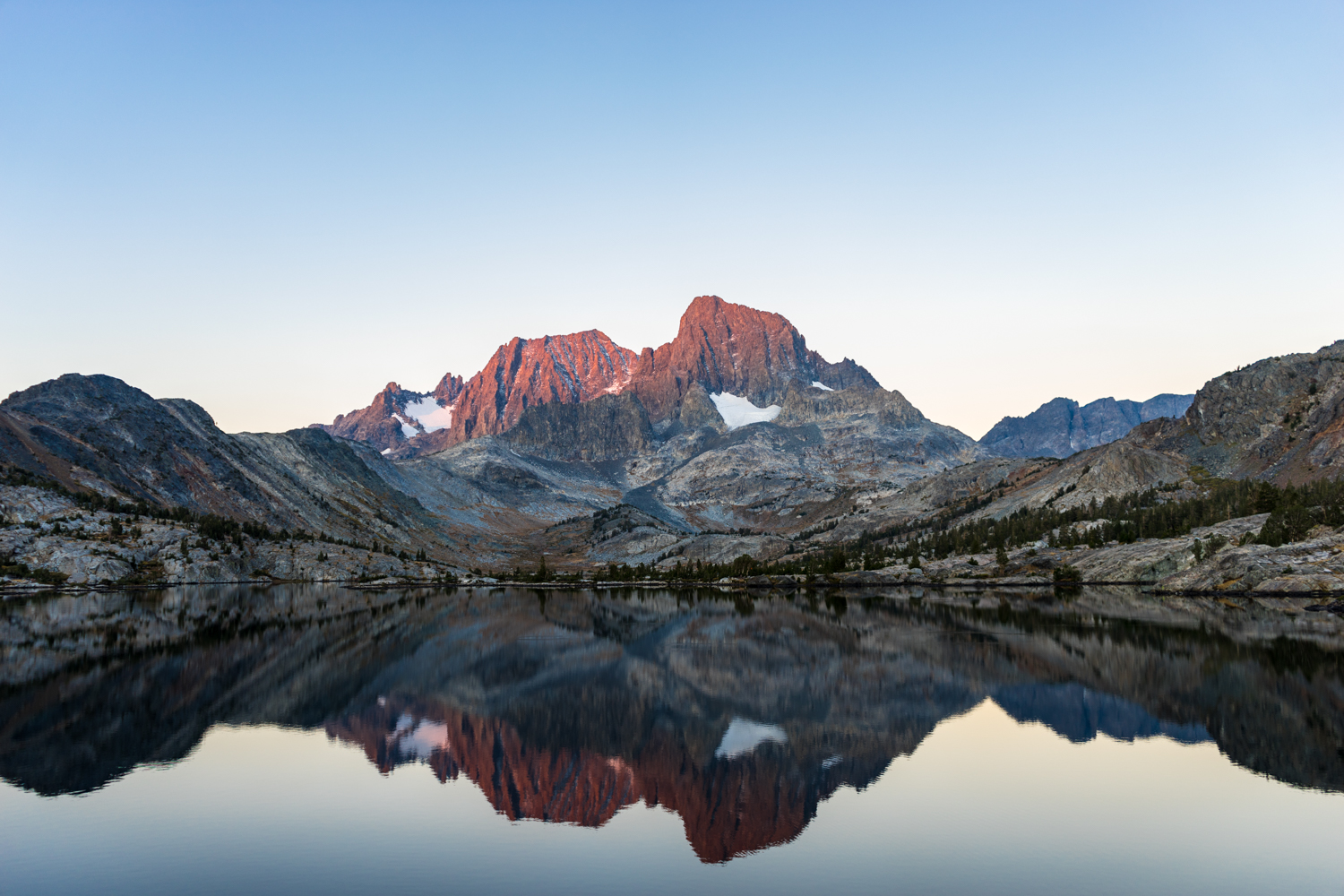
The first rays of sunshine kissing the tops of Banner Peak and Mt Ritter.
After a great night of taking Milky Way images of the lake we woke up early and made breakfast and coffee and watched and took pictures of the sunrise against Mount Ritter and Banner Peak on the south western side of Garnet Lake. After enjoying the morning we headed back along the way we came on the northern side of the lake until we reached the foot bridge. Directly on the southern side of the footbridge is a trail that will take you down to the river trail, its a little bit of a scramble and I would be especially careful when there is any ice along this route. Its about 0.20 miles down to the bottom of the rocks at which point you may see some confusing trails around your take the well used trail to your left that heads east down and away from the rocks. Follow the trail for about 0.80 miles descending over 600 feet back down into the valley. At the bottom of the trail there is a trail on the right heading along the southern edge of the river, this is not the trail you want to take. Head left at the bottom and then over the river ( we used a log bridge – not sure if there is a regular way over the river at this point or not) and follow the River Trail on the northern edge of the river back down into the valley and towards Agnew Meadows. After rejoining the River Trail its about a 5 mile hike back to Agnew Meadows. Did I tell you the best part, there was a cold beer waiting for me.
Weather forecast for Hiking to Garnet Lake:
Pictures from the hiking trail:


