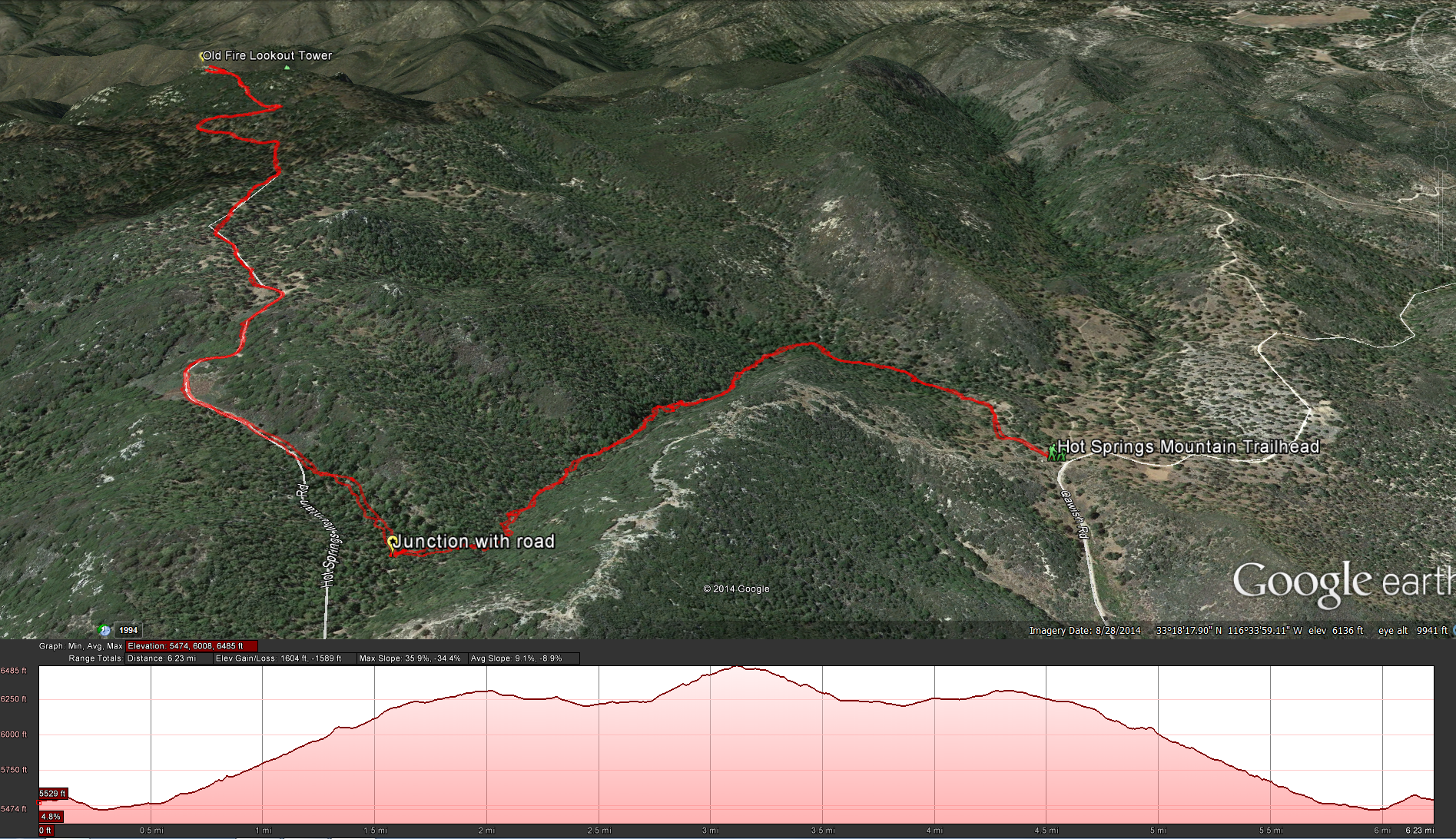
Distance: 6.4 miles .Elevation Gain: 1036 feet. Time to complete: 3 hours roundtrip
Directions: To the Hot Springs Mountain Trailhead ( I was able to load this into google maps on my iphone and it took me directly to the trailhead) by Nelsons Camp: From Just south of Warner Springs on Highway 79, turn east on Camino San Ignacio. After 0.6 miles bear right on Los Tules Road and continue 4.5 miles to the Los Coyotes Indian Reservation gate, where you must check in. Ahead, follow the main road, which becomes dirt and eventually goes past the reservation campground. Continue to and intersection of roads in a valley 6.1 miles past the entrance gate. Turn left (west) and drive up the valley on a sandy road to reach a saddle above the valley, 2.2 miles farther, just beyond this saddle on the left (west) side of the road is Nelsons Camp, with campsites nestled in a shallow bowl shaded by live oak, pine, and cedar trees.
There is another way up, on the Lookout Road as described in this web page at the Modern Hiker web site. I decided against this way because the road can also be used by vehicles to access the top of Hot Springs Mountain and I wanted more seclusion, but if you want more of a workout this may be the better hike for you.
Fees: $10 per vehicle. Hot Springs Mountain sits on the reservation of the Los Coyotes Band of Indians. It is private land. Unfortunately the tribe had some issues with visitors causing off road damage in the past and as a consequence the reservation was closed to the general public for some time. Please be mindful of what you do while on the reservation.
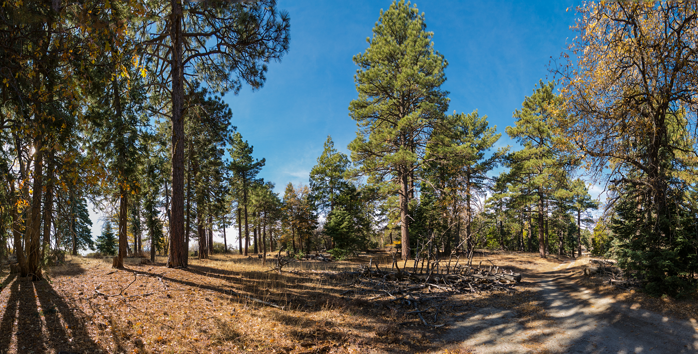
Once you get to the trailhead, park and the trail will start on the left side of the road, just to the right of a old cement water tank. You will take the trail up a short hill and then down along the left side of a small stream. About 0.25 miles into the trail you should come across some old campsites.
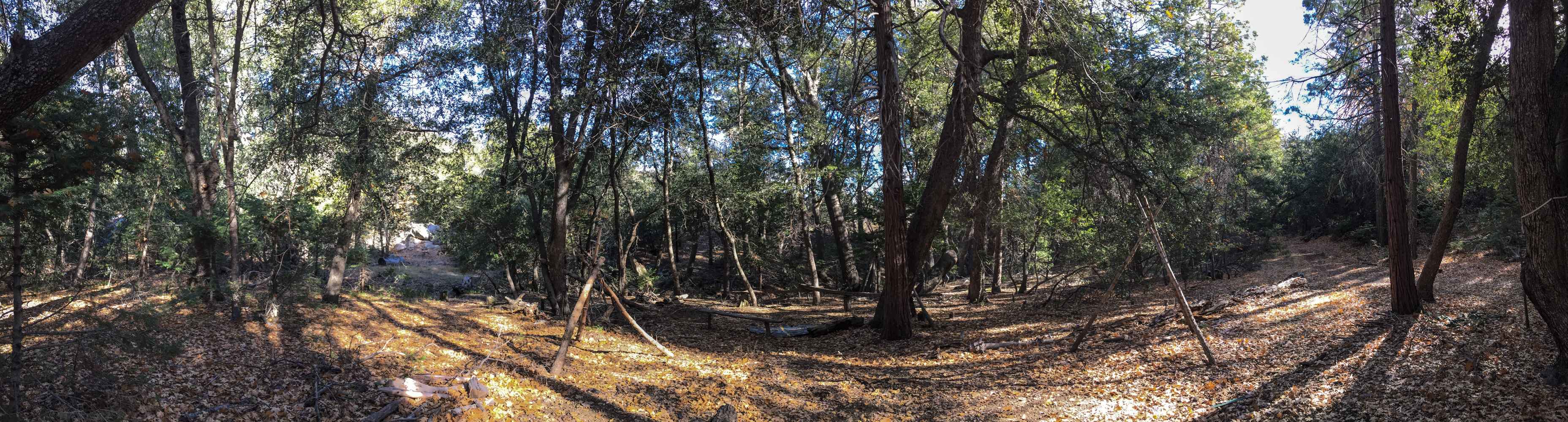
Teepee Camp Site
Soon after you go past the camps your uphill climb will begin. If you brought a pair of poles to use, this is where they will come in handy. Over the next mile you will gain about 500 feet. Its hard to believe that this road used to be used by anybody, there are some serious ruts and boulder in the way on they way up this hill. There is even a truck chassis stuck in the middle of the road that has been completely flattened over the years.
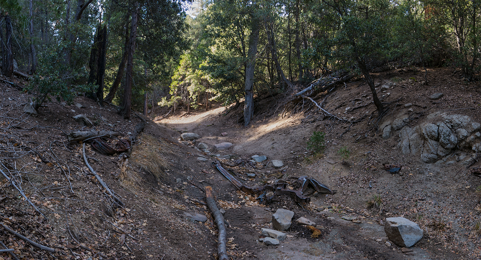
Some one was not lucky when they lost this car years ago
Enjoy the solitude on this trail. I only saw two groups of people on this hike. One group of 3 people that arrived just as I was starting out and another group of two women that I ran into on the way down. If you stop and listen once in a while you won’t hear any man made sounds, its quite relaxing. After 1.3 miles of climbing up this slope on the old jeep trail you are on will eventually connect up with the Lookout Road. Turn right and head west for another 1.6 miles climbing another 500 feet along the ridge line to the end of the road.
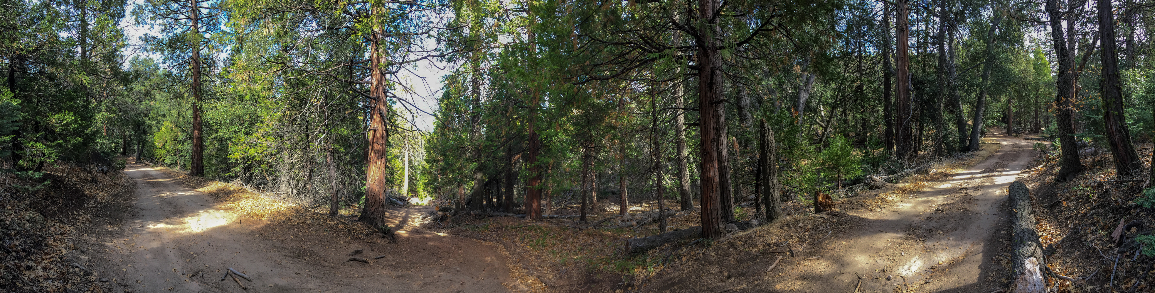
Trail Junction between the old jeep trail from Nelsons Camp and Lookout Road
I found this section of the hike to be much easier and relaxing. The most interesting thing happened to me on this section. At one point I keep hearing birds fluttering, I looked up in the trees and saw 20-30 pheasant’s flying away from the tree. As I walked along this happened to me for the next 10-15 minutes. I must have seen at least 20 groups of birds doing this along the way, of course by the time it occurred to me to try to get a picture of this they where all gone, I thought I might see them on the way down but no dice, maybe next time.
Walking along the Lookout Road on the way up to Hot Springs Mountain
Eventually you will come towards the end of the ridge, at this point you will start seeing more of the valley below. The view stretches all the way to the south with a prominent view of Cuyamaca Peak, which is just 20 feet shorter then the peak of Hot Springs Mountain. Their also happens to be a great hike down in this valley that I had done 2 months earlier. The Hike to Eagle Rock. You can see the rock from the road as you are traveling towards the reservation before you begin the hike.
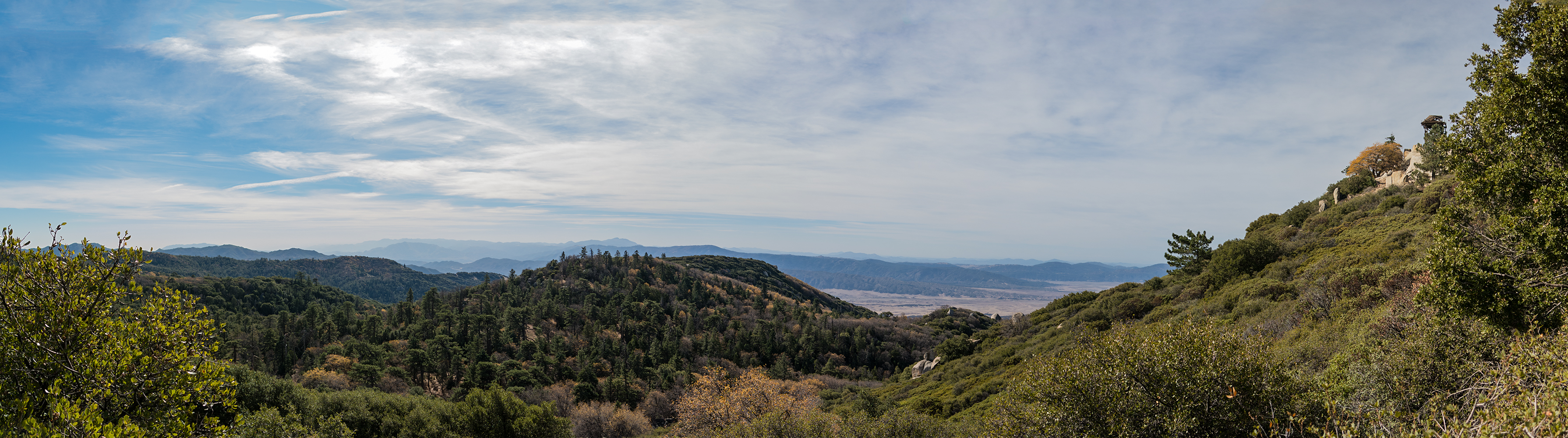
Looking south from the ridge on the way up to Hot Springs Mountain. The fire lookout tower in the far right, and a great view all the way to Cuyamaca Peak
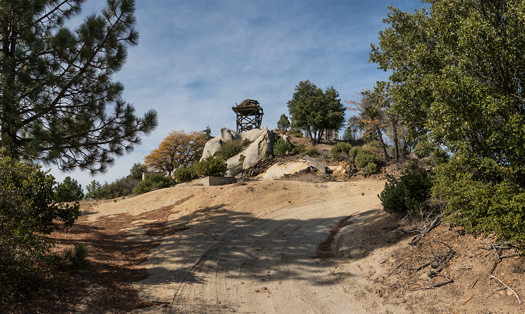
The last push up the hill will come in the last .03 miles of the hike where you will gain another 250 feet of elevation, going up one 180 degree switch back and then a straight shot to the top. At this point having a jacket in your back pack may come in handy. I was pretty warm all the way towards the top but once I hit this section ( especially at the tower) I was getting hammered by the wind and freezing my but off. When you get to the fire lookout tower take your time and explore around it. Some blog authors talk about climbing up on this thing but it looks to rickety for my tastes, so I stayed off of the tower but had a good time exploring around it. If you want to go to the true high point on this ridge, just before you start climbing up the last little bit to the tower is a big turn out and the true high point for Hot Springs Mountain is there to the right. I didnt explore it the first time I went up, but the 2nd time a couple of weeks later with a group I decided to check it out. It is a little hard to find. Their is a faint trail leading up to the top through all the trees and Manzanita, you may think you have reached it, but you will know when you finally come to a group of very large boulders with some glass sprinkled around. It looks like this is where the first fire look tower was built in 1912. If you look up you are bound to eventally see a cement block on the tallest boulder. When you scale the boulder you will find what looks to be a small foundation and what looks like a pathway for stairs at one time. This is also where you will find the 2 geological survey markers.
Finally getting to the Fire Lookout Tower on Hot Springs Mountain
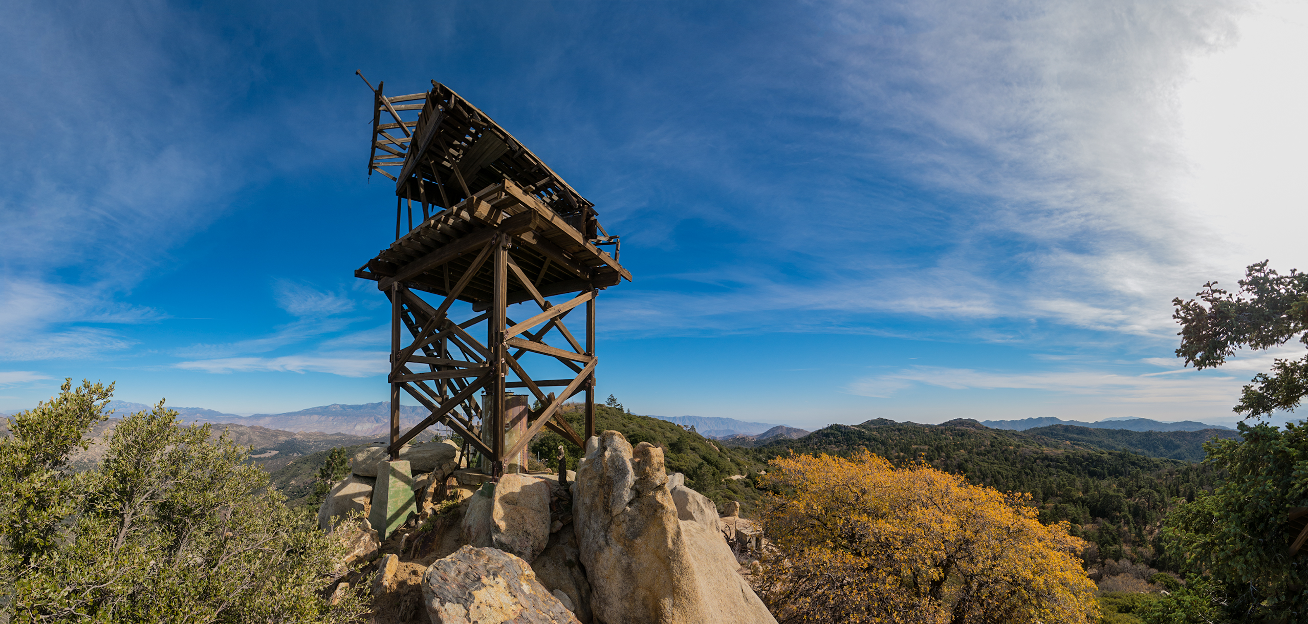
Looking east towards the desert behind the fire lookout tower on Hot Springs Mountain
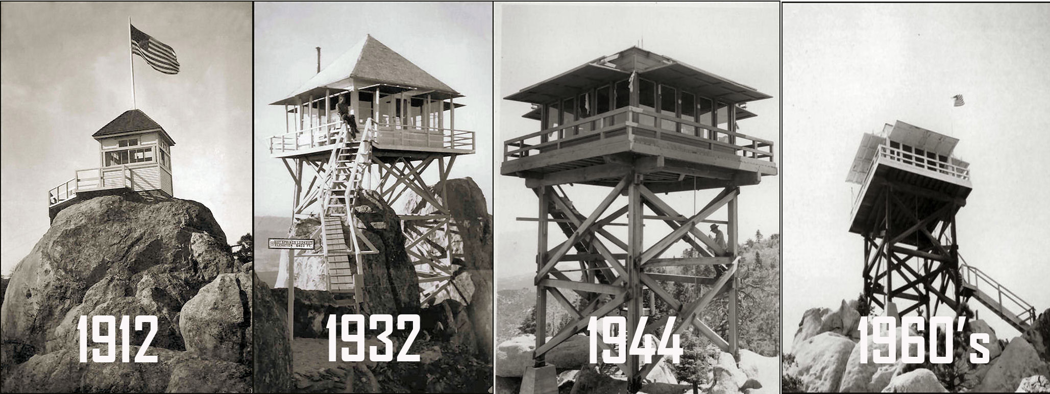
How the Hot Springs Mountain Fire Look Out Towers have looked over the years.


