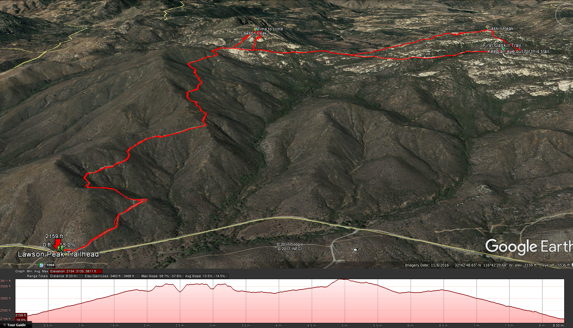
Distance: 7.5 Miles ( even though it shows more in the map – my GPS was turning on and off) Elevation Gained: 1569 Feet. Top Elevation : 3953 feet. Time : 4-6 Hours
Difficulty : Hard. The distance of the hike is not necessarily difficult but once you add in all the bushwhacking, the steep approach to the top of Mt Lawson, the bouldering, and the climb up the fissure, the difficulty mounts. If you have a hard time with heights or are claustrophobic you may have a hard time with this hike.
Equipment: I would strongly suggest long pant and long sleeves. With all the bushwhacking you are going to do if you do not have long pants and long sleeves you will regret it.
Bathroom facilities: There are none. Make sure you take care of business before hand and or bring the supplies you need.
Kid friendly: Not really, but if you have a child with the right skills they might really enjoy this one.
Pet friendly: Definitely not. At least not if you are trying to get to the top of either peak.
Fees: Free
To Get to the Trail head: Exit Interstate 8 at Highway 79 / Japatul Valley Road near Descanso. Follow Japatul Valley Road south for 5 miles , and then turn left on Lyons Valley Road. Proceed 4.9 miles south to the unpaved Carveacre Road on the right. There are two small turnouts for parking nearby, near mile marker 13 on Lyons Valley Road. Google Maps Directions
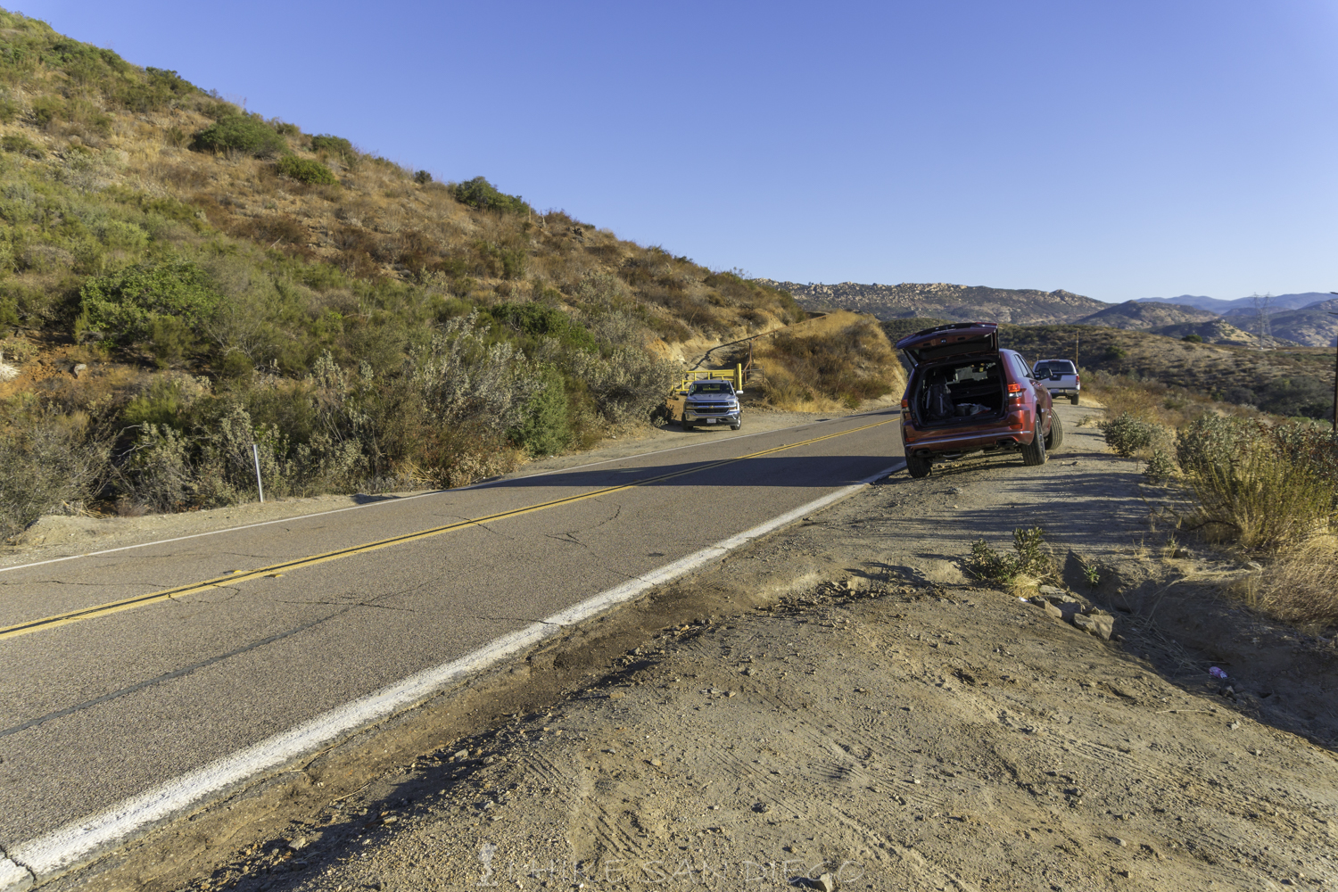
The two small pullouts for parking near the Lawson Peak Trailhead
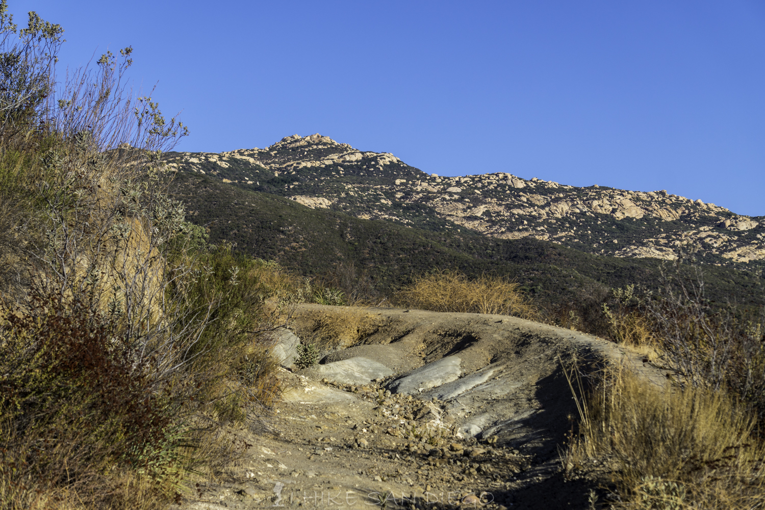
The hike starts behind a locked gate that close’s Carveacre Road from the public. Make your way up the rutted dirt road for about 2 miles before you make it to the bottom of the bushwhacking trail that heads up Lawson Peak.
Looking towards Gaskill peak from road on the way up.
As you make your way up the road if you look towards the east you will see Corte Madera Peak and Pyles Peak. I did not realize what I was look at until I was looking at it from the top of Lawson Peak. Lyons Valley Road is also a very popular area for bikers to ride, so you will more then likely hear the roar of bikers testing their metal on the corners of the road in the valley below as you hike.
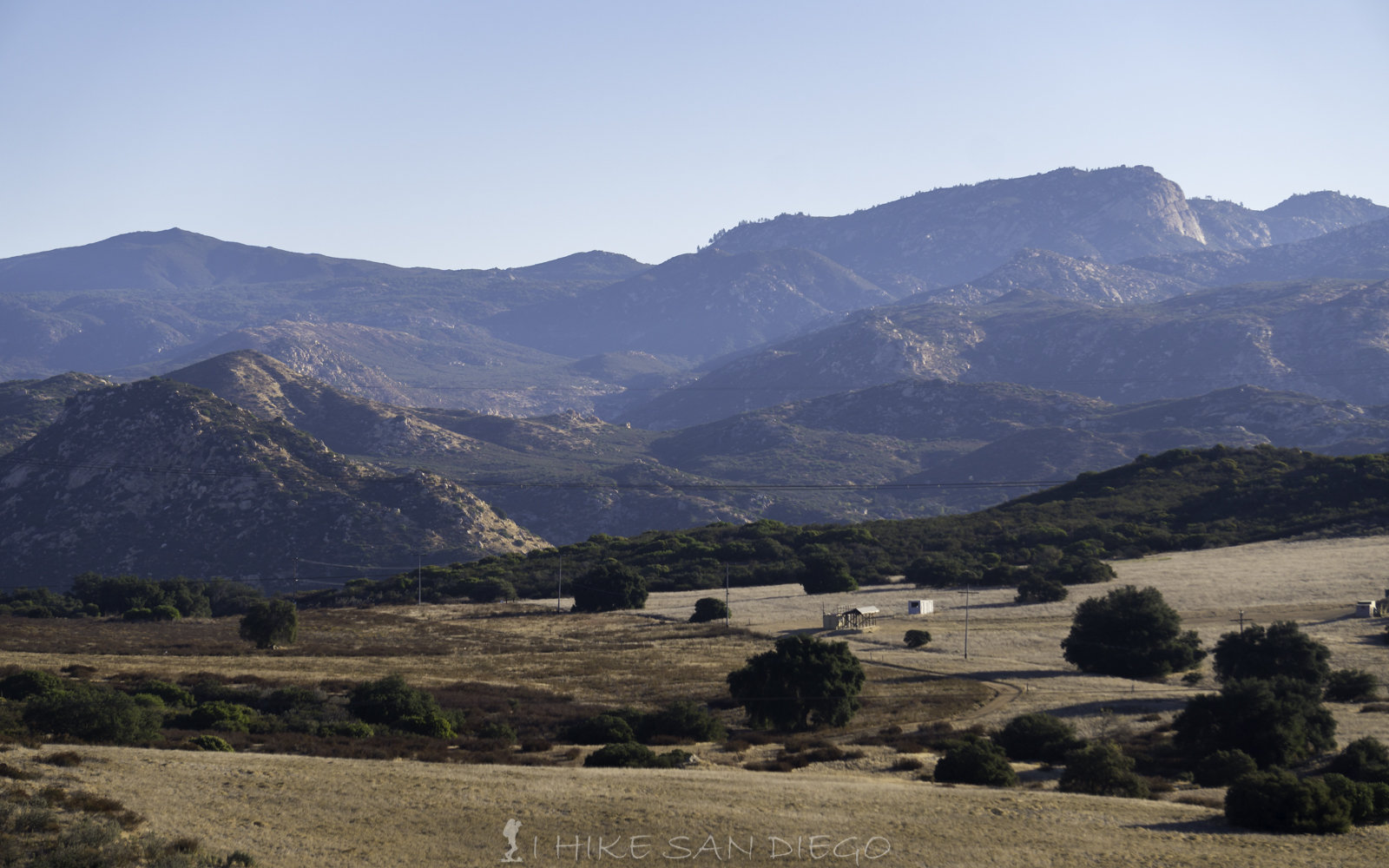
Looking towards Corte Madre Peak from the trail on the way up to Lawsons Peak
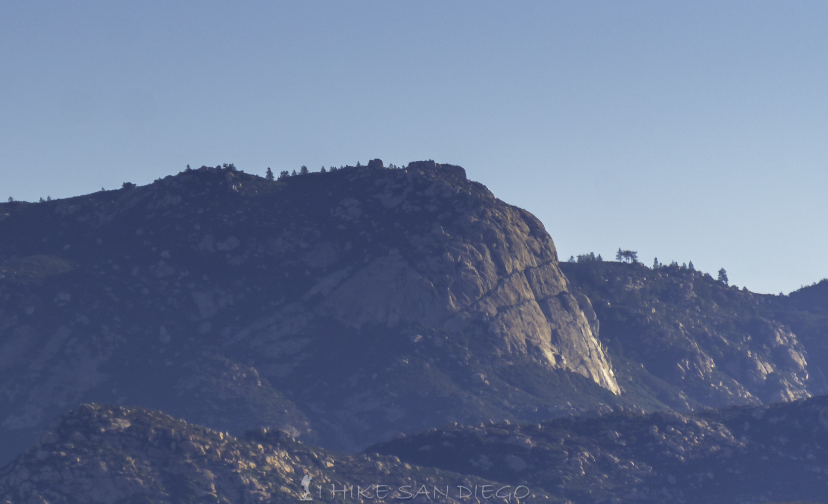
Closer view of the face of Corte Madre from the Lawsons Peak Trail
Just short of 2 miles you will crest the road and start making your way down to Westcarver Road which runs along the base of Lawson Peak and Gaskill Peak. Enjoy the view and then make your way down until you meet up with the trail going up Lawson Peak and the true fund begins as you bushwhack your way up.
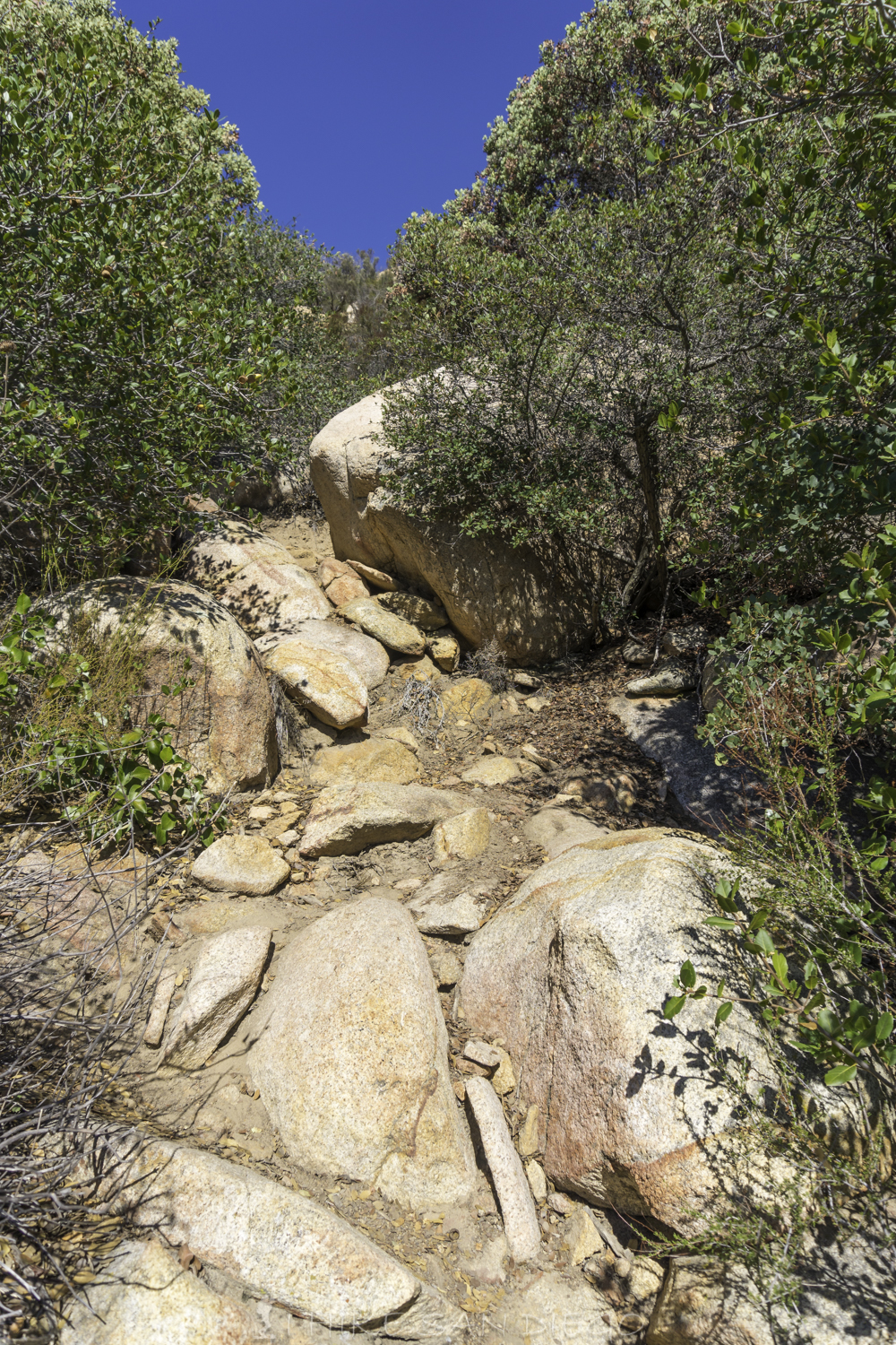
Looking up the trail before the bushwhacking adventure starts
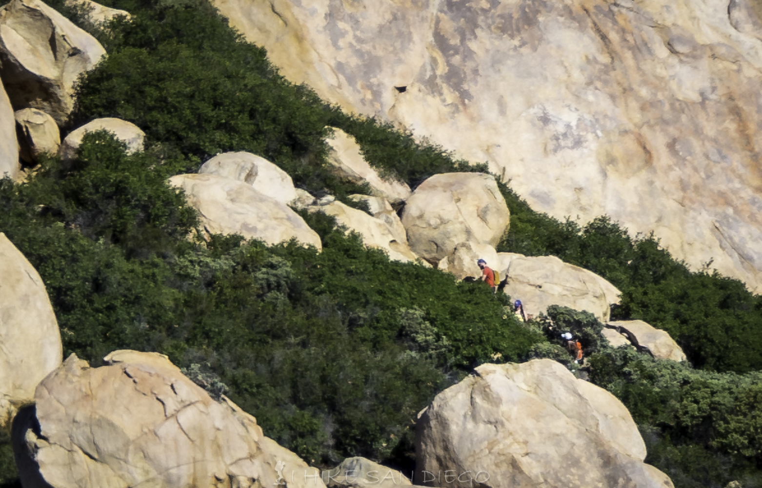
Hikers making their way up through the Manzanita and other chaparral
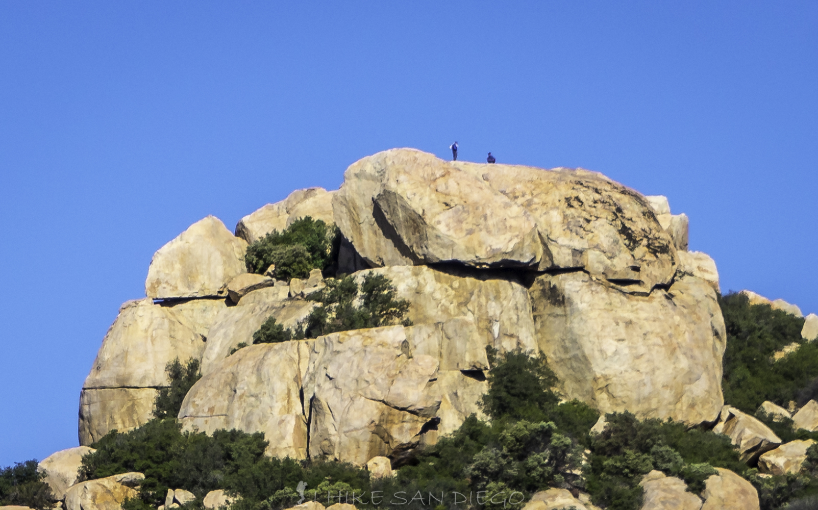
Hikers on top of Lawson Peak
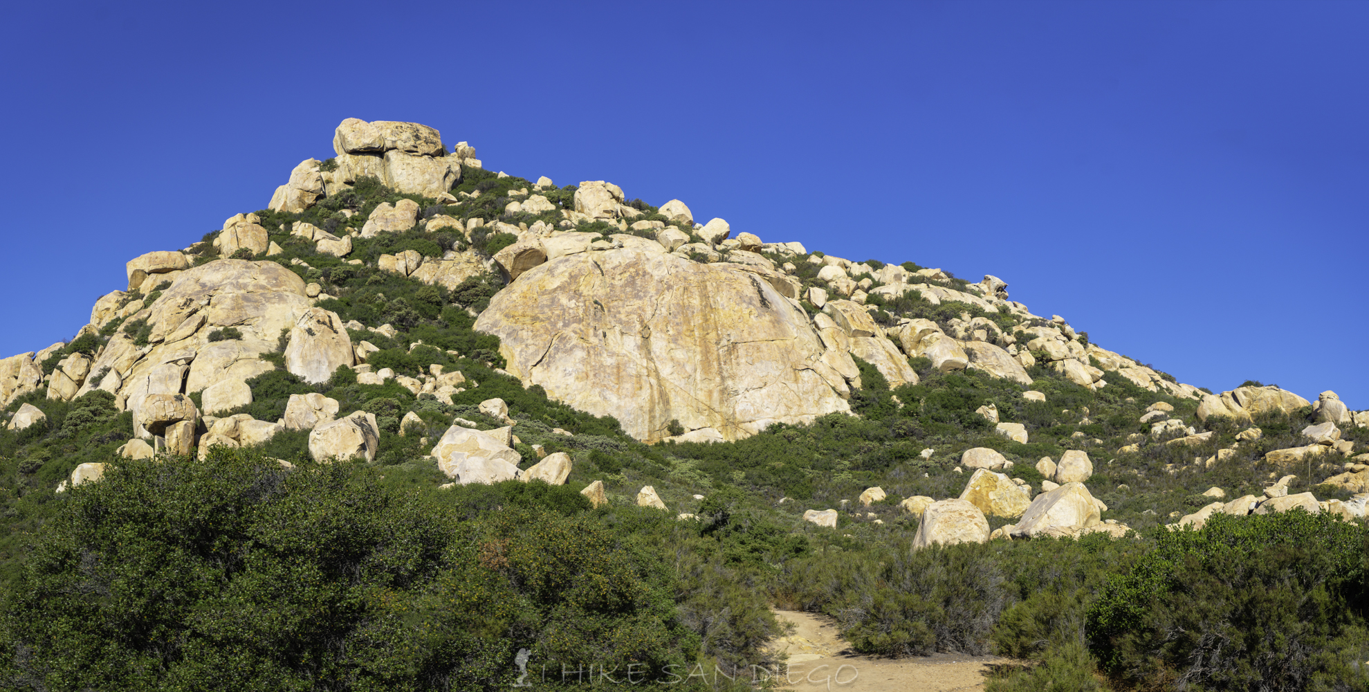
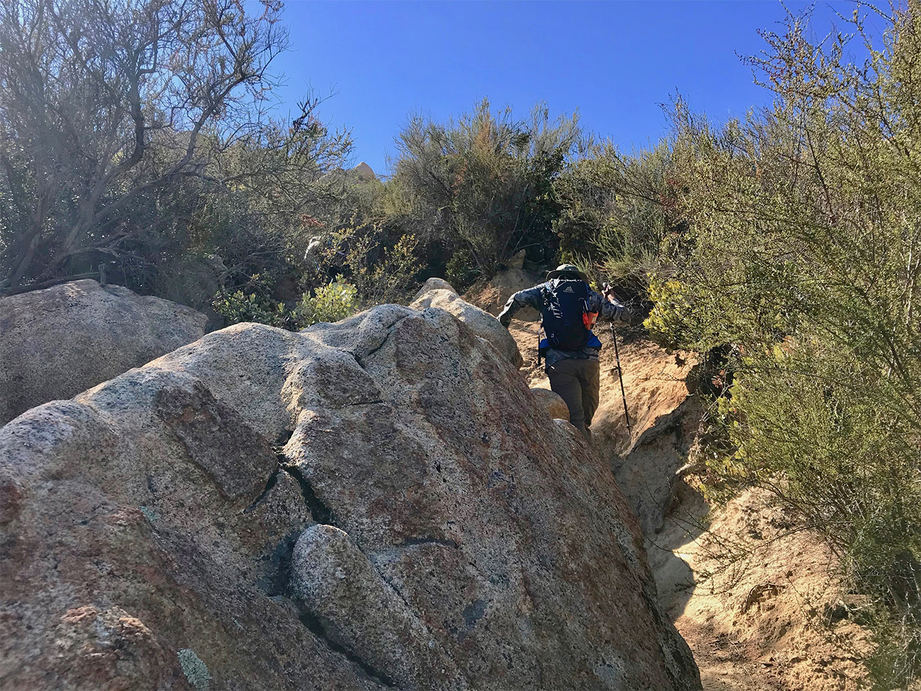
You will start making your way up the next 1/3 of a mile up the steep rocky path through the Manzanita and chaparral as you make your way around the back of the peak to the North / East side where you will make your way up a 20 to 30 foot vertical fissure to a little cave area. If you are carrying poles you might as well put them away at this point because you are going to need all hands on deck for this one, I also found it easier to take my pack off and put it on the ledge above me as I keep making my way up and down the fissure. Also if you are afraid of heights the fissure is going to probably be your sticking point on this hike.
The Lawson Peak trail surrounded by Manzanita and chaparral.
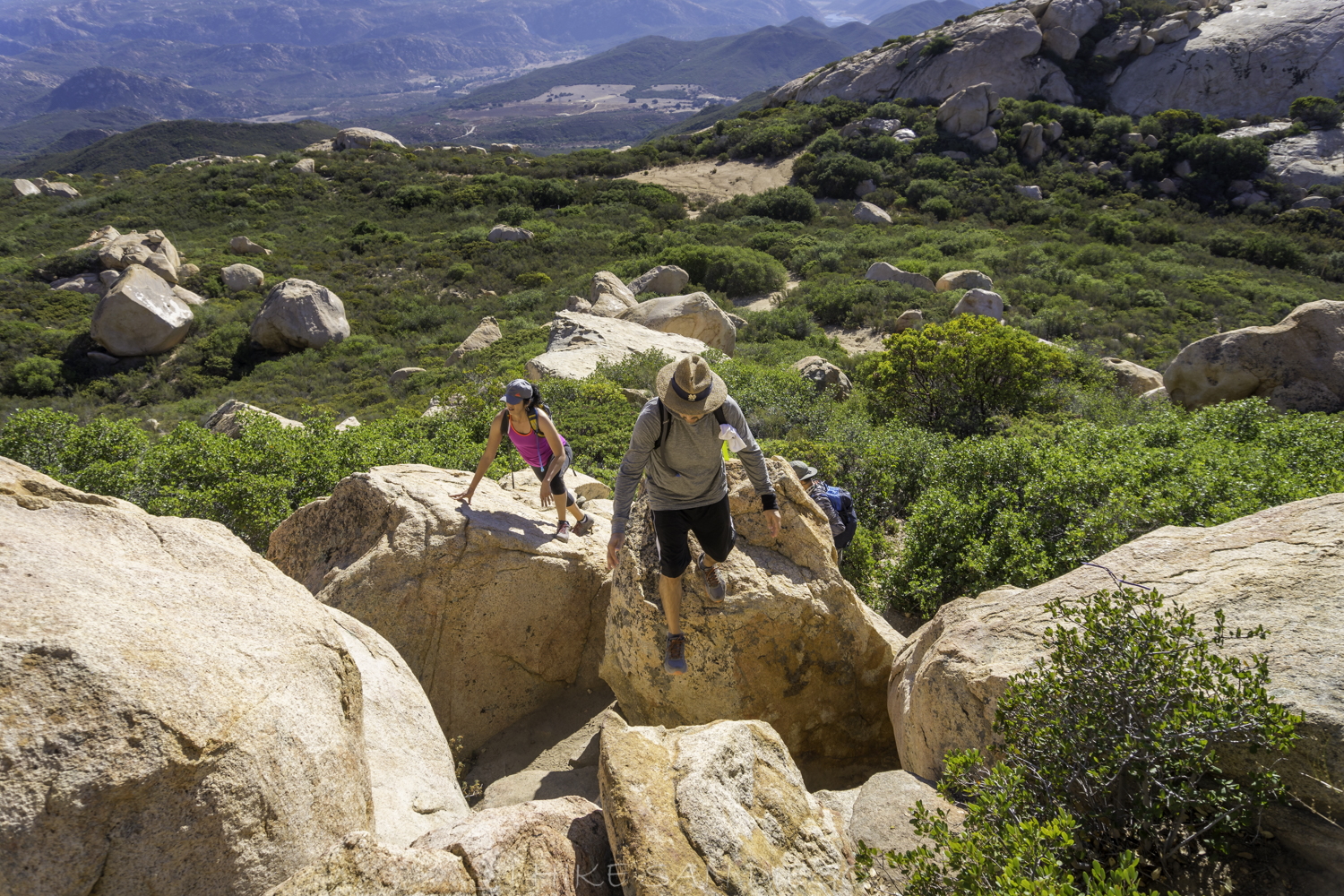
Group of hikers making their way up the boulders on the Lawson Peak Trail
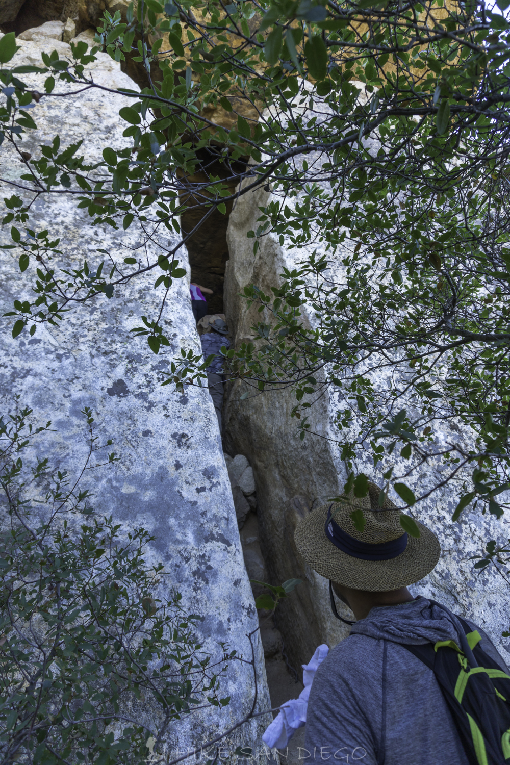
Looking up the vertical fissure you are going to have to climb up on Lawson Peak
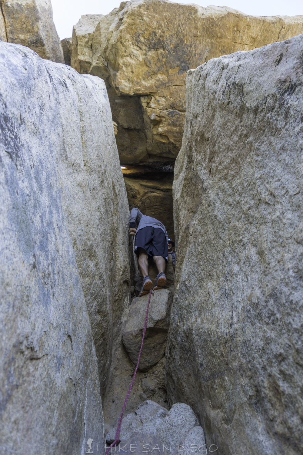
Hiker almost to the top of the fissure on Lawson Peak
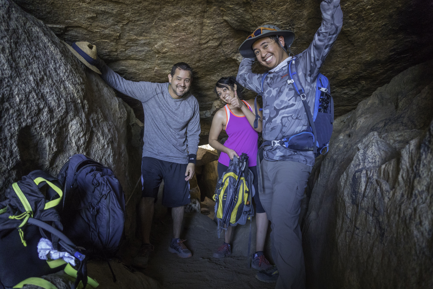
Hikers in boulder cave at Lawson Peak
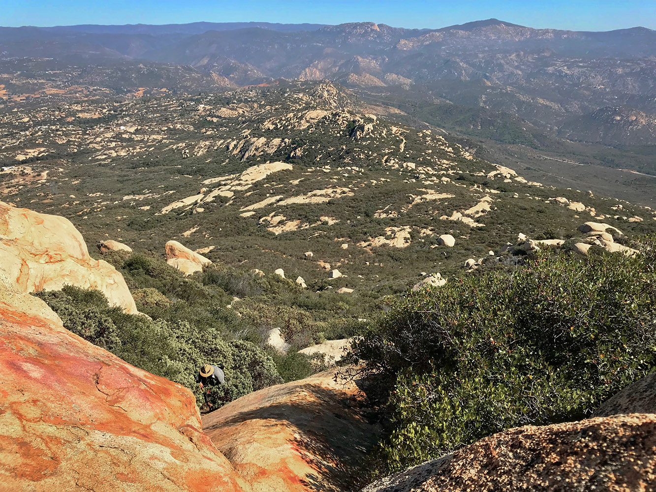
Now that I think about it, anybody that has a little claustrophobia might have a problem with the cave section as well. If you can make it this far head towards the back of the cave where you will need to use a little upper body strength to push your self up on a ledge and continue towards the top of the rocks. Once you make it up there take a break and have a snack, enjoy the view, you have earned it.
Looking down at the road we came up from the top of Lawson Peak
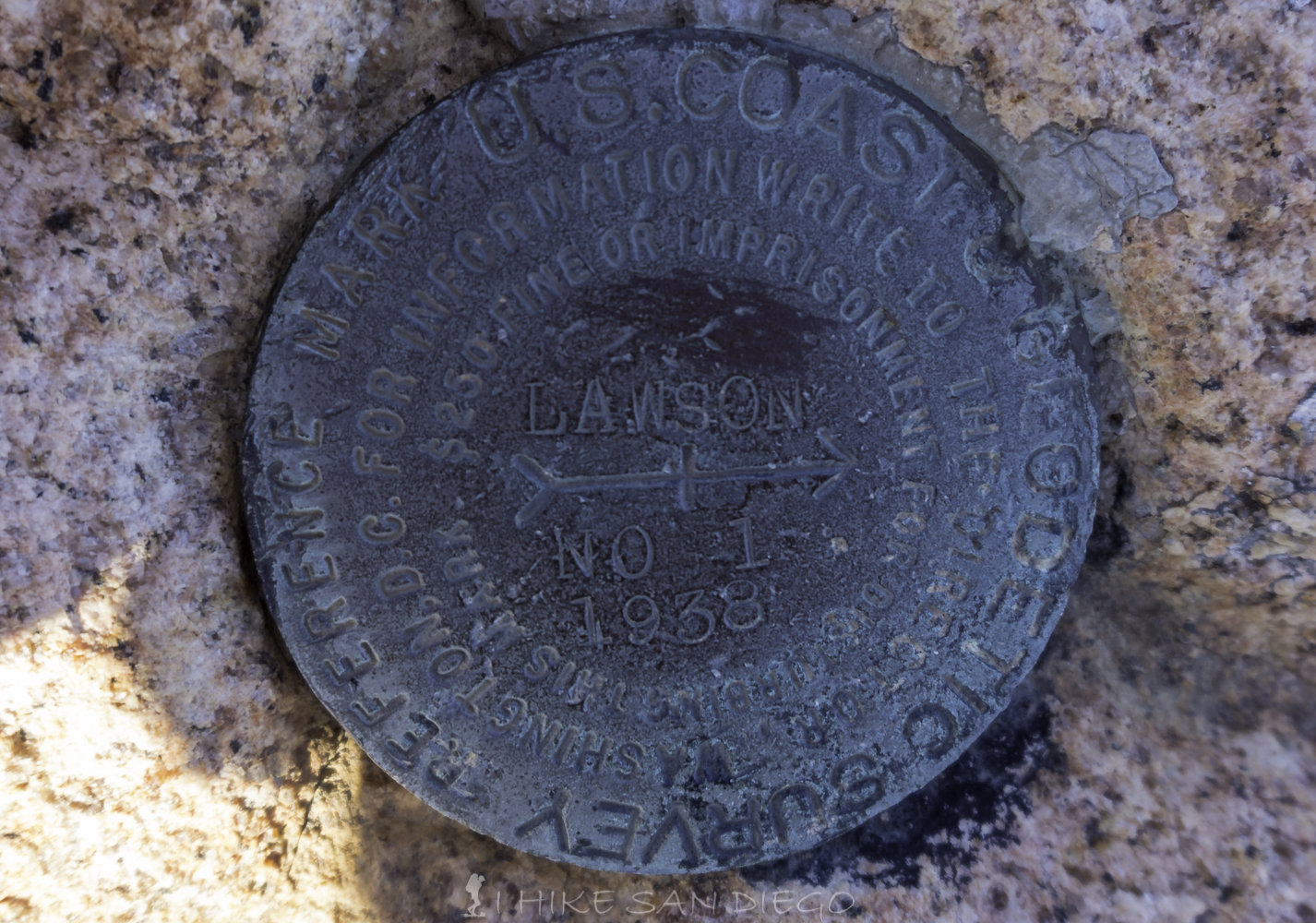
Lawson Peak Marker
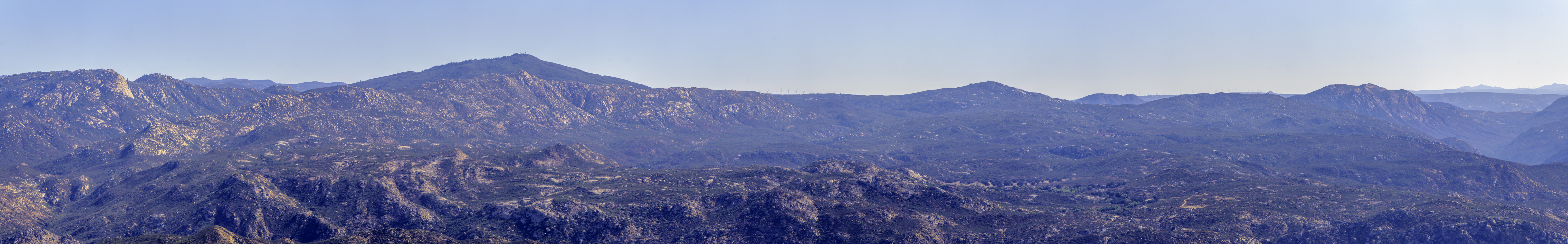
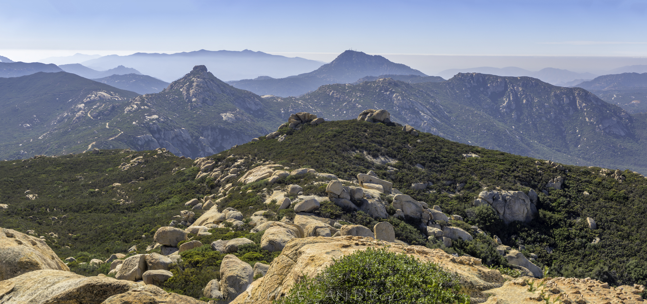
Looking towards Corte Madera and Plyes Peak towards the left, while Morena Butte is towards the far right.
Looking towards Lyons Peak, the tempting hike that is off limits.
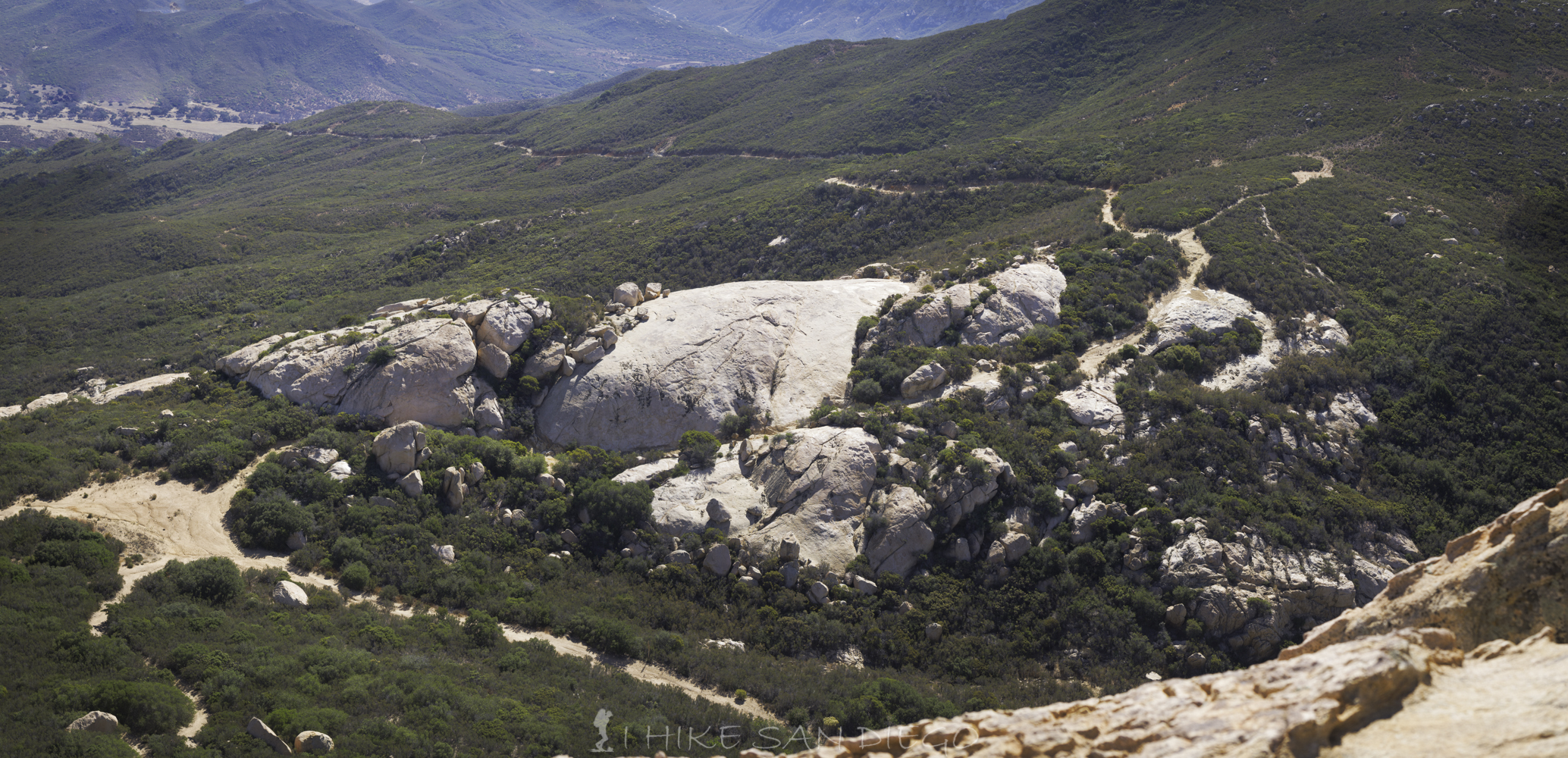
Now it is time to make your way back the same way you came up and make your way towards Gaskill Peak. If you are looking at my map and wondering what the heck is going on, that is something I’ll have to cover later in another article “My Garmin 5X and my big fat wrists”. My wrists would constantly be pushing against the buttons on my watch ( GPS device) starting and stopping my hike. There has to be a solution our there. Anyways make your way back down to the Wisecarver Road and head out about 1.3 Miles until you reach the trail that wraps along the north /western side of Gaskill Peak. The guide books will tell you about an obscure trail that starts at about 0.5 miles from the Lawson Peak Trail, but I can tell you obscure is an understatement, if you look at the map it is the 2nd part of the loop back from Gaskill Peak, but its not easy to follow. Personally I would suggest taking the further trail up and down Gaskill Peak.
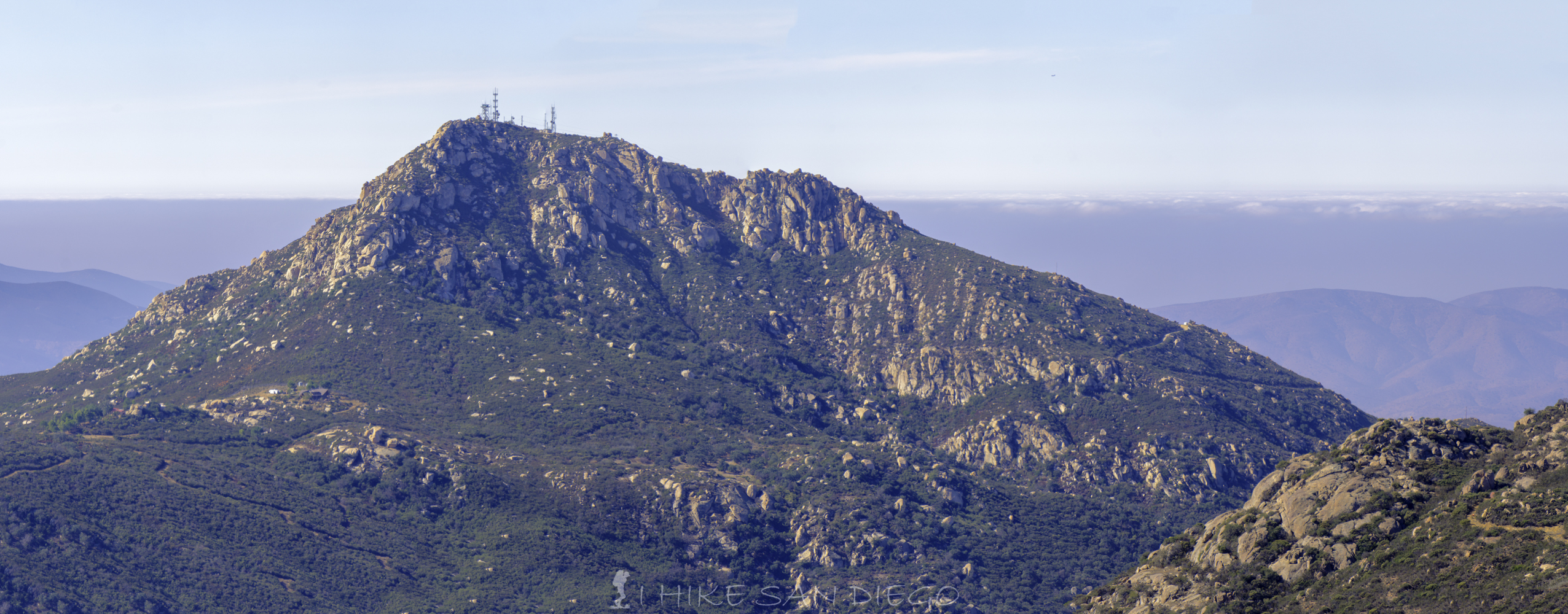
Looking towards Gaskill Peak with Cuyamaca Peak behind and to the left.
When you get to the far trail on the left side of the road, take it back just 1/10 of a mile and keep your eye open for a small trail heading up and west through all the Manzanita. Follow this trail for another 2/10 of a mile up through all the chaparral. Eventually you will start scrambling up rocks again to get to the top with the last bit a little bit of tricky rock climbing to get up to a great lunch spot. Enjoy the view again before you decide if you are going to head back down the way you came up or along the 2nd part of the loop. If you do the loop just keep in mind what direction you are heading and look for the cairns along the trail that sometimes help mark it.
Making our way up the thin trail to Gaskill Peak
Almost to the top of Gaskill Peak, a little more rock scrambling ahead.
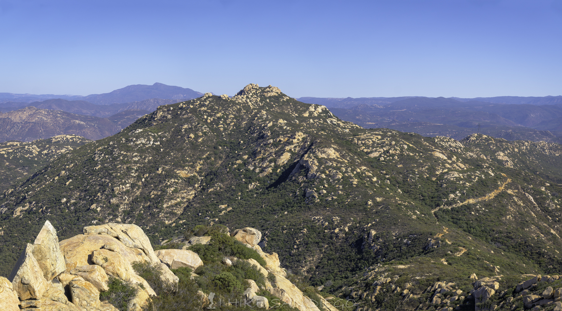
Lawson Peak and Lyons Peak in the distance, seen from the top of Gaskill Peak.
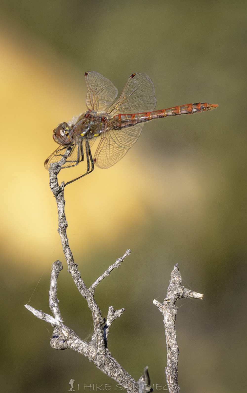
Dragon fly on Gaskill Peak
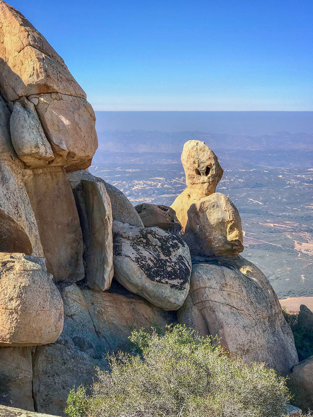
Keep your eye open for the alien