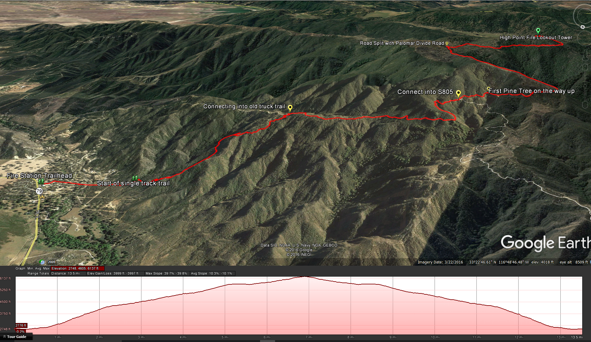
Distance: 14 miles. Elevation Gain: 3600 feet . Time to complete: 7-9 hours. Difficulty: Strenuous
Best Time to Visit: From Fall through Spring. While there are spots of shade along this trail, it would be a hot hike during the summer months.
Bathroom Facilities: There are no bathroom facilities at the bottom, there is a porta potty at the top and it looks like they are opening up a permanent bathroom structure but it was not ready for use when I was there. Bottom line – plan ahead.
Pets: Although this is a long hike, the terrain is not overly rough, on cool days it wouldn’t be so bad, but you need to bring water for both of you.
Permit: You will need an Adventure Pass for this hike. You can pick up a daily pass for $5, or a annual pass for $30 at Big 5 sporting goods stores.
Directions: This hike starts behind the fire station in Oak Grove. A small community off of Highway 79. You can get there by following highway 79 southeast from interstate 15 at Temecula for about 25 miles or about 28 miles north and then northwest on Highway 79 from Santa Ysabel. Here is the Google Maps link for the Oak Grove Trailhead.
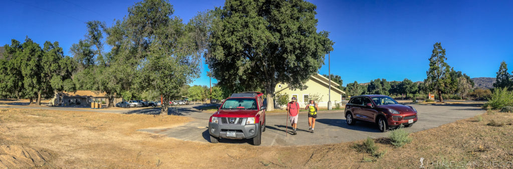
Parking lot on the side of the Fire Station.
To start this hike park at the parking lot on the eastern side of the fire station in Oak Grove. Walk back towards the mountains from the fire station and you will hit a dirt road ( Woodridge Lane) . Follow this road ( Woodridge Lane ) past a few rural homes until the road takes a bend and heads up to a water tank. Keep on the road until you see a sign ( with nothing on it ) and a trash can near the start of the single track for Oak Grove Trail.
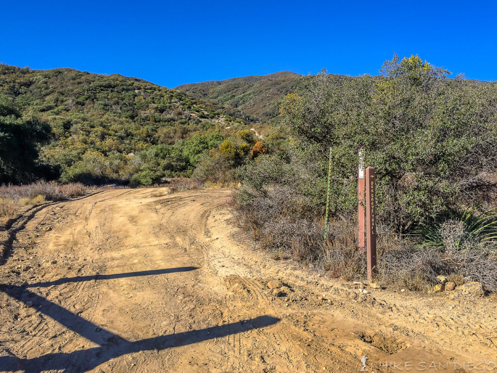
Follow the road up around the bend towards the water tank before you see the start of the single track trail.
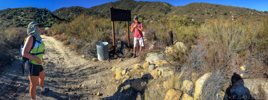
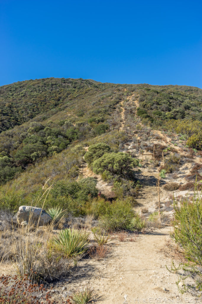
The start of the single track trail for Oak Grove Trail.
The single track trail starts at about 0.6 miles from the trailhead. You will follow this steep trail for about 1.8 miles until you reach Oak Grove Road. This is a nice little section of the hike with some batches of shade to take advantage off, just be careful to stay on the trail and not mistake some of the old trails that are part of the fire break, these other little trails are steep and you will be sorry if taking them, in fact while hiking up we came across some of the fire fighters from the fire station doing some morning PT in full gear pushing themselves up one of these trails which seemed to go straight up the ridge-line.
Stay on the trail ( to the left) do not take the steep trails ( on the right) that go straight up the ridge line
Looking back down to the valley from the Oak Grove Trail.
Reaching Oak Grove Road from Oak Grove Trail
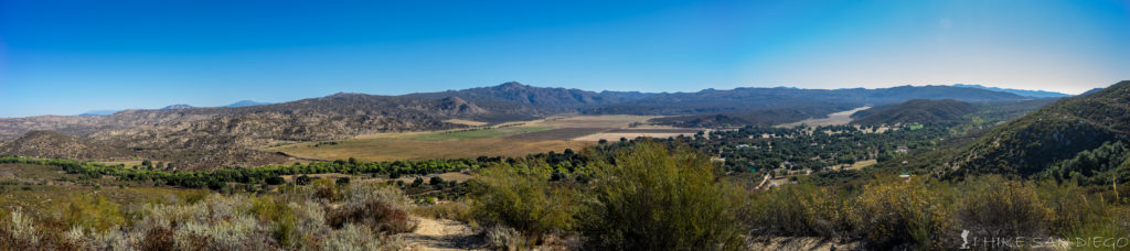
After reaching the Oak Grove Road at about 2.2 miles into the hike. Take a break and enjoy some shade ( there is a nice little spot straight across the way from where you reached the road) before you head up this road for about another 1.5 miles and connect up with High Point Road. This section of road is a nice section to enjoy, it is closed to vehicular traffic until you reach High Point Road so you don’t need to worry about sharing the road until then. On the way up you will start to get some great views of the mountain ranges to the east. Mt Baldy, San Gorgonio, San Jacinto, and Chuilla Mountain.
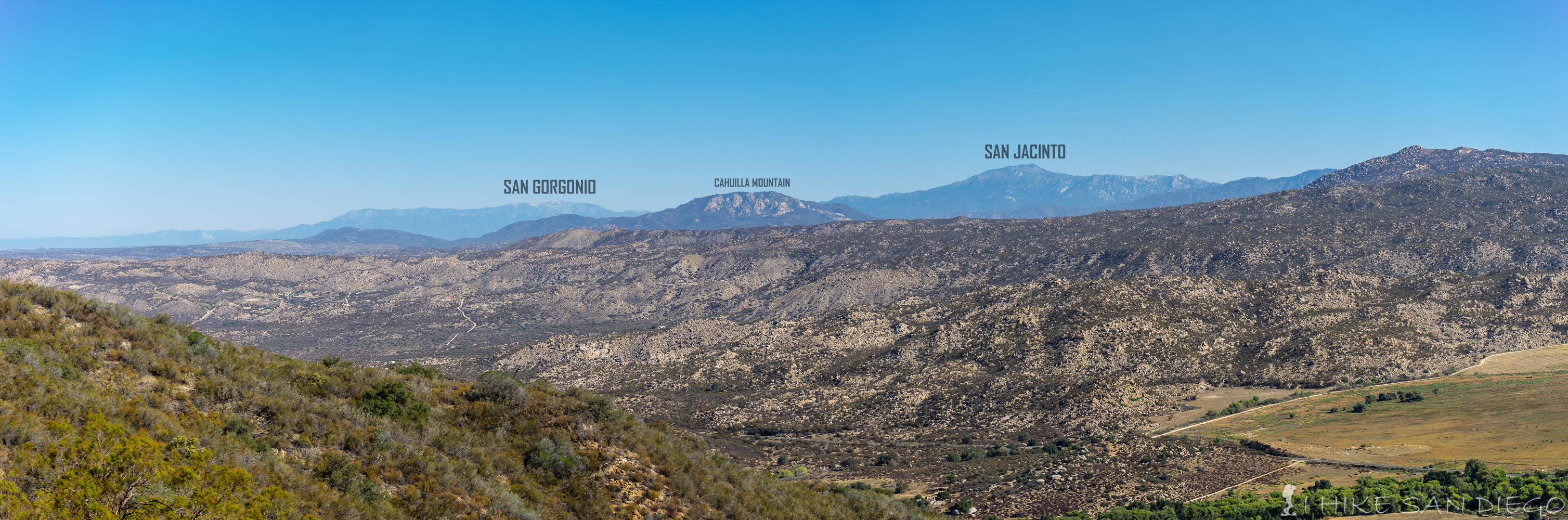
Looking west towards the mountains. San Gorgonio, San Jacinto, and Cahuilla Mountain.
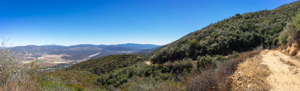
Looking back down to the valley as we head up Oak Grove Road.
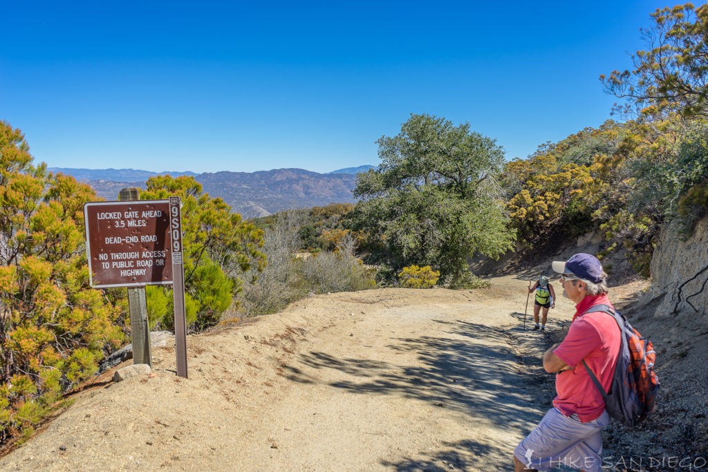
Sign warning travelers that this road is closed to the public just before connecting up with High Point Road
Connecting up with High Point Road from Oak Grove Road.
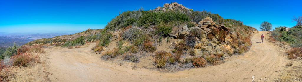
Realize that once you connect up with High Point Road you will be sharing the road with off – road enthusiasts heading up to the top of the mountain ( the easy way ). It is a relatively easy road for trucks to get up, you really don’t even need 4 wheel drive, even so we did see a large truck that didn’t have 4 wheel drive struggling to get up at one point and eating up the road causing some deep ruts, it doesn’t require 4-wheel drive but some driving skill will help. You will notice a history of fire on this mountain as you head up the High Point Road. There are signs of a fire as recently as 2015 that is easily recognizable on the slope above you and wide swaths of land devoid of thick vegetation that looks indicative of past fire below you. As you finally wrap around the ridge at around 4.4 miles into the hike you will start to see High Point and the fire lookout tower at the top.
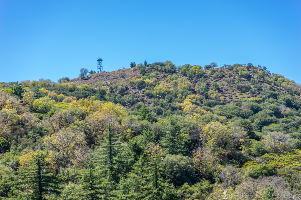
Looking up at the fire look out tower at the top of High Point
Finally hitting some flatter terrain near the top of High Point Road
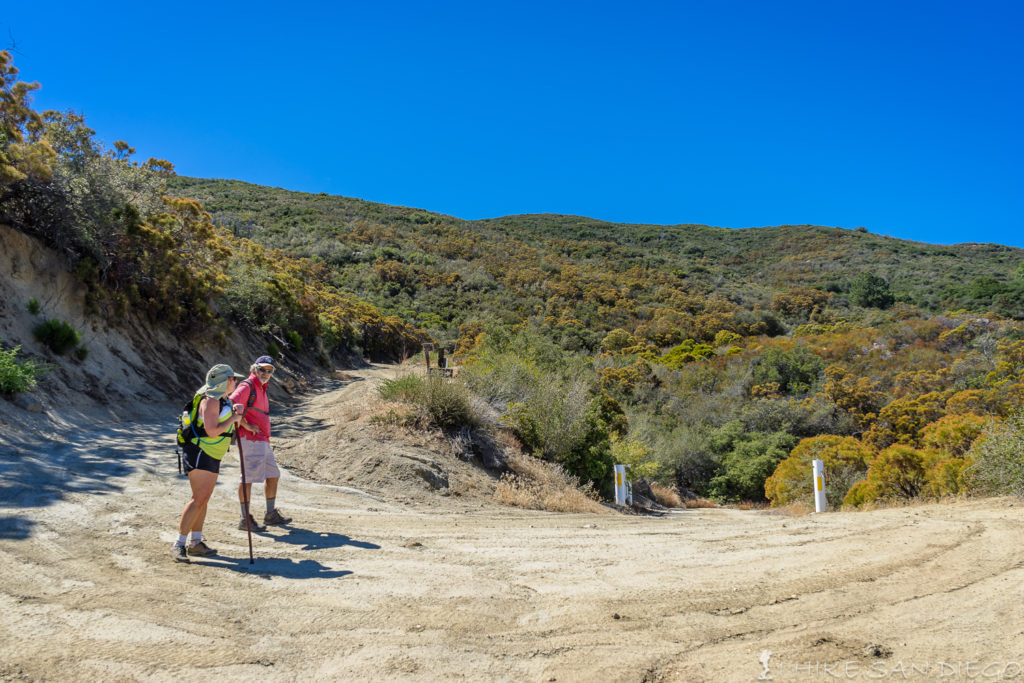
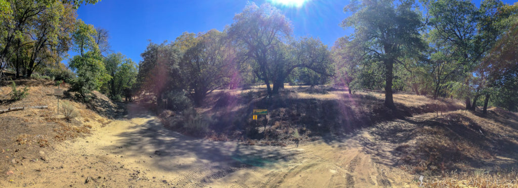
As you come to the top of High Point Road, you will start to see some trees (finally) and the connection with the Palomar Divide Road. At the junction with Palomar Divide Road, take the road to the right ( heading west) though wonderfully shaded road under the oak trees. I took the Palomar Divide Road from Highway 79 a long time ago on a mountain bike, it was a lot of fun, especially on the way down.
High Point Road connecting up with the Palomar Divide Road. Take the road to the right ( west).
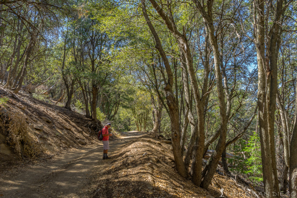
Heading up the Palomar Divide Road under the oak trees on our way up to High Point.
After wandering through the shade of the oak trees on the Palomar Divide Road for about a mile you will wrap around the peak and see a gate on your right side and another steep road on your left. Head up the road on your left for the last little bit of road before you hit the top of High Point.
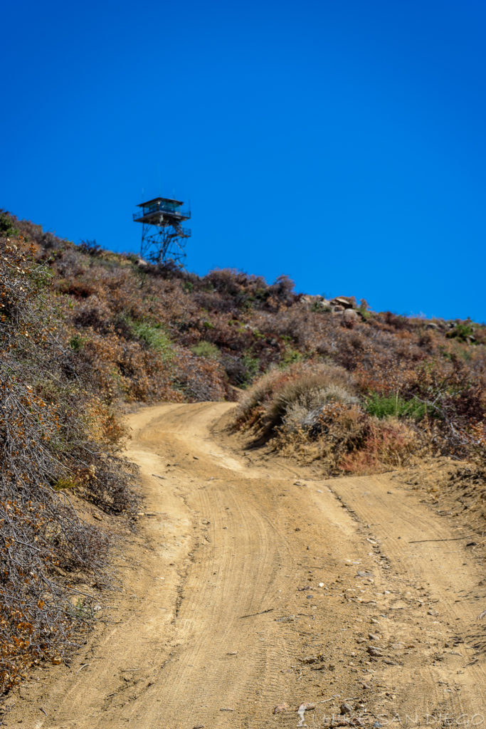
The last little road up to the fire lookout tower at High Point on Palomar Mountain
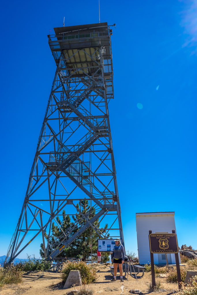
The fire tower at High Point on Palomar Mountain
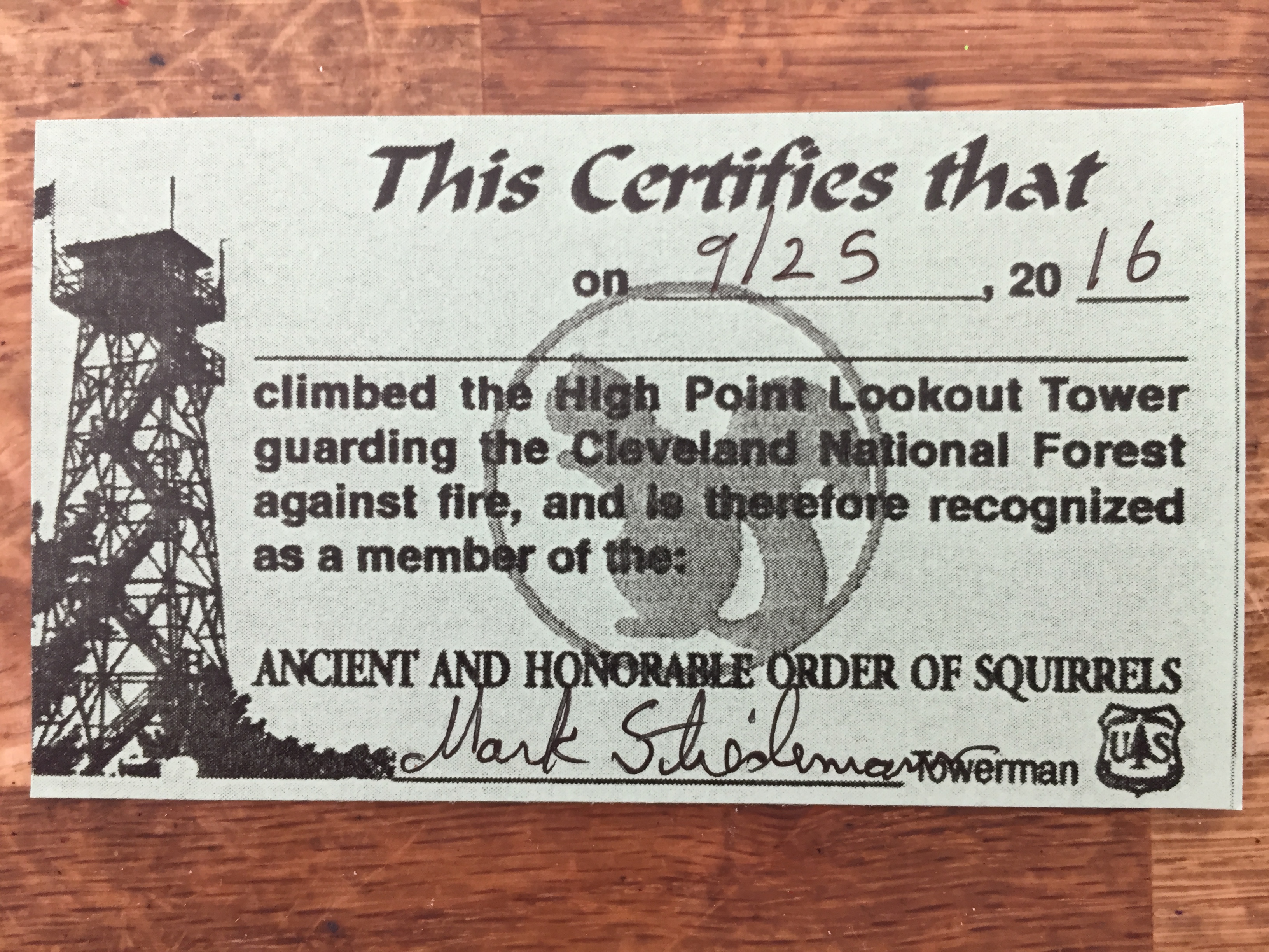
Don’t forget to get your Squirrel Card from the volunteer at the Fire Lookout.
Once you are up at the top, relax, take in the scenery. You will see the observatories to the west of you. I was told by one of our hikers who was with us and volunteers at Palomar Observatory that the doors to the dome usually will open about 1/2 hour after sunset. One a clear day ( like this day was) you have a great view all the way down to Point Loma and downtown San Diego.
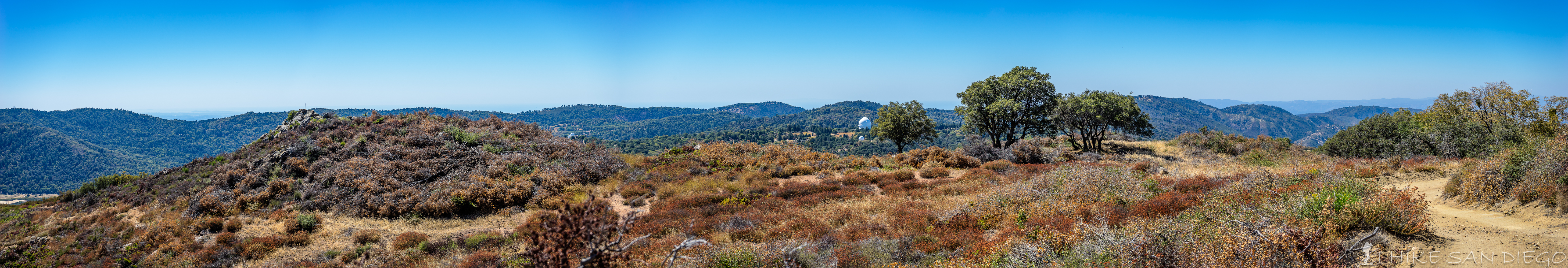
Looking west from High Point on Palomar Mountain towards the Observatories.
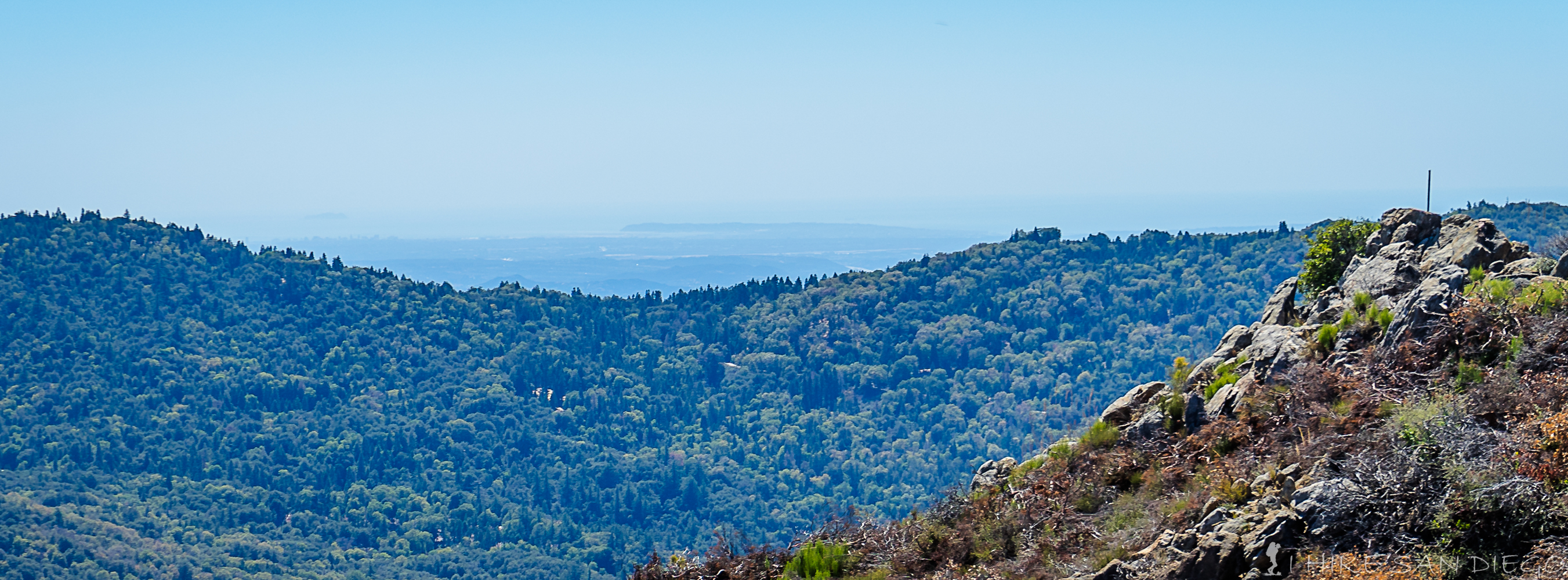
Looking west at Point Loma and downtown San Diego from High Point on Palomar Mountain.
Weather Forecast for Oak Grove to High Point Hike: