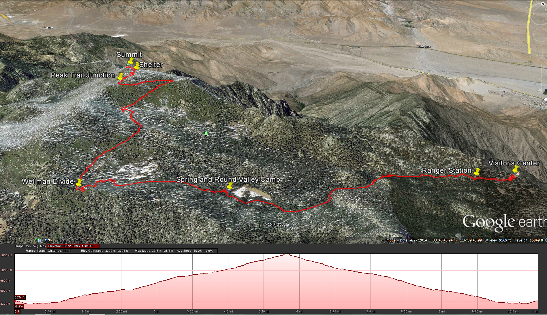
Distance: 12 miles. Elevation Gained: 2362 feet. Top Elevation : 10,834 feet. Moderately Strenuous
Start the hike: At the Palm Springs Tram. The tram will take you from the Valley Station at an elevation of 2,643 feet up to the Mountain Station at an elevation of 8,516 Feet. Here are directions to the tram: Valley Station for Palm Springs Tram
Once you get to the top of the tram, walk down the cement walkway and take a right towards the Long Valley Ranger Station in order to get your permit. Once you have your permit your ready to start the hike. Head past the ranger station following the trail towards Round Valley. You will soon see a junction sign telling you which way to go.
Keep following the trail towards Round Valley and the San Jacinto Peak. You will wander along the trail and past several foot bridges. At about .75 miles you will start to climb, you will gain about 650 feet of elevation over the next 1.5 miles or so until you reach the Round Valley Campground Area at about 2.3 miles into the trail and 9100 feet of elevation gain. Here you can resupply any water you may need at the spigot by the side of the trail, right next to the elevation marker, but remember you are going to need some way to treat that water as well.
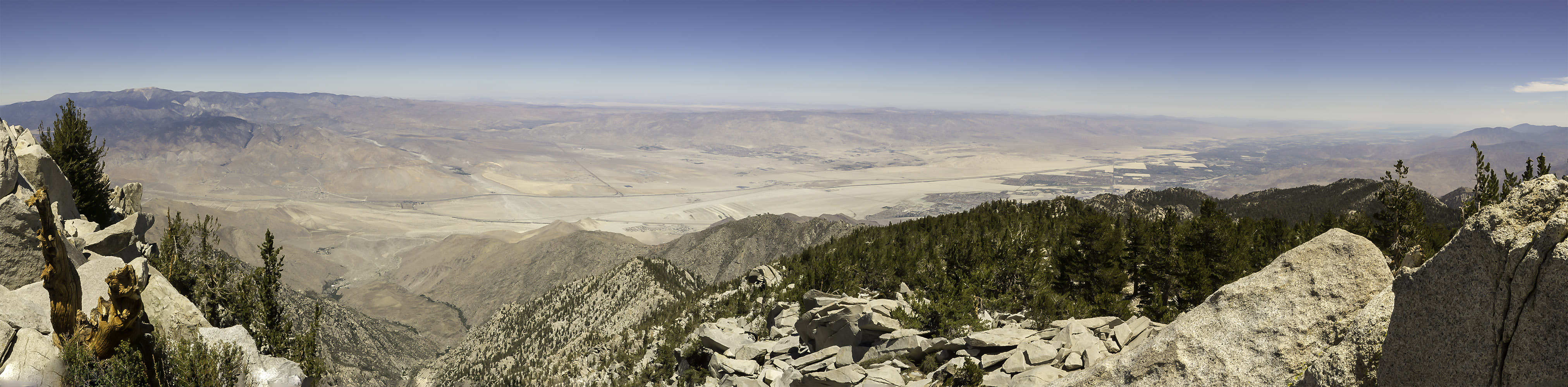
After leaving the Round Valley Campground Area you will soon start climbing again, from 9100 feet to 9700 feet over the next mile until you reach Wellmans Divide. Here you will get some great views looking south towards Tahquitz Peak and Palm Dessert.
After taking a break and taking in the views at Wellmans Divide, head up the Peak Trail. You will gain about another 700 feet as you rise from 9700 feet to about 10,400 feet over the next 1.4 miles as you head north along the eastern side of the mountain, before you hit the one switch back and start heading south along the eastern side of the mountain for another .4 miles and gaining another 200 feet until you hit the junction with Deer Springs Trail at 10.600 feet.
After you hit the Deer Springs Junction head north towards the peak, in about .2 miles and another 100 feet of elevation gain (at this altitude that feels like a lot) you should see the Emergency Hut on the right side of the trail at about 10,700 feet. Take a look around, its been there for some time, the shelter was built some time around 1933 by the California Conservation Corp’s.
After taking a look in the Shelter, head up the last .1 mile and 134 feet of elevation to get to the top. This is where it gets tricky, the trail starts to disappear, but if you look carefully you can see the wear patterns on the rocks where most people go and you may be able to spot some trail cairns that have been left for you to follow towards the top.


Weather at the top of the Mountain: National Weather Service for Mt San Jacinto at 8600 Feet.


