Distance: 7-8 Miles. Elevation Gained: 800 Feet. Time : 3-5 Hours
Transportation: You do not need a 4 – Wheel drive for this hike, you can with a good enough 4 x 4 drive most of the way to the sheep tanks.
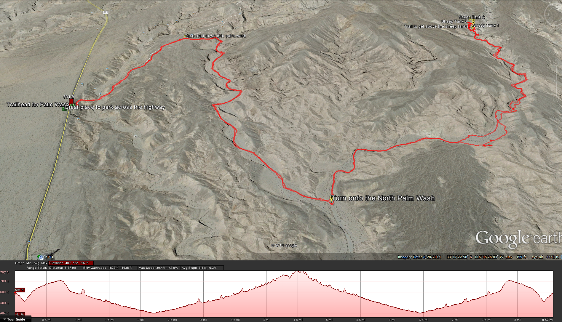
Directions: From Borrego Springs, follow Highway S-22 east for about 19 miles to a large north-side turnout just past mile 38, with a view of both the Calcite Mine area to the north and the Salton Sea to the east. *Although the road you will start your hike is on the north-side of the highway, there is a bit of a parking area on the south side of the highway that is much more comfortable to park at. * Here are google maps directions
Although this is listed as a Loop Hike in Jerry Schad’s “Afoot & Afield” we did this as an out and back hike. * At the end of this hike where the sheep tanks are I think you can keep following the ravine west that feeds the slot canyon and it should reach the main slot canyon of the Calcite Mines, but as I have yet to do this you do so at your own risk and with your own skill*
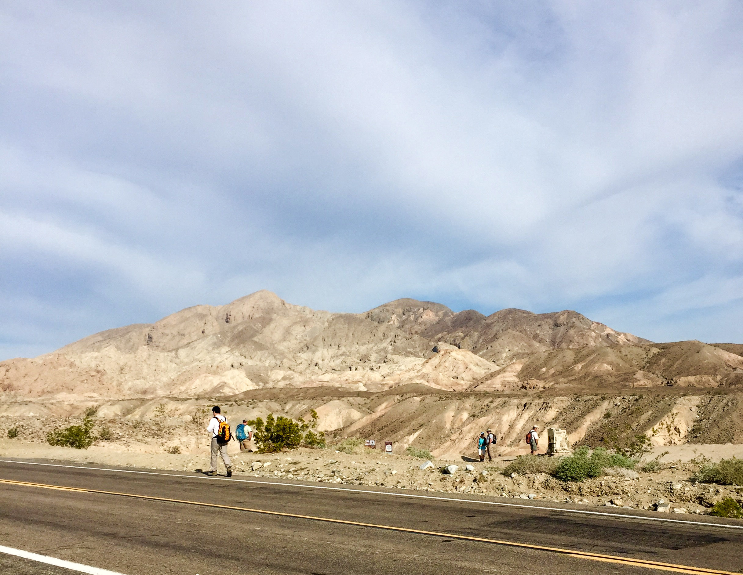
Trailhead for the Calcite Mine and Palm Wash
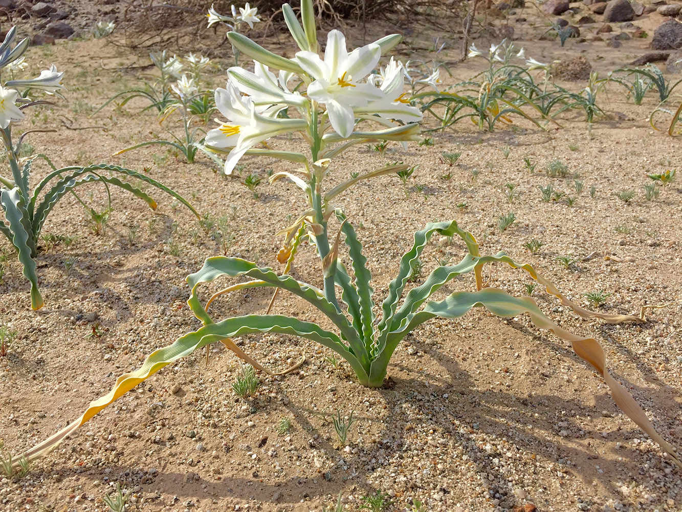
Desert Lily in full bloom after recent rains
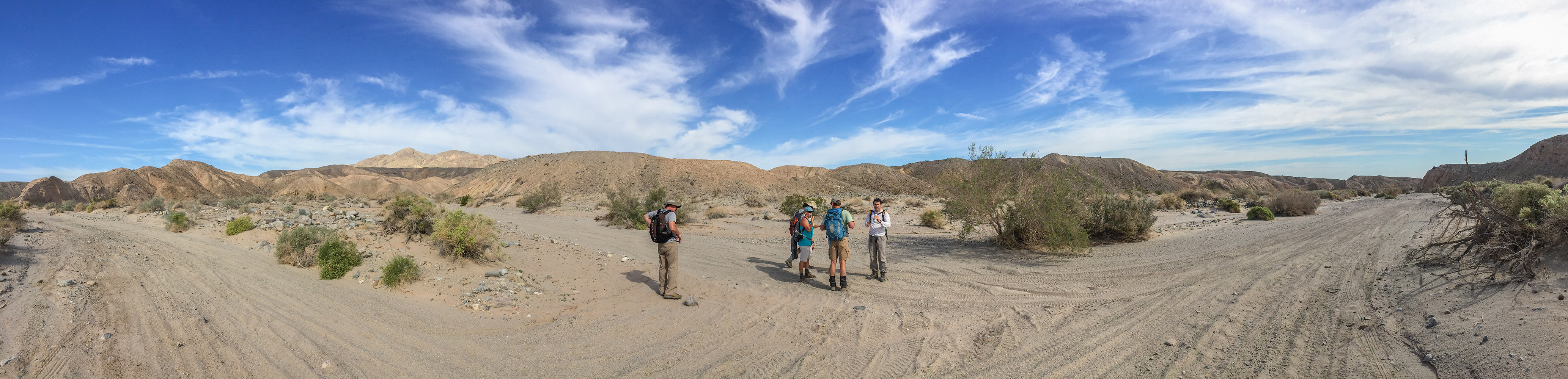
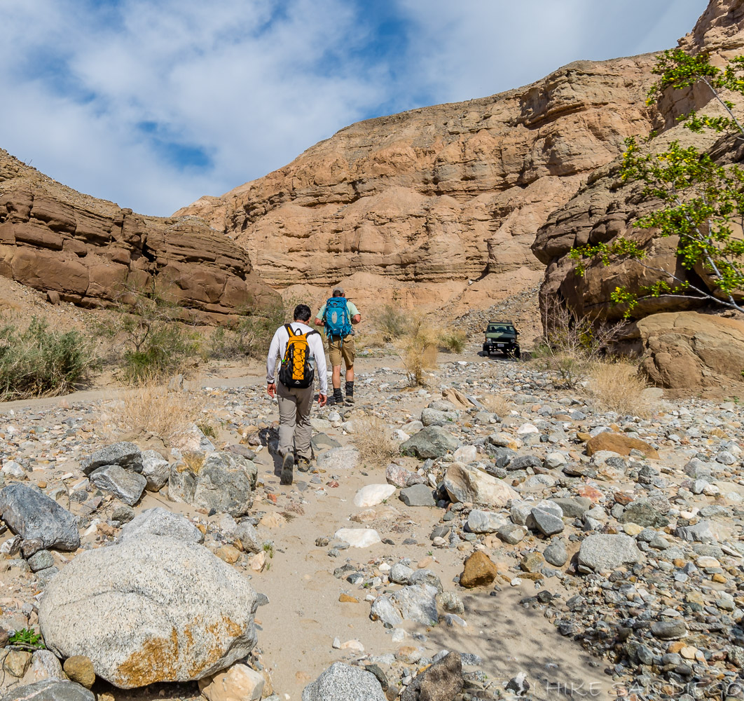
You will start the hike on the north side of Highway S-22. Follow the Calcite Mine Road down into the first wash and then back up another hill for about 0.8 miles before you will see another dirt road off to your right with a small sign for the Palm Wash. Follow this road down into Palm Wash.
Descending the road into Palm Wash
When you get down into the wash follow the dirt road to the right ( south – east ). At this point all your going to do is follow the dirt road for the next 1.2 miles through the wash until you see another another road that leads off to your left ( north) this is the North Fork Palm Wash.
North Fork leading off of Palm Wash Road
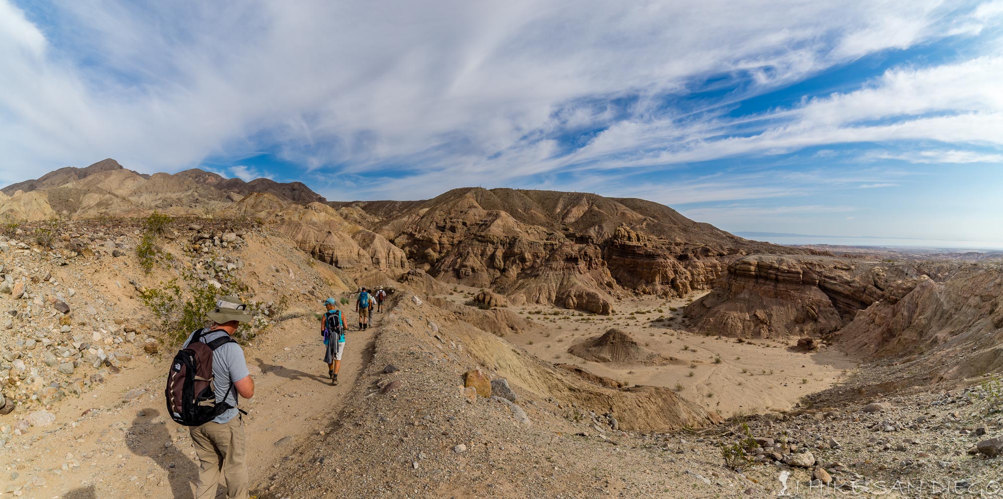
Keep an eye open for 4 x 4’s and dirt-bikes along the road. Most where going slow enough that it wasn’t an issue, and there is plenty of room to move around out here so that your not in each others way.
Hikers and off-road enthusiasts sharing the space.
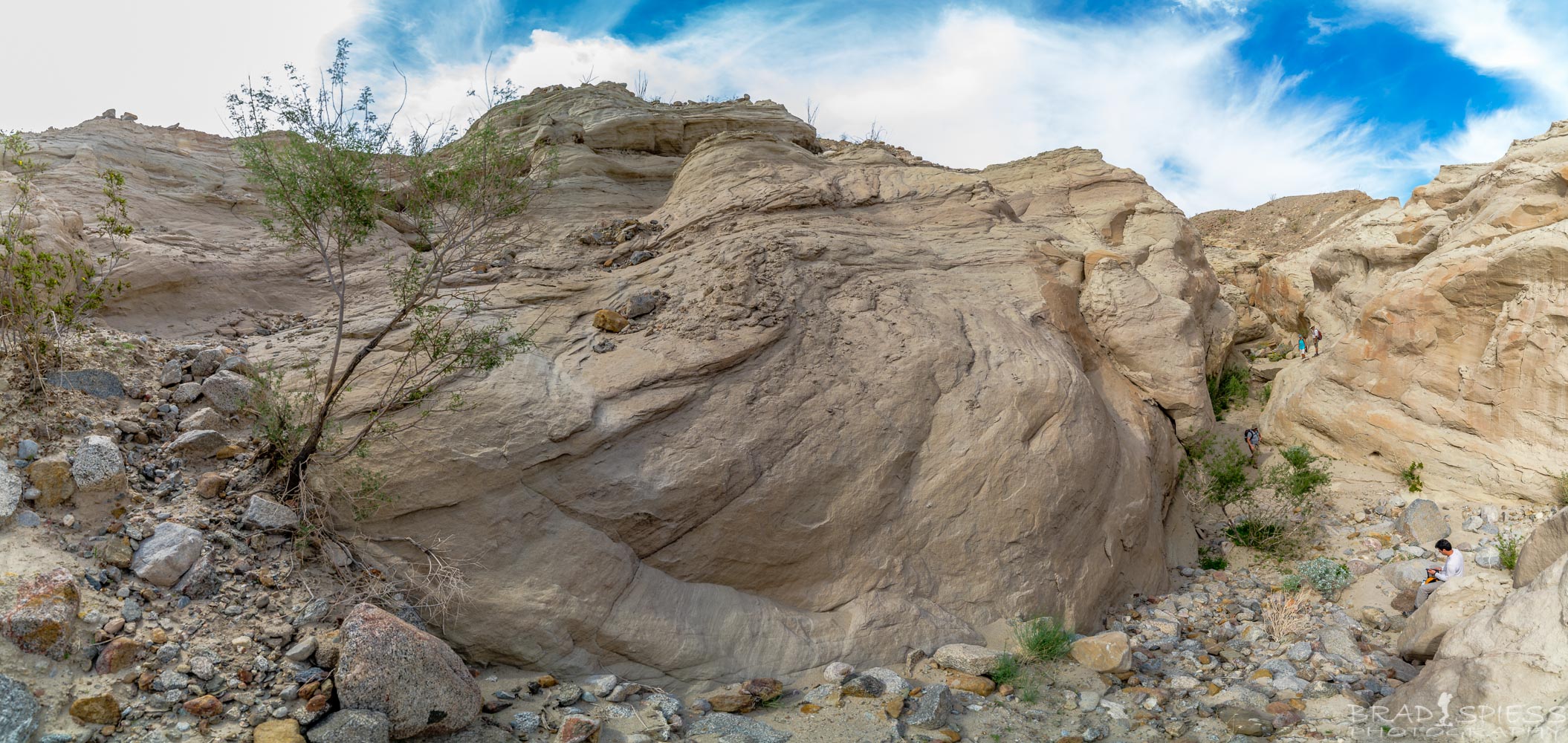
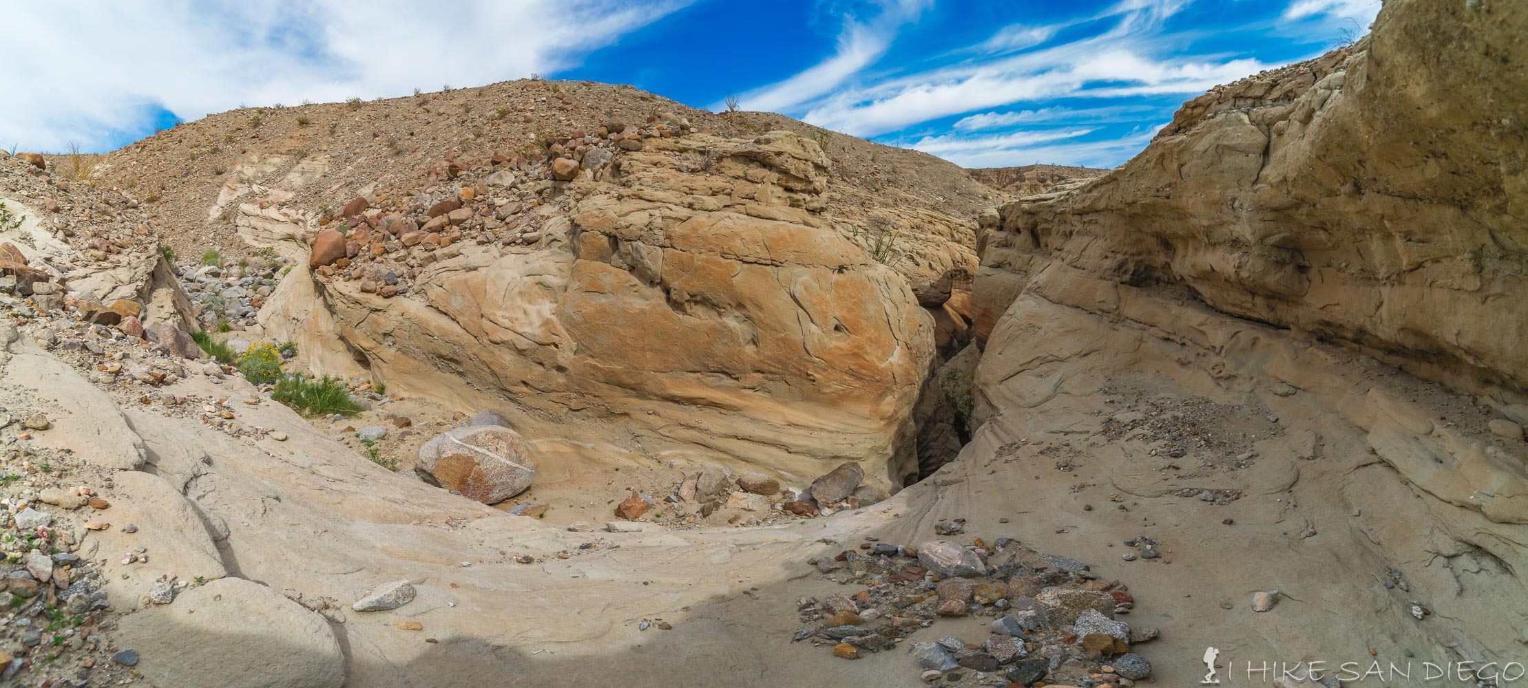
Follow this road for another 2 miles. The road will continue to narrow until it starts going through a slot canyon. As you come out of the slot canyon the wash will split into a fork, look for a Sign that points you towards a hiking trail on the left fork. Take this trail up as far as you can, this will lead you to the easiest “Sheep Tank” to see.
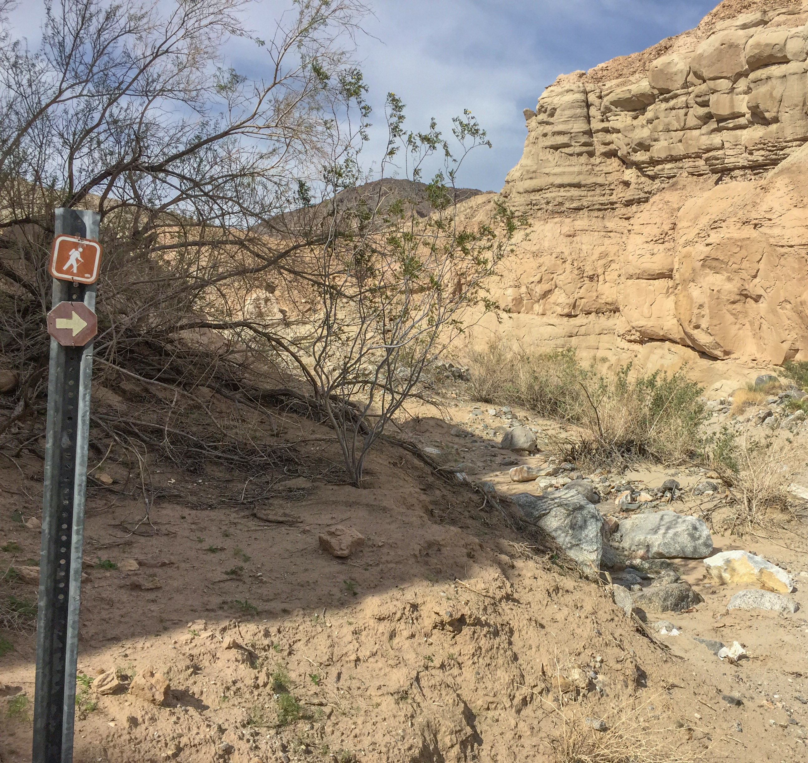
Sign for the hiking trail off of North Fork
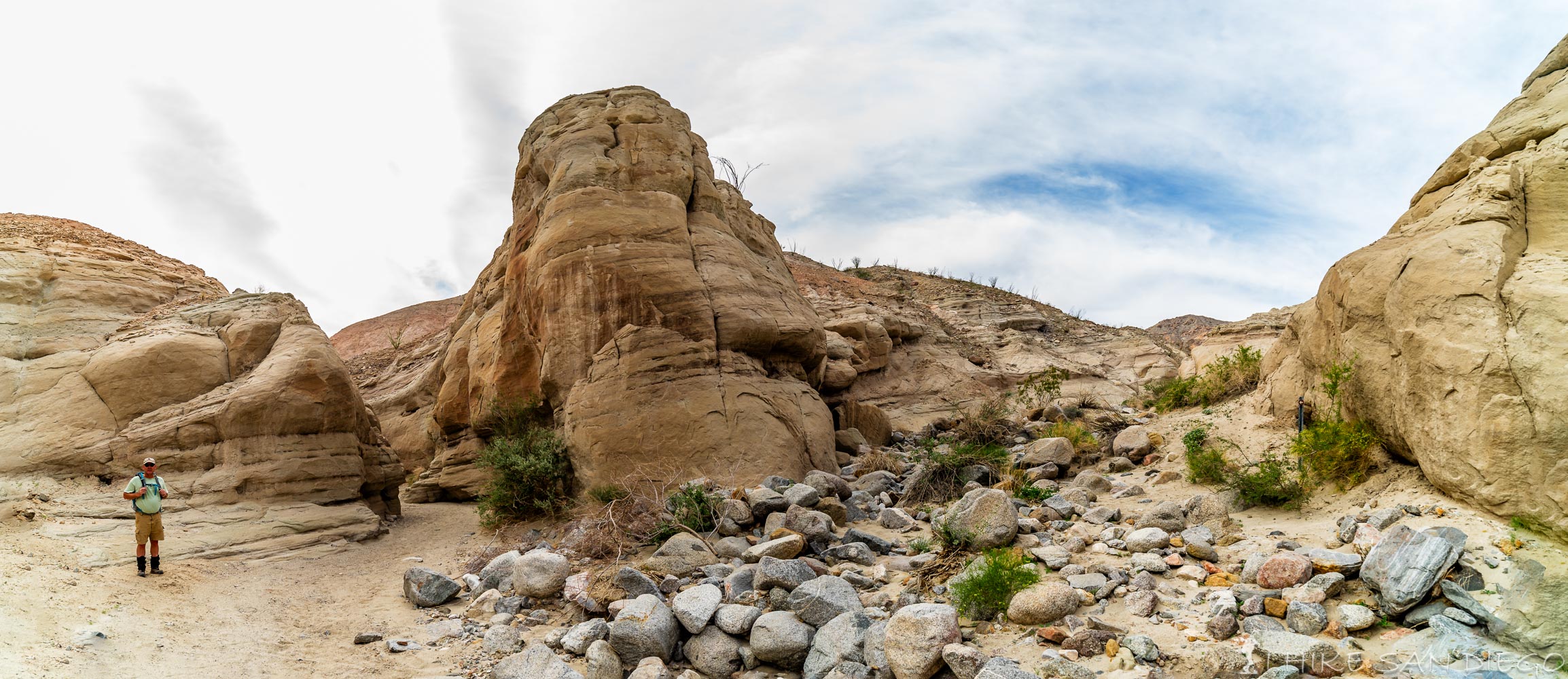
Slot canyon and hiking sign
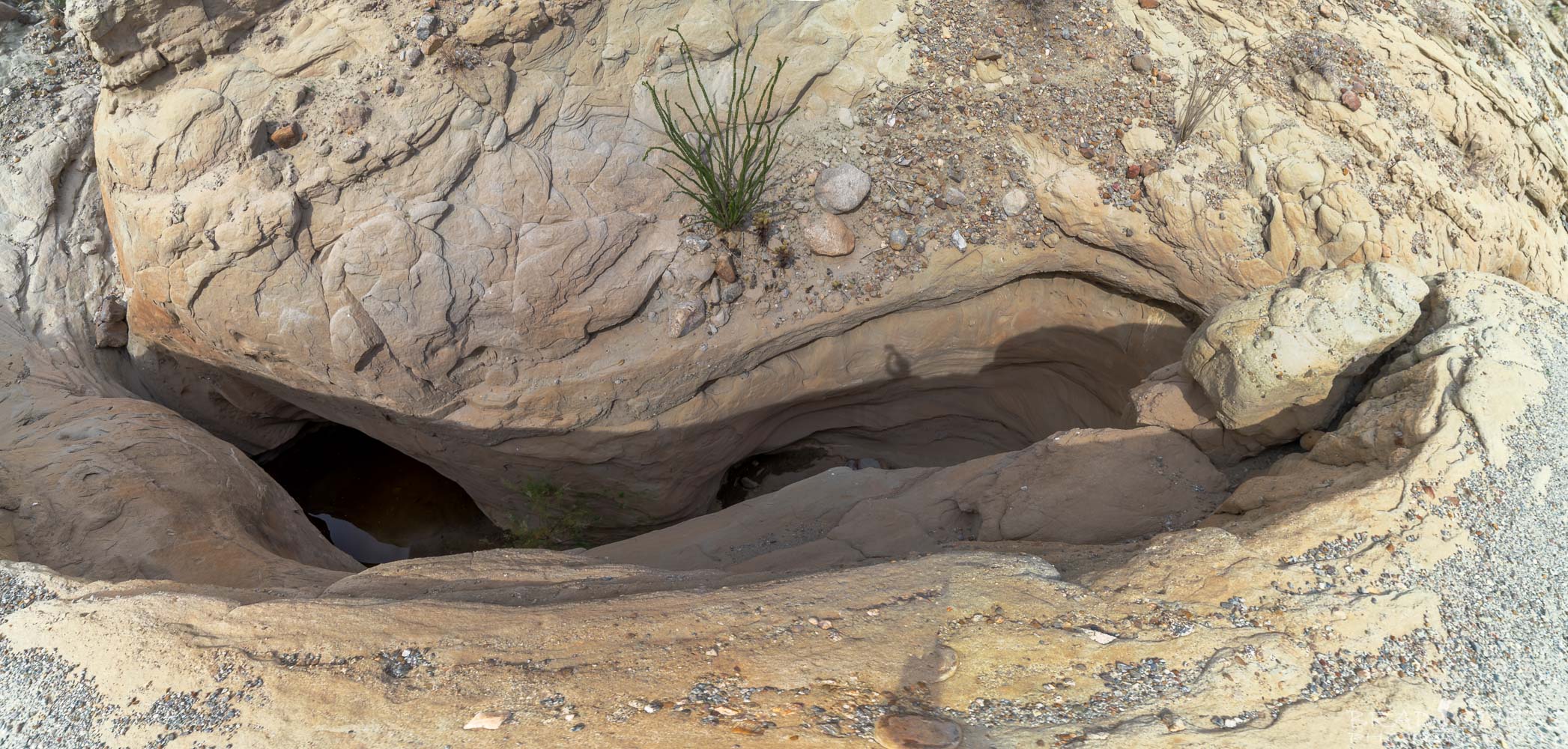
Make your way up to the “Sheep Tank”. Check it out, but I would suggest that you wait for a lunch break until you get to the top of the “Sheep Tanks”, unless you want to take advantage of the shade.
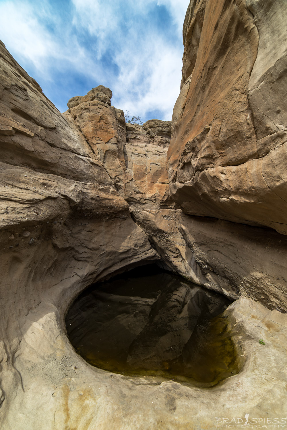
The 1st Sheep Tank and most prominent one you will see.
After you are done looking at the nasty green water in the first sheep tank back track a little bit until you see a way up the right side of the canyon ( north side), find your way up towards the top of the canyon looking for the easiest way, towards the top you should be able to pick out a very slight use trail that heads towards the top of the slot canyon, make your way over there, but watch your step.
The way up to the top of the slot canyon, as you back track from the “Sheep Tank”.
When you get towards the slot canyon, drop your bags and inch your way towards the edge to look down and over, just be careful, its a long drop to the bottom and it would be very difficult to get out of.
Looking down into the slot canyon from above
If you want another view, head towards the other end of the slot canyon and you will see another use trail that should skirt its way along the side of the slot canyon until you can drop down and make your way to the mouth of the first drop. Check it out.
The mouth to the upper part of the slot canyon
Again if you feel confident in your skills you may want to try the ravine at this point and work your way back towards the main slot canyon at the Calcite Mines, otherwise just head back the way you came. I’m sure there is something cold and refreshing waiting for you back in Borrego Springs on your way back from this hike.
Weather forecast for the Palm Wash to Sheep Tanks Hike: