Heading up San Jancinto after 2 inches of snow in November
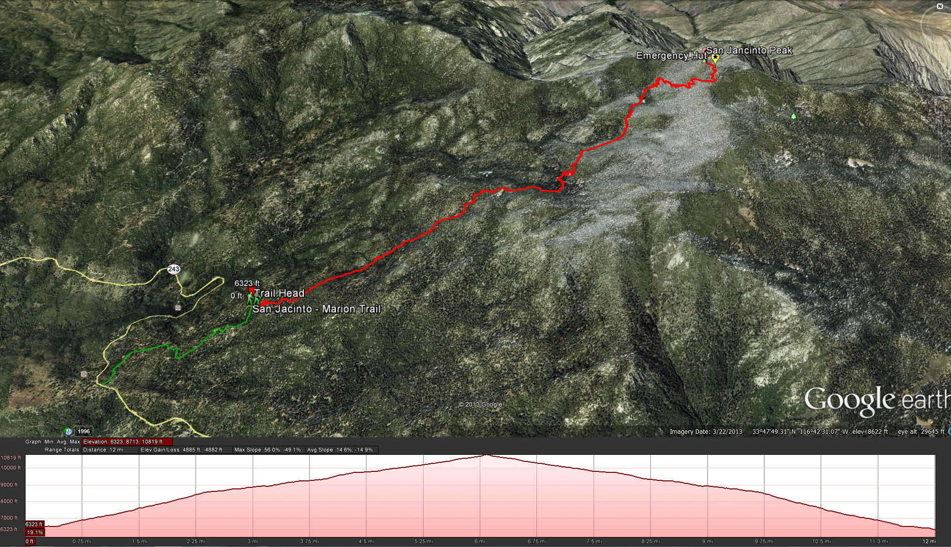
Marion Mountain Trail to San Jancinto Peak
Distance: 11.8 miles
Elevation Gained: 4800 Feet, with a top elevation of 10,834 feet.
Time to complete the trail: 8-12 hours. All day event, times will vary depending on your fitness levels.
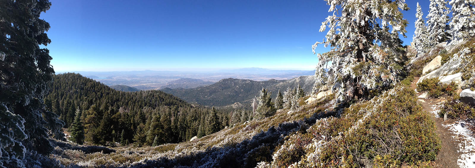
We decided to hike this trail in November and that was a stroke of luck. I wasn’t completely sure of the weather, the forecast keep changing but didn’t expect any big storms, but when we started the hike there was about 2 inches of snow is some places and the ground was rock hard. My buddy told me this was a good thing as he had done this hike before with his wife and the soil was quite loose in some parts making it hard to trudge through, we did experience some of that coming back down but on the way up the rock hard ground was great to push off of.
Getting There: We stayed in the town of Idyllwild the night before so we could get an early start the next day, but we blew that out of the water by going to look for some breakfast and not really starting the trail until 9 am or so. From the town of Idyllwild you follow the 243 towards banning for about 10-15 minutes before you get to the turn off for the Marion Mountain Campground Road, follow that road as it continues to fork off to different campgrounds. Take the first fork left, the 2nd fork right, and the 3rd fork right until you will see a sign that says you cant go any further unless you are camping, usually you should see a car or two parked along the road as this is the trail head.
Make sure you have an adventure pass present in your windshield and make sure to stop off in town at the ranger station before you hit the trail to get a permit, you can self check the permit which makes it much easier especially since the office doesn’t open up until 8am and most people are going to want to hit this trail earlier.
Bring lots of water: figure on at least 3-4 Liters on a cool day, if its hot you are going to need much more. There are some streams along the way to fill up your water and use your filter, but when we went up in November those streams where frozen solid, my 2nd time up this trail in late September there was still water in some of the streams.
Bring a headlamp: Both times I’ve been up this trail it was dark an hour before we got back to our car, and a headlamp is a lifesaver in these circumstances.
Printable Map:http://www.parks.ca.gov/pages/636/files/MtSanJacintoSPmap.pdf
Adventure Pass: http://www.fs.usda.gov/detailfull/r5/passes-permits/recreation/?cid=stelprdb5208699&width=full
Permits:http://www.parks.ca.gov/?page_id=636
As you start the trail you will make your way up the mountain and pass by a camp ground on your left hand side, you will know you are still on the right trail when you pass by a sign showing you the way to the trail after about a 1/2 mile as you cross a dirt road ( path). The climb now begins, enjoy the scenery as you go up , the switch backs start at about 1.2 miles. Keep your eye on the trail, some times it can be tricky, at one point the trail went right along a exposed piece of granite for a little bit and you really couldn’t see it, so we followed false trail that had started to appear to the left and keep following it until we realized our mistake and then set out to find the real trail again, which we did but its a good thing to remember to keep aware of path and where its supposed to be heading.
Weather forecast for the hike:
Pictures from the hiking trail:


