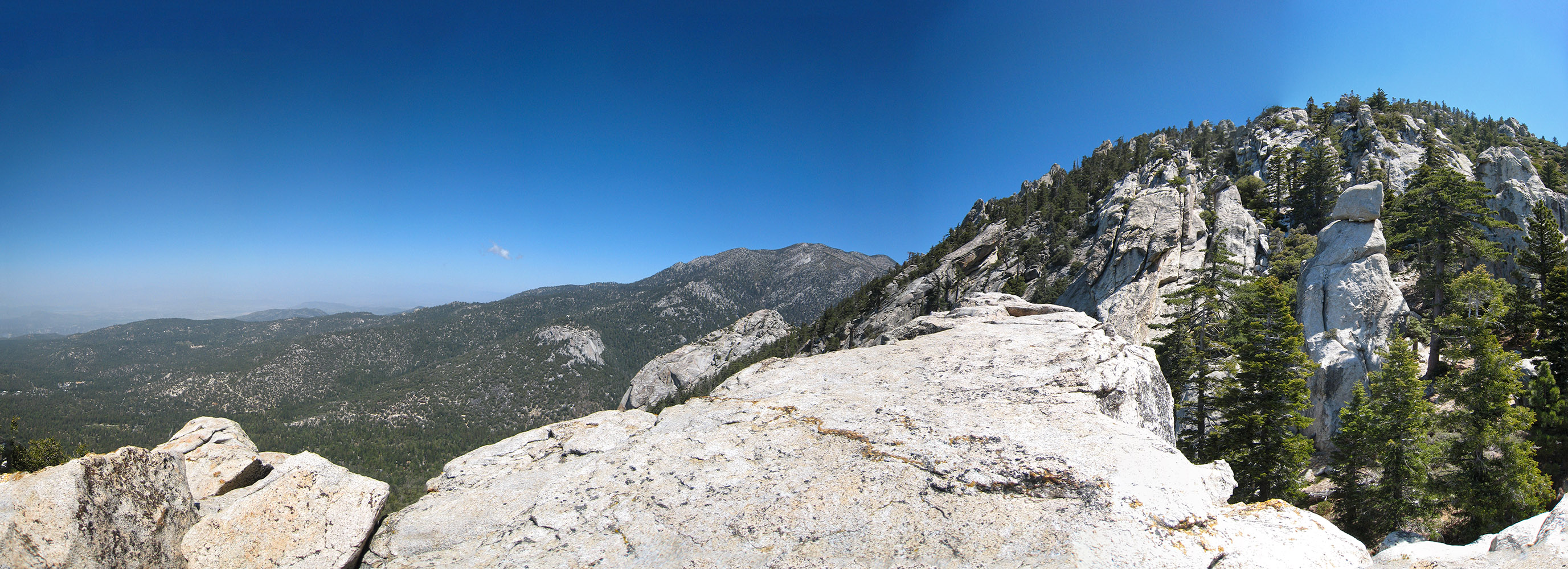
Looking towards Suicide Rock and Lily Rock on the way up to Tahquitz Peak
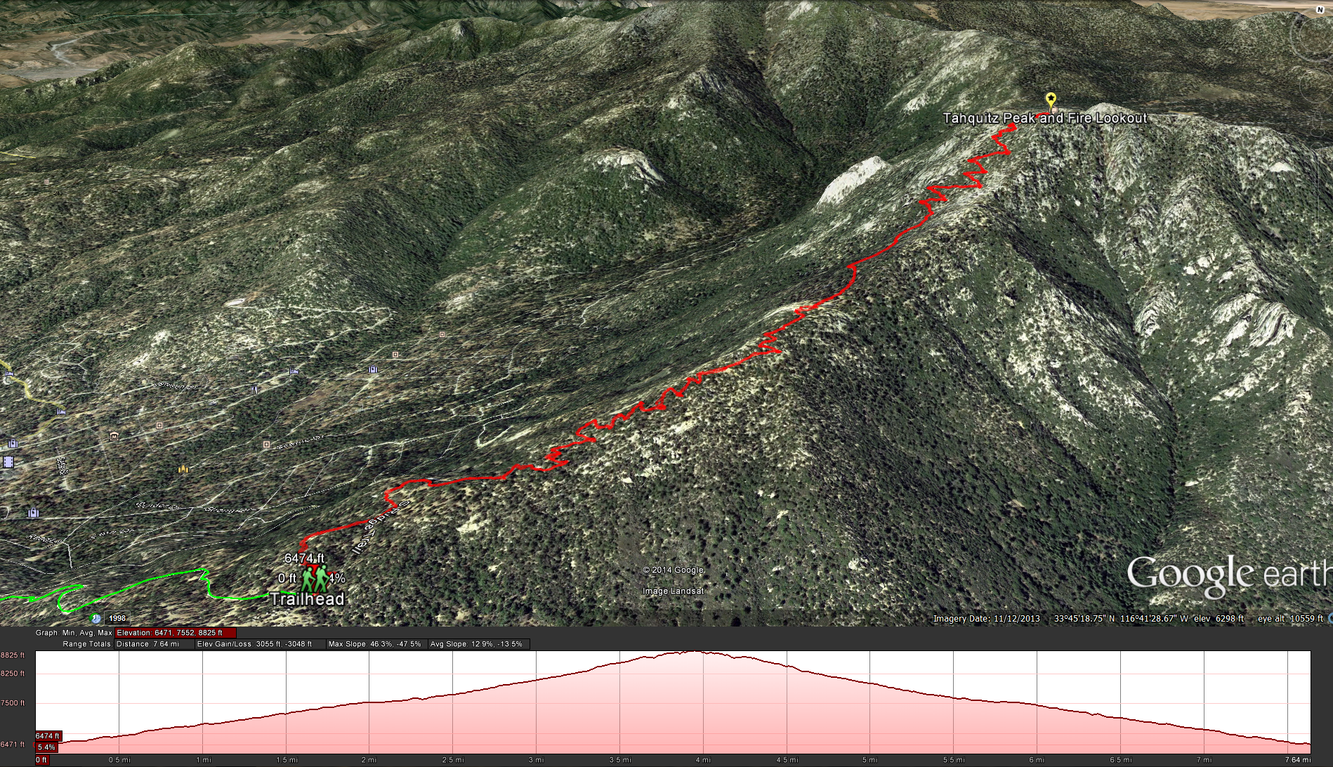
South Ridge to Trail to Tahquitz Peak
Distance: 8 miles. Elevation Gained: 2,187 feet. Top Elevation : 8,846 feet. Moderate Level Hike with the last mile getting harder.
Permits: A Wilderness Permit is required, you can apply here. As is an Adventure Pass
Bathroom Facilities: There are no bathroom facilities, so I would go in town before you hit the dirt road, maybe at the ranger station when your getting the permit.
To start this hike, head up to the town of Idyllwild. Once in town you can turn east onto either Saunders Meadow Road, or Marian View Dr, Marian View Dr will connect to Saunders Meadow Road. Keep Following Saunders Meadow Road until you can make a left onto Pine Ave which quickly becomes Tahquitz View Dr. Follow Tahquitz View Dr until you see a dirt road on your right side, take a right onto the dirt road Forest Route 5S11, follow this road until it ends at the South Ridge Trail Head. My only concern at this point was that I noticed a lot of kids partying here as I got back to the trailhead at the end of the hike ( no self respecting teenager would be up at the time I start my hikes on the weekend).
This is a pretty moderate trail, that being said it did start to get a little harder for the last mile, once you start going up all the switch backs. There are many great points to take in the views down into the town of Idyllwild. Looking towards San Jacinto Peak you can see Suicide Rock and Lily Rock ( which is technically also Tahquitz Rock) two very popular rock climbing areas in the town of Idyllwild, in fact the Yosemite Decimal System for grading the difficulty or walks, hikes, and climbs was developed on Tahquitz. On the southern side of the mountain you get great views down into Garner Valley and the view towards the desert. While looking towards the south you can also see a wide swath of land that was burnt in the 2013 “Mountain Fire”.


