3 Sisters Waterfalls
Google Earth: 3 Sisters Waterfalls Hike
This is a video of the hike to the waterfall, but with the old trail so you can see what it used to be like.
Distance: 4.2 miles .Elevation Gain: 724 feet. Time to complete: 3 hours roundtrip * This really depends on your skill levels, if you are experienced and fit it should take you about 3 hours, more if you spend some time swimming around at the falls or if you are inexperienced at hiking *
Equipment: Make sure you have a good pair of hiking boots, I see a lot of kids hiking in running shoes but that is a good way to twist an ankle, also you are going to want the grip that a good pair of hiking boots will give you. Also make sure your bring a lot of water, you may not notice it on the way down but you will need it for the return trip. You Used to need a pair of gloves for the ropes, and long pants and long sleeves for all the poison oak, but with the new trail you probably won’t need these items. You are no longer using a rope and as long as follow the trail you don’t drop down into the creek you are less likely to rub up against poison oak.
Permits and or Adventure Pass: At this time it does not look like you need an adventure pass. I called the Palomar Ranger District to check on this, with all the improvements they made to the trail head and trail system I thought they might implement this on the trail but it may have not been implemented because its still not an official trail. At this time there has not been a permit system implemented for this trail as well, again going back to it being and unofficial trail, that probably has something to do with it, but if all the emergency calls continue out there you may see it go the same way the Cedar Creek Falls Trail went as well.
Parking and Bathrooms: Another great improvement to this trail is the inclusion of a parking lot and porta-pottys. If you are familiar with this trail you will now notice the corner where everyone used to park along Boulder Creek Road now has signs everywhere telling you that you can no longer park there, heed this warning, I don’t know how much this in enforced, but as I was leaving and heading up the road towards Julian I saw a patrol car heading in that direction. I don’t usually need to use the porta pottys you see on the trails, I try to take care of business before I head out there, but as you know “s*it happens”, so this inclusion into the trail system is a good one, and will hopefully keep people from doing their business on the trail and leaving human waste that can become quite a problem on a busy trail.
To Get There: From Interstate , exit at Highway 79 ( the Descanso exit) and drive north. After 1.3 miles turn left on Riverside Drive. Continue 0.6 miles to the main crossroads (post office, etc.) of the hamlet of Descanso. From there take Oak Grove Drive 1.6 miles to the intersection of Boulder Creek Road on the right. Follow Boulder Creek Road north for 13.0 miles (the first half is paved and the rest is dirt) to a hairpin turn where unpaved Cedar Creek Road joins from the west. Park there, at the 3 Sisters waterfalls Hike Trailhead taking care not to block traffic, and post an Adventure Pass on your car. (This hairpin turn and intersection can also be reached, more circuitously by way of Engineers Road or Pine Hills Road to the north.)
Is this trail dog or kid friendly : The new trail is dog and kid friendly. But I do warn you that you must bring enough water for yourself and your kids and or dog, and If you have to carry the kids, this is probably not the trail to take. Also not that when you get to the middle waterfall, the trail to get to the top waterfall can be treacherous and I would not recommend this for dogs or for kids who are not strong hikers and or climbers.
A Word of Caution: When you drive out here you will realize just how far away from everything you are. Remember that if you are planning to head out here and are drinking or climbing all the way up to the top of the waterfall. If something goes wrong its going to be a long time before help can come for you. Be as self sufficient as possible. In 2023 two hikers died in two seperate events. A women fell to her death after after going to help one of the teenage girls with her on the hike whom had also slipped. Just over a week later a 27 old man drowned in the middle pool of the falls and they had to diverte water in order to find his body. I don’t want to rain on your parade but remember that you are essentially responsible for your own saftey out here.
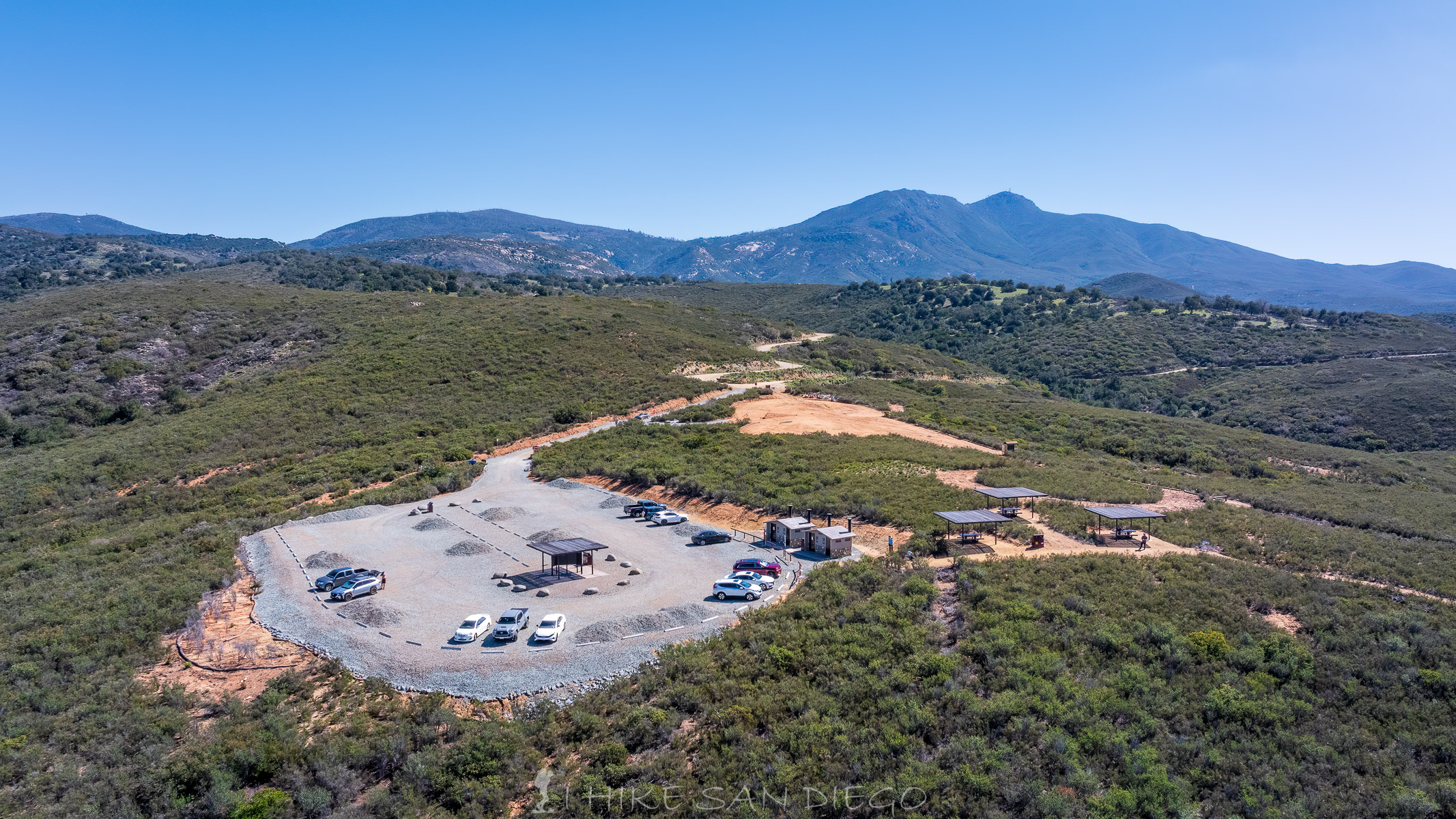
The much newer parking lot for 3 Sister Waterfalls Hike with 4 bathrooms and some shade structures. You can see the older dirt parking lot still there in the upper right and then the road where you used to have to park on a long time ago.
The New Parking Lot for the 3 Sisters Waterfall Hike
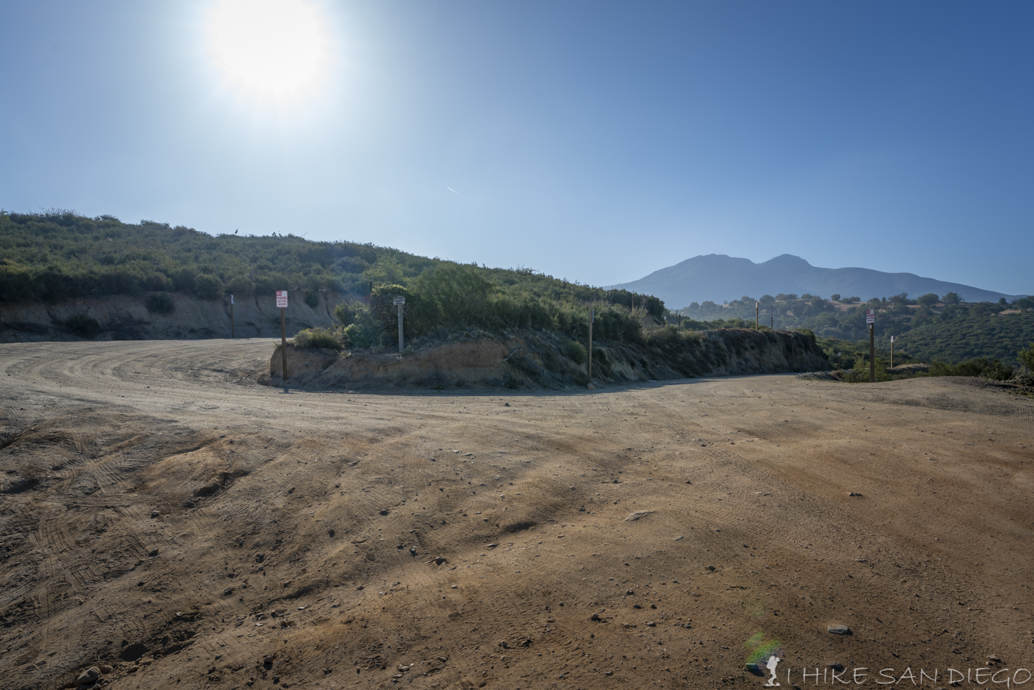
The road where you used to park has a lot of no parking signs
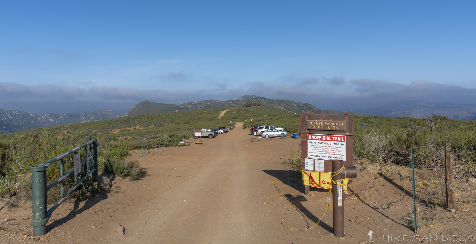
T his trail starts out at the same trail head as for Eagle Peak, so if you see other hikers there that look like they have some rock climbing gear that’s probably where they are heading to. I would suggest that you take advantage of the porta pottys before you start your hike, there isn’t a whole lot of good area to drop your shorts and do your business once you get down into the canyon.
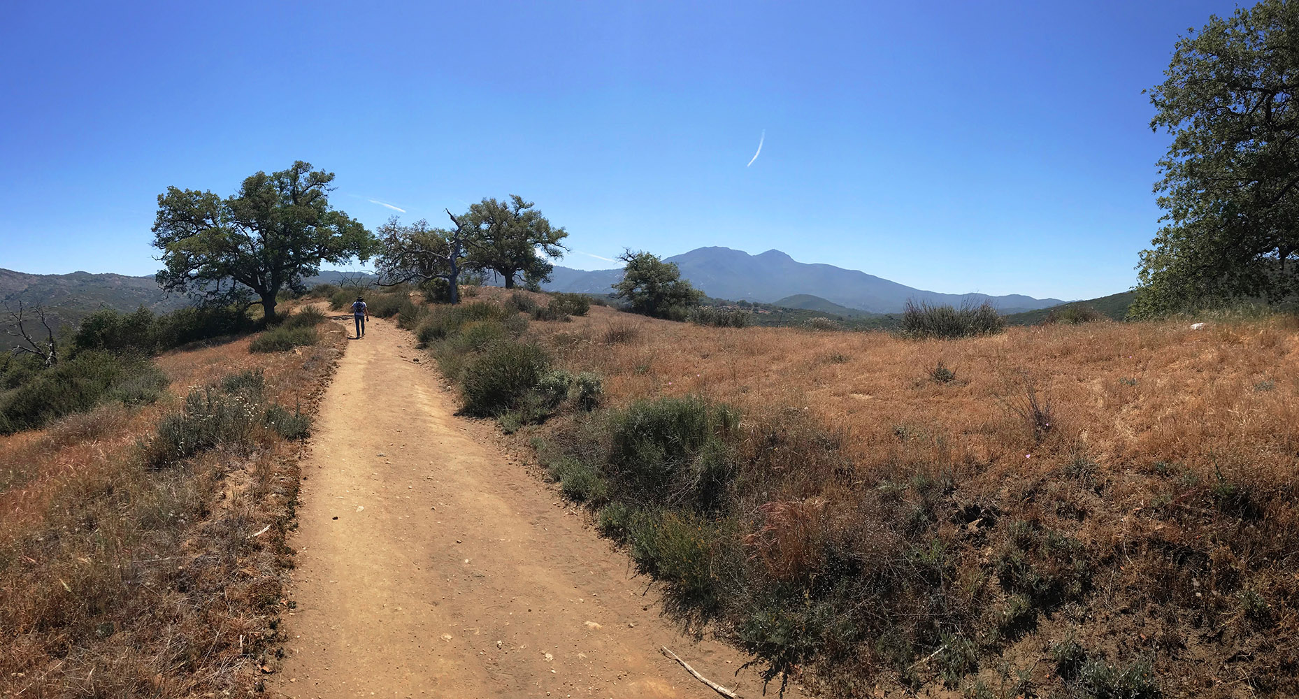
A collection of oak trees along the trail not to far from the begging of the trail.
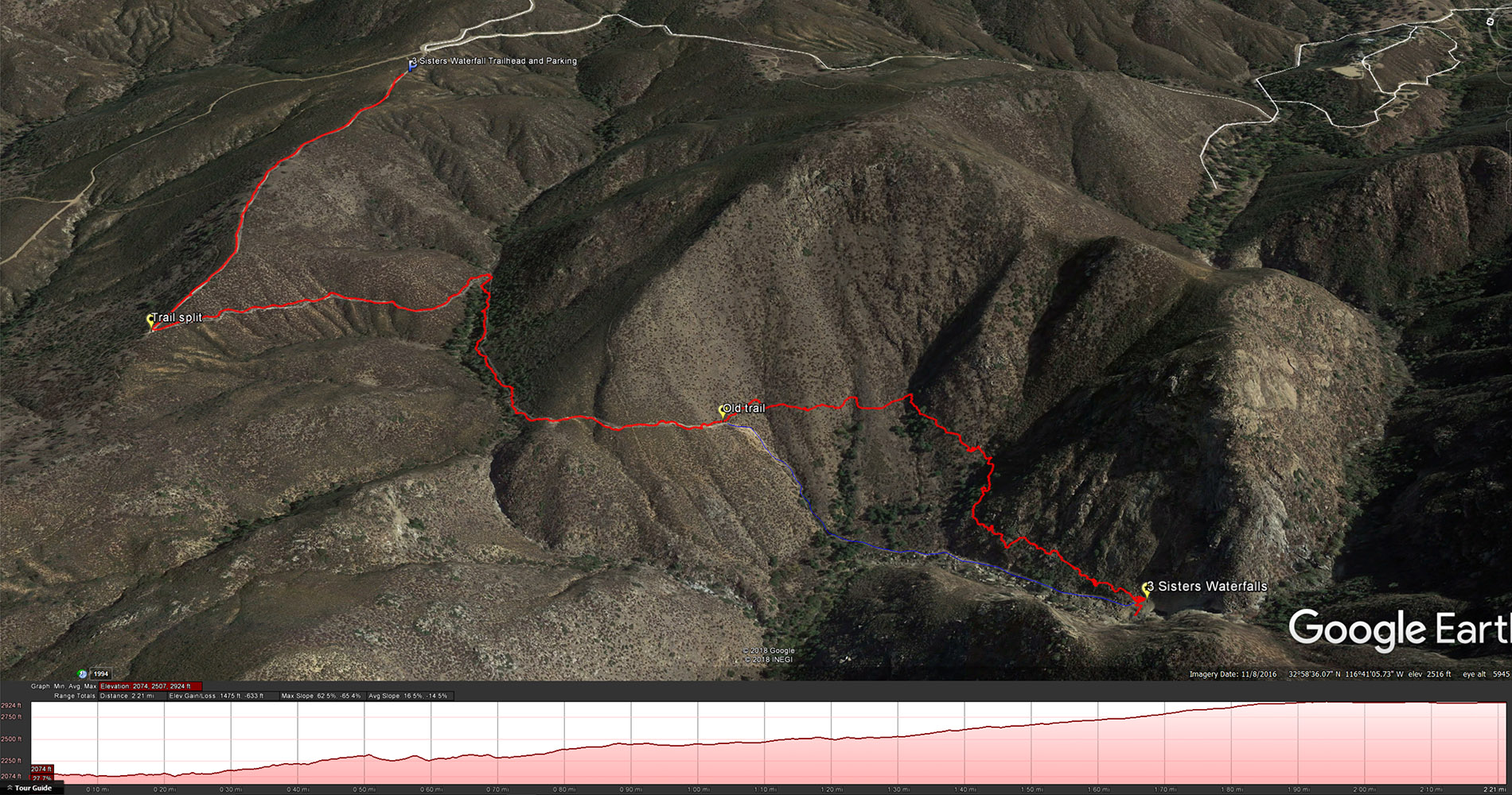
The trail starts at the end of the parking lot, head west along the trail , past the cool shade from some of the remaining oak trees in the area to the trail junction about 2/3 of a mile from the start of the hike. At the junction if you keep heading straight you will head towards Eagle Peak, turn left on the trail and head down the hill, you should see the 3 Sisters Waterfalls off in the distance.

Where the trail splits, going left down to the waterfalls and heading right towards Eagle Peak.
After the trail split you will head downhill for about 1/2 a mile before you head into some shade from the surrounding trees, enjoy it because soon you will come back out into the sun. This is kind of a fun section where it feels like your going through little tunnels of foliage. After about a 1/4 of mile going through the vegetation you will come out onto a little ridge that gives you your first unfettered access to viewing the whole falls. If you want to get a good picture of the entirety of the 3 waterfalls, this is a great spot to get a shot in.
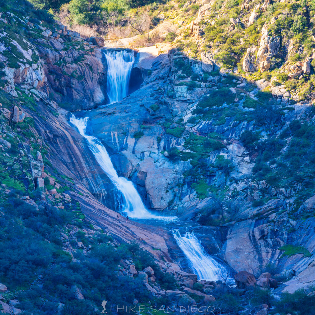
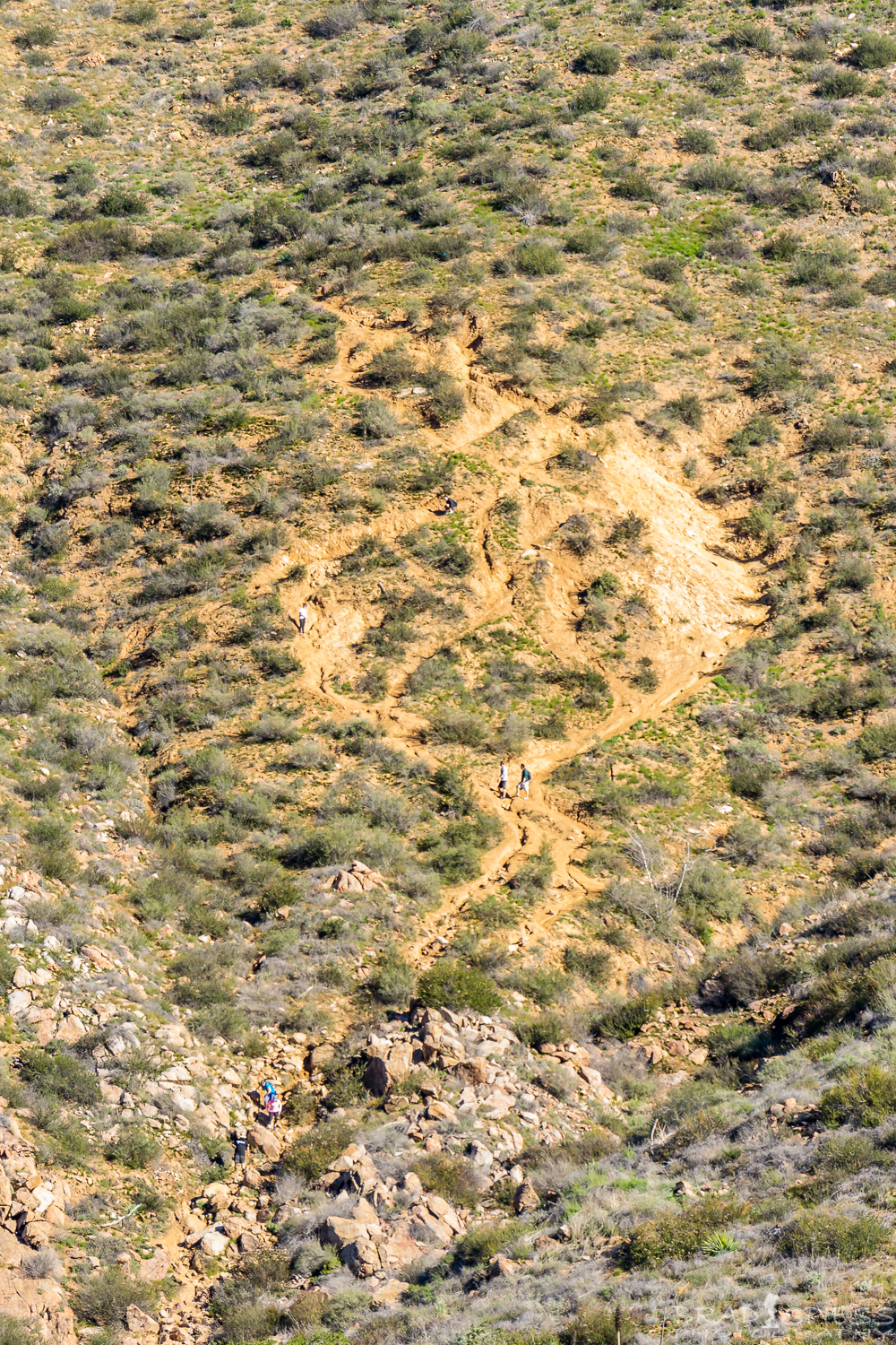
3 Sisters Waterfalls, see the two people at the bottom left of the waterfall for scale.
The 3 Sisters Waterfalls in their entirety.
After taking in the scene of the waterfalls continue down the trail, this is where the trail will change quite a bit from what it used to be. About 2/10 of a mile further you will see where the old trail used to drop down the steep terrain to get to the canyon floor. Some people may lament the loss of this part of the trail and the experience of using the ropes to shimmy down the trail, but it has certainly made the trail safer and more accessible to everyone.
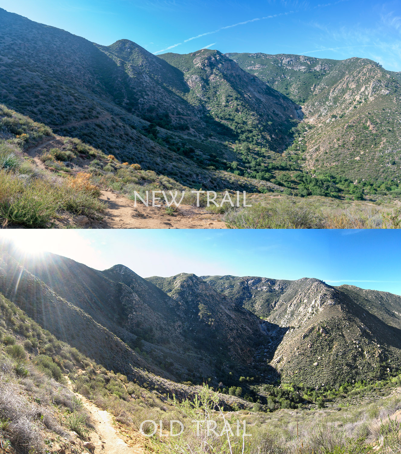
A view of the new trail vs the old trail system.
Another view of the new trail with a view of the old steep trail down the hill as well
The Scar, the old trail that would steeply drop down into the canyon below. You can make out the people going up and down the trail if you look closely.
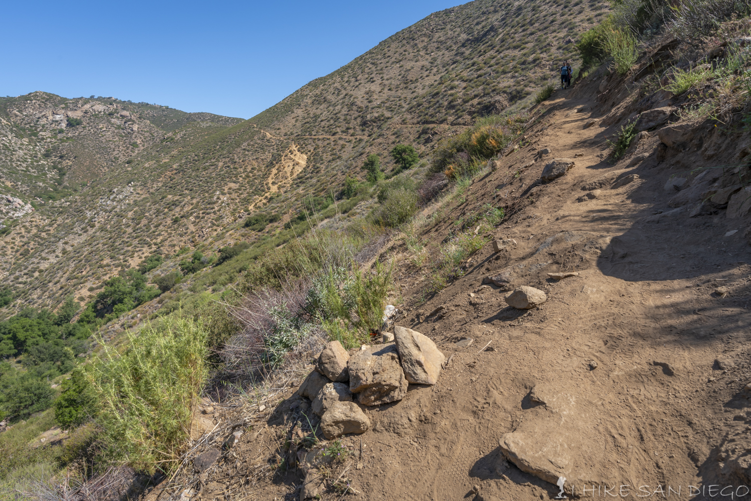
As you pass by the red tape closing the trail to the old cut scar on the hillside that made its way steeply down to the canyon you can see the new trail stretch out in front you and around the hillside. You will continue for about 1/2 mile along the new trail before you start hitting a much rockier area of the trail. If you get lost on the trail, don’t automatically go further down towards the creek but look for the pink ribbons, follow those ribbons and you should get to the bottom of the falls in another 1/4 a mile.
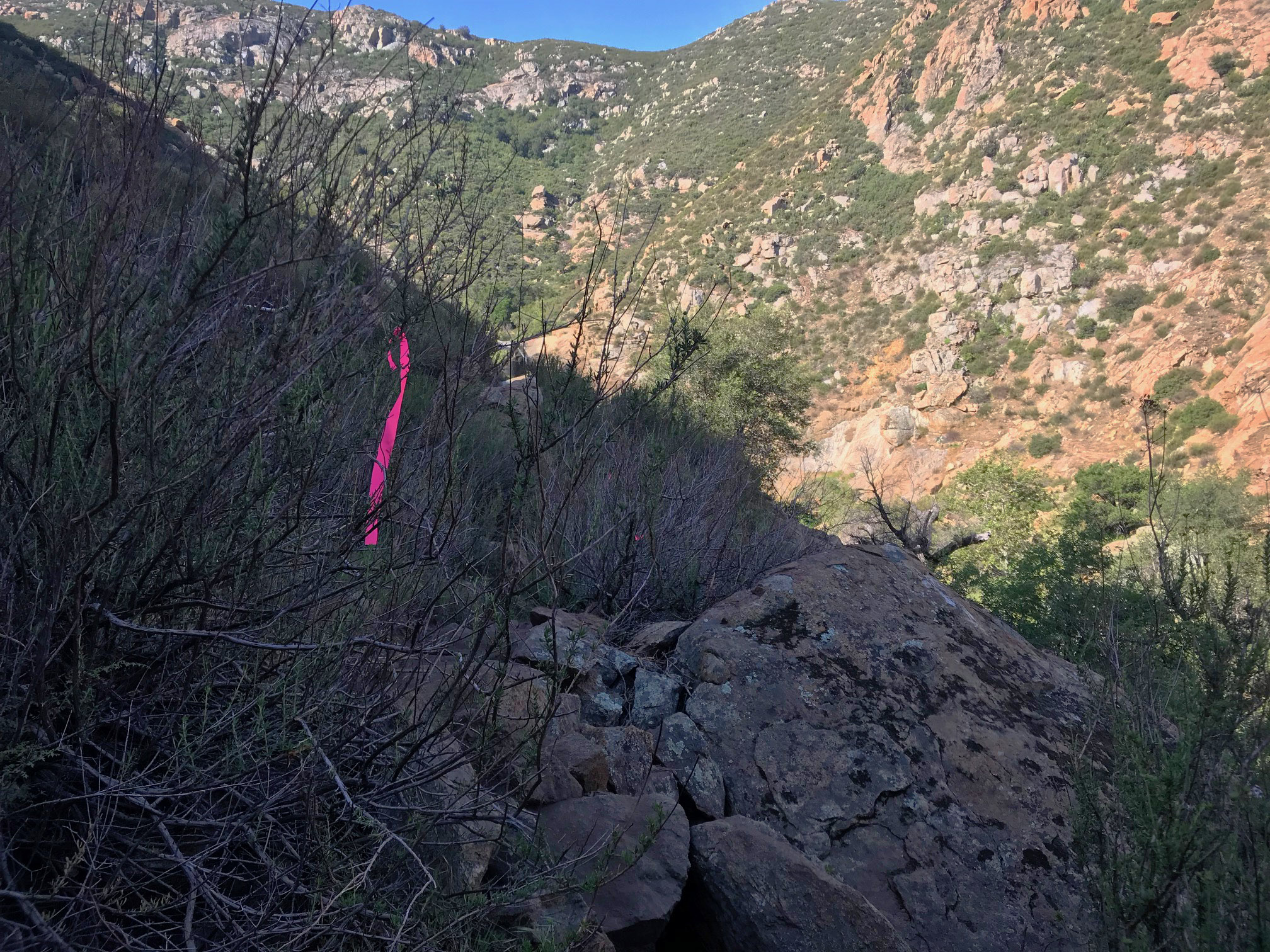
Follow the pink ribbons to keep on the trail.
After trapsing along the rocky hillside for about 1/4 a mile you will come out near the bottom of the middle waterfall and pool. Take a breather and take in the site and then decide if you want to keep on going to the top of the waterfalls.
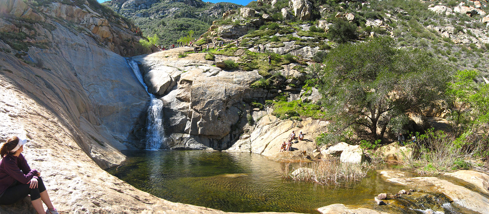
The middle waterfall and pool area of the 3 sisters waterfalls.
If you decide to keep on going to the top, make your way over the edge of the pool to the other side and make your way up behind the tree. You should see a vague trail heading up from there. Be careful as you head up this part of the trail, I once had a rock the size of a volleyball come bouncing down into my shoulder because of someone loosening it above me. As you make your way up the trail you can go to the left and head towards the bottom of the top pool or head up and over the rocks to get to the very top waterfall.
Looking down from the very top waterfall
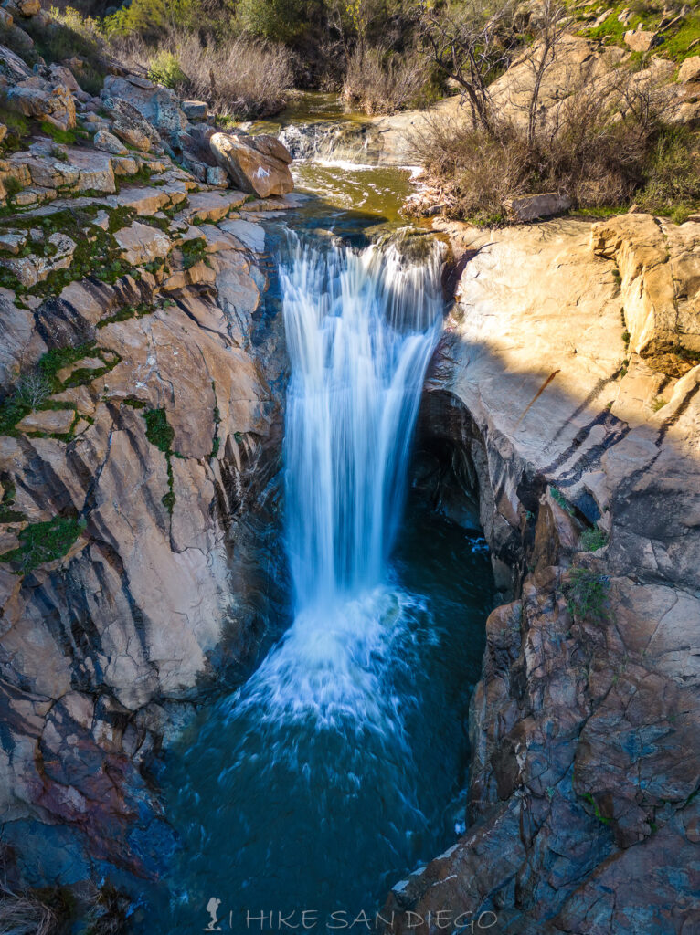
The Top Waterfall at 3 Sisters Waterfalls
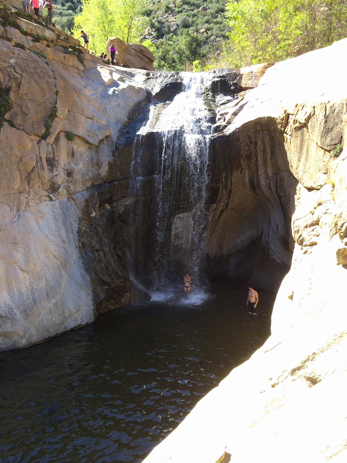
Cooling off under the top waterfall
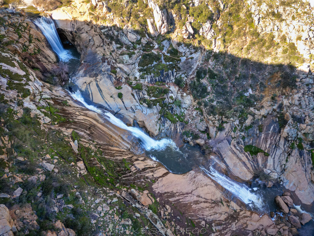
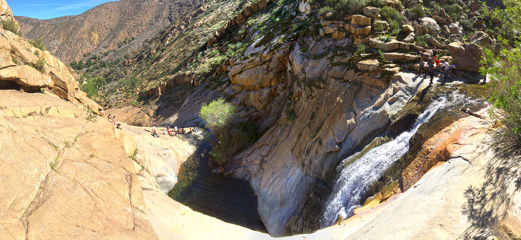
A Top down view of all 3 waterfalls and pools at 3 Sisters Waterfalls
This a fun hike, just remember to bring a lot of water with you and be properly equipped. Its not going to be a lot of fun if you have to be rescued and become a statistic, hopefully the changes that where made to the trail will help with that.