Video of the Hike:
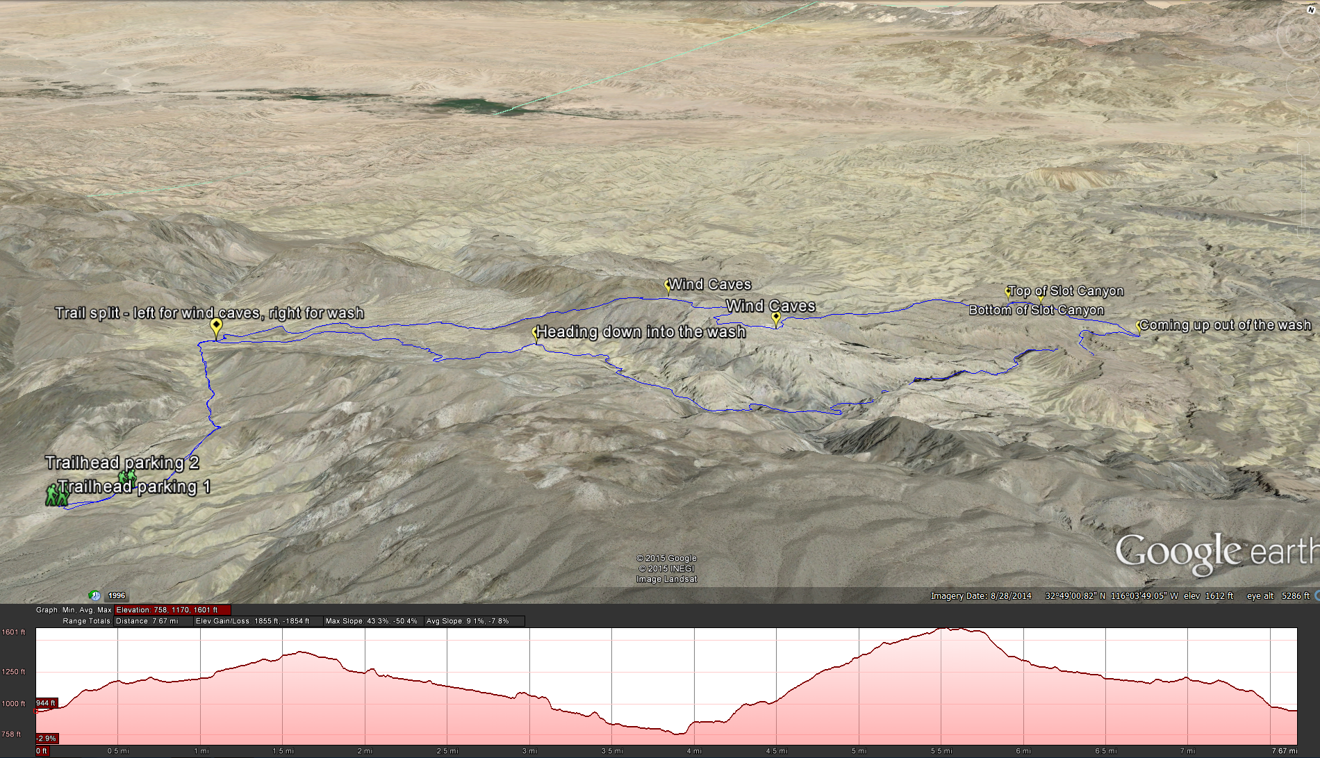
Distance: 9 miles. Elevation Gain: 1266 feet . Time to complete: 5 hours. Difficulty: Moderately Strenuous
Best Time to Visit: Winter Time – December through March
Bathroom Facilities: Lots of Cactus ! Make sure to use the bathroom at the gas station as you get off of Highway 8, its your last chance.
Pets: not really the best trail for dogs. I can’t imagine trying to get my dogs through the slot canyon, and the terrain is pretty rough in areas.
Directions: Domelands Trailhead. Take Highway 8 east from San Diego to the the Imperial Highway exit / Route S2. Turn Left and go under the Freeway and head north on Route S2 for about 7.2 miles. Look for Road 93 on your right hand side. There will be a large sign explaining the history of the area and a large arrow pointing towards the mountains by the roadside. Once you get off the highway take the dirt road until it ends, usually there are a couple of cars already around there, but you will know you you have reached the trail head when you see some metal poles with chain through them and one opening for you to go through and start your hike.
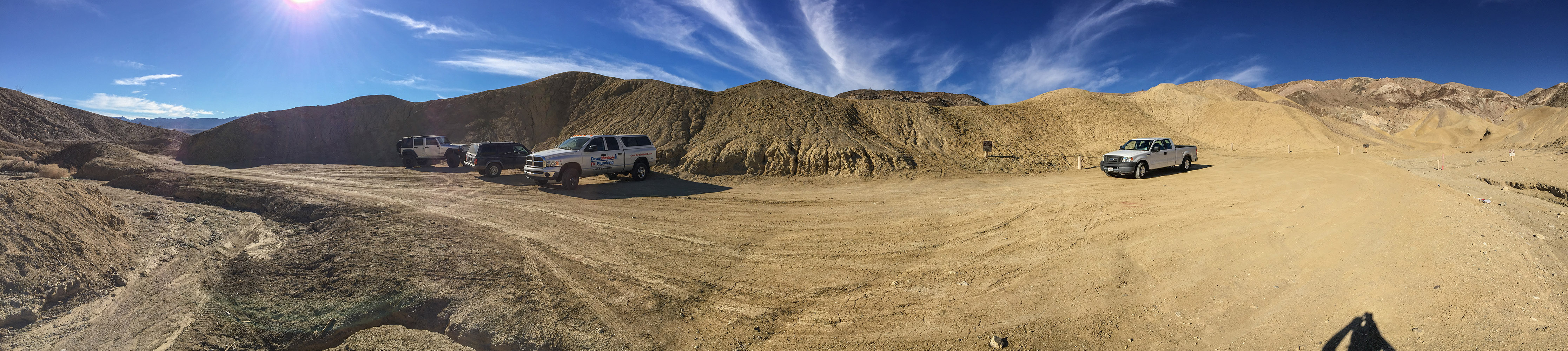
Trailhead for the hike
From the trailhead, go through the opening in the chains and head up what used to be an old jeep trail but now seems more like a single track trail. As you heading up look behind you and get a good look at the field of windmills that spreads out on the desert floor. Head along this track for about .82 miles until you get to a wash that heads away from you to the south. At this point you can go clockwise in a loop or counter clock wise in a loop, I’ve tried both and I found to prefer the counter clockwise loop. If you go clockwise by the time you drop down into the wash and make your way back towards the trail head it will be hot and you will have no breeze, while if you go counter clockwise and drop into the wash first in the morning and then make your way back along the ridge during the afternoon, you can take advantage of the desert breeze on your way back.
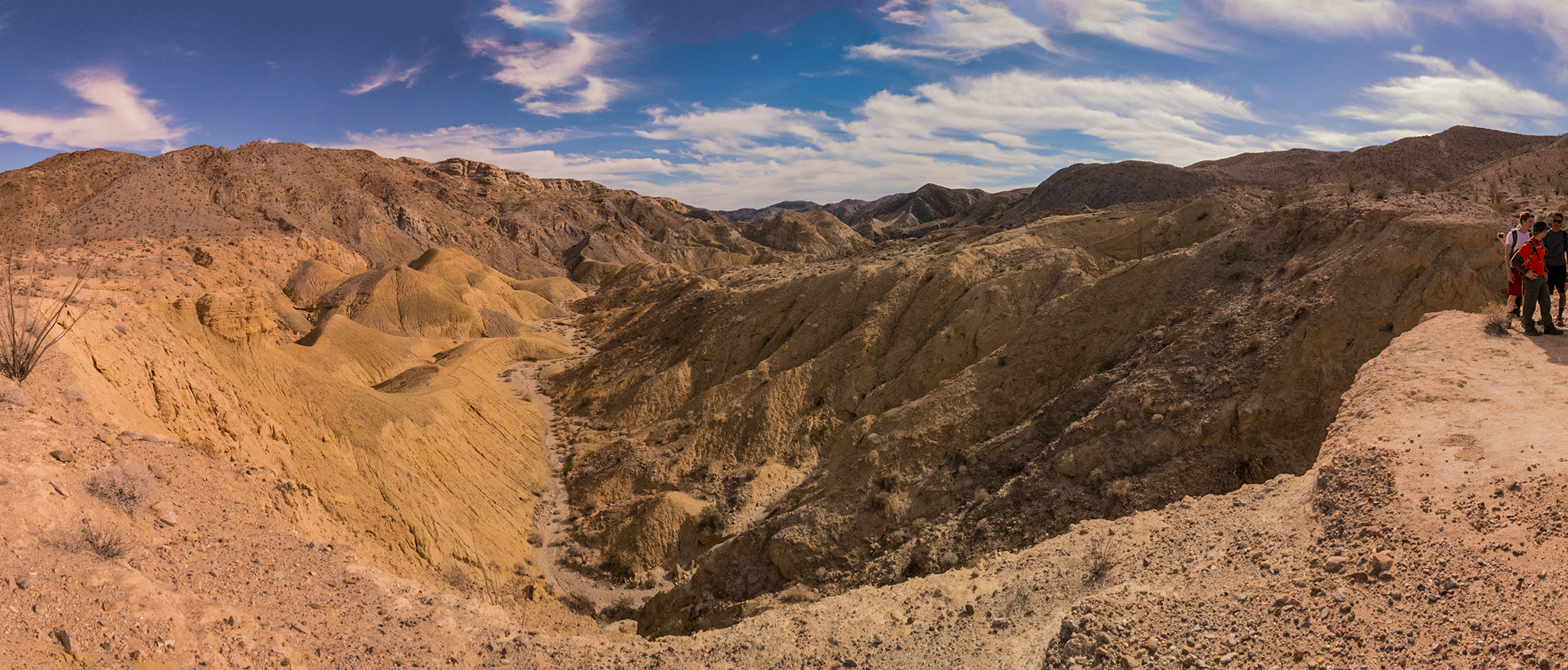
Looking down into the wash at Domelands
As you head down into the wash, keep an eye open for fossils, we found them everywhere. You will start in the low part of the wash and before you know it you will have towering cliffs over your head. Its interesting to see the landscape and how its eroded over time, exposing sediment layers, fossils, and the evidence for the tectonic forces that created the beautiful landscape.
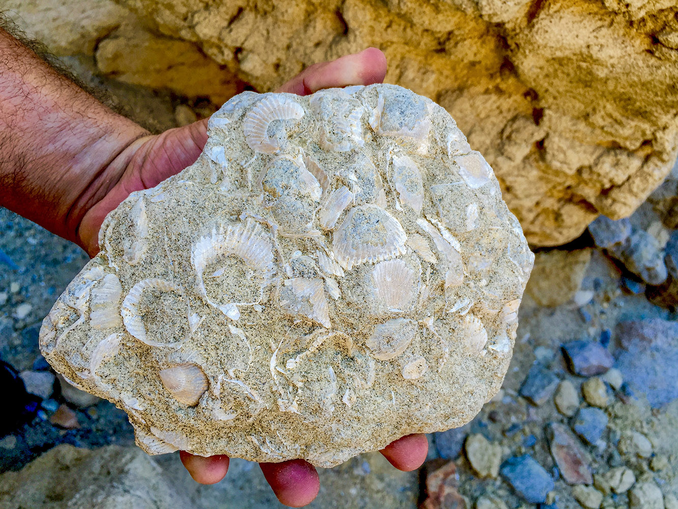
Some of the fossils we found along the way
After about 2 miles of easy hiking through the wash you will come to the steep ridge that will take you up above the wash, take a left, head up the ridge and then when you reach the top keep following the trail until you reach the bottom of the slot canyon.
Looking back down into the wash we just climbed out of
In about 1/2 after coming up the ridge you will reach the bottom of the slot canyon, this is a good place to take a break and enjoy the shade with a snack before you start climbing again.
taking a break before the slot canyon
As you make your way up the slot canyon there are a couple of spots that let in some natural light for some great pictures.
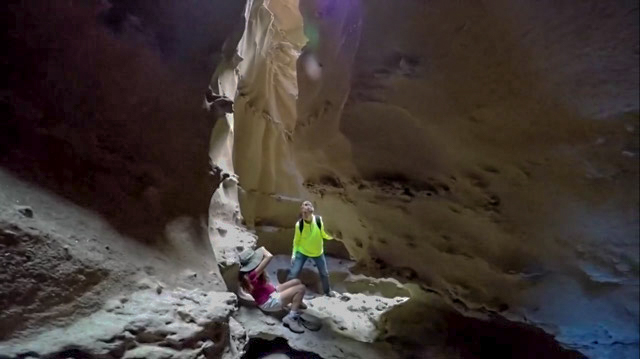
stopping the take pictures in the slot canyon
Also the footing can get a little treacherous so keep an eye on where you are stepping, I had a tough time trying to hold my GoPro, film, and negotiate the terrain at the same time.
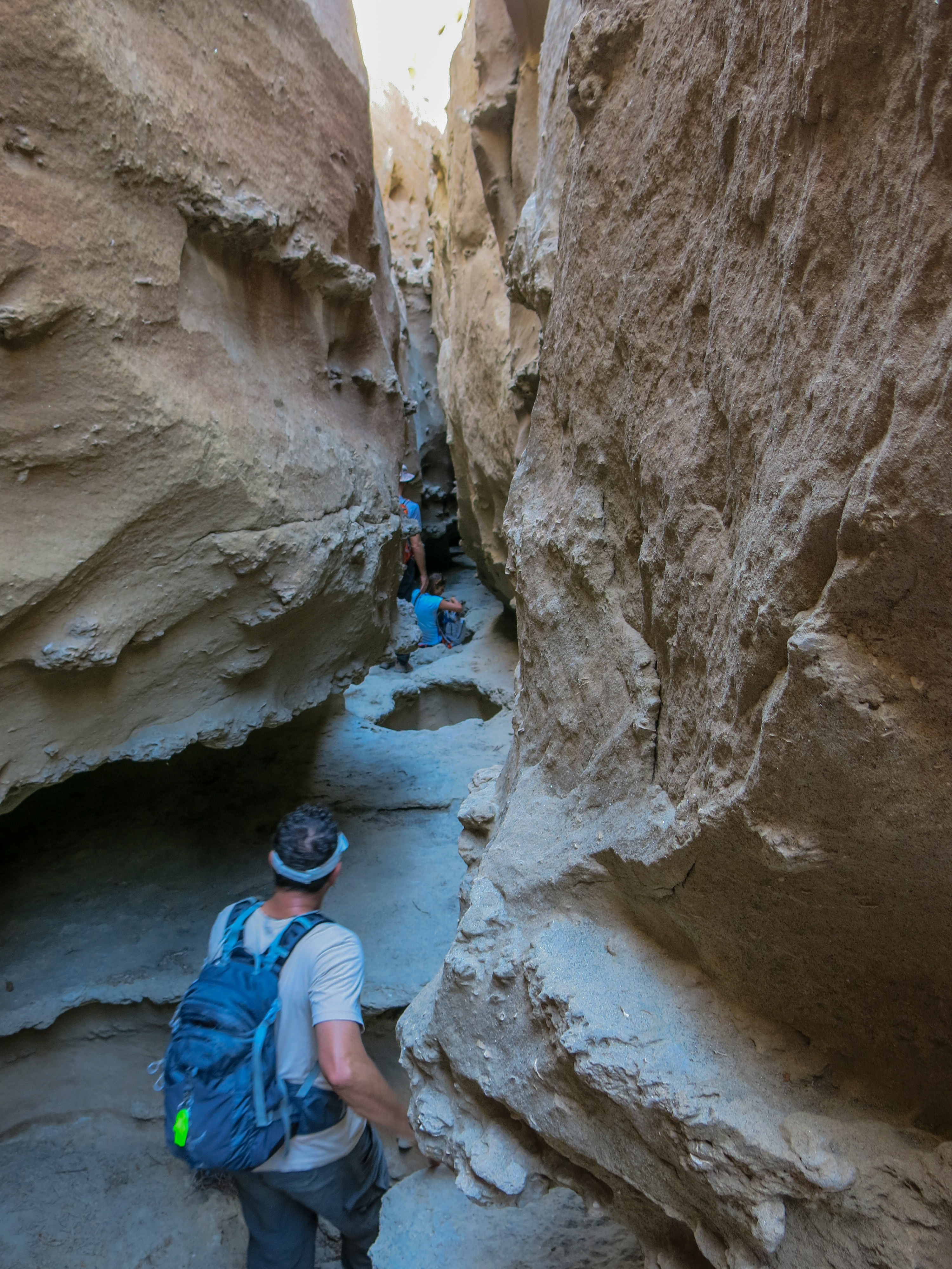
treacherous footing while going through the slot canyon
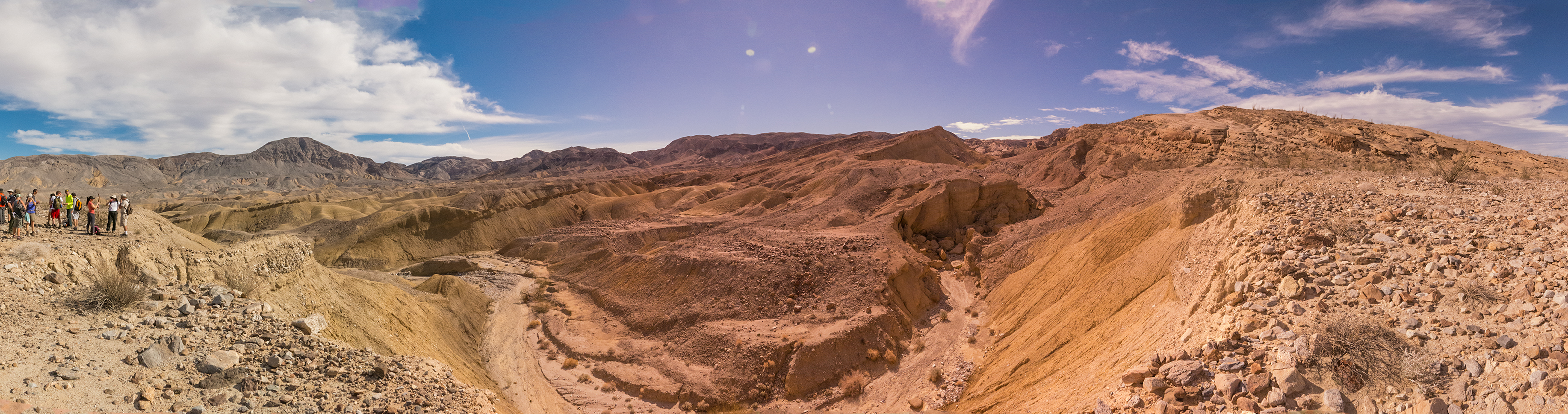
After you come out of the slot canyon, head up through a small wash to the east, this is where it helps to have a GPS track to follow as the trail can get really faint and or disappear at times. Eventually you will come out of the small canyon / wash onto a ridge line with a great view back towards the badlands, Salton Sea, and the mountains to the north and east.
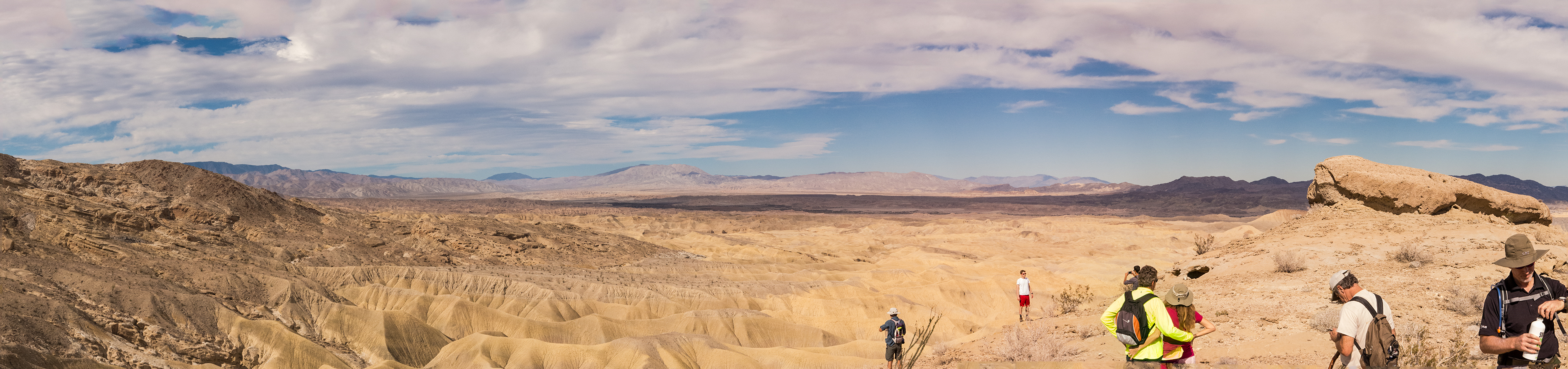
Looking back towards the badlands and the mountains to the north and east.
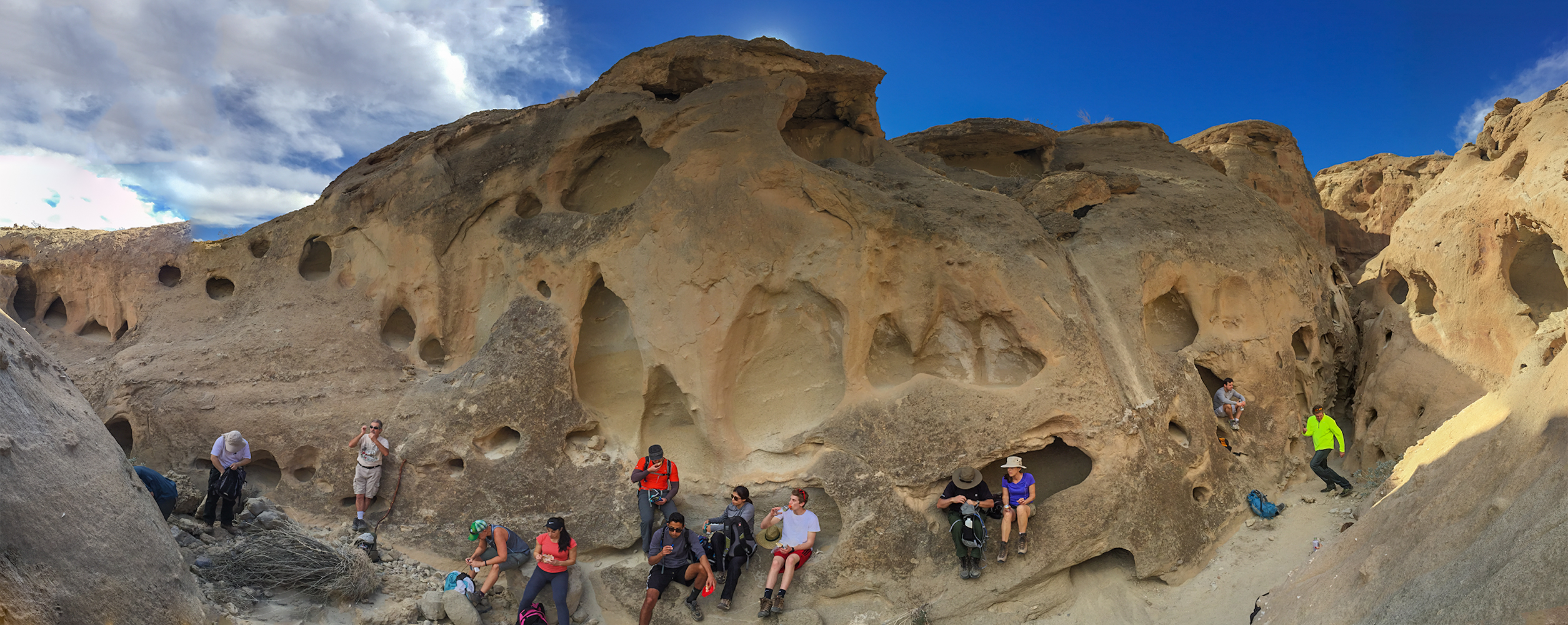
After taking in the view, make your way up the ridge line for another mile until you come to some really cool wind caves. This is a great place to explore and see how erosion and the tectonic forces have shaped the typography.
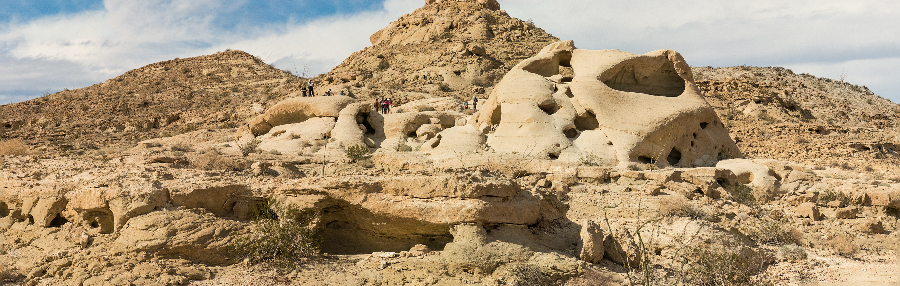
Looking at another side to the wind caves
When you get done exploring this area head back out onto the trail and make your way north, you will pass another little mountain with some cool wind caves on it, if you want to explore the top you can make your way up the left side of the mountain, just watch your footing.
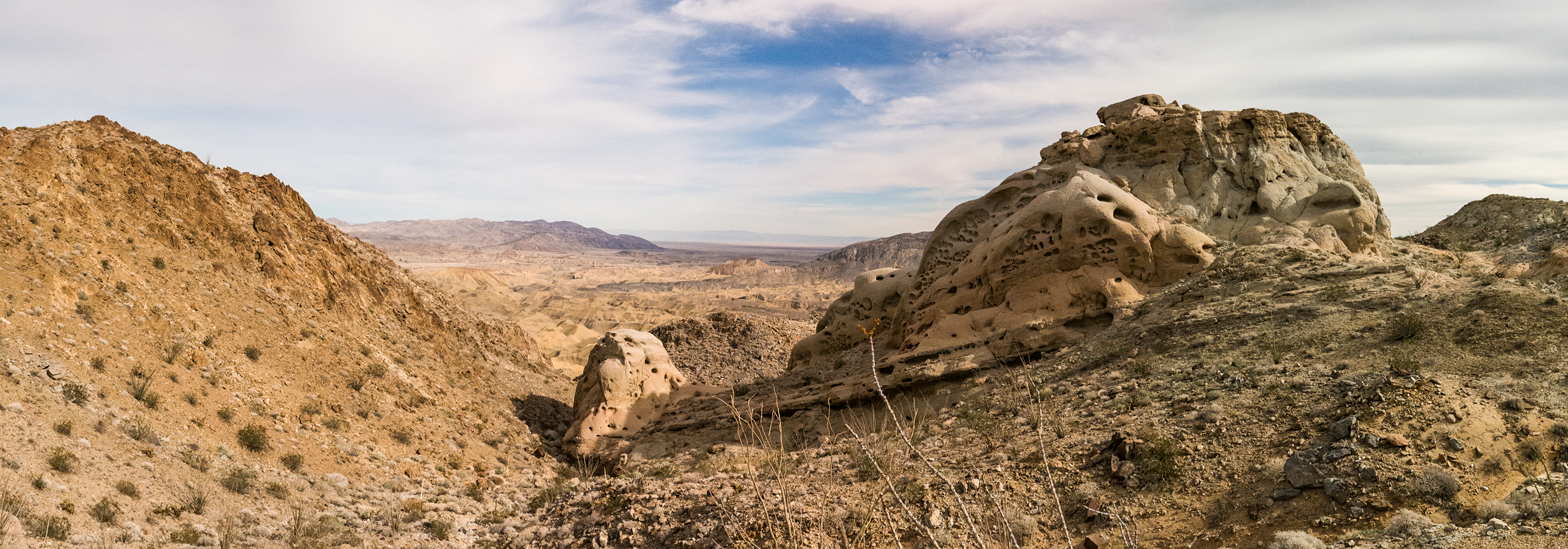
More Wind Caves on top of the ridge
After exploring the 2nd set of wind caves, start making your way down the mountain. Once you make your way down to flatter terrain you can either take the trail on the left and head back towards the top of the wash and connect back up with the trail that way, or head to the right and make a wide sweeping left turn to make your way back towards the main trail, but going this way means negotiating a couple of washes along the way.
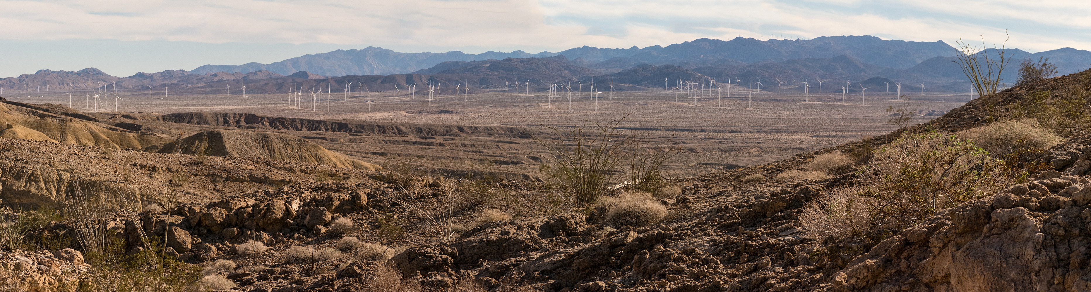
Looking down at all the windmills on the desert floor as we head down to the trailhead


