
Distance: 10 miles .Elevation Gain: 1000 feet. Time to complete: 3 – 4 hours roundtrip. Difficulty: Moderate
How to get there: Take the 67 from San Diego through Ramona where it becomes the 78. Keep heading east towards Julian until you reach Santa Ysabel. At Santa Ysabel you will take a left onto highway 79 and head about 16 miles to Warner Springs. About a 1.5 miles past Warner Springs you will see a large turn out on the left side of the road. This is the 10 mile Trailhead for Eagle Rock, if you see the airfield you have gone to far. At this point the trail to the Pacific Crest Trail starts just across the highway. If you would like a shorter hike, the 7 mile hike starts near the fire station just before Warner Springs.
To Start the hike: Cross the Highway to the northern side and find the trail that looks like a little dirt road with a little barb wire fence in front of it. Go to the left of the fence up on over the hill and back on to the little dirt road ( a gentelman was waiting there after the hike and informed us that this used to be part of the California Riding and Hiking Trail) and follow it to connect into the Pacific Crest Trail.
Eagle Rock is a great place for some Astrophotography as well as nice hike. If you are heading here for Astrophotography I would suggest starting at the Fire Station and keeping your hike a little shorter. Also keep your eyes open for rattlesnakes are you are hiking in the dark, they are still out there.
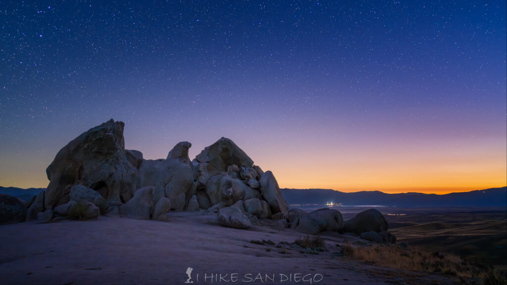
Eagle Rock at twilight
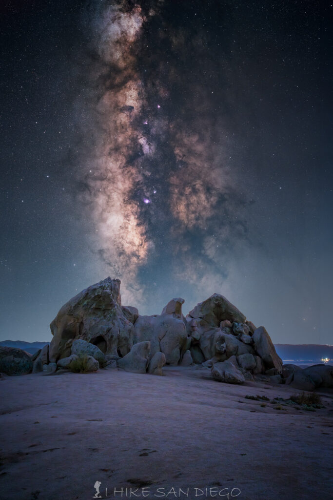
The Milky Way rising up over Eagle Rock
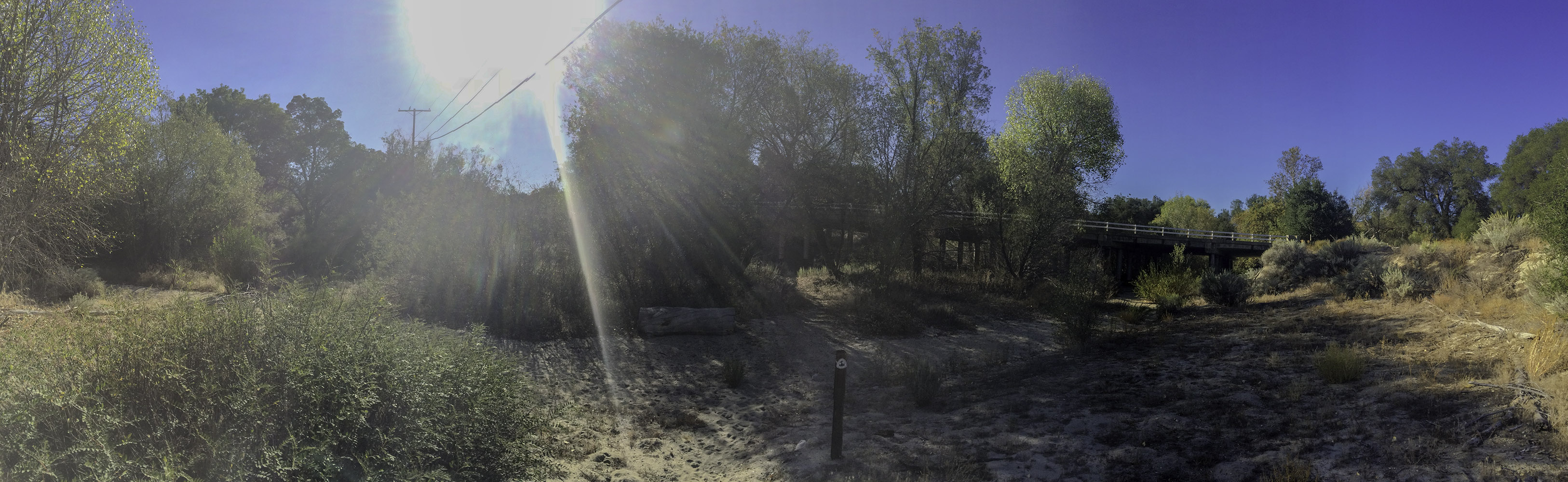
Starting the hike on the Pacific Crest Trail, under the bridge and along the Agua Caliente Creek to the other side
Bear right and onto the Pacific Crest Trail, once you are on the other side of the bridge, continue to follow the trail southwest until you come across the large backpackers campsite amongst a large grove of oak trees. This beautiful camp site is used by the backpackers who travel along the Pacific Crest Trail.
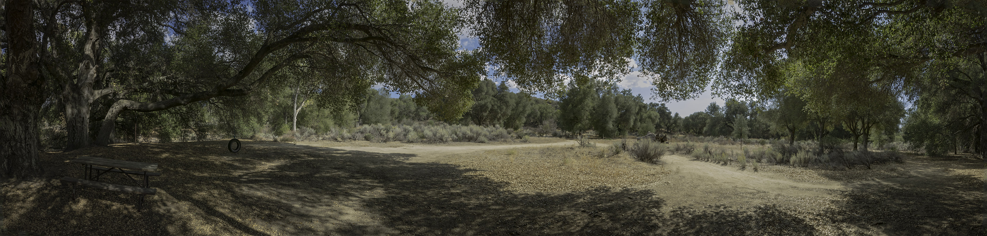
Pacific Crest Trail campsite for backpackers near the Agua Caliente Creek
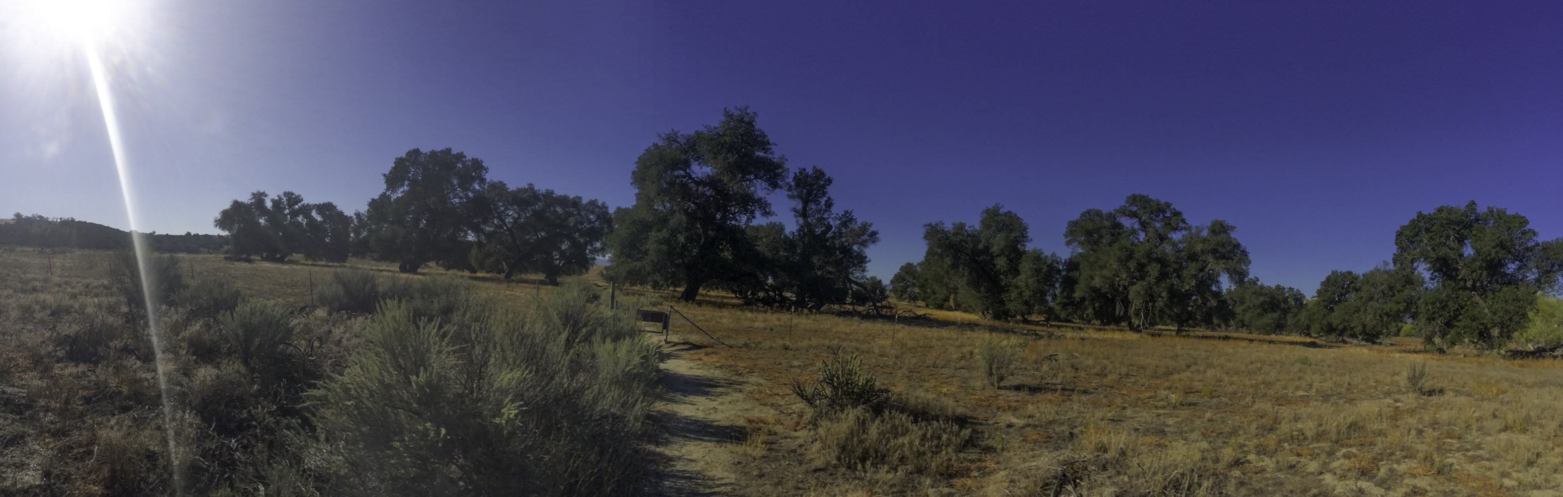
After passing through the backpackers campsite continue to follow the trail southwest out of the campsite, make sure you don’t follow one of the trails back towards the highway you just came from. As you leave the campsite area you should start climbing up to the grasslands. Continue to follow the trail through a gate that you are going to want to close and secure behind you to make sure that no cattle get out ( when they are there, we did not see any in October ).
Pasture Gate to keep cattle in, make sure you secure it after going through.
As you hike through this grass land, you will see a lot of intersecting dirt roads and cattle trails, it can get a little confusing, especially because some of the wood posts along the trail no longer have the Pacific Crest Trail logo on them, but I found that if you just keep following the trail with the wood posts next to it you should be fine.
Heading along the Pacific Crest Trail through the pasture land with Hot Springs Mountain in the background.
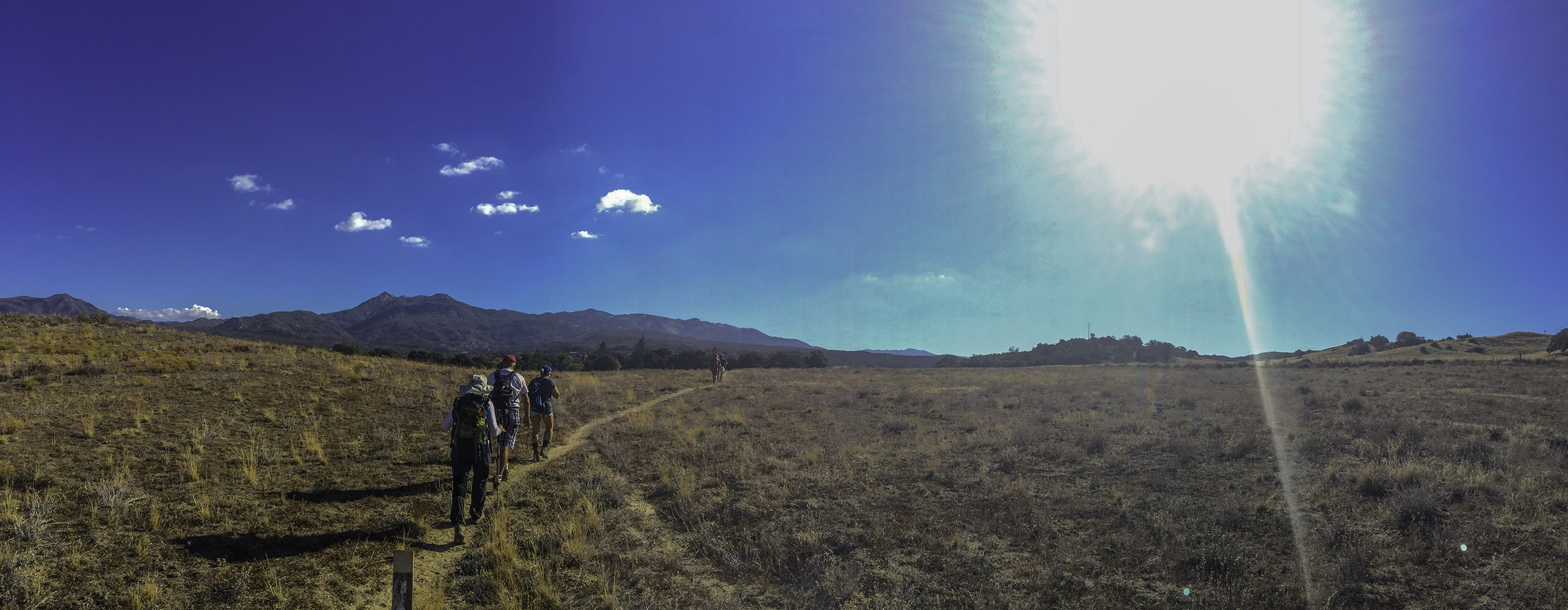
As you pass through the pasture land the trail will back a long wide bend to the east and back towards highway 79. Along the trail you will see a mixer of wood post trail markers and plastic Pacific Crest Trail Markers. As you start heading east you should start getting a good view of Hot Springs Mountain. The Tallest point in San Diego County.
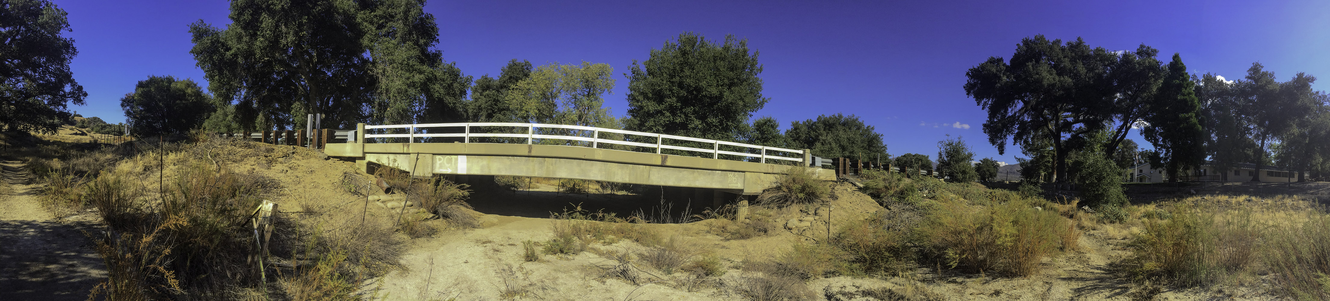
On the eastern side of the bridge on Highway 79 near the fire station that you cannot cross under but must go up and across the 79 to connect back up to the Pacific Crest Trail
Eventually the Pacific Crest Trail will bring you into contact again with Highway 79. You cannot cross under the bridge at this point because it is blocked with barbed wire. You must go slightly north of the bridge and cross the highway to the eastern side. You will see a gate on the eastern side to go through and back onto the Pacific Crest Trail. At this point you will also see a massive fire station next to the gate. I’m not sure that they want a lot of people asking if they can use there bathrooms, but a few of the hikers with me did take advantage of the facilities at this point.
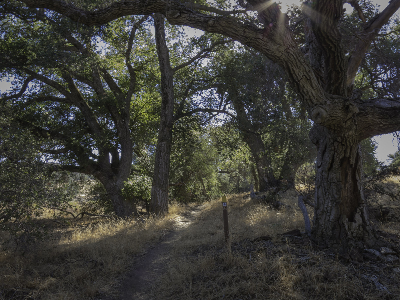
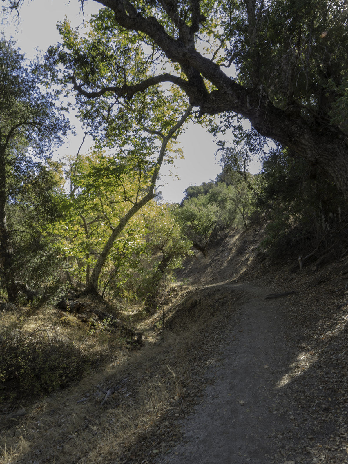
Up through the old oaks on the Pacific Crest Trail
After reconnecting to the Pacific Crest Trail after the fire station you will head southeast along the southern edge of a large wash and start to climb back up through the old oak trees. It will soon become apparent where all the water is coming from for the wash as you start to hike along the southern edge of a large ravine that continues all the way up until you come out of the trees and back onto the grassy fields.
The ravine that feeds the creek and wash on the northern edge of the Pacific Crest Trail as you climb up the ridge towards the grasslands.
As the trail comes out of the oak trees and into the grassy fields you will have some fantastic views of the surrounding mountains. Volcan Mountain to the southeast. Palomar Mountain with the observatory plainly visible and lake Henshaw to the southwest. Hot Springs Mountain and the Los Coyotes Indian Reservation to the North.
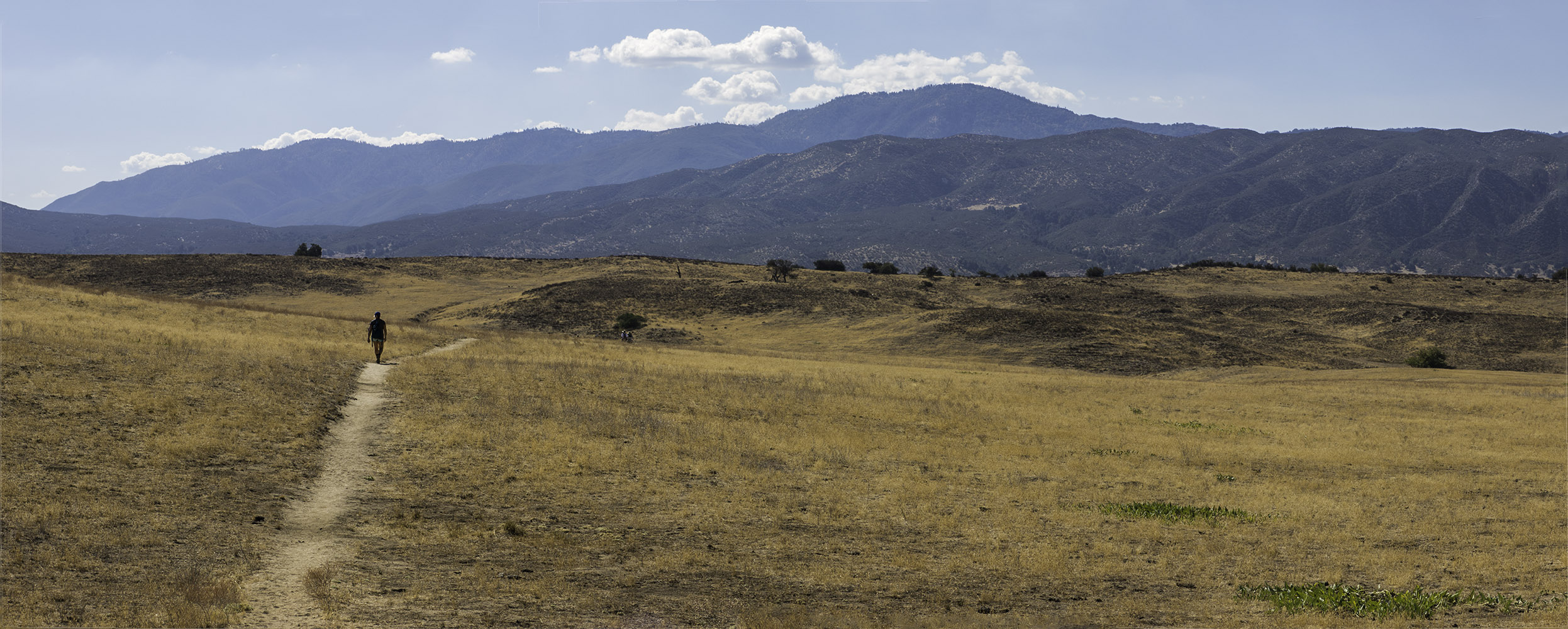
On the Pacific Crest Trail heading southeast. Volcan Mountain near Julian in the back ground.
You will continue along the Pacific Crest Trail through the grass lands going up, down, and around hills as you go. You will see a few other paths but as long as you stay on the trail that has the Pacific Crest Trail posts and wooden posts you should be fine. Eventually you will see a group of boulders north east of you. The trail will dip down and then make a gradual climb on the southern side of these boulders. As you come up behind the boulders you will start to make out the wings and head of the eagle.
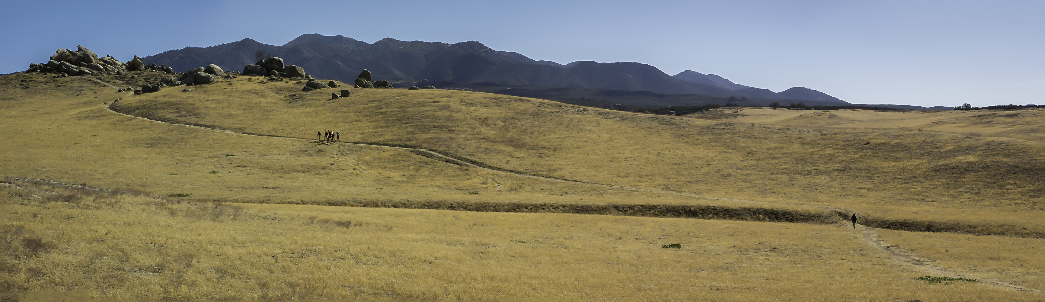
The Pacific Crest Trail making its way up behind the group of boulders that make up Eagle Rock.
As you come around the northern side of the boulders you will get a great view of the uncanny way the rocks form a eagle with views of Volcan Mountain to the South east, and Palomar Mountain to the Southwest, its a great view.
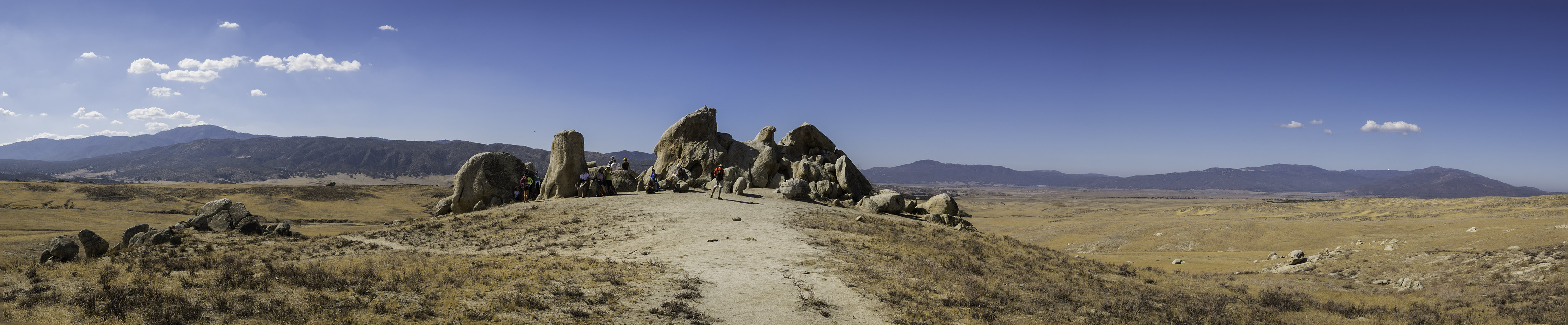
Eagle Rock, with Volcan Mountain in the southeast and Palomar Mountain in the southwest