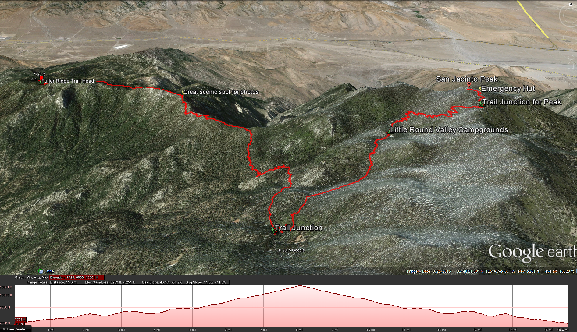
Google Earth Map: Fuller Ridge Trail
Distance: 16 miles. Elevation Gained: 3100 feet. Top Elevation : 10,834 feet. Time : 8 – 11 Hours
Fees and Permits: You will need and Adventure Pass for your car and a ( free) Wilderness Permit that you can pick up in town (Idyllwild) at the ranger station.
To Get to the Trail head: Take State Route 243 South from Idyllwild for about 8 miles until you see the turnout and dirt road for Black Mountain and Fuller Ridge. Turn East onto Black Mountain Road ( Dirt Road) follow it for 8 miles until you see the signed turnoff for the fuller ridge trail, park in the open lot. I’ve read reports saying that you can get up this road in a regular clearance vehicle, but I wouldn’t suggest it. The ride up in my Xterra was rough but fun, hitting a couple of rough rutted spots ( not a problem for my Xterra but would be extremely hard with a normal car), I was surprised when someone in my car spotted a BMW sedan pulled off to the side of the road most of the way up ( he must not like his car). https://www.google.com/maps/preview?hl=en#!data=!1m4!1m3!1d1137!2d-116.7571255!3d33.8245185!4m18!3m15!1m0!1m4!3m2!3d33.8243959!4d-116.7579462!6e2!3m8!1m3!1d1137!2d-116.7571255!3d33.8245185!3m2!1i1920!2i1054!4f13.1!7m1!3b1&fid=0
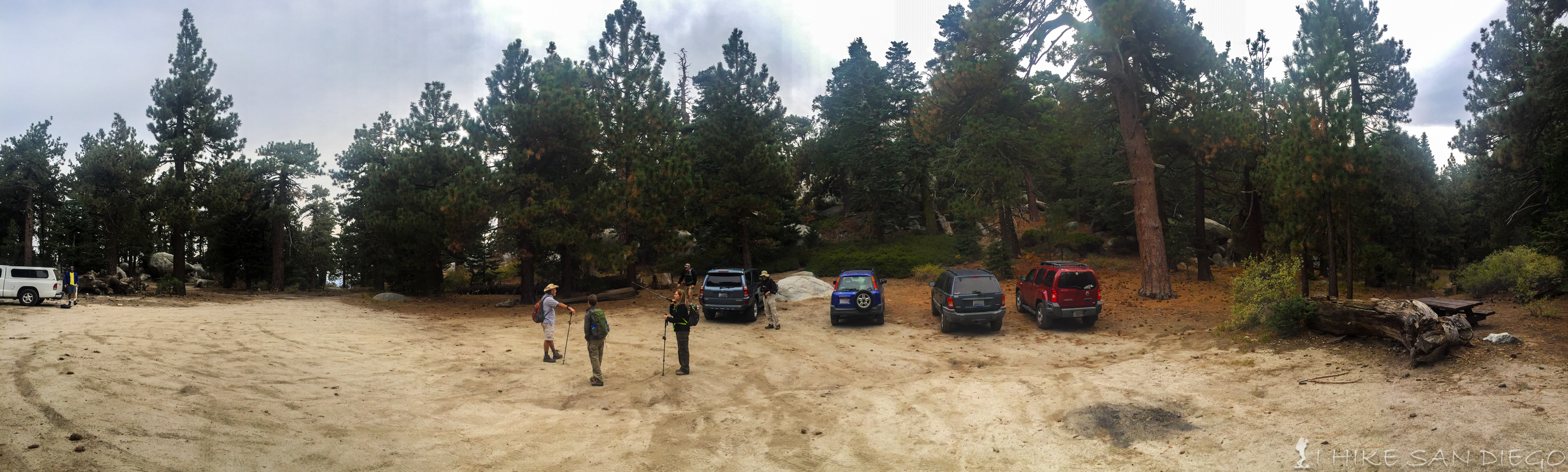
Fuller Ridge Trailhead
Water: Bring lots of water, your not going to find any on the trail depending on what time of year it is. We did this hike in October and there was plenty of water coming down the springs just before the junction of the PCT with Deer Springs Trail ( almost 5 miles into the trail) but none we could see in the Little Round Valley Campground.
The Fuller Ridge Trail is part of the Pacific Crest Trail. After doing the bump and grind up the Black Mountain Road to the Fuller Ridge Campgrounds and Trailhead you should find the trailhead at the far southeastern side of the dirt lot that serves as a parking area. Almost as soon as you get on the trail you will see a sign warning you that a wilderness permit is needed for this trail. The trail hugs the north eastern side of the ridge for the first 2 miles. After being on the trail for about 1.25 miles you should hit the Wilderness Boundary and see a sign telling you that you are now entering Mt San Jacinto State Park.
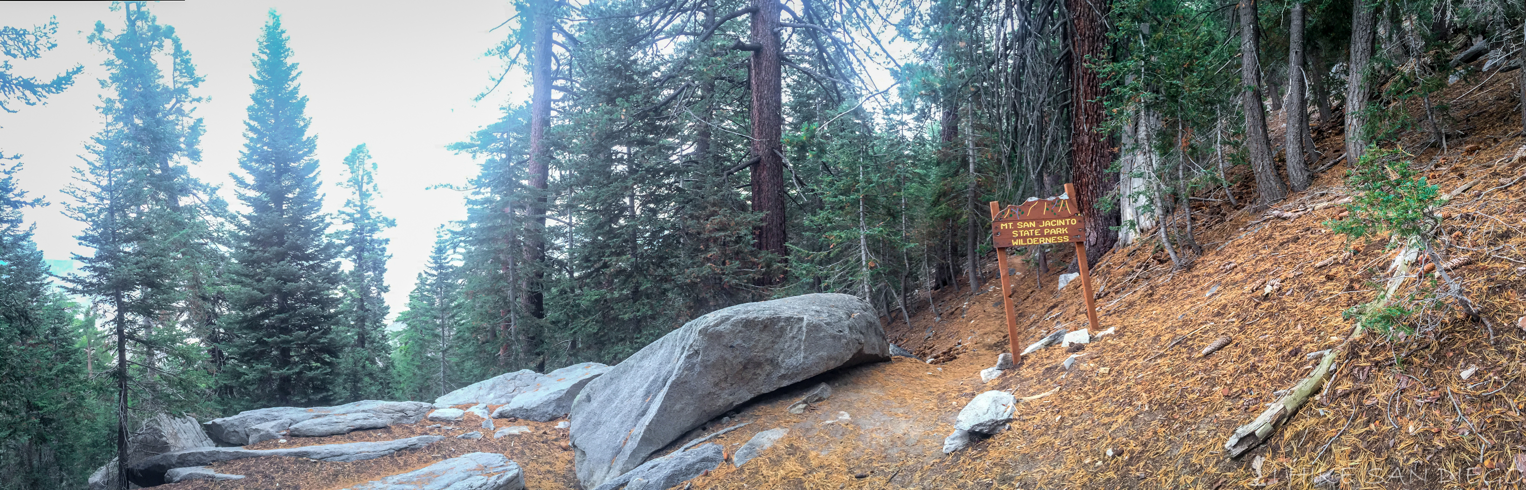
San Jacinto Wilderness Sign
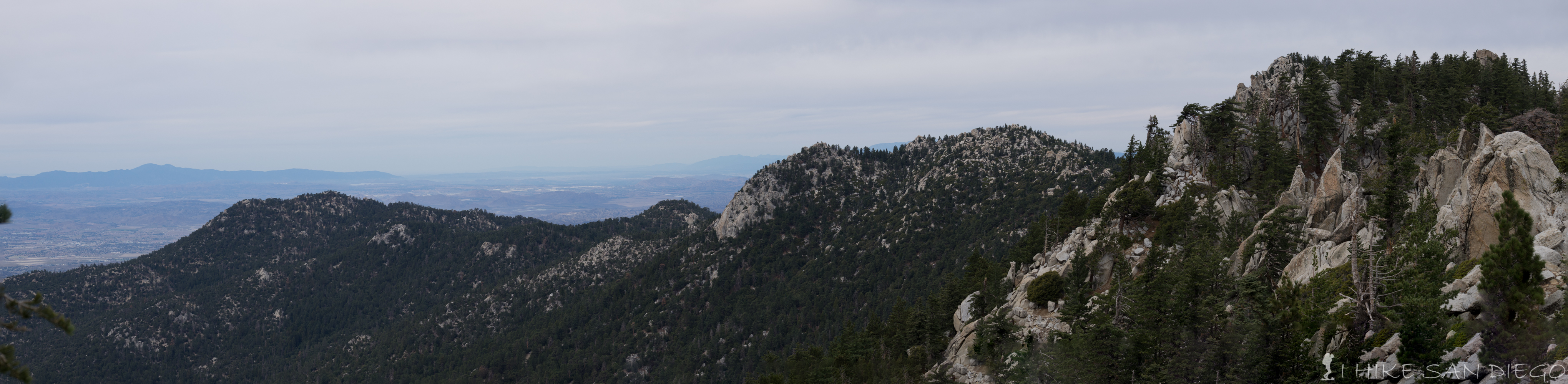
At the point that the trail hits the 2 mile mark you should crest the ridge and see a spectacular spot for photographying the western flank of the mountain and the drainage that runs into Snow Creek. This is a great spot to take a break and take in the views.
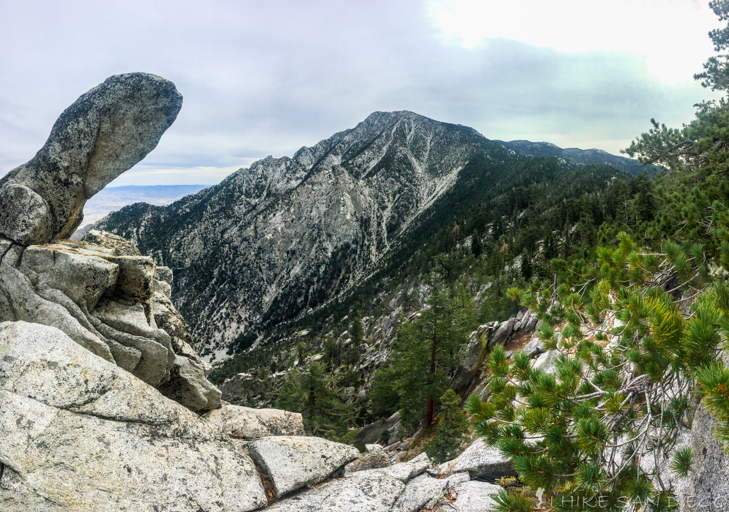
Great spot to take in the view of Mt San Jacinto at about 2 miles into the Fuller Ridge Trail Hike
After the 2 mile mark the trail will dip down 200 feet over the next 1/2 mile as you now switch over to the southwestern side of the ridge. After about 1/2 a mile or at the 2.5 marker you will start climbing again for about the next half a mile gaining about 350 feet until you reach 8700 feet close to the 3 mile marker.
Looking back across Fuller Ridge towards the Inland Empire
Around 3 miles into the trail you will crest the ridge again and do a small bit of up and down as you make your way along the ridge around 3.3 miles you will again dip down about 200 feet as you now start to head away from the ridge and up the western flank of the mountain. Around 3.7 miles you will start climbing again for the final ascent to the junction with Deer Springs Trail, gaining about 400 feet of elevation, coming close to 9,000 feet by the junction.
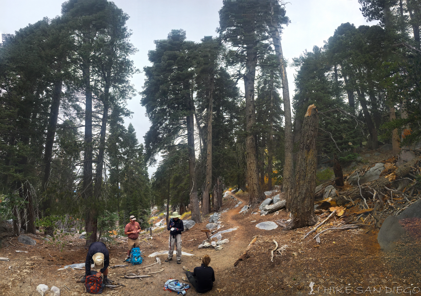
Taking a break at the Deer Springs Junction with Fuller Ridge Trail
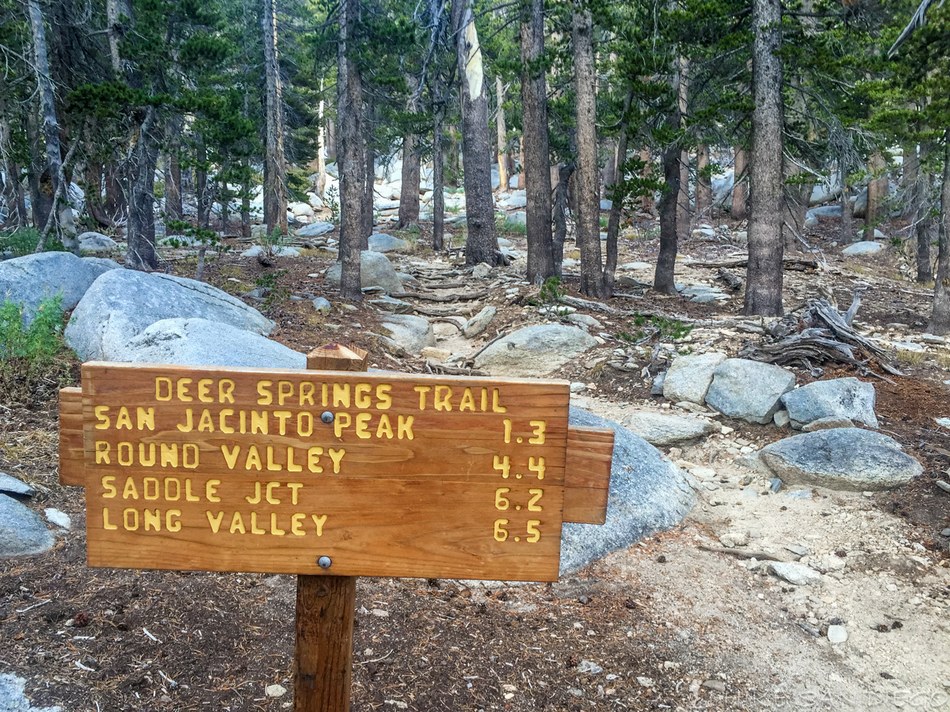
The Deer Springs Junction is a good place to take another break and get some energy in you before you tackle the next section. At the junction you will head left and ascend over 700 feet for the next mile before you hit the Little Round Valley Campgrounds. Enjoy the relatively easy 1/2 mile through the Little Round Valley Campgrounds.
Leaving the Little Round Valley on the way up to San Jacinto Peak
Soon after the campgrounds around mile 6.5 you should start hitting the switchbacks, this will continue for about a mile until you hit the junction gaining another 700 feet of elevation before you hit the next junction around 10,500 feet. Around 7.5 miles you should hit the junction. Your drained of energy at this point but your almost there.
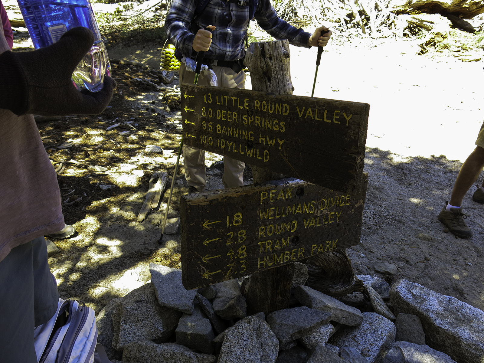
The sign at the last trail junction before the top of San Jacinto Peak
Turn left at the junction and head up the last 0.3 miles to the peak, in about 2/10 of a mile you should come across the Emergency Hut, take a look in there and then head up towards the peak for some great views. Soon after the hut the trail loss’s itself and you will be scrambling across some boulders to get to the very apex of the mountain, it can get very icy at this point in the winter time so be careful and take your time. There is a excellent spot to sit and eat lunch at the top or if you want some shade have lunch back at the hut.
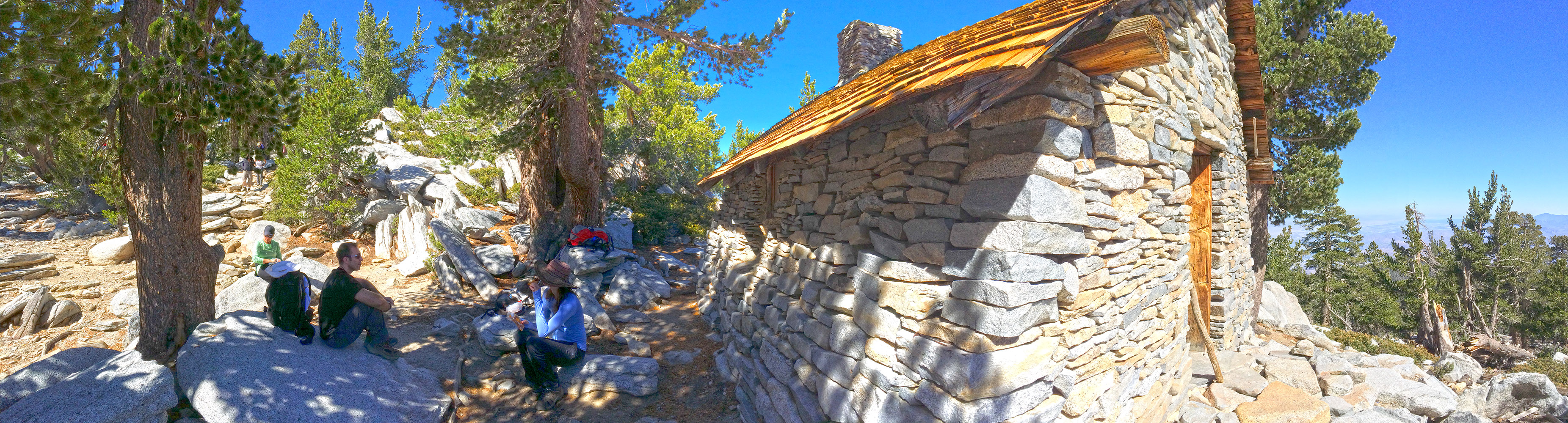
Sitting down for a bite to eat by the San Jacinto Emergency Hut
Weather forecast for the hike:
[forecast location="92549" caption="Weather for San Jancinto Peak Hike" measurement='F' todaylabel="Today" datelabel="(%%weekday%%)"highlow='%%high%%°/%%low%%°' numdays="5" iconset="Contemporary" cache="true" width="100%"]


