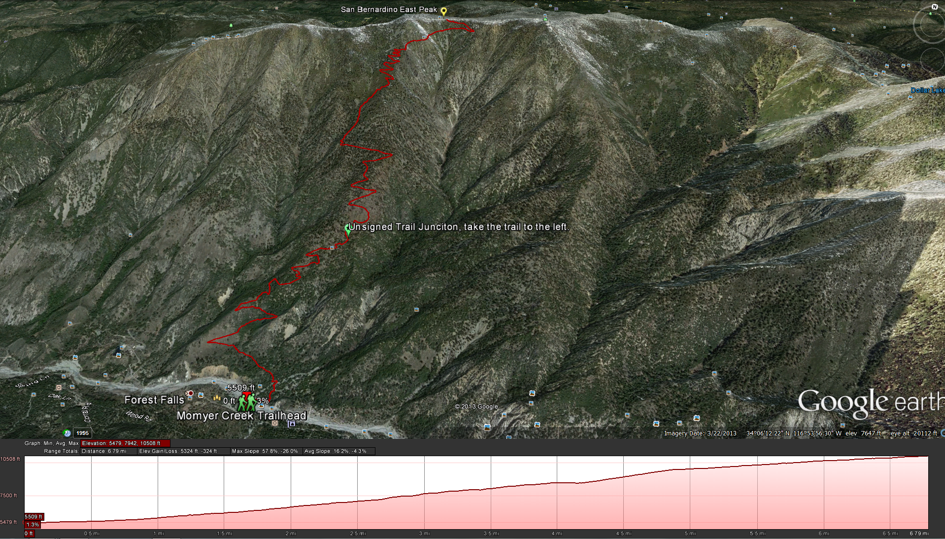
Momyer Creek Trail
Distance: 13 miles Elevation Gained: 5,200 feet. Top Elevation : 10,691 feet.
Getting There: From Highway 38 heading up into Big Bear turn off onto Valley of the Falls Road. Follow Valley of the Falls Road for 2.9 miles until you see the signed lot for Momyer/Alger Creek Trail. on the left side of the road.
Fees and Permits: A Wilderness Permit is required for this hike. as is an Adventure Pass
For up to date water information check out this link: http://www.howlingduck.com/cgi-local/display_water_data.pl
Weather Forecast for Momyer Creek Trail
[forecast location="92339" caption="Weather for Momyer Creek Trail" measurement='F' todaylabel="Today" datelabel="(%%weekday%%)"highlow='%%high%%°/%%low%%°' numdays="5" iconset="Contemporary" cache="true" width="100%"]