Printable Map:http://www.co.san-diego.ca.us/reusable_components/images/parks/doc/Trails_Los_Penasquitos.pdf
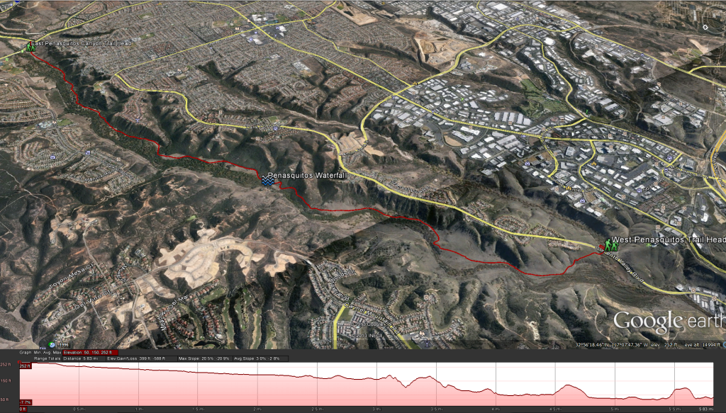
Google Earth: Penasquitos Canyon TrailEast Approach Distance: 6.4 miles round trip to the falls. Elevation Gain: 300 feet Time to complete: 3 hours round trip
West Approach Distance: 5.5 miles round trip to the falls. Elevation Gain: 200 feet Time to complete: 2 hours round trip
Getting There: For the East Approach: Exit Interstate 15 at Scripps Poway Parkway/Mercy Road. Go West on Mercy Road for 1 mile until it ends at the T intersection with Black Mountain Road. Straight across the T intersection is the East Trail Head for Los Penasquitos Canyon Preserve.
For the West Approach: Exit interstate 805 at Mira Mesa Boulevard /Sorrento Valley Road. Take either Sorrento Valley Road ( to the west of 805) or Vista Sorrento Parkway ( to the east of 805) 1 mile north to Sorrento Valley Boulevard. Turn right and continue 1 mile east to the Western Staging Area for Los Penasquitos Canyon Preserve. This will be on the right side of the road.
Hiking Guide for this hike coming soon
Weather forecast for the hike:


