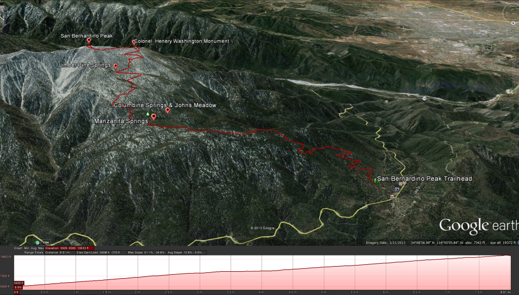
Distance: 15 miles Elevation Gained: 4,650 feet. Top Elevation : 10,649 feet.
San Bernardino Peak Trail Head to Manzanita Flats: Distance 4.2 miles; Elevation change of 2,280 feet, from 5,960 to 8,240 feet.
Manzanita Flats to Columbine Springs: Distance 0.7 miles, 4.9 miles overall; Elevation change of – 240 feet, from 8,240 to 8,000 feet.
Columbine Springs to Limber Pine Bench: Distance 0.9 miles, 5.8 Miles overall; Elevation change of 1,360 feet, from 8,000 to 9,360 feet.
Limber Pine Bench to San Bernardino Peak: Distance 2.1 miles, 7.9 Miles overall; Elevation change of 1,289 feet, from 9,360 to 10,649 feet.
Getting There: Take State Route 38 out of Redlands towards Big Bear. Soon after the town of Angelus Oaks turn right onto Manzanita street and follow Forest Service Road 1N07 0.25 miles to the trail head.
Fees and Permits: A Wilderness Permit is required for this hike. as is an Adventure Pass
For up to date water information check out this link: http://www.howlingduck.com/cgi-local/display_water_data.pl
Weather Forecast for San Bernardino Peak Trail
