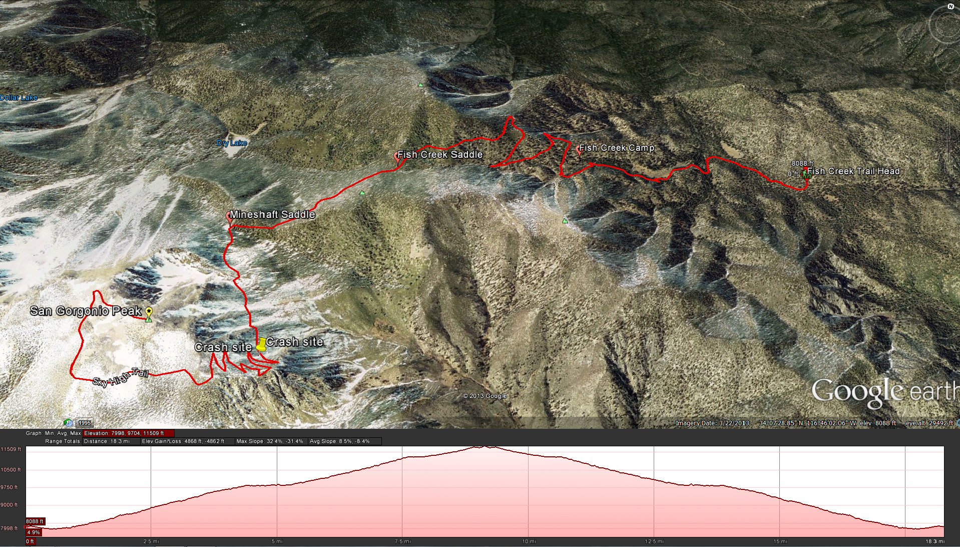
Distance: 20.2 miles Elevation Gained: 3,342 feet. Top Elevation : 11,502 feet.
Fish Creek Trail Head to Fish Creek Camp: Distance 2.6 miles; Elevation change of 160 feet, from 8,160 to 8,320 feet.
Fish Creek Camp to Fish Creek Saddle: Distance 2.3 miles, 4.9 miles overall; Elevation change of 1485 feet, from 8,320 to 9,805 feet.
Fish Creek Saddle to Mineshaft Saddle: Distance 1.1 miles, 6.0 Miles overall; Elevation change of 115 feet, from 9,805 to 9,920 feet.
Mineshaft Saddle to San Gorgonio Peak: Distance 4.1 miles, 10.1 Miles overall; Elevation change of 1582 feet, from 9,920 to 11,502 feet.
For up to date water information check out this link: http://www.howlingduck.com/cgi-local/display_water_data.pl
Getting to the trailhead: Take State Route 38 north and east from Redlands and follow the highway towards Big Bear. Turn Right 6 miles beyond Barton Flats Visitor Center onto forest service road 1N02. Follow the paved road until it forks, then continue right onto forest service road 1N05 and go 7 miles to the Fish Creek Trailhead. A high-clearance vehicle is recommended.
Fees and Permits: A Wilderness Permit is required for this hike. as is an Adventure Pass
Weather Forecast for San Gorgonio via Fish Creek Trail
