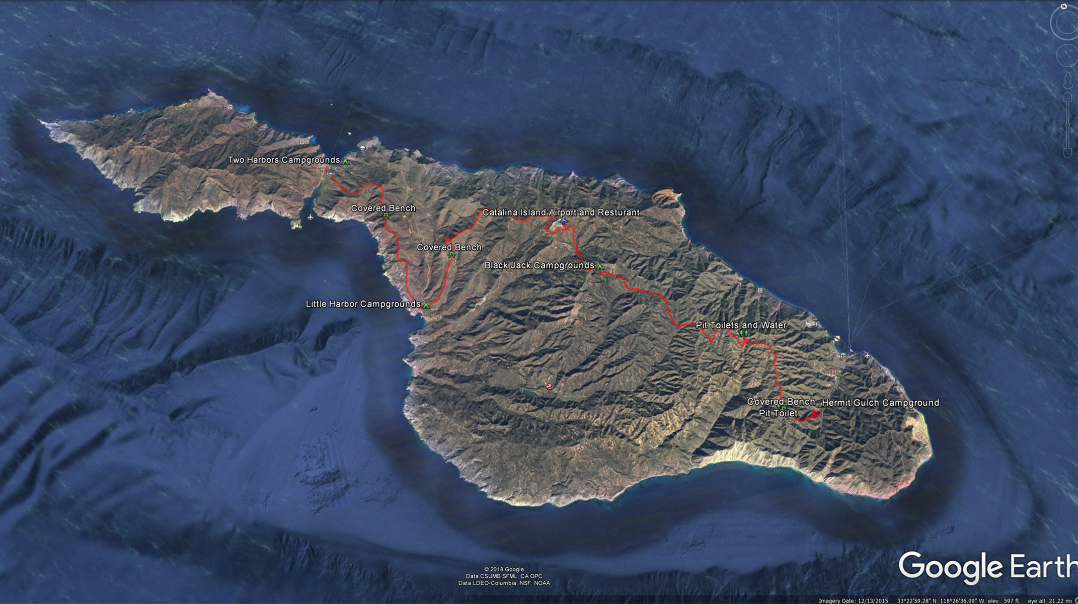
PDF Map of Caaltina Island provided by the Catalina Conservancy Group.
Catalina Island Conservancy Map PDFTrans Catalina Trail : From Hermit Gulch to Two Harbors
Distance : 24 miles ( the way we hiked it from Hermit Gulch to Two Harbors) if you do the whole trail it is 37.2 Miles officially with a backtrack of 7 miles or so to make a total of close to 45 miles.
Hermit Gulch to Black Jack Campground : 10 Miles
Black Jack Campground to Little Harbor Campground : 8 Miles
Little Harbor Campground to Two Harbor Campground : 6 Miles
Camping Reservations: Getting back and forth to the island is realtivly easy, its the campsites that you need to make sure you get before hand and therefore I would recommend you check what reservations are available as you are planning your trip. You can check the web site for each campsite Here:
Permits Needed : None if you are camping, the permit is included with the campsite. If you are just hiking a small section of the trail for the day without camping then yes you would need a permit which you can pick up at the Conservancy House in Avalon, the Wrigley Memorial & Botanic Garden, Nature Center at Avalon Canyon, the Airport in the Sky, and the Visitor’s Center at Two Harbors.
Transportation to the Island: Use the Catalina Island Ferry that takes out of several ports ( San Pedro, Long Beach, Dana Point, Newport Terminal , and Pine Ave Pier ) and arrives at either Avalon or Two Harbors. Check out all the information here:
Transportation from Two Harbors back to Avalon: Take a 2 hour ride on the Safari Bus for $45 on Friday and Saturday there is the option to take the Cyclon Speed Boat back to Avalon from Two Harbors for $15, I would highly recommend this option.
Equipment Sherpa’s: The Catalina Backcountry company will shlep your gear from campsite to campsite, I’m sure how much it costs but the girls we ran into were using this service and after hauling 40-50 lbs on my back for 10 miles the first day, this idea sounded like genius. If you have the money and want to enjoy the hike with out the back breaking haul, this is something to consider.
Equipment needed for the trip:
A good pair of hiking boots; there are some steep up hills and down hills on parts of this trail that will benefit from a steady pair of boots, maybe not nessarly the stiffest boots but at least ones with good traction and ankle support.
Cloths: I would suggest wearing whatever you are going to hike in, and keeping a pair of pants and shirt to change into when you get into camp. Every time I would get into camp I would put on my swim trunks and shower a little, sometimes just washing the funk from the important areas and then changing into my camp cloths. This would allow me to put out my hiking cloths and let them dry out before I put them back on the next day.
Hiking poles: If you are backpacking on this island you will defiantly enjoy using a pair of hiking poles, it will really help with those steep sections of the hike.
Water: There are reliable sources of water along the whole trail, so you really do not need to carry excess amounts of water.
Tents: Check the weather outlook, it there is not rain you can probably get away with just the tent and not need to worry about carrying the extra weight of a rain fly.
Food: You really don’t need food for the campsites at Hermit Gulch at and at Two Harbors. But you will want to bring food for Black Jack and Little Harbor. I would also suggest a breakfast meal for your stay at Hermit Gulch so that you don’t need to head back into town for a meal before starting your hike. If you like burgers I would also suggest saving some room for the bison burger at the Airport after a 2 mile uphill hike from Black Jack Campgrounds.
Areas to charge your phone. I did not go looking for an area to charge while at Hermit Gulch but there did look like there was an area near the campsite that was possible, the next chance you would get would be either at the airport while taking a break or at Two Harbors at the local bar and restaurant. I must have seen 20 -30 phones being charged up around the deck. I would suggest shutting yourself off from your phone most of the time and just enjoy the people around you, but I did use my phone at night to call or text my wife to let her know I was ok and to listen to an audio book as I was falling asleep. There is pretty descent coverage on the whole island. I don’t think there was one area where I couldn’t at least get one bar of reception.
Even though all the signs warn of bison encounters we only saw the bison a few times, and when we did see them they where not blocking the trail, but after seeing Bison Poop everywhere ( and fresh ones at that), I would not be surprised to come across one on the trail.
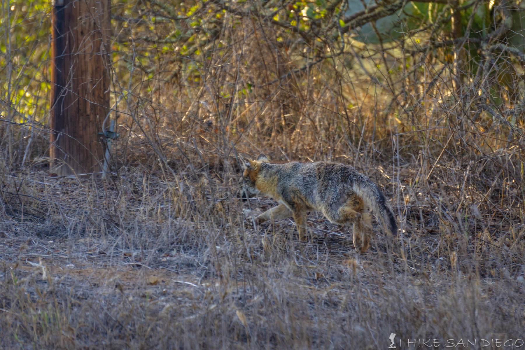
A Fox on the prowl in the Blackjack Campgrounds along the Trans Catalina Trail
Fox’s: The Catalina Island fox population is not talked about a whole lot on the blogs that I have read, but after having the little thieves steal beef jerky out of my bag the first night, we started to make sure that all our stuff was locked away when we were not around in the campground. We did see them at every campground we were at and they tend to come out towards the evening as things die down in the campground.
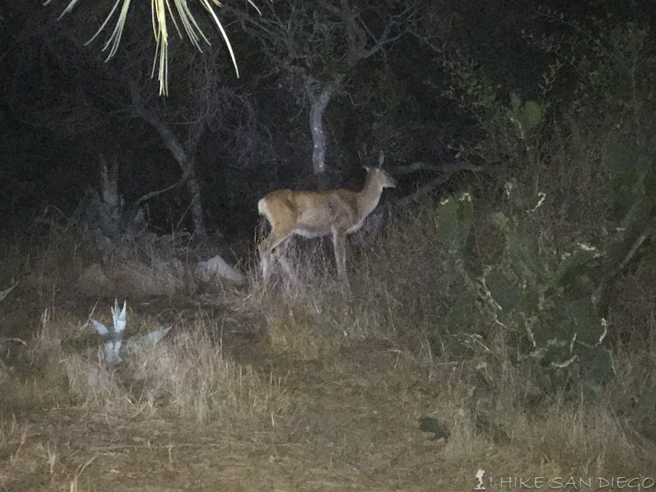
My crappy Iphone picture of a deer eating cactus 10 feet from my tent at 2am in Hermit Gulch Campgrounds
Deer: We saw a lot of Mule Deer while hiking, especially at the first campground Hemit Gulch. So much so that I was awakened at 2am by a deer comping on a cactus 10 feet from my tent.
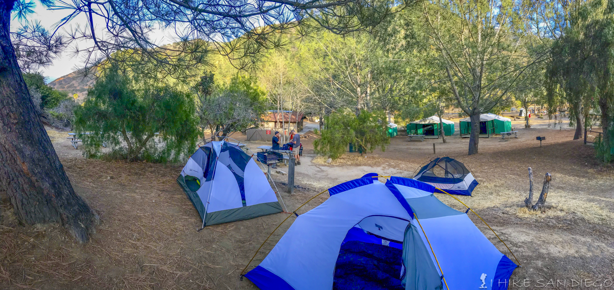
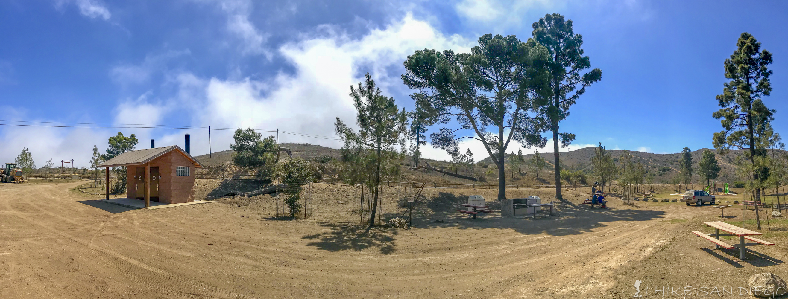
Tent Sites 13 and 14 at Hermit Gulch Campgrounds
Hermit Gulch Campground
The Hermit Gulch Campgrounds are about 1.5 miles up the canyon from the main city of Avalon, it makes a great place to start the hike from.I would not recommend getting site 13 or 14, both reside up at the top of the hill and are right next to animal trails, so you will get the fox’s and deer going right through your campsite most of the time. Bathrooms are nice and there are quarter showers at the facility . We stayed here the first night before starting out on our hike and discovered a great little mexian restaurant by the golf course as we were walking up to the campgrounds; The Sand Trap, a great little spot where you can get $1 street tacos at Happy Hour from 2pm -7pm and $4 beers. Great little spot to hang out. You can reserve your camping spot here:
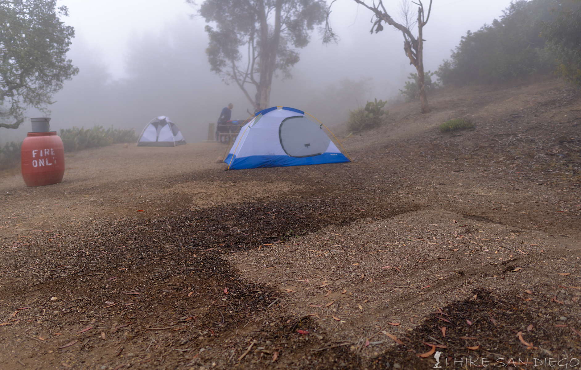
Getting dripped on in Blackjack Campgrounds on the Trans Catalina Island Trail
BlackJack Campground:
Black Jack Campground was established back in the 1920‘s as a hunting campsite when mule deer where brought onto the island as a way of attracting a new wave of sports hunters and accelerate the islands tourism industry, but was abandoned just after 4 years of operation because the expected hunting audience never materialized. You will notice a gigantic stone BBQ pit in the middle of the campgrounds, and I wonder if that was installed at the time to help cook the deer, its just so big, a mystery you will have to decide for yourself. We had site 3 for our campsite and thought that it was one of the best campsites there. Campsites 2 and 3 are close enough to the bathrooms so its not a pain in the ass to get to them but far enough away and slightly down a hill so you don’t even know its there. These campsites feel very removed from the rest of the campgrounds. The only thing I would highly suggest is making sure you do not erect your tents under the trees if it is super foggy. My two buddies did and one of them had to get up in the middle of the night and throw his rain fly onto his tent because all the fog was condensing on the trees and then dripping down on their tents. My tent was more out in the open so I did not have a problem, but I was close enough to the bear box that it sounded like it was raining all night as the water dripped onto the box. You can reserve your spot here:
Looking down at the Little Harbor Campsites from the trail
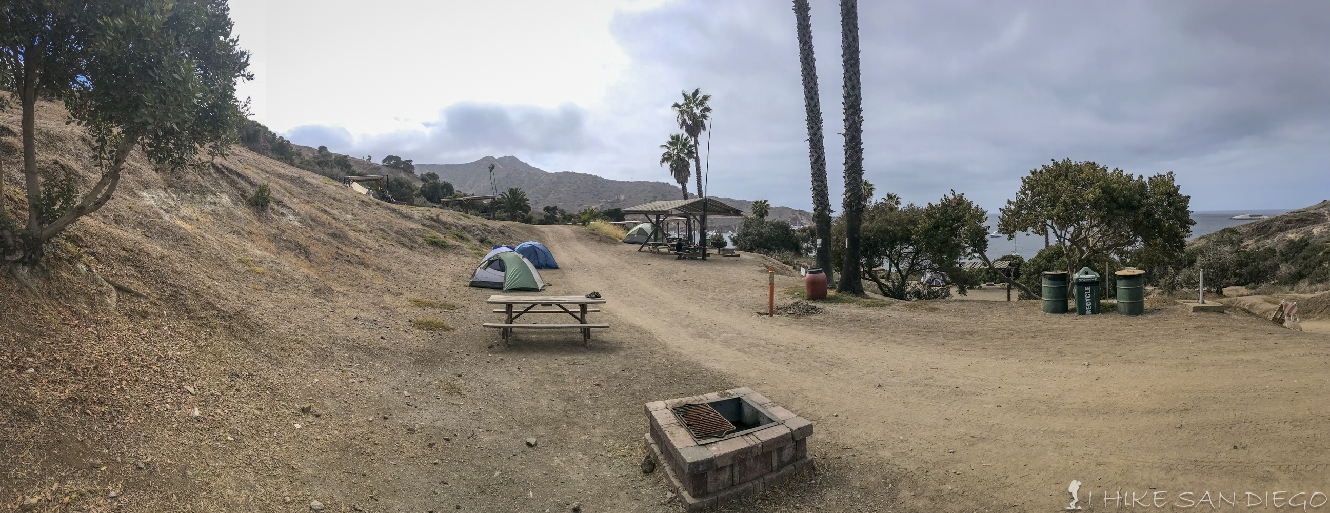
Little Harbor Campground:
I would recommend getting the campsites down towards the beach and not the ones up on top of the hill. The campsites down towards the beach where huge. We could have fit 10 tents on our campsite easy with room to spare without every one steeping on each other. It was also nice to have grass around the campsite, whereas the ones on top of the hill were just dirt. There where porta potties at this campsite instead of pit toilets, but it seemed like they were keep pretty clean most of the time. There are no pay showers but there are a couple of ring showers to use, the only pain in the ass part of using these are there is no privacy, so you would need to shower in a bathing suit, and you have to keep a button pressed in for the water, so it made it rather tricky to use. I think this was our favorite campsite. Reserve your campsite here:
Two Harbors Campgrounds Campsite.
Two Harbors Campgrounds
This is the largest campsite we saw on the island and it was mostly full by nightfall. Although we noticed a fair number of unused campsites even though we were told the campsite was full, we speculated that it was because people who did not cancel their reservation for the campsite, and since you would lose the money anyways no one really followed up on these campsites. Because this was such a big campsite I found it to be much nosier then the rest and even though I did not need it,I put my rain fly on my tent just for a little more privacy, as there are pathways that wander back and forth in front of all the tent sites and we found a steady stream of people walking in front of our tents and with headlamps on at night, that gets annoying. There are ring showers at this campsite as well, but I would recommend using the pay showers in town a 10 minute walk away from the campsite. Make sure you bring two dollars in quarters for a 3.5 minute shower, there is a change machine in the larger bathroom complex in town as well. In the campsite there are portapotties instead of pit toilets. You can reserve your spot here:
Hiking the Trans Catalina Trail
Day 1 Hermit Gulch to Black Jack Campgrounds: 10 Miles
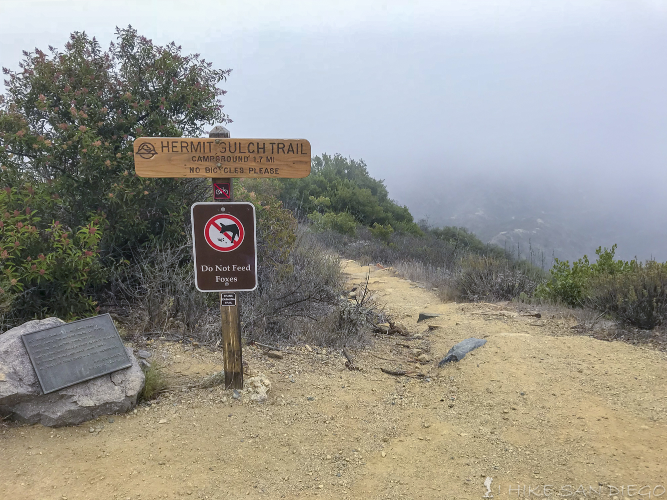
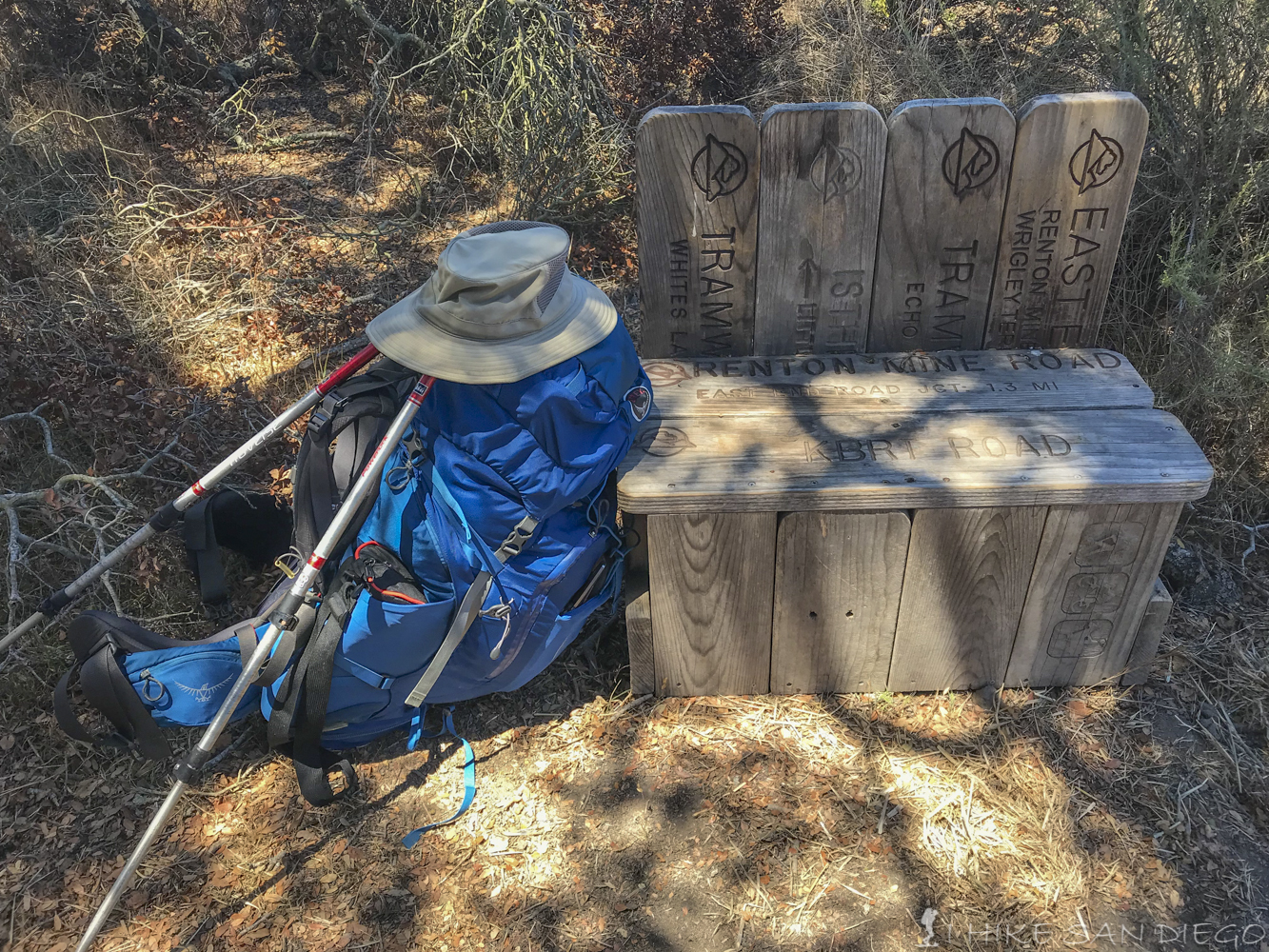
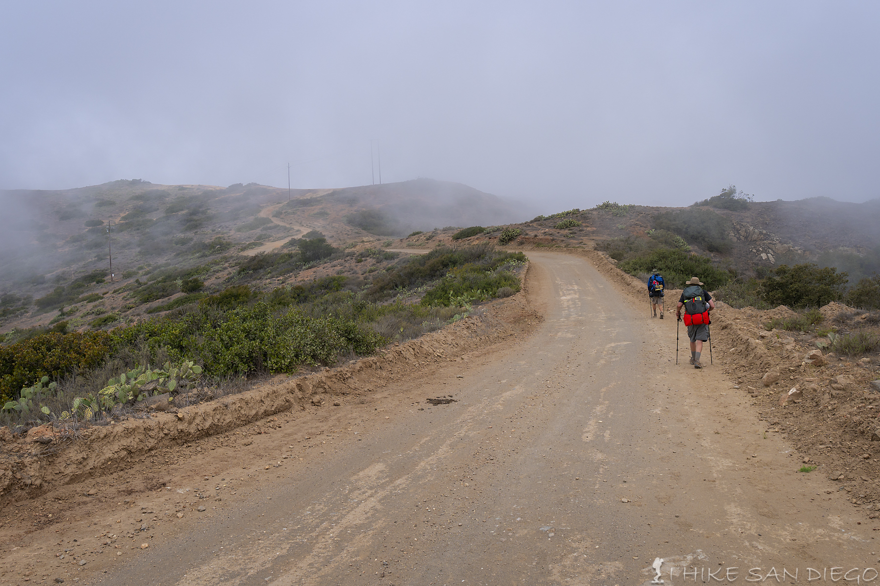
As you walk to the back of Hermit Gulch Campgrounds you will see the start of the Trans Catalina Island Trail. It is a steady climb on switch backs for the next 1.7 miles as you head out of the canyon and up to the top of a ridge to connect into a road that makes up part of the trail system. As you head up you will get some great views looking back towards the city of Avalon, although the day we started the hike ( and for most of the hike) we were socked in with fog. The fog made the temperature much more comfortable for the hike but not to great for the views. Once you get to the top of the Hermit Gulch trail you will see a shaded bench to relax on before you continue on with the hike, take heed of the restroom sign on the side of the hut, the restroom is just up the road within site.
Sign telling you how far you just came up from Hermit Gulch
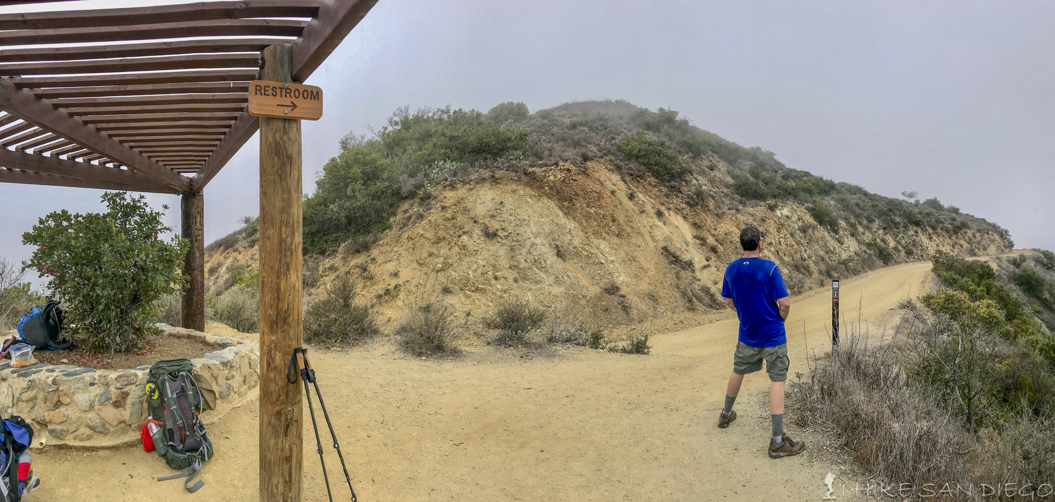
Enjoy the shade and area to rest, but take heed of the sign, the restroom is just up the road.
There is a restroom on the road not to long after you connect to it from the Hermit Gulch Trail
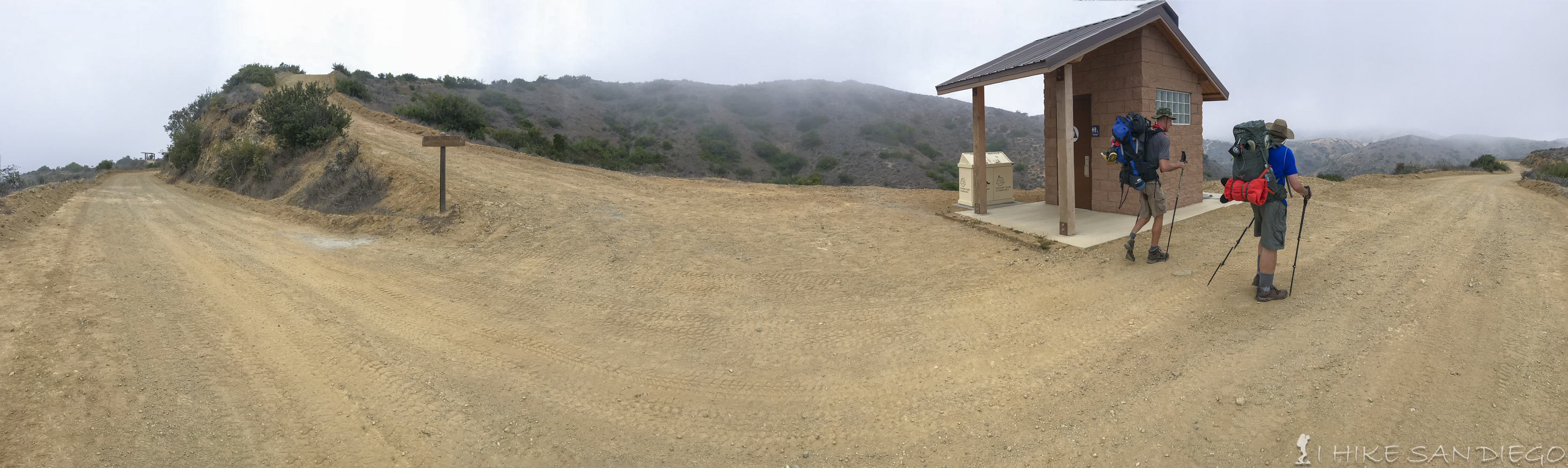
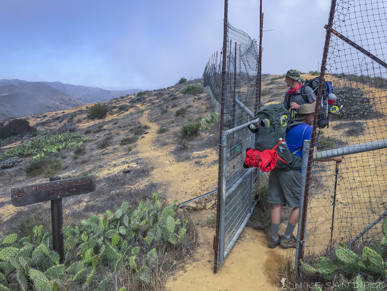
After you connect into the road from Hermit Gulch you have a pretty easy stroll on the road for the next 1.7 miles before you get to get back onto a real trail. I was happy to see the trail again by that point, I thought we might be following the road all the way and that would not make me happy. As you connect back onto the trail system you will head towards Haypress Reservoir, keep an eye on the trail, you will pass through a gate that you need to to open and then lock back up in order to continue and we wondered if the trail we saw to the left of the gate was an animal trail or a trail caused by all the people who don’t get it and continue on past the gate. About .7 miles after going through the gate you should hit the Haypress Picnic Area. This is a good place for you to rest up for a little, use the restroom in the pit toilets and refill your water from the spigots before continuing on, a word to the wise, make sure you bring your own toilet paper, you never know if there is going to be any in these toilets and you don’t want to begging for a square to spare. 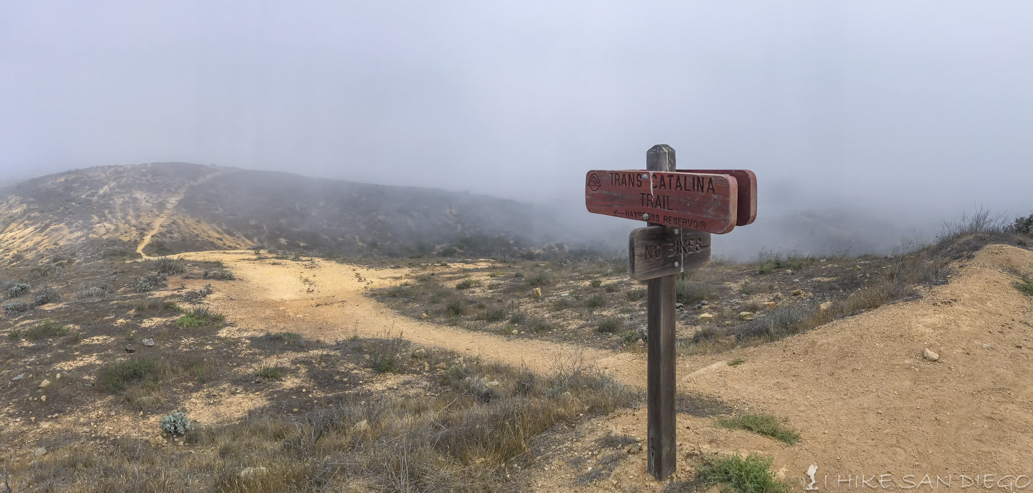
Trail system going back to single track from the road before heading pass Haypress Reservoir.
The gate you need to pass through to continue on the trail by Haypress Reservoir.
Haypress Picnic Area. You would never know that this area had been hit by fire in the Island Fire of 2007. Take advantage of this area to use the restroom and refill water.
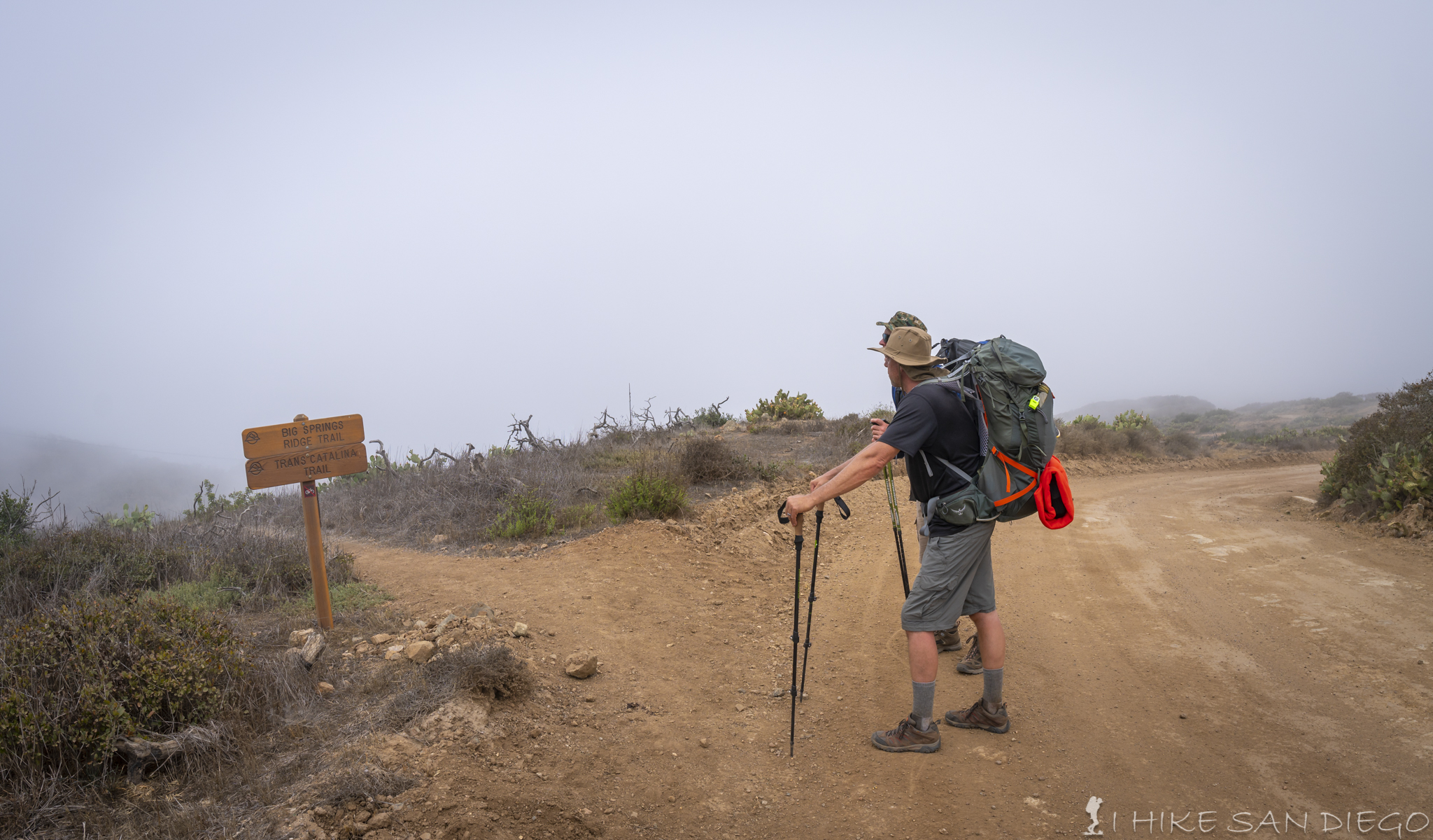
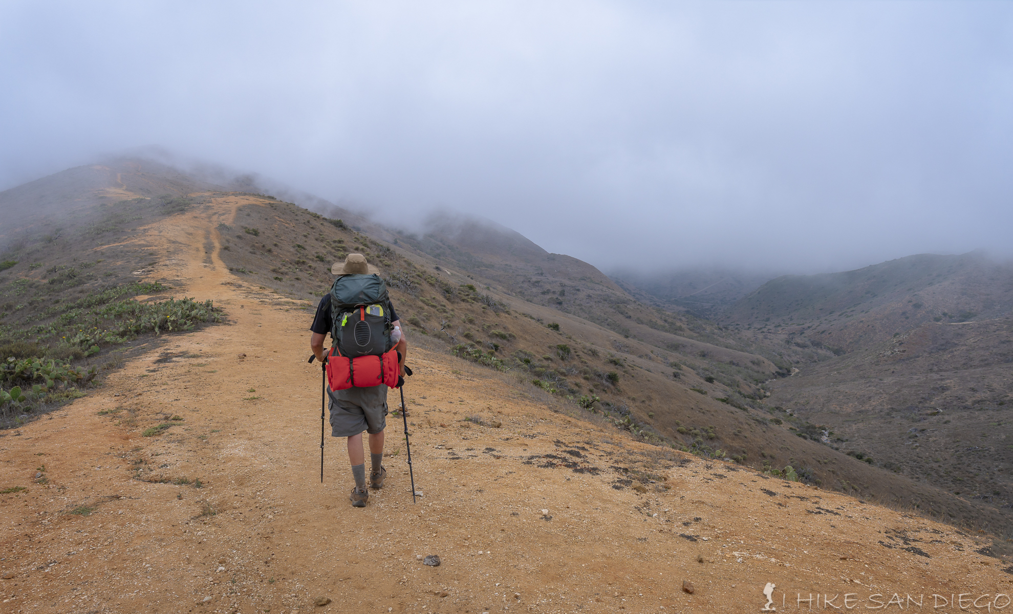
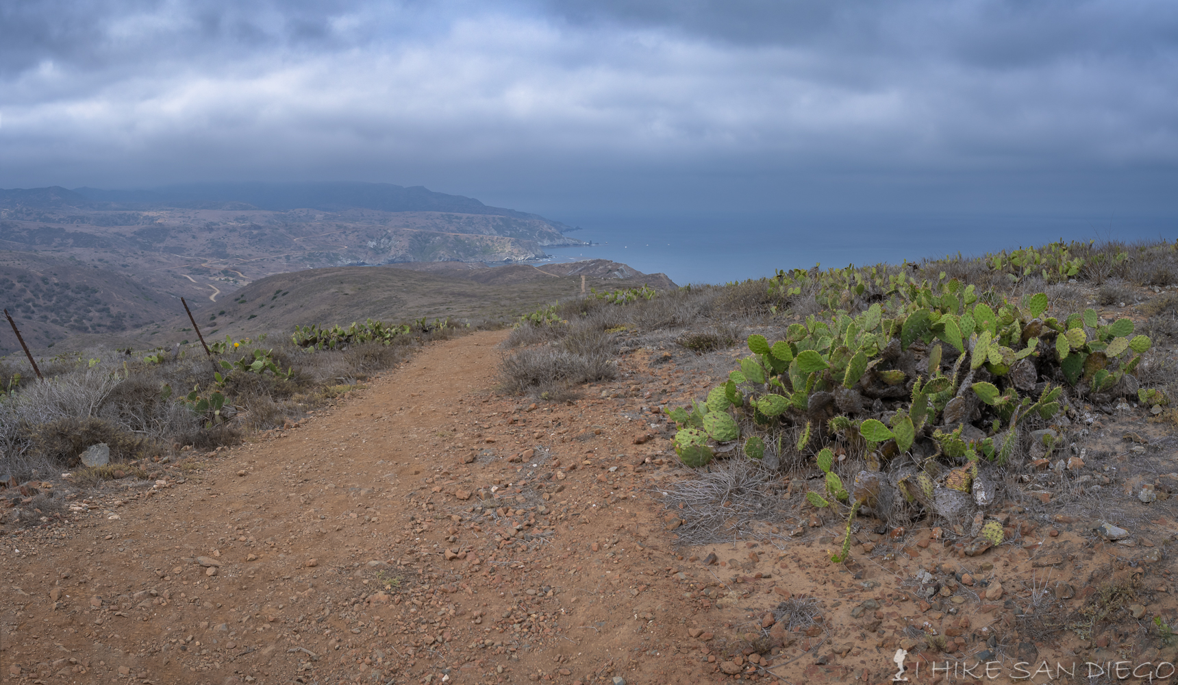
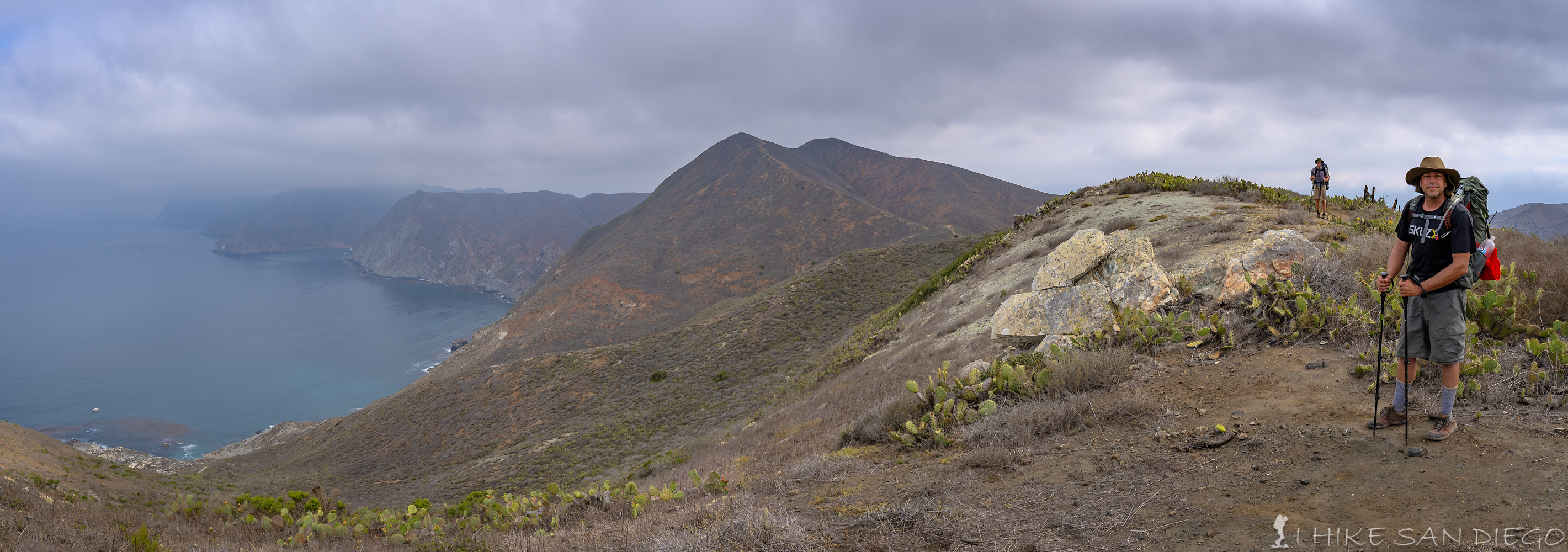
After you have rested up some and and ready to head back onto the trail head southwest through the picnic area past the play structures and you should see the Trans Catalina Trail sign. You will meander on the trail for about another mile before you go across the road only to make a short bypass of the road and connect back into the trail. The next mile is unremarkable except for the fact that you will work your way down into a little valley and then back out again heading up to a spot on the road that you will swear would have been far easier and made more sense if you had just stayed on the road to get to it, ( but hey, we are traveling on the Trans – Catalina Trail, not the road,…right ! ), just make sure you follow the signs, you can see other trails heading off into different directions that you would swear make more sense to follow unless you are looking at it on a map. As you cross the road and back onto the trail you will follow a steep trail as you drop about 500 feet of elevation over the next mile on your way down into the valley bellow. Unfortunately there is not much shade to enjoy at this point, and you are going to love ( not you won’t ) the next 3/4 a mile as you make your way up the next hill and gain all that 500 feet of elevation back that you lost as you came down into the valley. The reward at the top of this hill is the view down into Whites Landing below with all its blue waters. We even had a great scene of a Bison in front of our view down into Whites Landing. After taking in the scene head down hill for about 4/10 of a mile before you hit a great little shady area with a little bench. Take your time and rest a little at this area as the next two miles don’t have a whole lot of shade and its mostly up hill as you gain that 500 feet of elevation back before you make your way into the Black Jack Campgrounds.
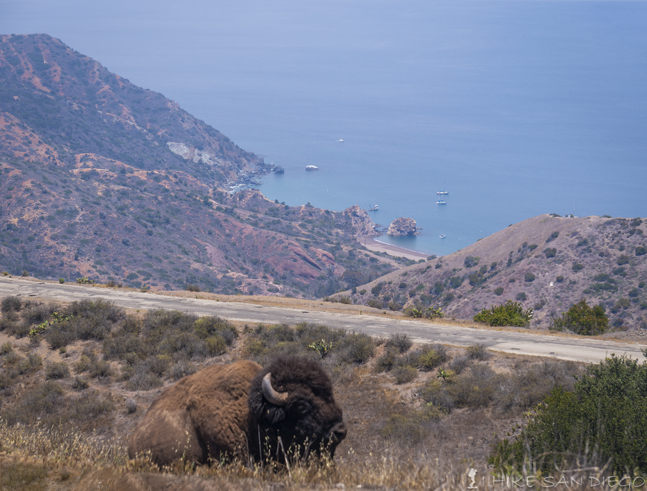
Bison resting by the Trans Catalina Trail with Whites Landing visible in the distance.
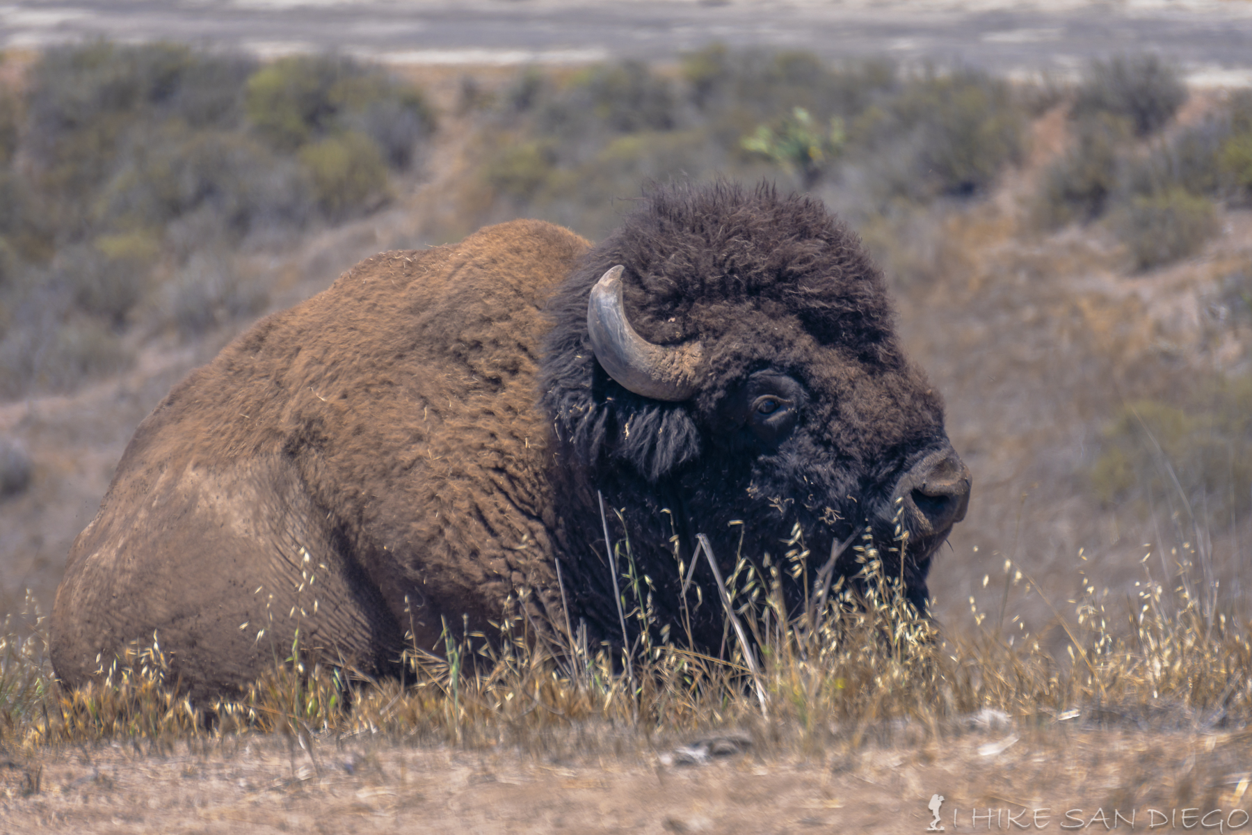
A closer look at the Bison of Catalina Island on the Trans Catalina Trail
Nice little bench in the shade to rest on before making your way up the hill for the last 2 miles into Black Jack Campgrounds.
Crappy Iphone pano of the resting spot. Enjoy the shade while you can.
We got into the Black Jack Campgrounds with plenty of time to spare ( I think we were the first people to make it into the campgrounds that day) We sent up our tents and took a little nap. I explored the area and found a ring shower ( the ring shower consisted of a shower head exposed for all to see with a ring of cement around the base ) and enjoyed a refreshing shower in my trunks, and that helped take some trail funk off me and cool off with plenty of time for me to dry out before the sun went down. As I made my way back down to the campsite I ran into some women who were camped 2 campsites over who became overly excited when I told them I had just taken a refreshing shower ( they told me I was a big tease, they where expecting a real shower ). These two women were smart and had one of company’s on the island,ferry all their gear from camp site to camp site so that all they had to hike with was a day pack with water and trail food, a much easier way to travel on this trail and one that would probably make it much more enjoyable if you have the extra money for it. They had also brought some fire wood up to the campsite ( check to see if your campsite allows it before you do this ) and we went over and enjoyed great conversation with them at the end of the day where we also discovered that instead of planning on taking the safari bus back to Avalon they had made reservations on the Cyclone speed boat, ( we were flabbergasted, what is the speed boat and how do we get on this, this sounded like a much better option then the bus). After learning that it was the first time one of the women had made a campfire we gave her the name of “Firestarter” and the other women talked about enjoying her Quiet time ( time for introspection or meditation ) that we gave her the trail name of “Quiet Time”. These two women also had a campsite at Two Harbors for two nights, something that we had not been able to accomplish and said we could share it with them as well, more on this later. It was the end of a long, exhausting day of hiking and hauling our gear up and down the hills and we were ready for some sleep.
Day 2 Black Jack Campgrounds to Little Harbor: 8 Miles
Getting dripped on in Blackjack Campgrounds on the Trans Catalina Island Trail
Knowing that our 2nd day was much shorter then the 1st day and that our first stop was in 2 miles for a Bison Burger at the DC-3 ( the restaurant at Catalina’s airport ) we took our time breaking down our campsite and getting started. Even though we were going to sit down for some good food in a few miles it is still a good idea to put a little something into your stomach because the last mile before you get to the airport is straight up hill. But first things first. Head north west out of the Black Jack Campgrounds until you see the road fork, take the right fork and follow this road for about 500 feet until you see the trail head, turn left and head down hill. You will follow this downhill section for about 6/10 of a mile before you see a dry stream bed that you cross ( it looks like an old soap stone quarrie was here). You will follow this stream bed for a little bit before you start making your way uphill.
Take the right fork of the road as you head out of Black Jack Campgrounds
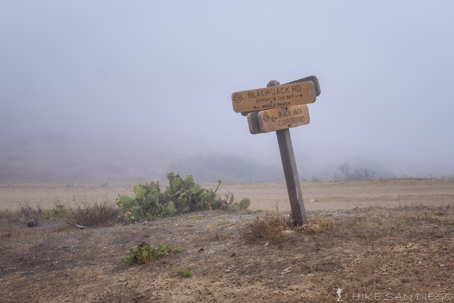
The sign on the fork as you head out of Black Jack Campgrounds
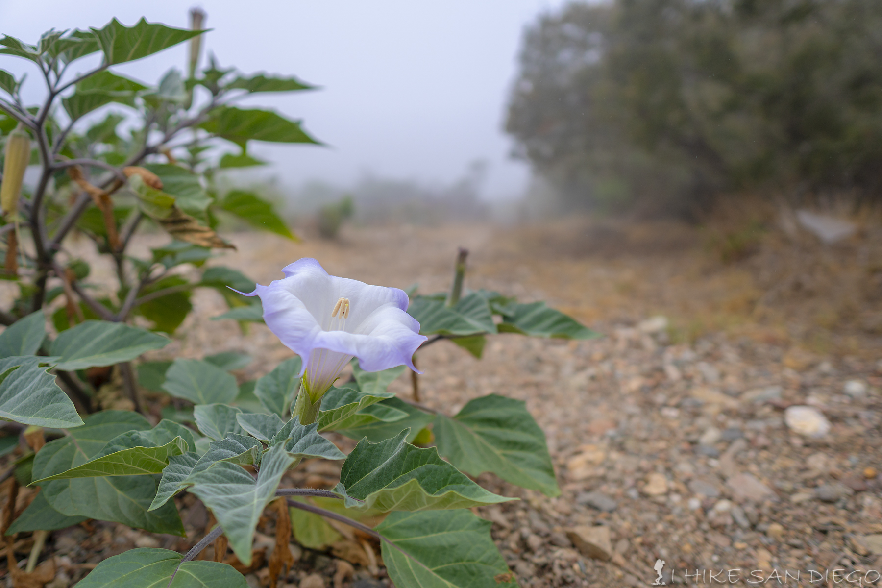
Beautiful flower in dry stream bed along the Trans Catalina Trail
You will follow the trail up hill for close to a mile gaining close to 500 feet of elevation before you hit the sign telling you where to go for the airport ( this 500 foot elevation gain and loss seems to be a trend ). Head towards the airport and past the airplane hanger ( it seems like a no brainier, but in the heavy fog we would not have seen which way to head had we not seen people coming back to the trail from the restaurant). The restaurant serves other things other then Bison Burgers but since thats all I have read about I decided to go with the burger and was not disappointed. This a good chance for you to also use the restroom with a real flushing toilet and refill your water again before heading out on the trail.
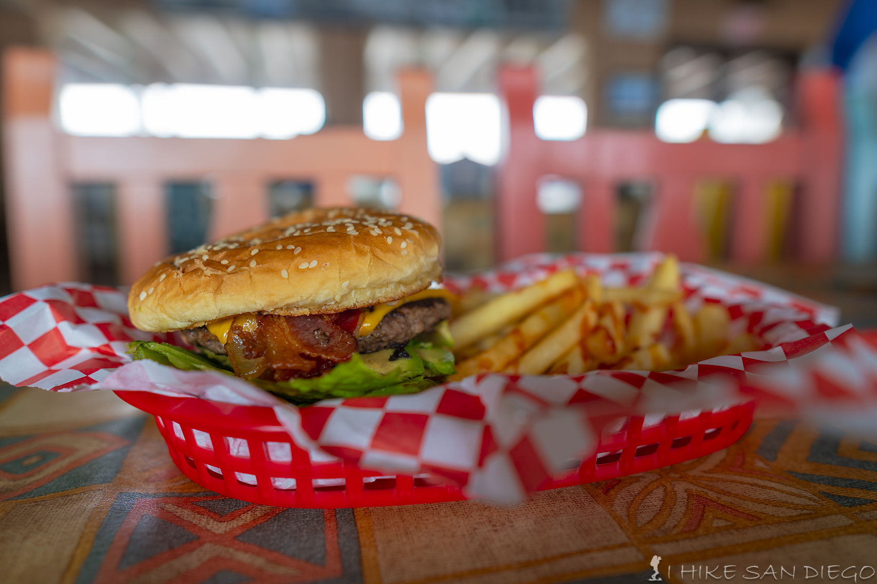
Tasty Bison Burger at the DC-3, Catalina Islands Airport Restaurant.
Once you have had your fill and you head back onto the trail, head back the way you came until you see the sign and then take the Airport loop trail for about a mile as it makes its way around the end of the airport runway and then back towards a road. At this point no one would blame you if you got a little confused, we were looking for more signs or something that would let us know we were still on the right track since you will follow this road for about another 1.2 miles before you see the sign pointing back to some single track trail, you will see a mile marker along the side of the road which did help alleviate my fears that we missed a turn somewhere.
Following the road (um….trail) after leaving the DC-3 restaurant at the airport.
Finally seeing the sign that points back to a single track trail after traipsing along the road after the airport
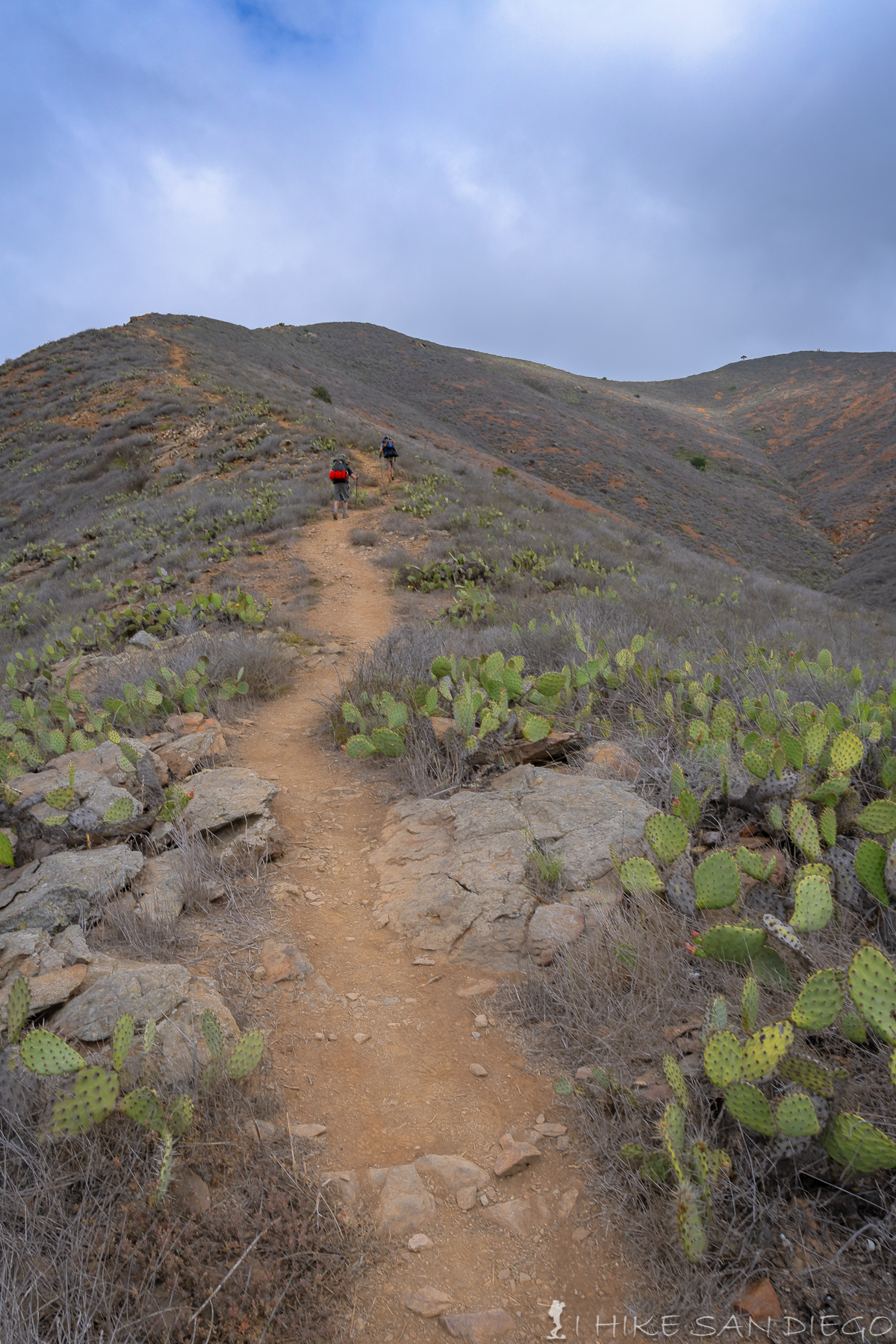
As you head back onto the single track trail you will head mostly down hill but you will continue to go up and down a few ridges as you continue. Going downhill is my least favorite part of this trail when I’m carrying all that weight on my back, it took some time for my knees to feel normal after this trip. You will follow the trail for about 2.7 miles going down hill before you get to a great little covered bench to sit on and rest your legs and finish the last little bit of downhill before hitting the campgrounds at about 8.5 miles after starting the trail from Black Jack Campgrounds.
Heading up and down the ridges on the way down to Little Harbor Campgrounds from Black Jack Campgrounds
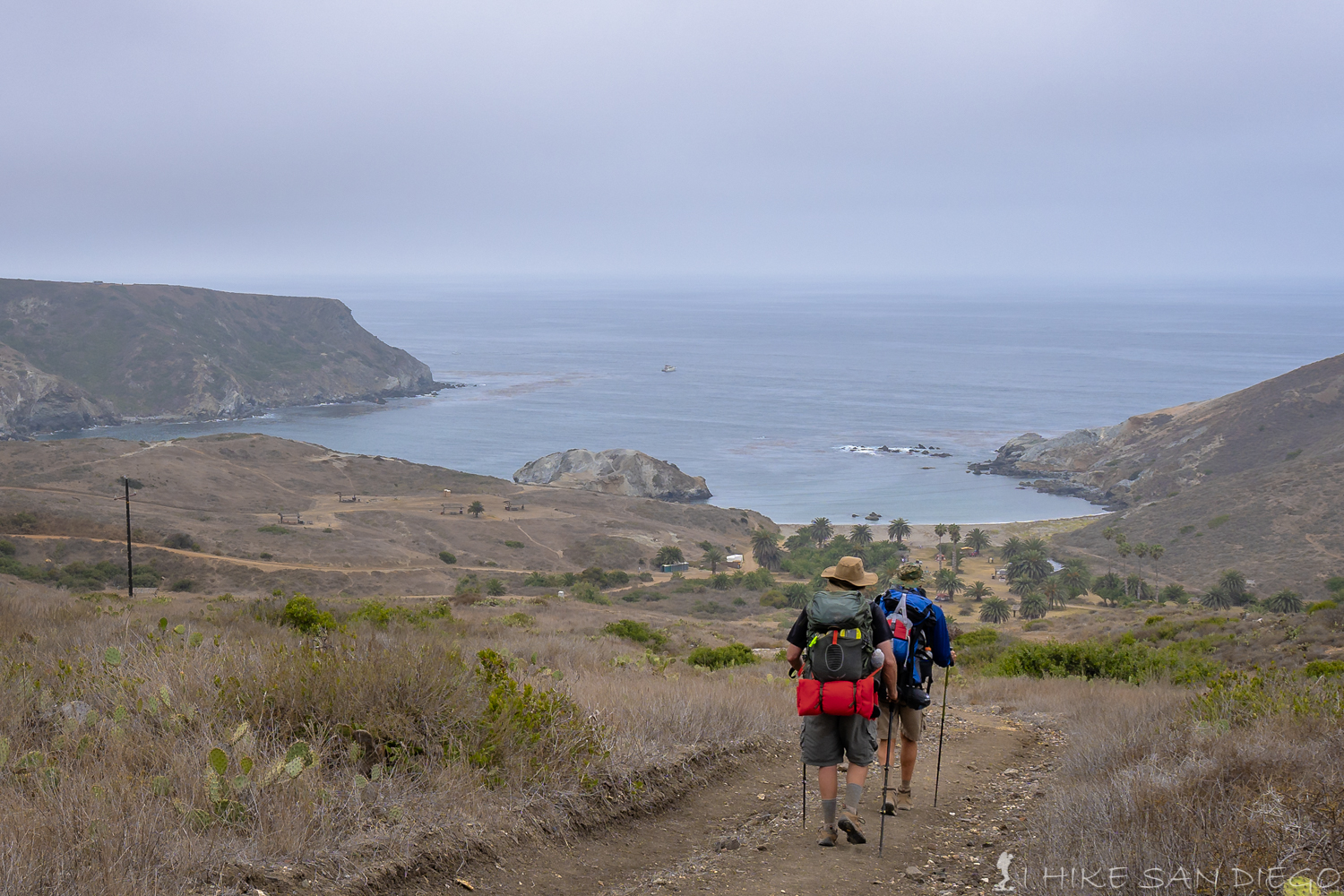
Looking down at the Little Harbor Campsites from the trail
I think the Little Harbor campsite was my favorite one among the bunch. I had a lot of fun exploring around the area and went back to the water as the light was going out to get some long exposure shots of Shark Harbor and all the waves exploding on the rocks.
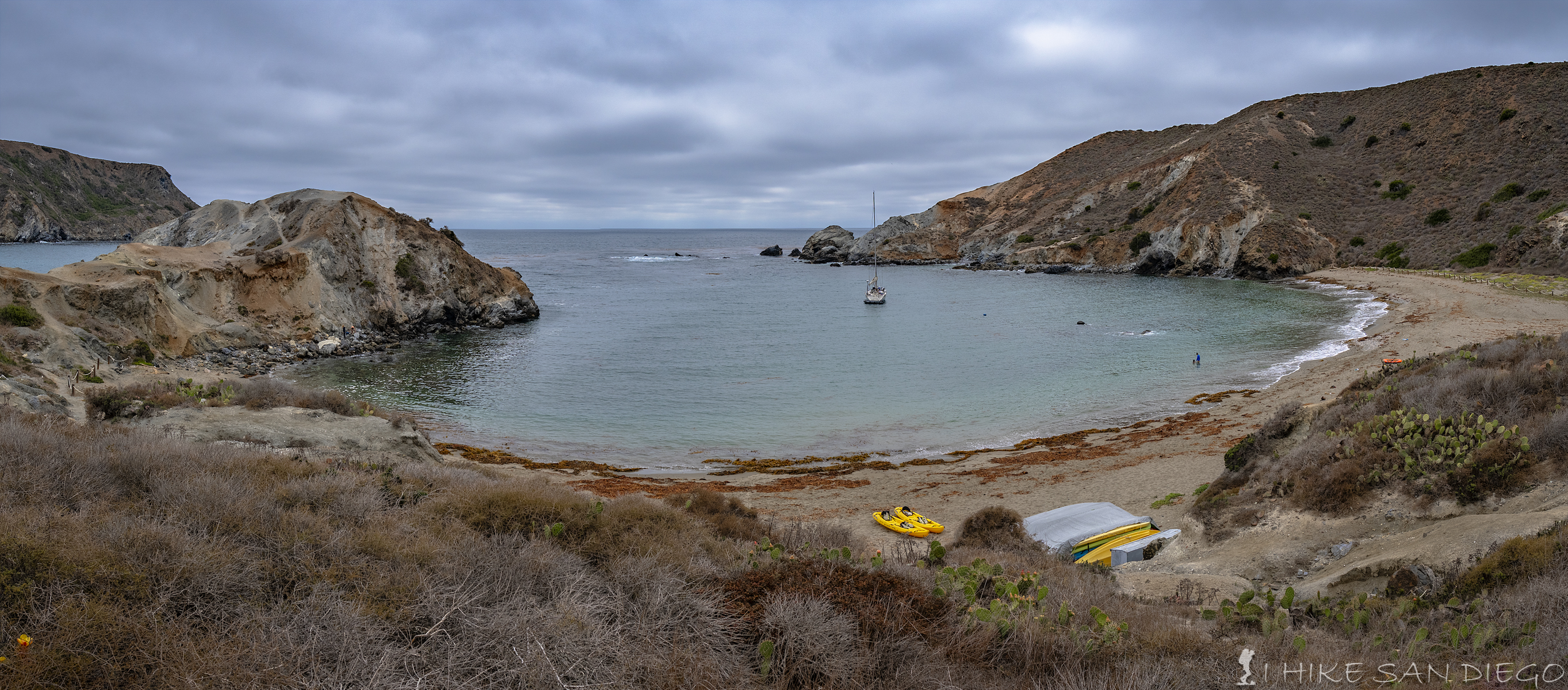
Little Harbor with a sailboat anchored in the middle.
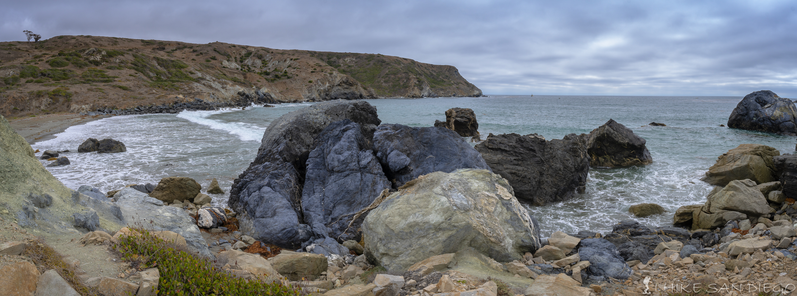
Shark Harbor is a well known surfing spot just to the left of Little Harbor
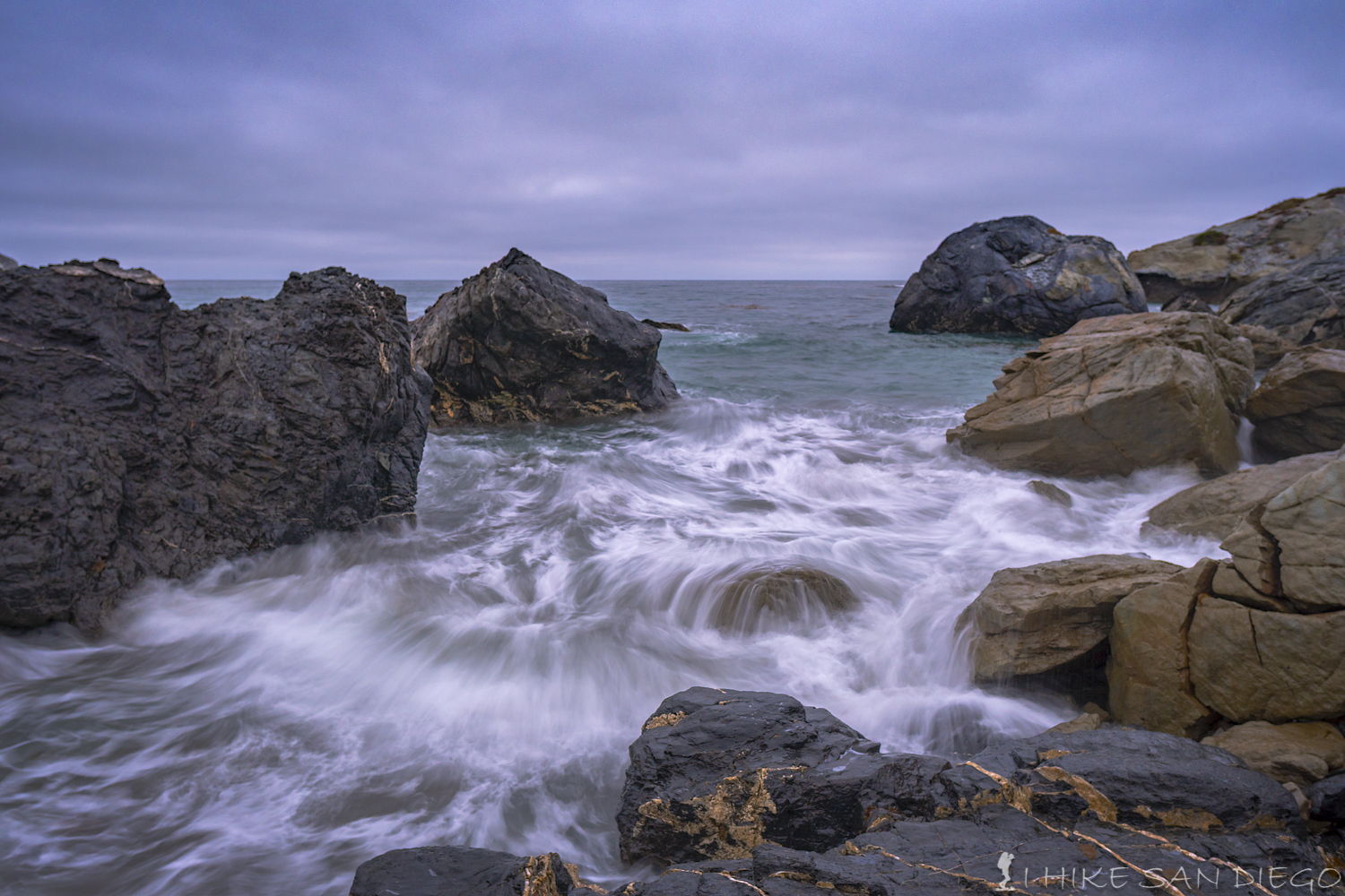
Waves crashing on the rocks in Shark Harbor
Day 3 Little Harbor to Two Harbors : 6 Miles
Trail leading up and out of Little Harbor on your way to Two Harbors
This was the last day hiking and we knew it was not going to be to long of a day since it was only 6 miles. We could see the uphill climb out of the campgrounds but we had no idea just how much uphill there was going to be. It is really interesting as you head up out of the campgrounds, you start to really see a lot of erosion on the cliff’s on this side of the island. The initial push up the hill looks worse then it is, you will gain about 200 feet of elevation in the short section of switch backs and then you will be on a long gradual climb up hill gaining about 500 feet of elevation in the first mile.
Looking back down the trail towards Little Harbor as we head up the trail towards Two Harbors
About two mile into the hike the sky opened up a little bit and we started to see more of the coast line we were hiking, at this point you also start to see the inlet leading towards Cat Harbor, the south western harbor of Two Harbors. This is also where you will see the upcoming slog up the hill in front of you. This big hill climb will hit a 30 percent grade at points and will challenge you as you haul all your backpacking weight on your back. We started to think of our trail buddies that we meet back in Black Jack Campgrounds ( aka,…Firestarter and Quite time ), we wondered if after climbing this section they just said F#@k it !!, they were planning on going all the way to Parsons landing, which meant that when we got to stop and camp at Little Harbor after 8 miles they still had another six miles to go the previous days and heading up this slog of a hill before they got to Two Harbors, their one saving grace was the fact that they had a company schlepping all their gear from campsite to campsite so that all they had to carry was a day pack with water and trail food, genius !!
The sky opening up and starting to see more of the coastline and the slog of a climb up the next hill.
The up hill slog on one of the last steep hills of the hike will hit a 30 percent grade in some points
At around 2.85 miles you arrive at a covered bench, a great place to take a seat, take in the view and collect yourself before continuing on. This last section of the hike is a tease in that every time you arrive at a top of a ridge you will be rewarded with the view of another up coming ridge. At around 3.7 miles you will be rewarded with the view of your last downhill as you make your way into Two Harbors, but your knees will not be thanking you.
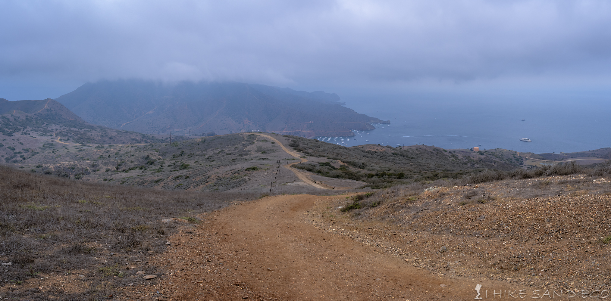
The view of your last downhill section heading down towards Two Harbors.
Just short of six miles you will make your way into the little village of Two Harbors. We decided to relax here for a bit and have a beer and a snack before making the 10 minute walk over to the campgrounds. You will notice the pay showers near the bathrooms in town, just remember that you will need 2 dollars worth of quarters for the showers. This particular day was pretty busy at Two Harbors as a group of prone paddle boarders and their friends with their chase boats where here for the Rock2Rock ( a 22 mile prone paddle board race from Two Harbors in Catalina to Manhattan Beach across the sea) which was happening the next morning, it gave the area and interesting energy that probably is not present most of the time.
After relaxing with our beer and snacks we decided to make our way over to the campgrounds. When we had meet our friends, aka…Firestarter and Quiet time at Blackjack Campgrounds they had told us that we could camp with them at the Two Harbors campgrounds as that was the one campground we could not get a reservation at, so we thought we would be able to easily find them and set up our tents at site 20 ( do not get this site if you have a choice). We looked everywhere in the campgrounds before finally giving up and finding someone who worked there who could point out where site 20 was, even he said it was hard to find, for one it does not even look like a site compared to the sites around it and for another thing the only sign that it was site 20 was on the picnic bench which was turned around backwards so that we could not even see the marking until I was setting up my tent and happened to glance behind me and saw the markings on the bench.

Our crappy little campsite 20 at Two Harbors campgrounds.
In the meantime we never found the girls and thought maybe they really had said screw it and decided to head back to the mainland early. We sat in the shade for a while trying to figure out what to do. Joe, one of my buddies finally decided that we has going to head back into town to see if we could get a campsite ( you can not get one once you get to the campsites, you have to reserve it back in town), he was successful and we got the crappy little site that we were already looking for ( site 20), which really made us think that our friends said screw it, as it was the only camp site open for a reservation ( we did notice a lot of campsites that never were used even though they said they were all reserved). We set up our tents and then decided to head back into town for showers and dinner.
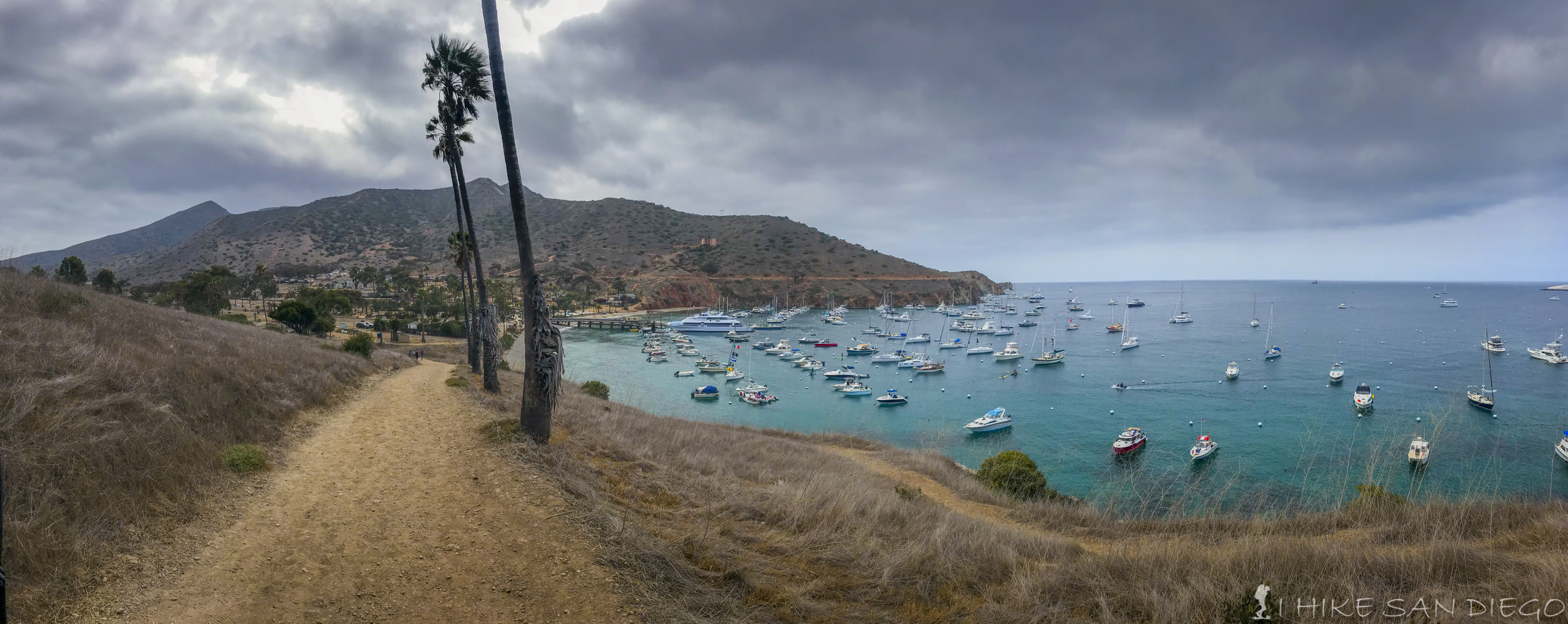
The view of Two Harbors and the blue green seas. A lot of boats where in the harbor for the Rock2Rock paddle board race which was happening the next morning.
We were very happy to run into our friends who had just finished their hike back from Parsons Landing when we went into town for our showers and dinner. It turns out they had showed up at the campgrounds the night before after hiking 14 miles only to find that their campsite was the crappy little campsite 20 and Quite Time ( was not very quite) and had made enough noise about it that they where able to get another camp site ( again why it was open when we went looking for a campsite) that was further up the hill. We had dinner in town and told our tales to each other and then agreed to come over to their campsite later for a fire and desert, Firestarter had brought a freeze dried ice cream sandwich and said we really had to try this thing out and we were pleasantly surprised by this desert.
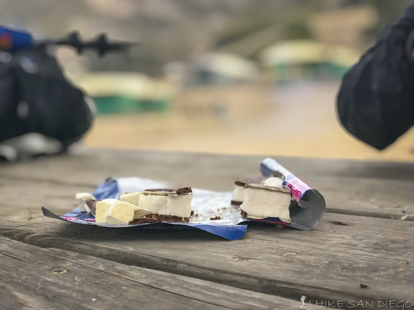
A freeze dried ice cream sandwich that our friends had brought on the trip that was surprisingly good.
After we all had said good night and my friends had gone to sleep I decided to make my way up and around the road behind the campgrounds to take some night photos of the harbor and it was interesting. I think in part because of all the people who where there for the Catalina Island Classic paddle board race that was happening the next morning there seemed to be a high energy in the harbor that night. Up on the road behind the campgrounds you could hear everyone down in the campgrounds enjoying their campfires and you could also hear everyone out in the harbor enjoying the night, it was quite a different experience from the other campgrounds we stayed in during this trip.
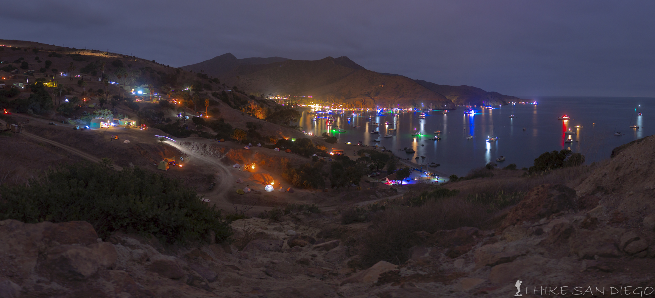
Looking down at the campgrounds and the harbor at night in Two Harbors Catalina Island.
The next morning we broke down our campsite and headed into town to have some breakfast and wait for our speed boat ride on the Cyclone back into Avalon. We had a little time to kill so we decided to head over to the other harbor behind the main one which I think is called Cat Harbor. It is a beautiful little spot and we decided that even if we had not gotten a campsite at the campgrounds that there were a couple of spots around this area where we may have been able to set up a couple of tents without much problem. Especially near the start of the last hike toward Parsons Landing which starts on the northern side of Cat Harbor near a small wharf with bathrooms and I think water and a shower.
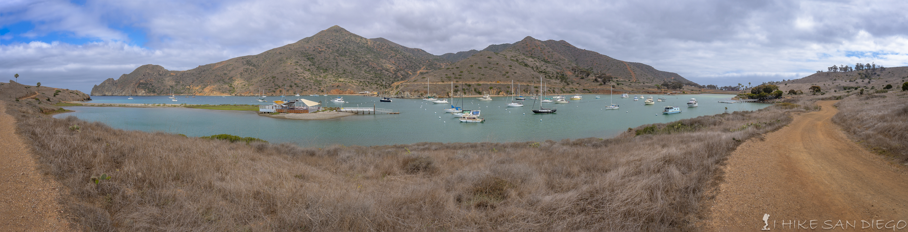
Cat Harbor, the harbor behind and on the western side of Two Harbors.
We had a great time on the boat ride back from Two Harbors to Avalon. I would highly recommend this option if its available ( it runs Friday, Saturday, and Sunday) over taking the 2 hour bus ride back to Avalon (although I have not taken the bus, so what do I know). I think we got back to Avalon in close to 30 minutes, it was a fun ride, they had good music playing, and you got to see a different view of the island that you would not normally see hiking or ride back on the bus.
Boat ride back on the Cyclone from Two Harbors to Avalon
Weather forecast for the Trans Catalina Trail. [forecast location="90704" caption="Weather for Trans Catalina Trail Hike" measurement='F' todaylabel="Today" datelabel="(%%weekday%%)"highlow='%%high%%°/%%low%%°' numdays="5" iconset="Contemporary" cache="true" width="100%"]