
Distance: 10 – 11 miles .Elevation Gain: 2,070 feet. Time to complete: 5-6 hours roundtrip Difficulty: Strenuous
To Get There: ( I would suggest taking a truck or SUV for the dirt road-Blair Valley Road ) take highway 78 out of Julian heading down the Banner Grade until you can turn south onto S2 ( the Great Southern Overland Stage Route) and follow it until you can turn off onto Little Blair Valley Road or the road just past it as they will both take you to the same place. The Whale Peak via the Pictrograph Trail Trailhead. Once your on the dirt road just keep following the signs ( 5-6 miles) until you reach the one for the Pictograph Trail.
I used a GPS Trail that you can download and use on your iphone on the App Map My Hike. This helped me out immensely
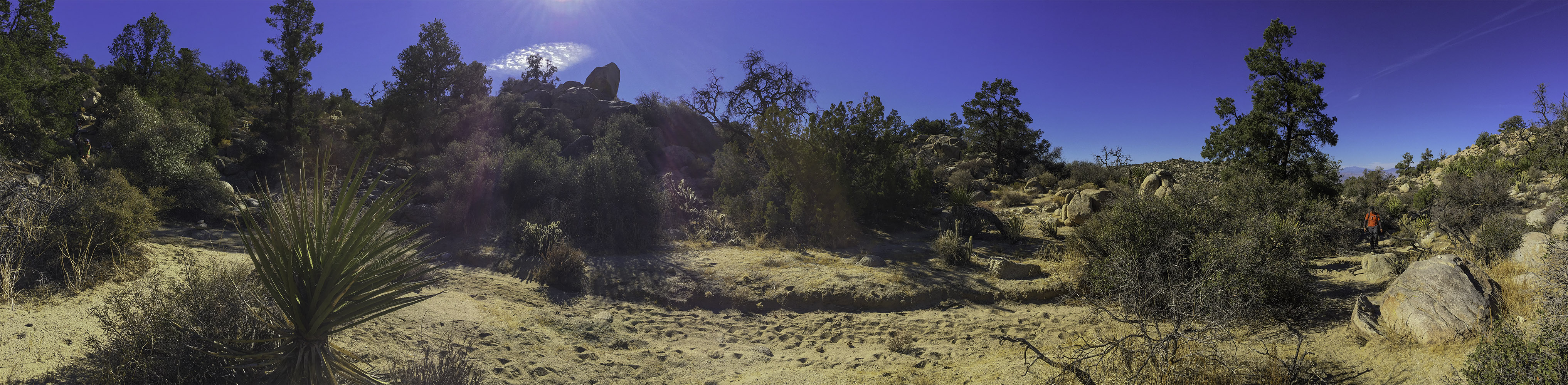
This hike starts out on the Pictograph Trail. Once you park at the trail head, head out onto the pictograph trail. Its a pretty easy trail, your going to be hiking along some pretty sandy soil for about 3/4 mile until you reach the Pictographs. There is not much there, but take a look and then decide which way you want to go, if you want to go straight on to the top of Whale Peak then head left and make your way north along a wide wash and then make a wide turn towards the right ( north east ) to the mouth of Smugglers Canyon at about 2 miles into the hike.
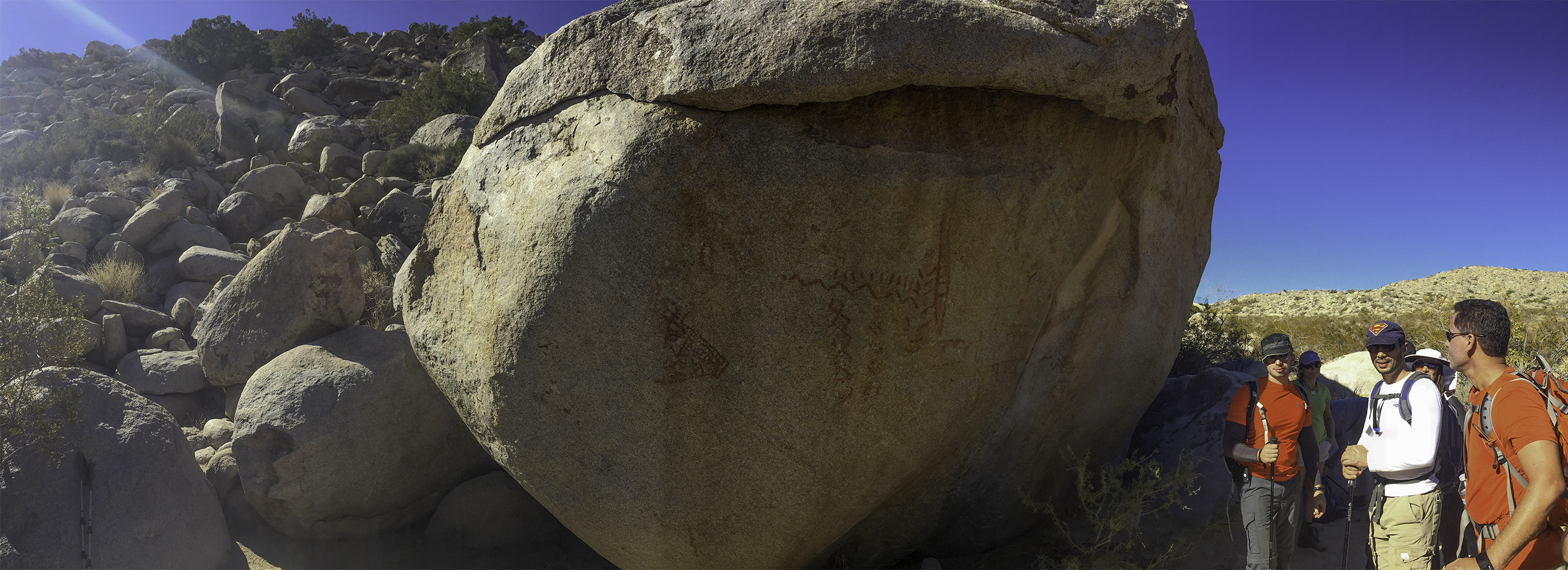
Taking a look at the Indian Pictrograph ( Petrogyphs) on the way up to Whale Peak
If you would like to see the waterfall ( which is dry most of the time but has a great view) then continue on the trail from the Pictograph’s for another 1/2 mile or so, this will add another mile to your hike, but its an easy extra mile and the view is worth it.
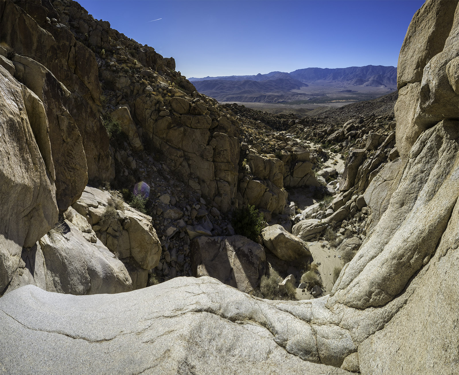
Looking south from the waterfall at the end of the wash in Smugglers Canyon
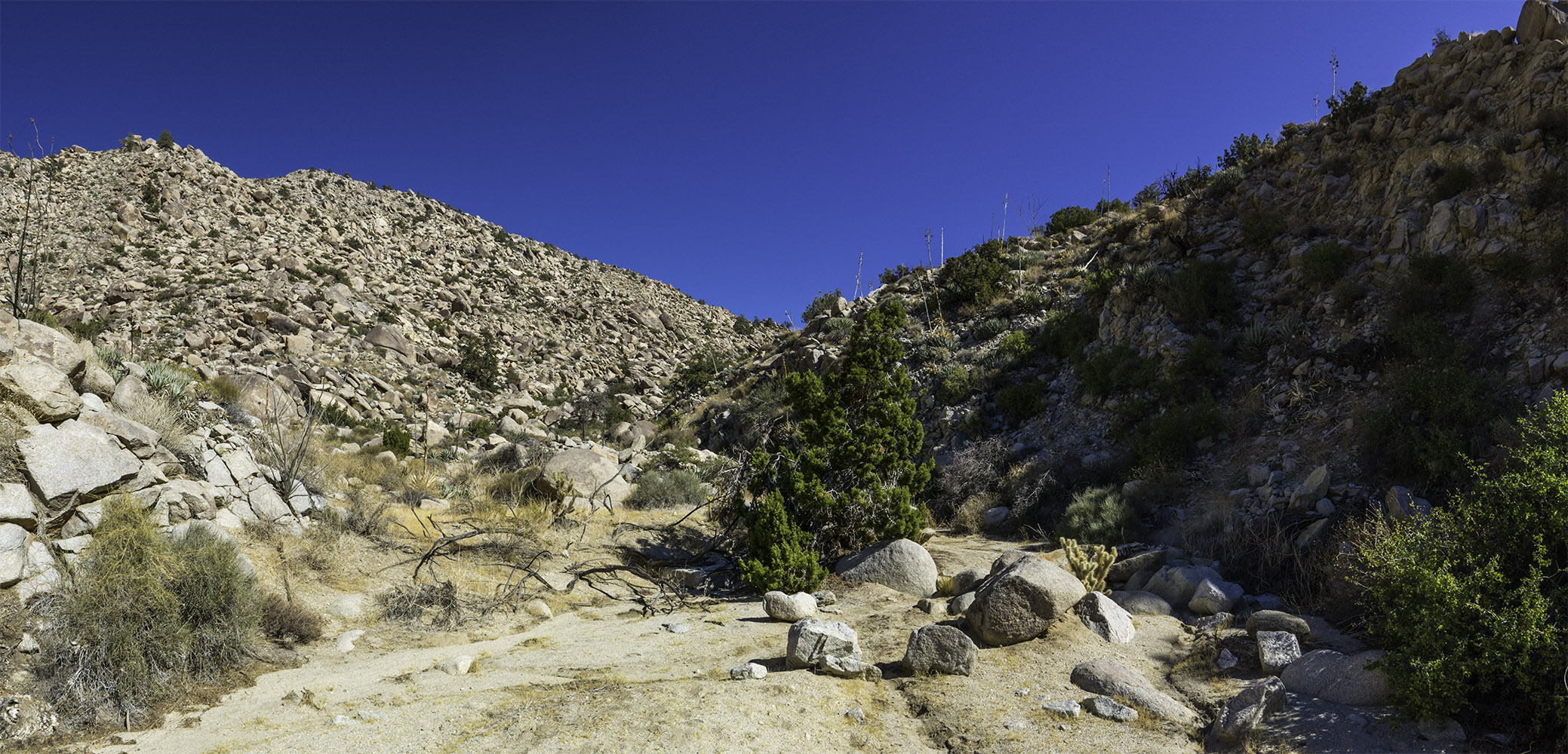
When you are making your way over to the mouth of Smugglers Canyon you may have a hard time finding your way because there is hardly a trail to follow. You are walking along a giant wash at the bottom of a canyon, so every time it rains its going to wash away the tracks, the good thing is that you don’t need to be precise in order to get to the mouth of the canyon, you just need to follow the general direction.
The mouth of Smugglers Canyon at the end of a giant canyon wash
Once you get to the mouth of Smugglers Canyon the real work begins, there is a little bit of a trail, but remember you are climbing up a canyon wash, so again every time it rains its going to rearrange the trail somewhat, we where hiking towards the end of the dry season, so there had been time for the trail to get etched into the landscape. Your also going to be climbing a lot of boulders on the way up, if you have any injuries with your upper body you may want to wait on this hike because your going to need your upper body strength as well as your legs. This part of the trail reminds me a lot of the hike I did at the Goat Canyon Trestle.
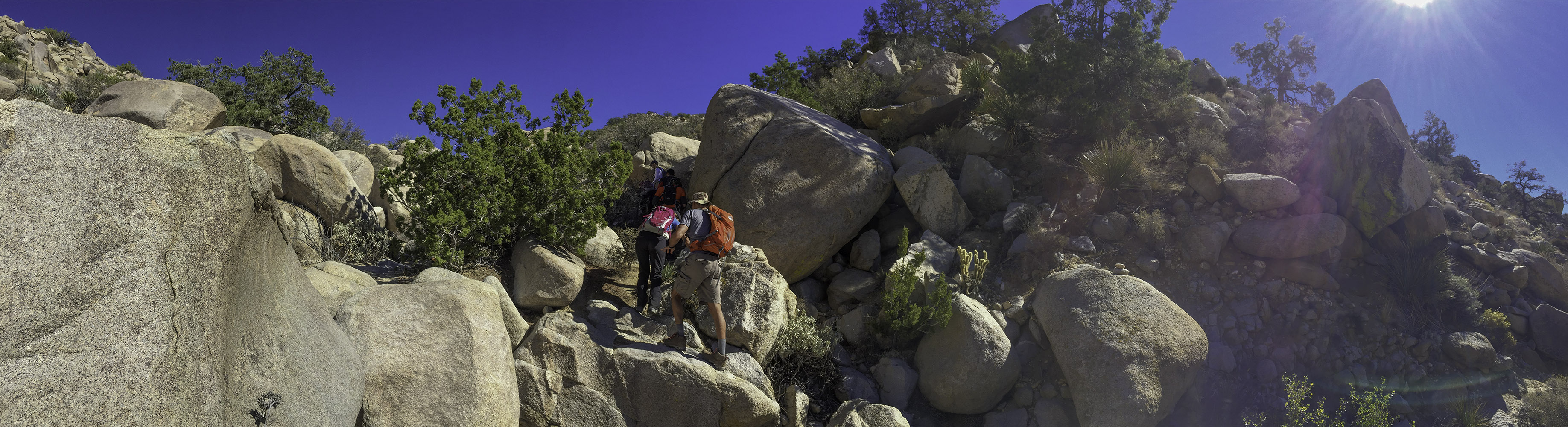
Boulder hopping up the trail in Smugglers Canyon on the way to Whale Peak
Eventually after about 1.8 miles and 1,000 feet of elevation gain over some rough trail you will make it towards the top of the canyon and the trail will take a bend to the right ( south) and continue on climbing another 400 feet of elevation over the next 6/10 of a mile until you hit a nice little plateau.Keep your eye open for cairns ( or trail ducks) that mark the way, the trail fades and comes back along this part of the hike, sometimes when you are heading along the sandy soil there is a definite trail to follow, other times you need to keep your eye open for the trail makers and refer back to your GPS if you have it ( having a GPS trail to follow on my iPhone app Map My Hike really made a difference).
Easy to follow track through the sandy soil towards the top of the hike
After you hit the plateau you will continue on the trail for an easy 1/3 mile until you hit the 4.6 mile marker of the hike, then you start the last and hard climb gaining another 300 feet of elevation gain over the last 0.4 miles before you make it to the top of Whale Peak. Once you are at the top make your way east along the ridge you you will eventually reach a group of large rocks with what looks like a little wind break someone built and a metallic Whale Peak marker sign left by Boy Scout Troop 500 of Point Loma.
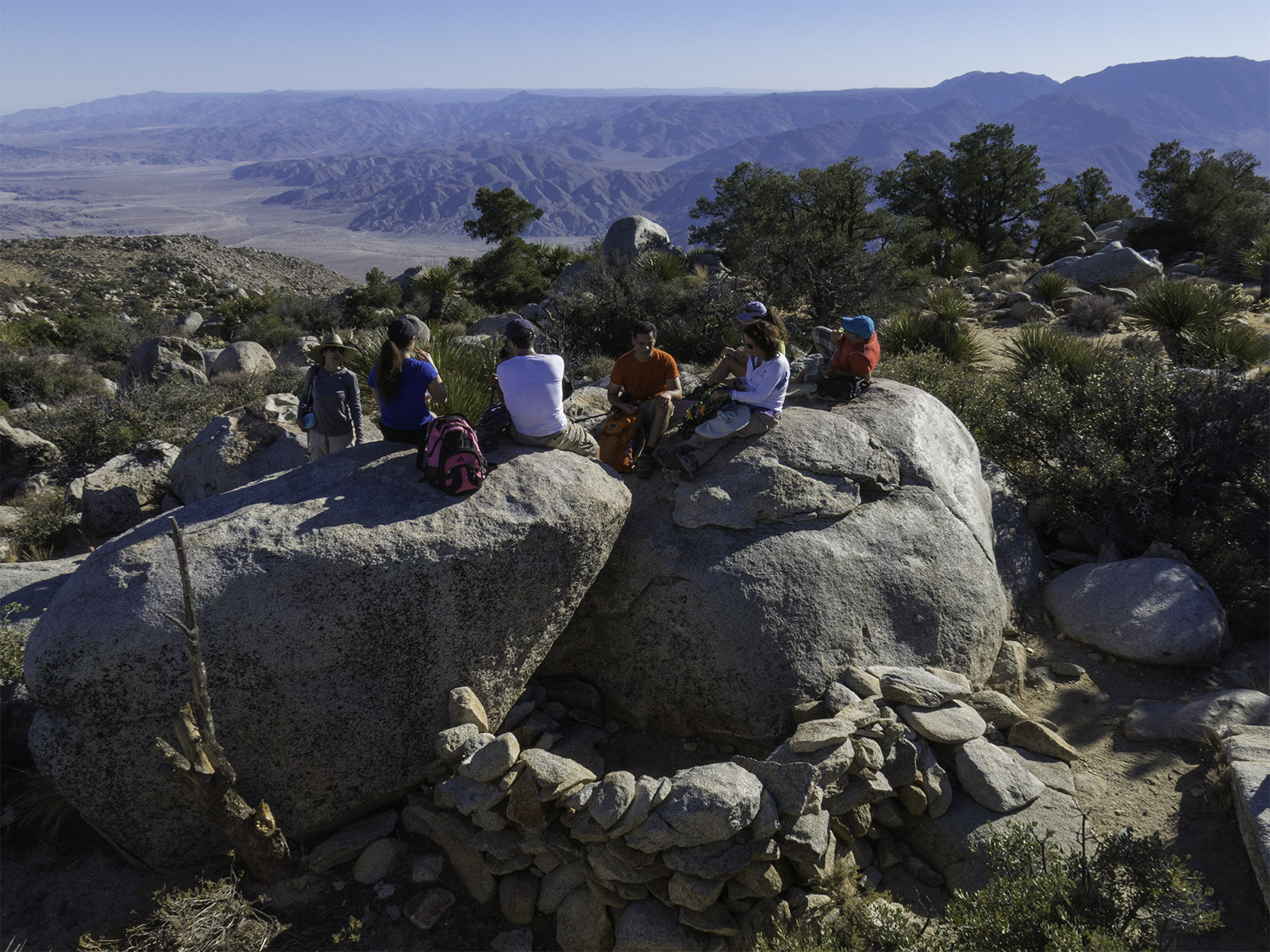
Having lunch on top of a rock with a little wind break built below it.
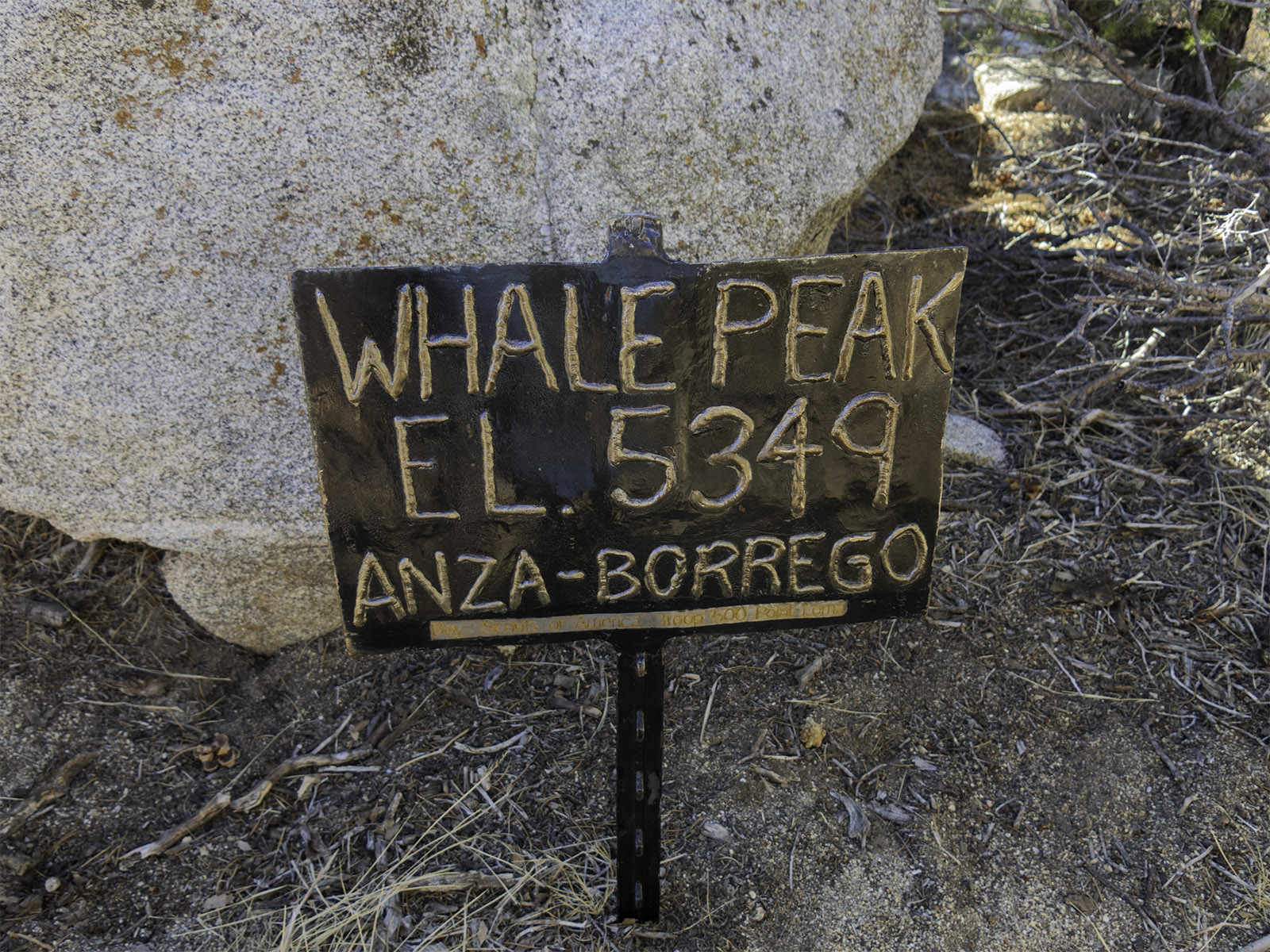
Whale Peak sign left by Boy Scout Troop 500 of Point Loma
[forecast location="92004" caption="Weather for Whale Peak" measurement='F' todaylabel="Today" datelabel="(%%weekday%%)"highlow='%%high%%°/%%low%%°' numdays="5" iconset="Contemporary" cache="true" width="100%"]


