
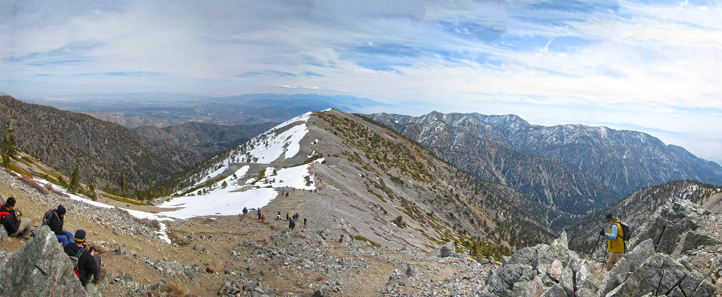
Heading down to the Devils Backbone from the peak of Mt Baldy
Climb for Heroes is a charity event to raise money for wounded veterens. All tax deductible donations go directly to The Heroes Project’s mission to organize climbs to the highest peaks in the world, each with our injured marines, soldiers and veterans. The event is held on Mt Baldy. I’ve been up Mt Baldy before and came back down the way I went up for this event and thought to myself that this way was kind of a joke after going up the shorter but much steeper side of Mt Baldy with the Sierra Club Ski Hut, but I’m here to tell you that the longer but less steep climb up to the notch and then along the Devils Backbone was no joke and still left me feeling like I had smoked a whole pack of cigarettes afterword’s. The event was well organized, signing in was a breeze, there was a nice little breakfast for you provided by Tender Greens. The first 15 minutes or so is this nice super steep road / trail that makes its way up to the main service road from the parking lot of the Mt Baldy Ski Area. Once up to the road its a nice long slog up to the “Notch” at Mt Baldy, technically the bottom of the ski area. A nice place to stop and take care of business before moving on. After passing the notch you will work your way up the ski area and towards the Devils Backbone. Once past the Devils Backbone you will see the peak ahead but the best is saved for last as you climb up the last hill close to 10,000 feet and sucking in O2 like its going out of style. The event has stations along the way where you collect coins that you then turn into the event coordinators at the bottom for swag. You will meet up with some of these vets at the different stations or even see them along the trail, stop and say hi. At station 3 they had beer and soda, but knowing there was still a but kicker of a hill coming up I decided to take a beer to go and celebrate at the top instead. This is a fun event for anyone living in Southern California and I would defiantly suggest this to anyone who likes to hike, and or supports our wounded warriors.

Posing with Mark Zambon
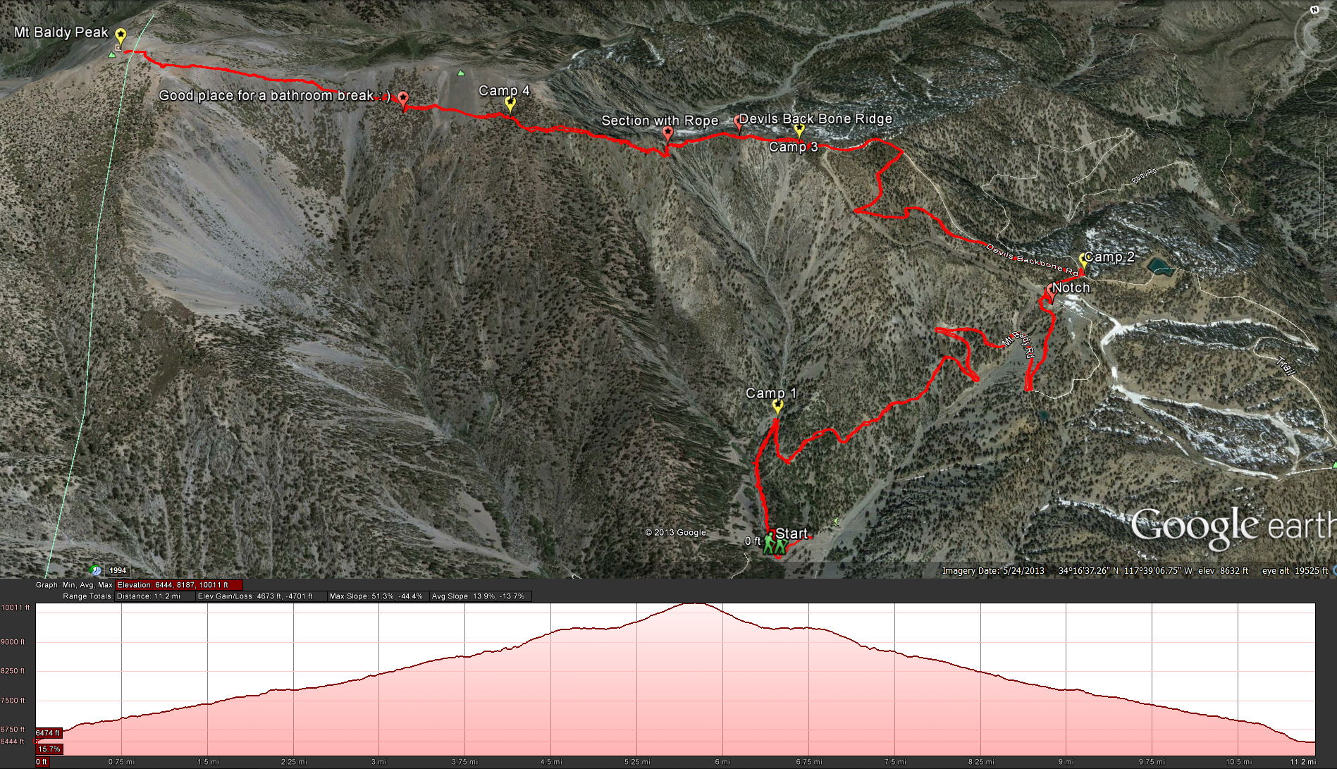
The route taken for the 2014 “Climb for Heroes”
Google Earth: The Route for Climb For Heroes 2014


Trackbacks/Pingbacks