Beating the Heat
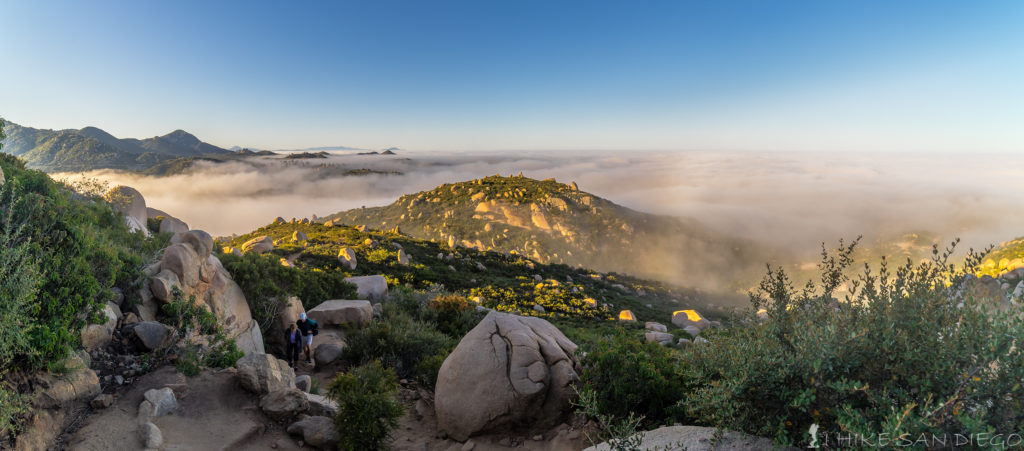
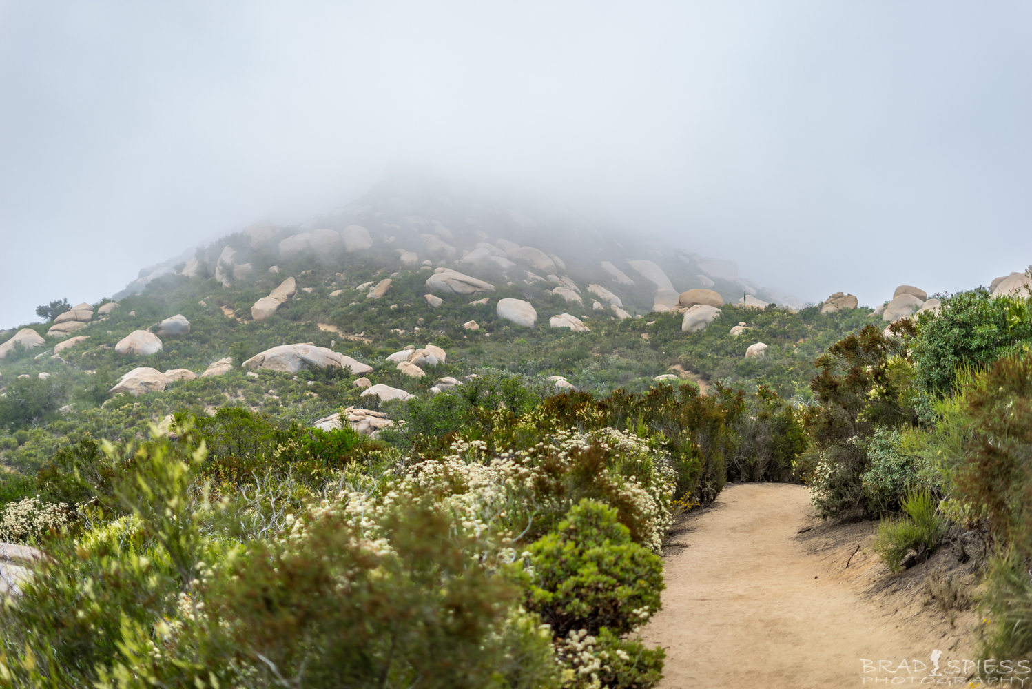
Getting and early start on hiking Mt Woodson not only makes the hike more comfortable but can give you some killer views like this one as I started hiking up out of the marine layer to look back down at it.
That time is coming again, the time when the heat starts early and people start asking themselves if they should go hiking or not. Just because the heat is getting dangerously high does not mean you have to stop hiking, but you need to be smart about when you decide to go. When I lead hiking groups I get many grumbling’s why are we meeting so early ( no later then 7am if we are hiking in San Diego, sometimes 5am if we have a 2 hour drive ahead of us), the reason I usually start my hikes so early is that when it starts to heat up I want to be well into my hike. People tend to forget that San Diego is considered a desert environment. While the fact that San Diego is a desert environment is not always recognizable when you are close to the coast, just drive 20-30 minutes inland and it starts to become abundantly clear.
So if you can’t go hiking at a normal “civilized time” because of the heat what are you to do ?
- Consider starting your hike really early
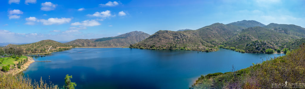
- How early is early, it really depends on where you are planning on going for a hike, is it close by so that you can get to it with a 20-30 min drive or is it going to take you 2-3 hours to drive to it. When I was coming back down from shooting the milky way on Mt Woodson I saw a group of hikers starting their way up at 4:30 am, more likely to get some sunrise pictures but I did run into a couple hiking Mt Woodson at 2 or 3am to beat the heat as they got ready for a big hike in Europe. With the heat coming this weekend I would suggest hitting the trail no latter then 6am, and even earlier if you are planning a long hike. I hit the trail at Mt Woodson the other day at 6am it was still foggy as I was nearing the top but by the time I turned around and had made it back down to Poway Lake all that marine layer had basically burned off and it was starting to heat up.
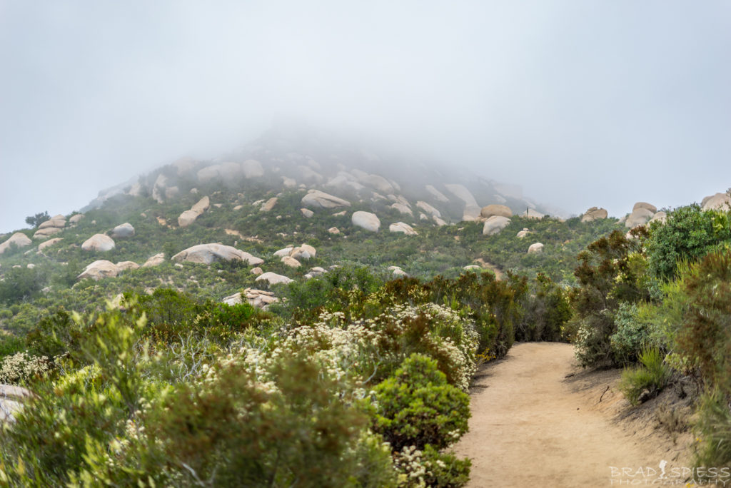
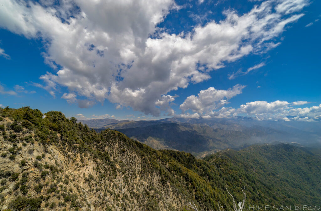
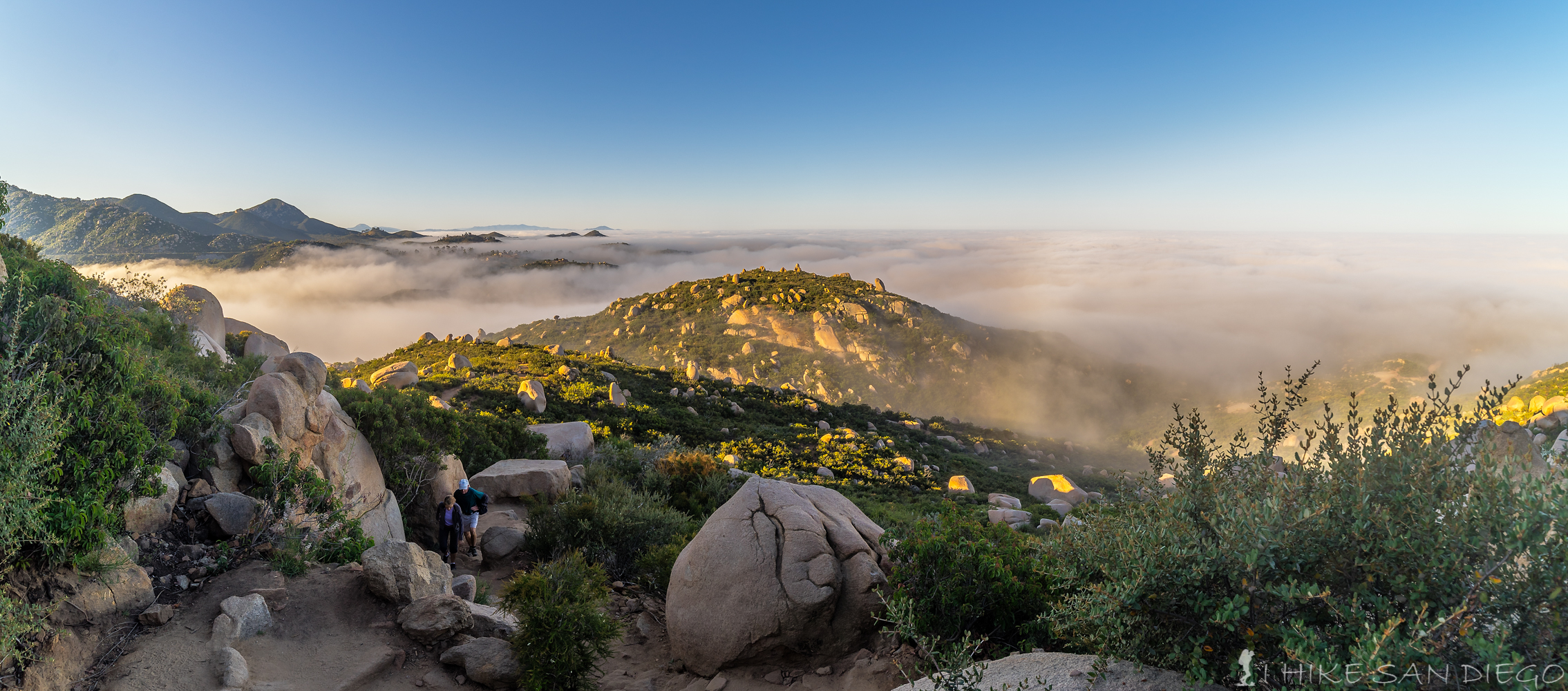
Foggy hike at 7am near the top of Mt Woodson
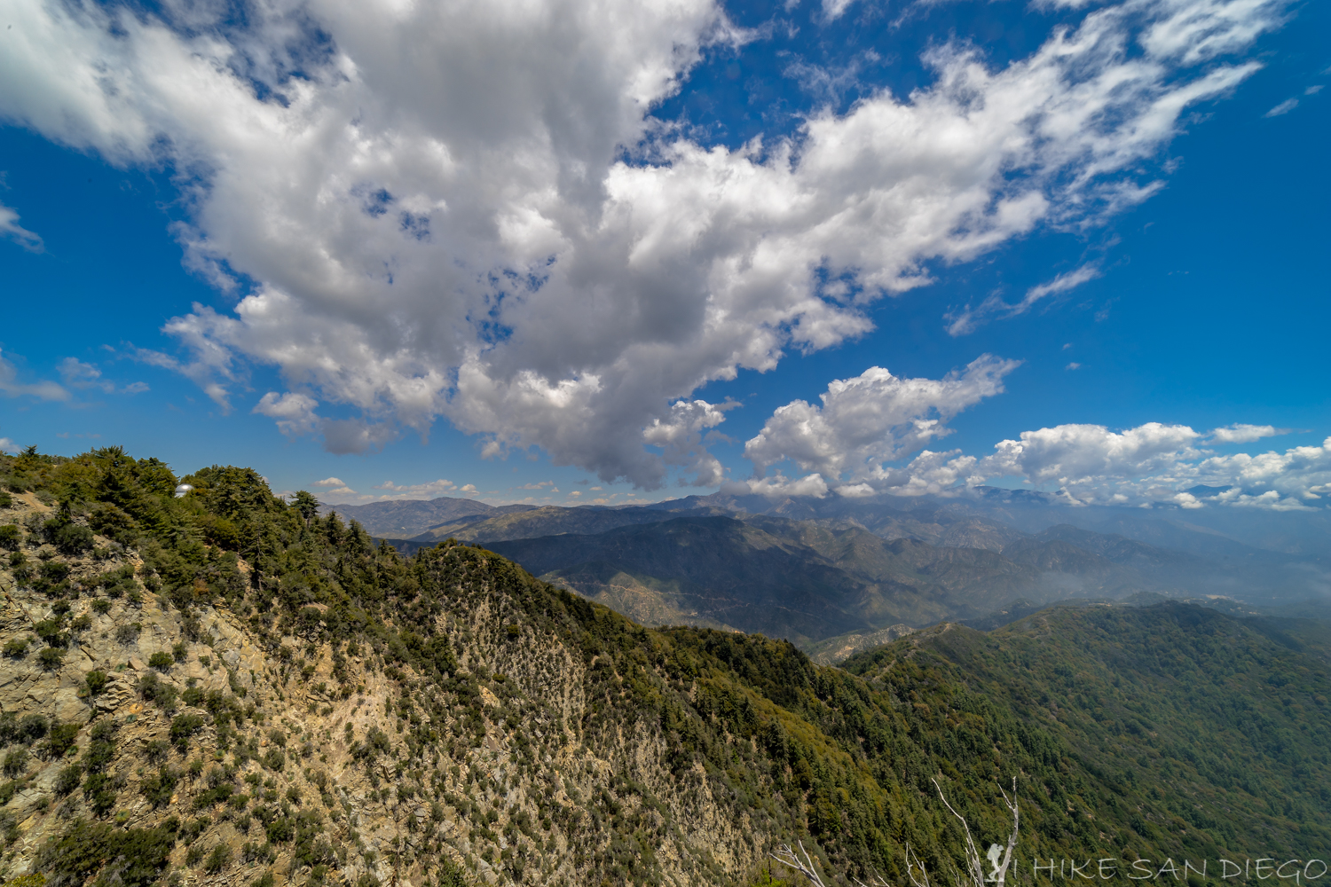
All the fog burned off by 9am
- How early is early, it really depends on where you are planning on going for a hike, is it close by so that you can get to it with a 20-30 min drive or is it going to take you 2-3 hours to drive to it. When I was coming back down from shooting the milky way on Mt Woodson I saw a group of hikers starting their way up at 4:30 am, more likely to get some sunrise pictures but I did run into a couple hiking Mt Woodson at 2 or 3am to beat the heat as they got ready for a big hike in Europe. With the heat coming this weekend I would suggest hitting the trail no latter then 6am, and even earlier if you are planning a long hike. I hit the trail at Mt Woodson the other day at 6am it was still foggy as I was nearing the top but by the time I turned around and had made it back down to Poway Lake all that marine layer had basically burned off and it was starting to heat up.
- Go for a sunset hike
- San Diego has some wonderful sunsets and sometimes the best place to see it are from the local mountain tops. I have had some great hikes to some of the local mountain tops for sunsets hikes, such as Mt.Woodson and Cowles Mountain. When you are going for a sunset hike remember to bring some essentials, a flashlight – preferably a headlamp so you can keep your hands free, even though its cooler still bring plenty of water – its amazing how much you still sweat as your hiking in the dark, hiking poles are a bonus – they help when making your way back down in the dark not to mention they make a good way of warding off any animals that you may meet on the trail ( mountain lions are the only one’s I worry about), some spare batteries in case your flashlight quits on you.

Looking west at the setting sun and balloons in Rancho Santa Fe from the top of Blacks Mountain.
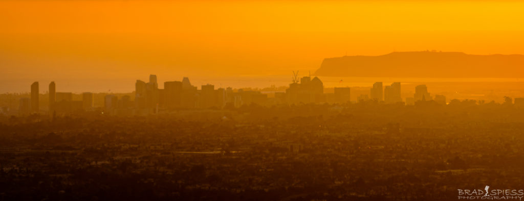
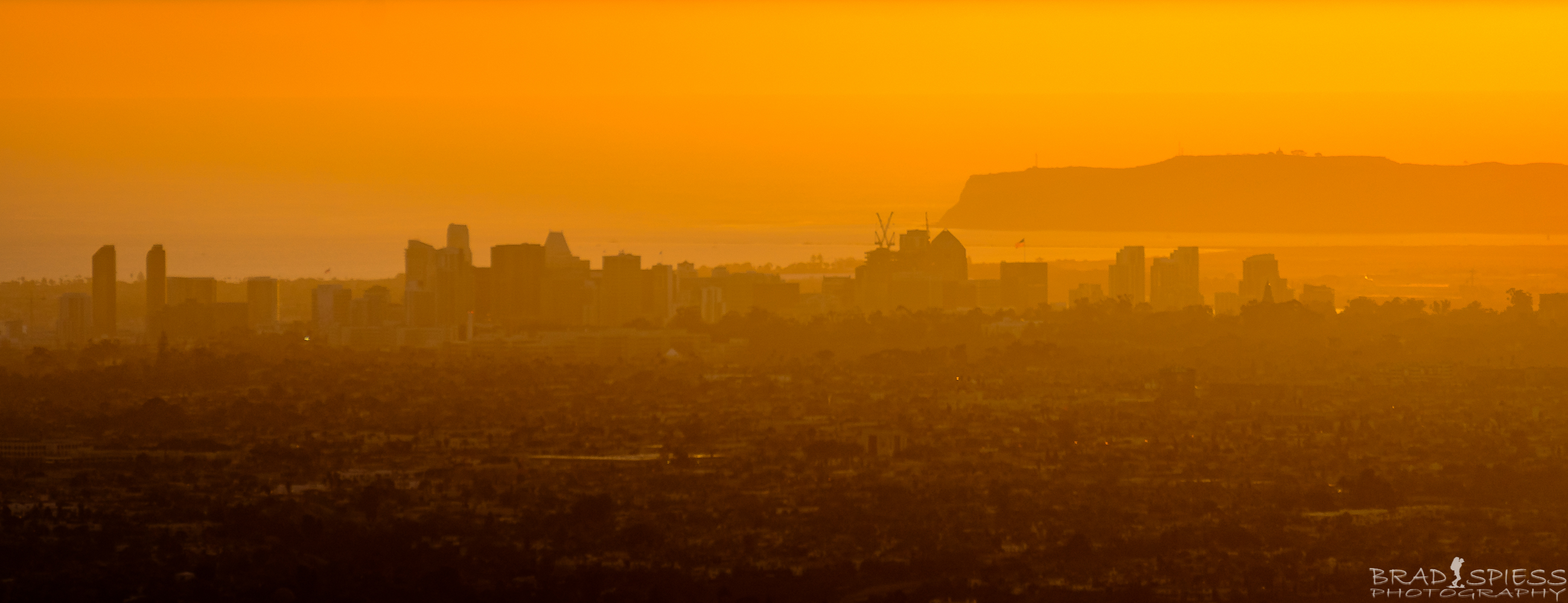
Looking at downtown San Diego during the sunset from the top of Cowles Mountain

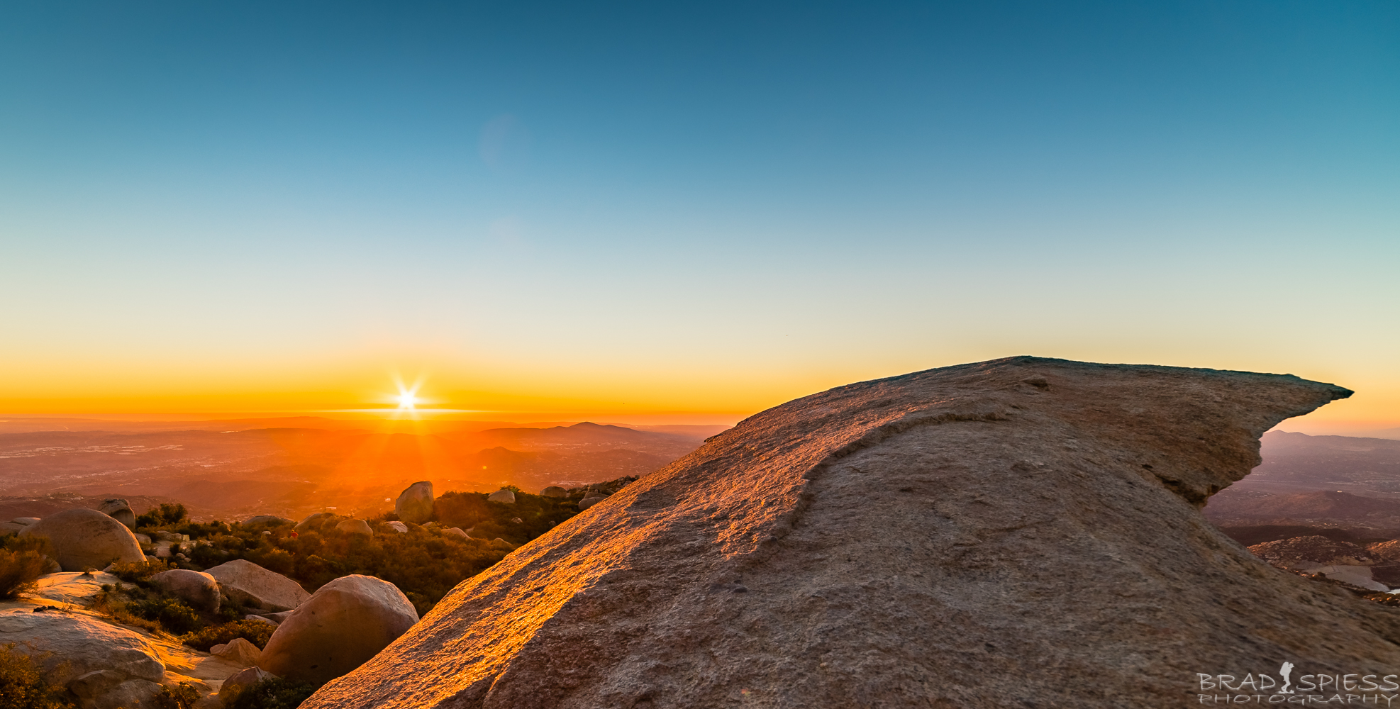
Watching the sunset from Potato Chip Rock on Mt Woodson in San Diego
- San Diego has some wonderful sunsets and sometimes the best place to see it are from the local mountain tops. I have had some great hikes to some of the local mountain tops for sunsets hikes, such as Mt.Woodson and Cowles Mountain. When you are going for a sunset hike remember to bring some essentials, a flashlight – preferably a headlamp so you can keep your hands free, even though its cooler still bring plenty of water – its amazing how much you still sweat as your hiking in the dark, hiking poles are a bonus – they help when making your way back down in the dark not to mention they make a good way of warding off any animals that you may meet on the trail ( mountain lions are the only one’s I worry about), some spare batteries in case your flashlight quits on you.
- Go for a night hike
- I never thought of this until I started heading out at night to photograph the Milky Way. You usually want to get as far away from the city in order to see the Milky Way but when there is no moon you can still see it pretty well in certain areas of the city. You will definitely need a flashlight / headlamp, on full moon nights you can sometimes make your way around without using it but on nights where the light in minimal you are going to need it. Bring a light jacket, you may find that as you are hiking you don’t need one but if you are going up to a mountain top it will be breezy and you will be sweaty, which means you will start to feel a chill pretty quickly, I always keep one in my pack just in case.
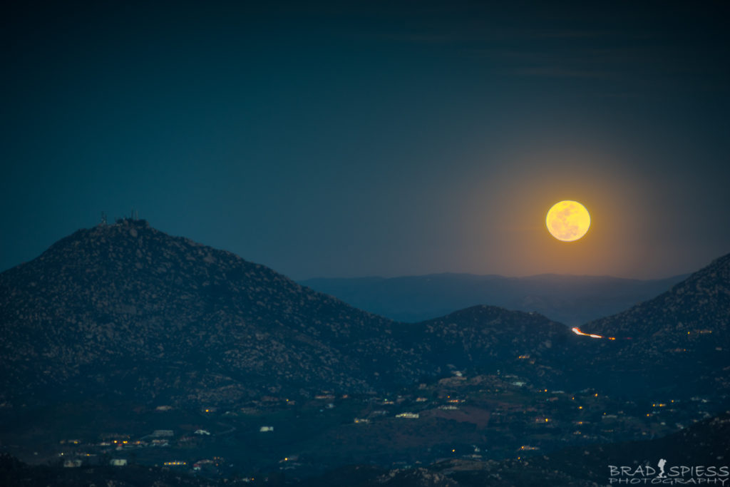
The full moon rising up behind Mt Woodson taken from the top of Black Mountain
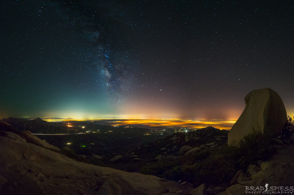
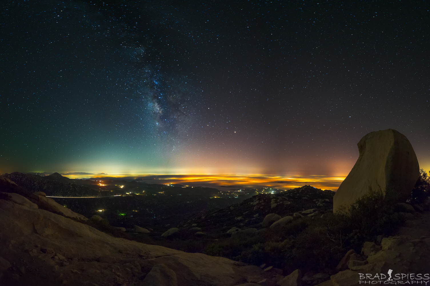
The Milky Way at 3am taken from the top of Mt Woodson
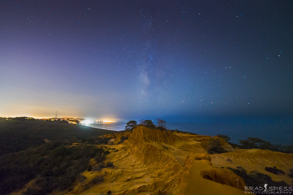
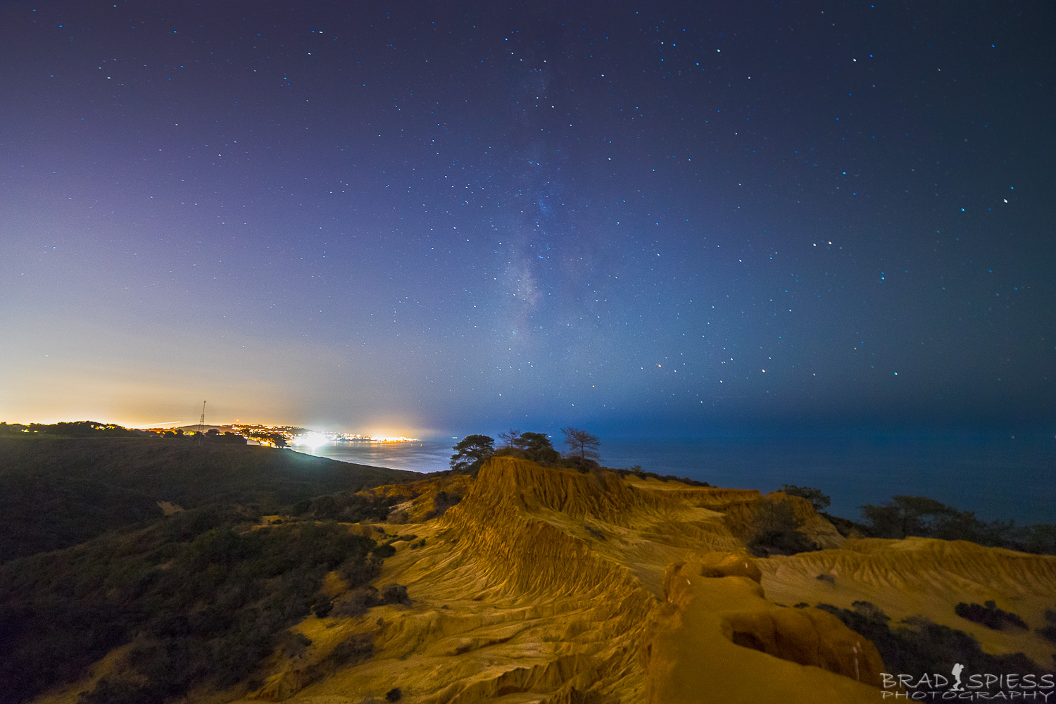
The Milky Way behind Broken Hill in Torrey Pines
- I never thought of this until I started heading out at night to photograph the Milky Way. You usually want to get as far away from the city in order to see the Milky Way but when there is no moon you can still see it pretty well in certain areas of the city. You will definitely need a flashlight / headlamp, on full moon nights you can sometimes make your way around without using it but on nights where the light in minimal you are going to need it. Bring a light jacket, you may find that as you are hiking you don’t need one but if you are going up to a mountain top it will be breezy and you will be sweaty, which means you will start to feel a chill pretty quickly, I always keep one in my pack just in case.


These are just some ideas on how to beat the heat during the heat waves and still get a hike in but remember that the only one who looks out for you,…is YOU! Bring lots of water, bring extra food, bring an extra layer, make sure someone knows where you are going in case you get lost. San Diego is a wonderful place to go hiking and we are all adults, don’t put someone else’s life on the line looking for you just because you may be unprepared when you go out for a hike. Things happen that we can’t always predict when we go out for an adventure, but its not much of a adventure if you can’t talk about it afterwords. Have a great weekend and enjoy where we live in the wonderful area of San Diego.