
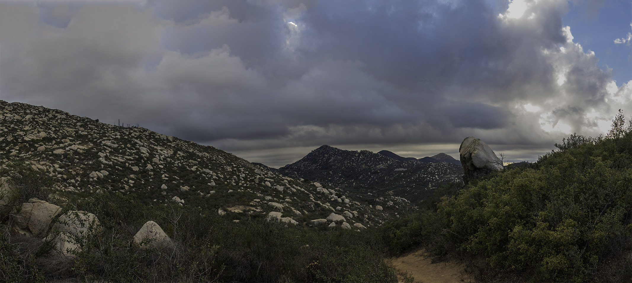
On the beginning of the Warren Canyon Trail on Mt Woodson – looking off towards Iron Mountain in the Distance
Warren Canyon Trail on Mt Woodson
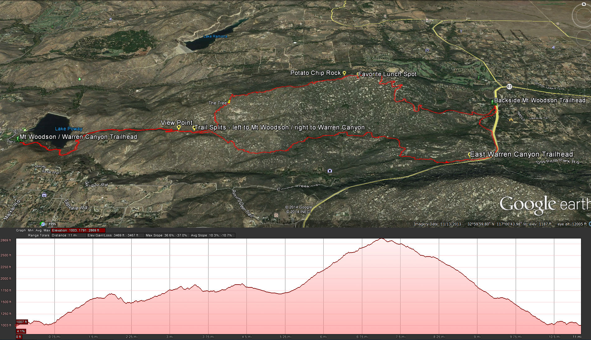
Distance: 11.82 miles ( Warren Canyon Trail being 2.3 miles of that) .Elevation Gain: 2398 feet. Time to complete: 5 hours roundtrip. Difficulty: Hard
Warren Canyon Trail is a 2.3 mile trail that starts about 1.6 miles into the hike up the front side of Mt Woodson. When the trail splits going left to head up the switch backs towards the top of Mt Woodson, this trail continues on straight ahead and skirts along the southern base of Mt Woodson to come out onto highway 67. I’ve always wondered about this trail, I’ve been up Mt Woodson more times then I can count and I always see the trail continuing on as I turn left and head up the mountain, wondering just where that trail heads off to, so I decided to quench my curiosity.
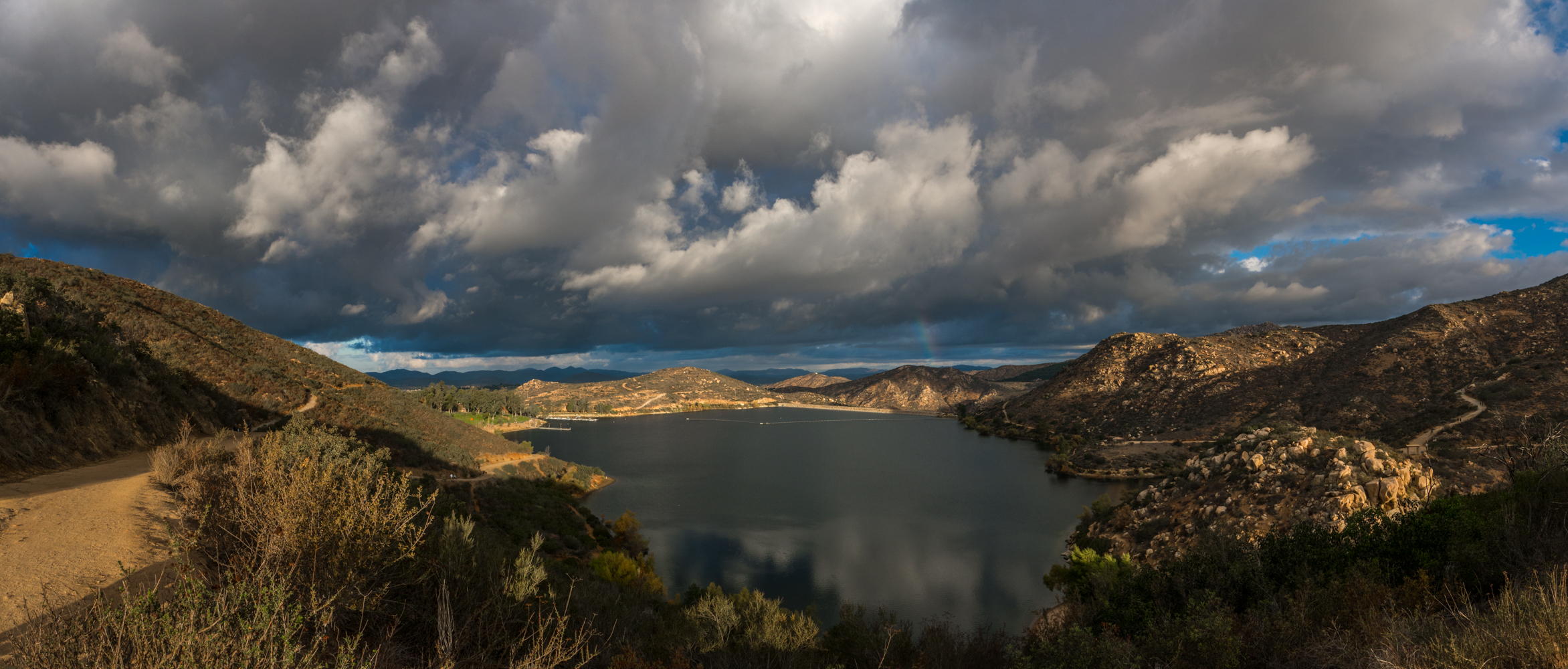
Looking back down at Lake Poway as I head for the first hill on the way up to Mt Woodson
Head up the front side of Mt Woodson as you normally would, starting at the Lake Poway Recreation area and heading back along the southern side of the lake to the east side where the trail starts climbing up the steep fire road gaining close to 600 feet of elevation in less then a mile. After you crest the fire road and come across the first view point with its picnic table, trash cans, and doggy bags ( all recent additions to this trail), you will continue on one of the only semi flat areas of this hike for 1/10th of a mile until you reach the area where the trail splits, going left to complete the last 1.9 miles of the trail up to the top of Mt Woodson or right ( straight) to complete the 2.3 miles of Warren Canyon before you reach the 67 highway.
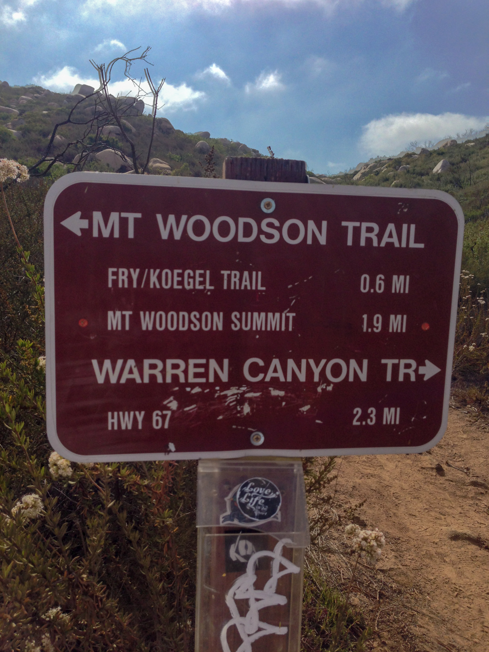
The Trail splits, left for the top of Mt Woodson, and right for Warren Canyon Trail
Right away you can tell that this is the road less traveled. This trail does not get much maintenance and it shows. This trail does not have many flat spots, it seems to ungulate most of the way, just as you go down one hill your going back up another, and the steep hills have deep ravines carved into them, I’ve read some mountain biking blogs talking about this trail and how they will never take it again, I can see why. While it may not be the most ideal trail for mountain biking, it is a hell of a leg burner for a hiker.
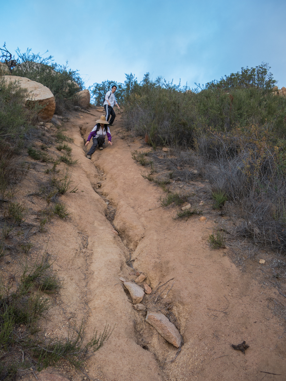
Hikers making their way down the steep terrain on Warren Canyon Trail
You will come across some old picnic tables along this trail which makes me think that this trail was used much more at one time. I can understand why it doesn’t get as much use now, not to many people want to hike 2.3 miles out on a trail only to hit a highway and then back track the way they came, that’s why I made it a loop and connected with the backside trail up Mt Woodson.
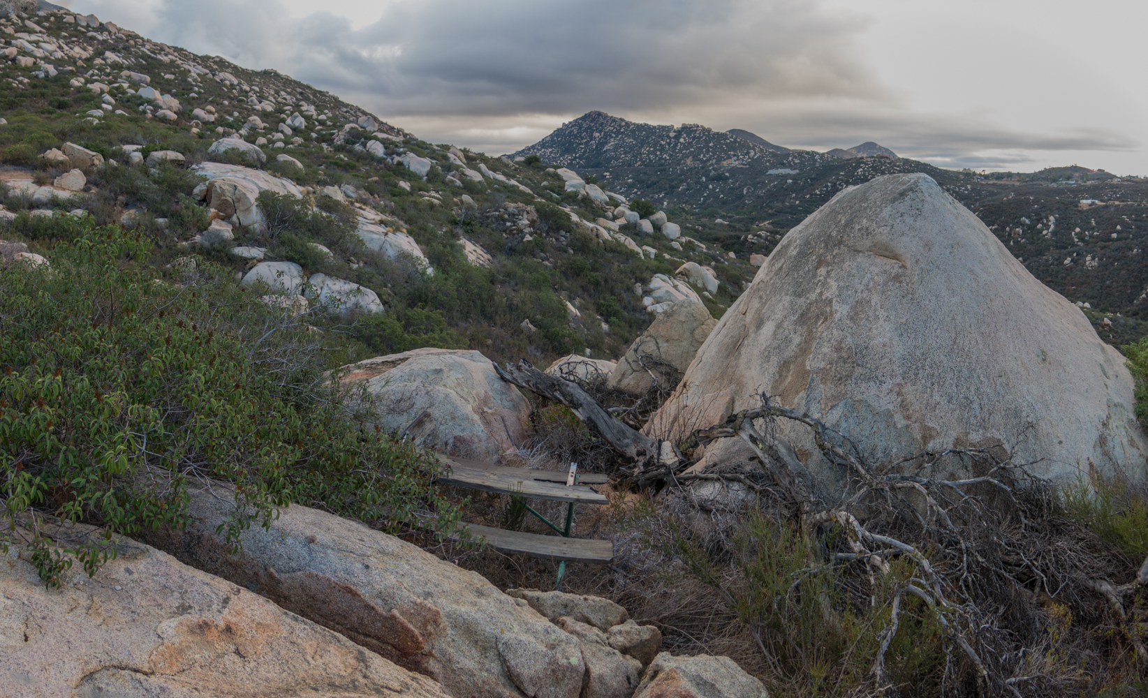
An old picnic table hidden amongst the brush along the Warren Canyon Trail
There isn’t a whole lot to see along this trail, your really only counting the steps until you reach the 67, but it does make a good leg burner. You will come across some old picnic tables and a few old oak trees but there isn’t much to see along the trail. You just keep looking up at Mt Woodson looming above you and then south to highway 67 wondering just how much closer you are to it. Just before you reach the 67 you will reach another fork in the trail, head left and back towards the highway, where as the right side trail skirts south west along the highway. About 3/10 of a mile after the fork in the trail you will come to what seems like the end of the trail at the bottom of this large ravine with towering gray boulders surrounding you and covered in the darkness of the surrounding trees. There may be a couple of ways out of this area but I just looked for where the water would run and found a little faint trail to the left side squeezing through some boulders and trees and squeezing underneath another large boulder before making my way up to the sunshine and the highway.

relaxing under the shade of the trees before making our way up to highway 67
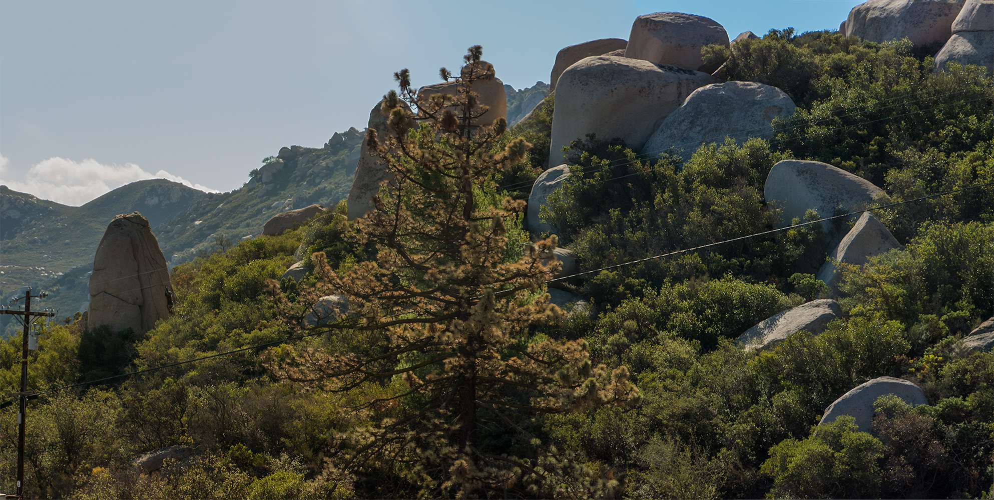
Connecting up with Highway 67 and walking along the shoulder against oncoming traffic is not my favorite thing to do, so at first chance after a 1/2 mile walk on the 67 I took the first residential road ( Mt Woodson Road ) in order to get off the highway for a little bit, don’t take the first road you see after coming off of the trail, that is a private driveway. Mt Woodson Road will connect back to the 67 in a short time but at least your not walking along the highway for a little bit. I tried looking for a way to get onto the back service road before hitting the highway, but as always the back gate to the service road is always closed and locked and unless you want to jump over some barbed wire to get to the other side just keep going until you get to the trailhead for the backside of Mt Woodson. Now you get to do some more climbing as you head up the back service road for 2 miles and 1200 feet of elevation gain. Along the way you get some fantastic views back towards Ramona and the surrounding mountains. Sometimes you will also see some rock climbers enjoying the extremely large boulders along the backside of Mt Woodson.
A rock climber making his way up one of the boulders on the backside of Mt Woodson.
After your 2 mile climb you will reach to the top of Mt Woodson and then start making your way down the front side and past all the antennas that clutter the top of the mountain. Just as the road ends and the trail begins you will reach Potato Chip Rock everyone’s favorite photo-op on Mt Woodson. On a weekend you may see somewhere between 50-70 people waiting to make their way onto the rock and get their picture taken proving they made it to the top of Mt Woodson, if you come during the weekend, you may find no one up here.
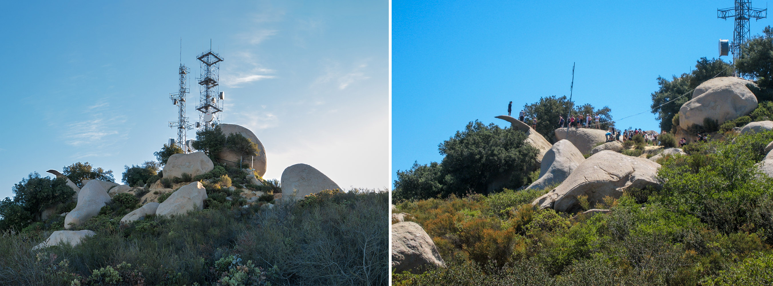
Weekday vs Weekend on Potato Chip Rock on Mt Woodson
After you take in the sites on top of the mountain, you will head back down 2 miles or so along the front side until you connect back into the trail that you left when you went along the Warren Canyon Trail. Head back down the way you came loving the fact that Poway Lake keeps getting closer and closer and that means you get to take off your boots and relax, having earned a good break after close to 12 miles of trail.
We did the Warren Canyon Trail today, mainly for two reasons, Woodson was again severely over saturated with hikers, two, like you, we were curious what we would find as we have hiked past Warren Canyon Trail hundreds of times. In truth, the trail is uninteresting. The only good things about the trail, 1. excellent work out (constant incline/decline) 2. uncrowded (we didn’t come across one hiker,although, we did see pole tracks so we know there was someone recently on the trail) 3. we were in nature. Other than that, it was pretty lame. On a hot day, it would have sucked, we would have felt trapped in an endless go nowhere, see nothing, lifeless canyon.
Yeah, its one of those things you just have to do once just to get it out of your head : )
I think it’s a mostly a climbers trail to access some rock climbs. https://www.mountainproject.com/area/109867923/rexrodes
I think it’s a mostly a climbers trail to access this climbing area: https://www.mountainproject.com/area/109867923/rexrodes